Mt. Coot-tha Summit Track

Mt. Coot-tha

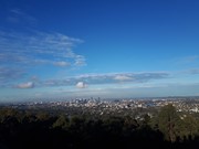
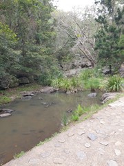
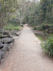
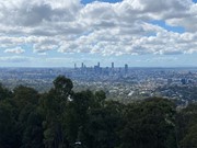
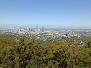
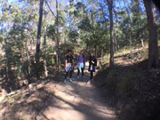
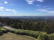
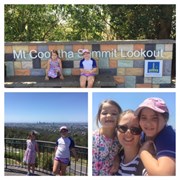
Mt Coot-tha Lookout has sweeping views of Brisbane City, Moreton Bay, and around to the Tweed Volcano, Main Range and Mount Barney and Flinders Peak. The walk to this lookout, from JC Slaughter Falls Picnic Area, is a potentially slightly testing but generally easy walk on a paved track that straddles a gully.

Lookouts
Picnic Facilities
Toilets
Dogs Permitted
Horses Permitted
Cycling Permitted
No Camping Permitted
Eucalypt Forest
231m
Maximum Elevation
156m
Total Climb

Getting there:

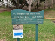
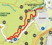
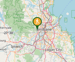
Walk starts at the far end of the JC Slaughter Falls picnic area. JC Slaughter Falls Road is off Sir Samuel Griffiths Drive.

Maps:

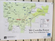
Mt Coot-tha Reserve

Route/Trail Notes:

None posted.

Permits/Costs:

None.

Other References/Comments:

You can in fact drive to the top along Sir Samuel Griffiths Drive, where there is restaurant and cafe.

Comments

Very easy and pleasurable walk. The path is really well maintained pretty much flat with a few hill here and there. It took not more than 1 hour to get to the summit. At the top there's a café where you can get coffee, other drinks and food.
It is a perfect way to spend a day off or a Sunday arvo if you are bored and not sure what to do around the city.

Daniela Paroletti on 30 Jul, 2023

A steady uphill climb to about the 1.6 km mark and then it takes a very steep change. The wide concrete walking paths make this enjoyable and it certainly stretches the leg muscles. Regular water fountain taps make it easy and the summit views are worth the effort. The trip back down was very quick and very enjoyable. A surprising walk so close to the city. one to tick a "do again".

Gordon/Susan on 1 Oct, 2022

A regular walk for me. The summit walk is good but I also enjoy a 10km walk around various connecting trails.

Hayley Nicholson on 9 Jan, 2022

Start at botanic gardens
Spotted gum trail up
Summit track down
9.8km

Kmxfitness on 23 Aug, 2021

Walked this one way starting at J.C. Slaughter falls. Found it a nice wide well maintained track with a constant uphill grade.

Trev C on 21 Jul, 2021

Have walked the Mt Coot-tha Summit Trek hundreds of times. It's been part of my weekly routine for many years, even in the dead of winter, cold, dark and hauntingly beautiful. It's an easy walk, well maintained and very popular, especially on weekends. We always go up over the mountain at the top, then head down to Fleming Rd, Chapel Hill, sometimes coming back via the Reservoir Trail. There are so many great walks for all types of fitness levels. The Kokoda trail is definitely a difficult walk and great for fitness training. For us Brisbane folk, we're super fortunate to have this mountain on our doorstep!

Koko on 22 Jul, 2020

Summit Trail from JC Slaughter Fslls
Mahogany Trail Down
Approx 5km
1hour

Kelly Seery on 6 Jul, 2020

I am a 12yr old who is writing a review on the Summit and Mahogany trail in Mt Coot-tha. When we did this trail we went up the Summit trail and down the Mahogany trail. Talking about the Summit trail, this trail is 1.9KM till the lookout at the top. When we went up it was steep the whole way up, but the track is wide and well marked and there are water drinking fountains to drink out of the whole way up, there are also ones for dogs too. When you get to the top you can walk up the road to the top of the hill and you can get a really good view of the whole city. You can also get some lunch and ice cream up there too, and there is also a souvenir shop there where you can get a souvenir. When you go back down, the Mahogany trail will be next to the map of Mt Coot-Tha. The track should be a wide dirt track, and really steep downhill. This track is around 2.6KM long till you get the picnic area. When you are walking down the Mahogany trail be aware of Mountain bikes because this is a horse and Mt bike trail too, and you might think this trail will be all downhill but don't be deceived like I said this is a horse and Mt bike trail too. Unlike the Summit trail the Mahogany trail does not have any drinking fountains and it is an extra 700m than the Summit trail to the bottom. We didn't have a picnic but it will be nice to have one at the end because there are lots of nice picnic areas around JC Slaughter Falls Picnic Area, there are also BBQs there too to cook some bacon and eggs. Even though it's only 4.5KM it is still really bone aching walk and your bones will be really tired the next day. BTW, the Summit trail is No.(58) and the Mahogany trail is No.(66) on the Brisbane City Council map. Hope this info is useful and have a nice day! XD

TheN8tureBoy on 2 Jul, 2020

This walk is short but uphill all the way to the top makes it interesting. Very enjoyable walk. We stopped at Japanese garden at the end of the walk which was very peaceful.

Ro on Jul, 2020

I did the Summit Track on the way up and Mahogany Trail on the way down (I parked at the beginning of JC Slaughter Falls picnic area). All up was 5.5km and took me 1 hour (not including stopping at the lookout at the top). The Summit Track was busy, lots of small children and dogs, so is not a very peaceful walk if you're looking for that. Mahogany Trail on the way back had less people but is more of a rocky track (good for mountain bike riding I would expect). The lookout was VERY busy but a great view of the city. Glad I've done it but probably won't do it again as I like my walks a bit more peaceful and in nature.

ChasingWaterfalls on 13 Jun, 2020

Spotted gum trail up summit track down 7km from botanic gardens car park follow number 6 to find the new trail

Kmxfitness on 6 Jun, 2020

Uphill part warms you up on a cool morning.

Wanderlust on 29 May, 2020

Nice and easy and fun for the kids in the rocky creek area

Will Walk For Food on 17 May, 2020

Nice easy walk to the lookout. You will sweat a lot in the summer.

Clem on 3 Feb, 2020

Really enjoyable walk. Even though Im out of shape I found this walk positively challenging (incline most of the way up) with super rewarding views at the top. Plenty of toilets and bins at the JC Slaughter Falls park, and water bubblers are scattered along the Summit Walk. The walk itself was well prepared and maintained, not quite a naturalists dream but awesome considering its 15 minutes from the CBD. Great for kids or those new to bushwalking!

Shaun on 10 Jan, 2020

Started from the Information centre, heading to the peak. This walk was quite nice and quiet, and got the heart pumping a few times.

Connor7106 on 24 Sep, 2019

Down summit track has been upgraded no loose stones or dirt anymore

Kmxfitness on 23 Aug, 2019

A good walk however, if you enjoy walking through bushland on tracks reminiscent of bushland this may not be your experience. The upgrades to this track include manicured edging, concrete steps (in the shape of stones), stone retaining walls , sealed track with small pebbles and concrete paths. If you are preparing for trail walking you may wish to select another track. I did this track as part of a 14k circuit.

Anoogle on 20 Jul, 2019

Completed this as track part of a 9km circuit - started with the Litchfield track, then the Ghost Hole Track, Powerful Owl Trail, Hovea Track and ended with the Summit Track. A great morning out walking but was a disappointing ending on the summit track with the natural track all but gone thanks to concrete and steel.

S K on 20 Jul, 2019

Short walk, easy. Views beautiful In the arvo. Cafe/restaurant at main lookout point

Kaitys on 24 Jun, 2019

Where

Click here to load this map.

Nearby Walks

Done this walk?

This walk has been ticked 370 times

Aussie Bushwalking can keep track of your bushwalks.

Login/signup to tick this walk off.

Tick walks to keep track of where you've been. You must Login to tick walks. Accounts are 100% free so sign up if you don't have one.