
Menu
Popular Walks
-
Mt Ngungun
(1156 ticks) -
Mount Coolum
(872 ticks) -
Mt Cordeaux
(668 ticks) -
Twin Falls Circuit
(636 ticks) -
Purling Brook Falls Circuit
(611 ticks)
Summary
The Sunshine State
Queensland has a wealth of bushwalking opportunities including multiple World Heritage Listed rainforests such as the Daintree and Lamington National Park, great coastal and island parks like Fraser Island and Hinchinbrook Island.
Popular Walks
-
Mt Ngungun
(1156 ticks) -
Mount Coolum
(872 ticks) -
Mt Cordeaux
(668 ticks) -
Twin Falls Circuit
(636 ticks) -
Purling Brook Falls Circuit
(611 ticks)
Sub-Regions
Other Information
World Heritage Areas
- Fraser Island
- Gondwana Rainforests of Australia (Lamington NP, Springbrook NP, Mount Chinghee NP, Mount Barney NP, Main Range NP)
- Great Barrier Reef
- Riversleigh
- Wet Tropics (Daintree NP, Barron Gorge NP, Cedar Bay NP, Girringun NP, Wooroonooran NP)
Contact details
Queensland Parks and Forest:
https://parks.des.qld.gov.au/
Regions
The link below provides a region map of QLD as a reference to what council zones are included in the 7 geographic regions of QLD.
https://en.wikipedia.org/wiki/Regions_of_Queensland#/media/File:Qld-regions-map.gif
- Far North Queensland
- North Queesnland
- Central Queensland
- Mackay, Isaac and Whitsunday
- Wide Bay Burnett
- Darling Downs South West
- South East Queensland

 500
m
return
500
m
return
 15
mins
15
mins
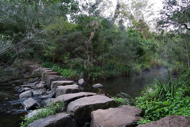
Peters Creek Walk
A short tadpole loop trail that has views over the creek and nice rainforest.
 3.5
km
return
1
hr
3.5
km
return
1
hr
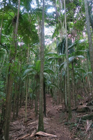
Piccabeen Circuit
Located at Charlie Moreland campgrounds, Imbil State Forest. Nice walk through open eucalypt and piccabeen palm grove. Nice day use area to have a picnic / bbq. Part of the circuit is along side a small creek.
 5.7
km
return
105
mins
5.7
km
return
105
mins
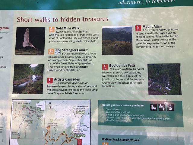
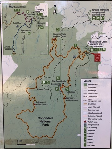
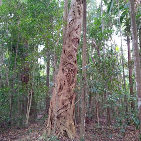
Strangler Cairn
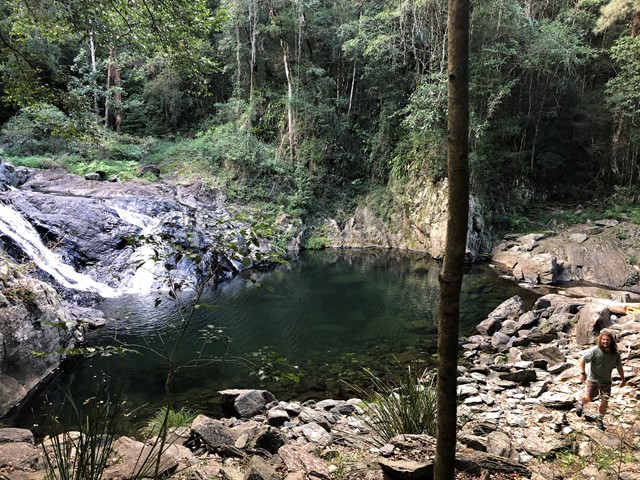
The Strangler Cairn was made by world renounced artist Andy Goldsworthy. It is composed of granite blocks shaped together with a strangler fig planted in the top. Over time the roots of the fig should grow down over the cairn. The walk is consists of a short side track off the Conondale Great Walk which is between the Gold Mine track and the Artists Cascades. The main track is through sub-tropical rainforest and wet sclerophyll forest.
 24.63
km
return
7.75
hrs
24.63
km
return
7.75
hrs
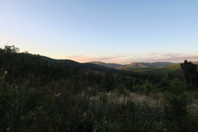
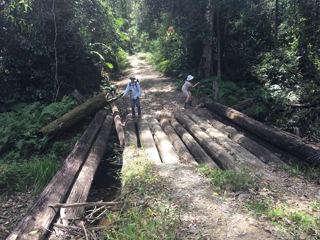
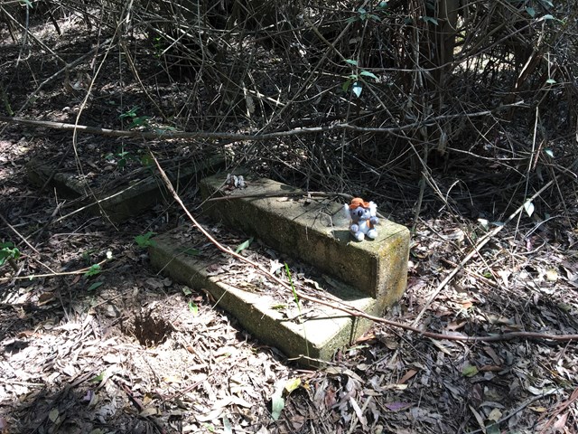
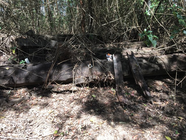
Sunday Creek Fire Tower
A lovely walk through pristine forest and patches of rainforest passing over old bridges.
 2.6
km
return
90
mins
2.6
km
return
90
mins
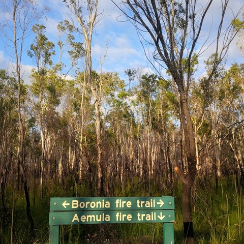
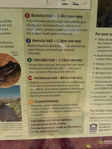
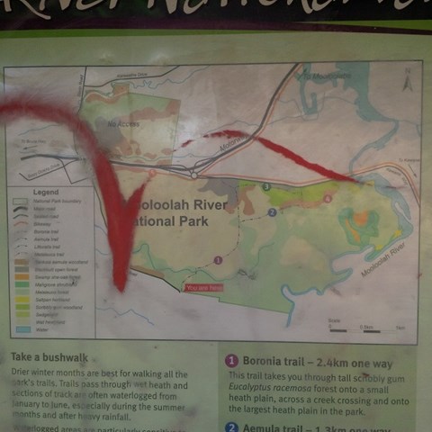
Aemula Trail
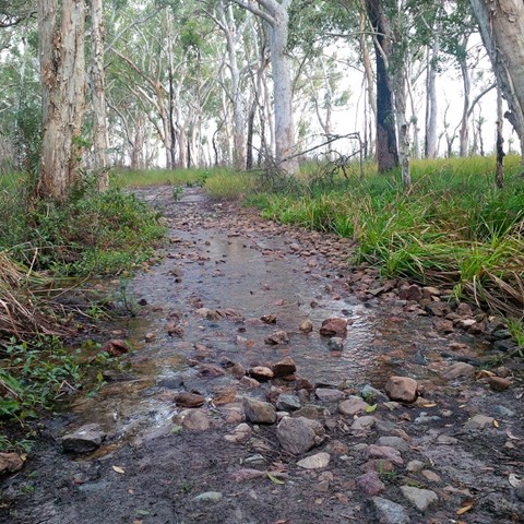
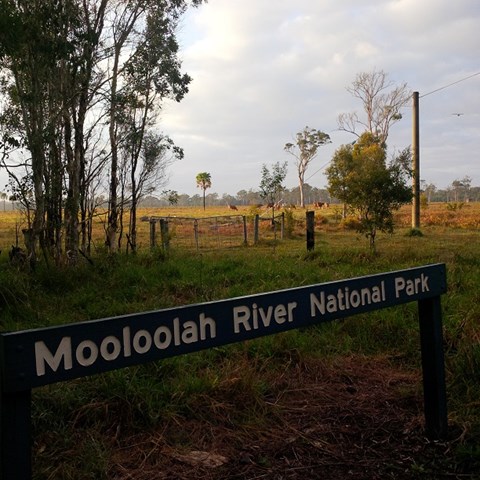
Adjoining the Mooloolah River, the Mooloolah River National Park protects valuable remnants of coastal lowland habitat, rainforest, open eucalypt woodlands, melaleuca forests, wallum banksia woodlands, scribbly gum open forests, wallum heath and sedgelands.
 4.2
km
return
2
hrs
4.2
km
return
2
hrs
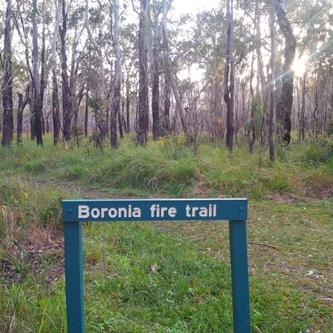
Boronia Trail
Did the full circurt , some bog holes to navigate not hard. Nice and close to home. Good bird life and some nice wild flowers out on show.
 2.7
km
return
1
hr
2.7
km
return
1
hr
Littoralis Trail
Adjoining the Mooloolah River, the Mooloolah River National Park protects valuable remnants of coastal lowland habitat, rainforest, open eucalypt woodlands, melaleuca forests, wallum banksia woodlands, scribbly gum open forests, wallum heath and sedgelands.
 1.5
km
return
30
mins
1.5
km
return
30
mins
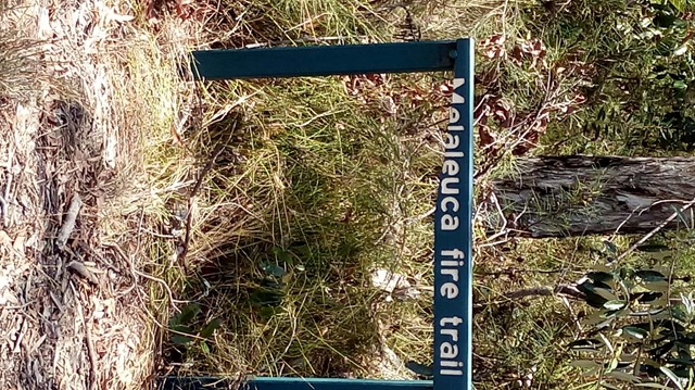
Melaleuca Trail
Adjoining the Mooloolah River, the Mooloolah River National Park protects valuable remnants of coastal lowland habitat, rainforest, open eucalypt woodlands, melaleuca forests, wallum banksia woodlands, scribbly gum open forests, wallum heath and sedgelands.
Walks in Wide Bay Burnett
140
m
return
10
mins
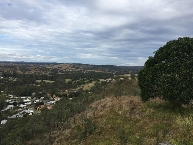
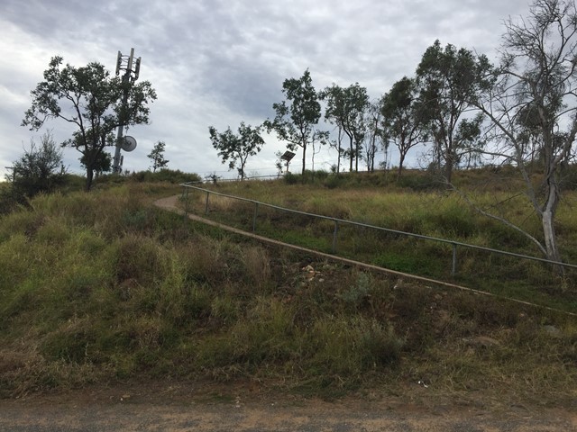
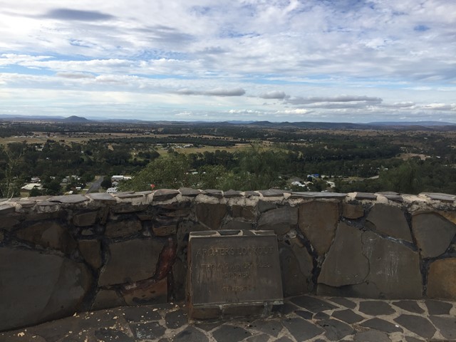
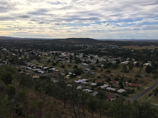
Archers Lookout
Archers Lookout sits atop Duke Mountain with 360 views over Gayndah.
 3.2
km
return
90
mins
3.2
km
return
90
mins
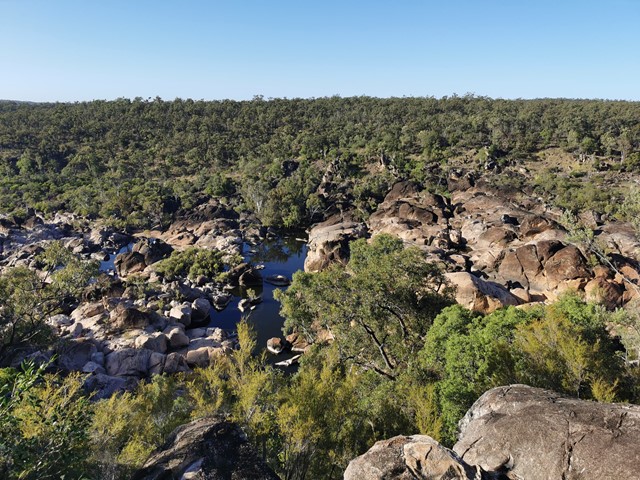
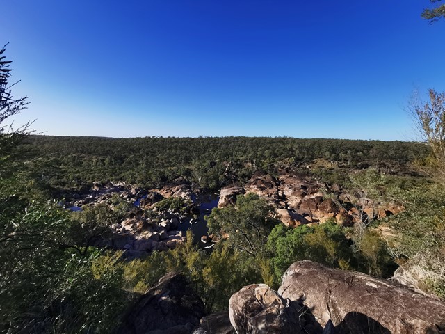
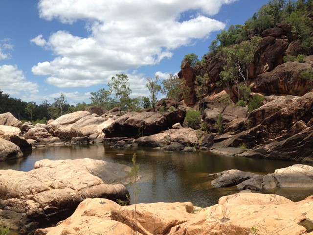
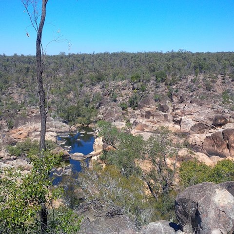
Auburn River National Park , Gorge -top walk
The track follows the river on a gentle walk through open eucalypt forest along the top of the gorge. At the lookout there are spectacular views down the river,
which flows over a series of cascades to the Auburn River Falls—best viewed after heavy rain.