
Menu
Popular Walks
-
Mt Ngungun
(1156 ticks) -
Mount Coolum
(872 ticks) -
Mt Cordeaux
(668 ticks) -
Twin Falls Circuit
(636 ticks) -
Purling Brook Falls Circuit
(611 ticks)
Summary
The Sunshine State
Queensland has a wealth of bushwalking opportunities including multiple World Heritage Listed rainforests such as the Daintree and Lamington National Park, great coastal and island parks like Fraser Island and Hinchinbrook Island.
Popular Walks
-
Mt Ngungun
(1156 ticks) -
Mount Coolum
(872 ticks) -
Mt Cordeaux
(668 ticks) -
Twin Falls Circuit
(636 ticks) -
Purling Brook Falls Circuit
(611 ticks)
Sub-Regions
Other Information
World Heritage Areas
- Fraser Island
- Gondwana Rainforests of Australia (Lamington NP, Springbrook NP, Mount Chinghee NP, Mount Barney NP, Main Range NP)
- Great Barrier Reef
- Riversleigh
- Wet Tropics (Daintree NP, Barron Gorge NP, Cedar Bay NP, Girringun NP, Wooroonooran NP)
Contact details
Queensland Parks and Forest:
https://parks.des.qld.gov.au/
Regions
The link below provides a region map of QLD as a reference to what council zones are included in the 7 geographic regions of QLD.
https://en.wikipedia.org/wiki/Regions_of_Queensland#/media/File:Qld-regions-map.gif
- Far North Queensland
- North Queesnland
- Central Queensland
- Mackay, Isaac and Whitsunday
- Wide Bay Burnett
- Darling Downs South West
- South East Queensland
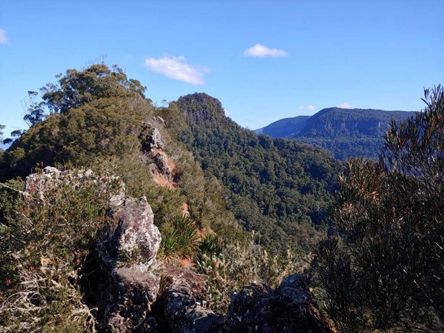
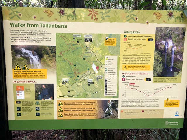
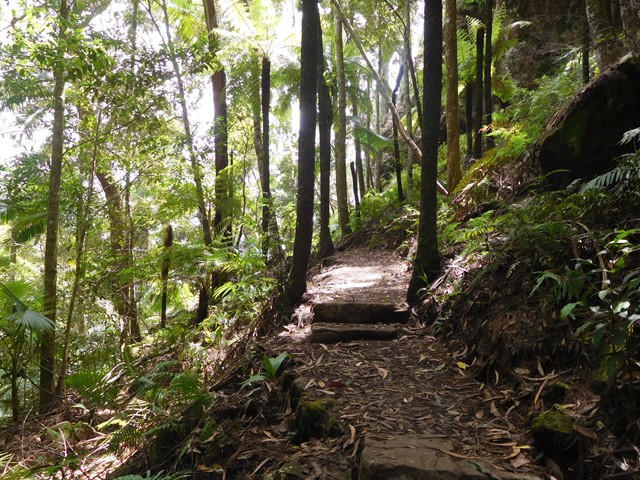
Walks in Springbrook National Park
(South East Queensland)
 4.2
km
return
4.2
km
return
 2
hrs
2
hrs
Bushrangers Cave
An off-track walk from the border gate to Bushrangers Caves, which used to be an aboriginal camp. The adventurous can head on up Mt Wagawn to join up with the main Lamington track system.
 1.6
km
return
1
hr
1.6
km
return
1
hr
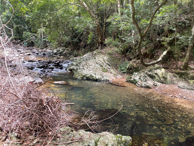
Cougal Cascades
A short walk next to Currumbin Creek. Great for a short walk not too far from the Gold Coast or for cooling off on a hot day (without the sand and salt of the sea).
There are plenty of fantastic swimming holes further up the cascades if you don't mind a 20min walk upstream .
 14.5
km
return
6
hrs
14.5
km
return
6
hrs
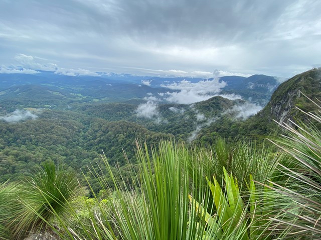
Cougal Cascades to Boyd’s Butte and Mt Cougal East Peak
A circuit walk from Cougal Cascades to Boyd's Butte and Mt Cougal. Includes views from both peaks.
 4.4
km
return
90
mins
4.4
km
return
90
mins
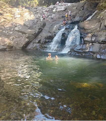
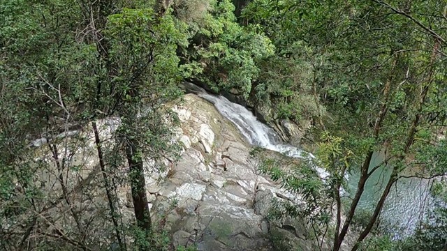
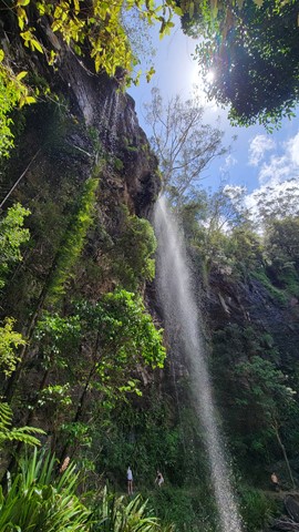
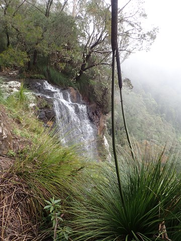
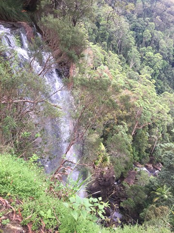
Goomoolahra Falls and Rainbow Falls
No need to complete the full 14 kilometre Warrie circuit, but instead walk 3 kilometres (of the 17 km track) and see at least 3 waterfalls. You are walking along the side of the cliff with sheer drops below and rock faces above.
Very picturesque and one of the nicest walks in Springbrook National Park. Not to be confused with the view of the Goomoolahra Falls from above.
 600
m
return
10
mins
600
m
return
10
mins
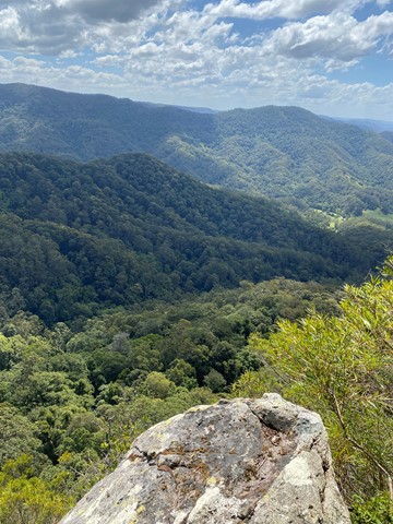
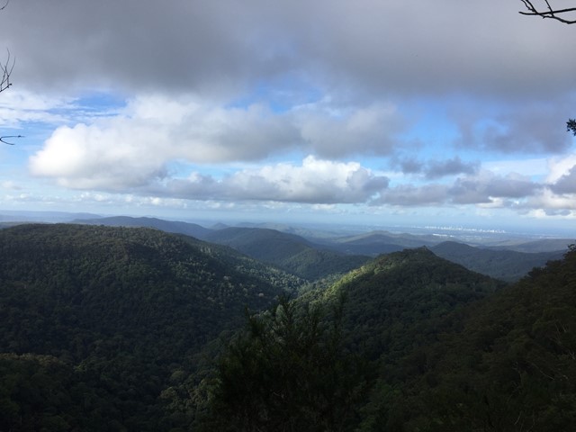
Goomoolahra Falls Lookout Track
Picnic area with a view. Wheelchair friendly track to a stunning view of the top of Goomoolahra Falls with the warrie circuit track below and views of the Springbrook Pinnacle and out to the coast and the general hinterland.
 4
km
return
2
hrs
4
km
return
2
hrs
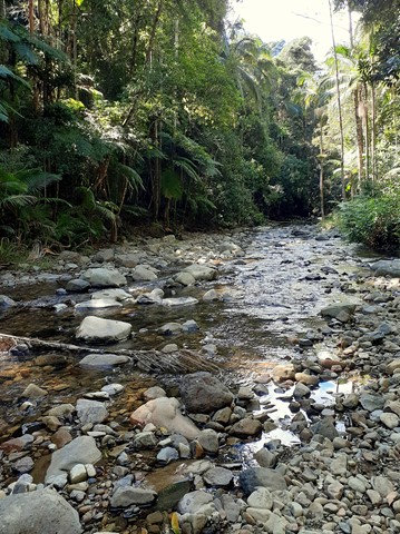
Gorge Falls
Gorge Falls is a 5.6km return walk along the Cream Track, beginning at the end of Tallebudgera Creek Road.
When you reach the cream track signpost that takes you up some man made steps bear left and follow the path to the left to get to the falls. The track seems to disappear a few times but just continue along the edge of the creek and you keep finding it.
 10.5
km
return
4
hrs
10.5
km
return
4
hrs
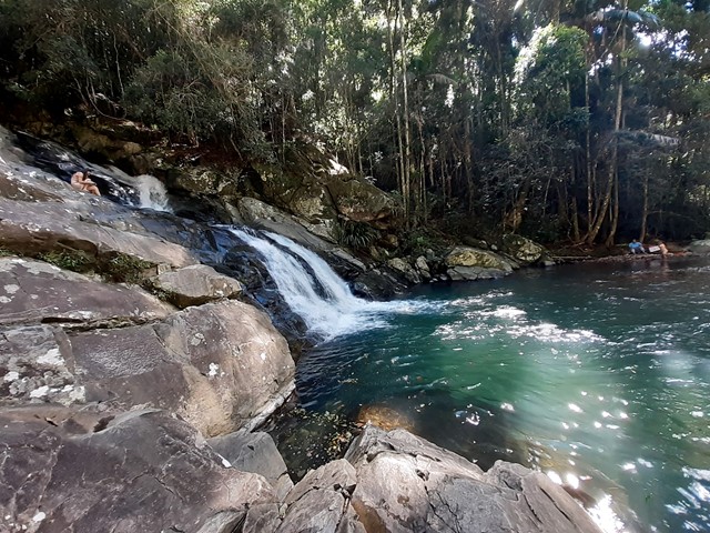
Little Nerang Creek, Purlingbrook Falls, Road return
This walk incorporates parts of the Gold Coast Hinterland Great Walk and the Purlingbrook Falls circuit to see spectacular waterfalls and beautiful rainforest, and it has some great waterholes if it's a hot day!
 2
km
return
1
hr
2
km
return
1
hr
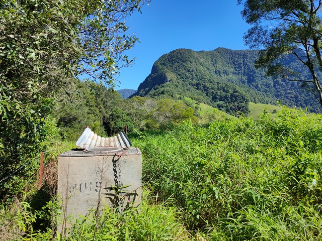
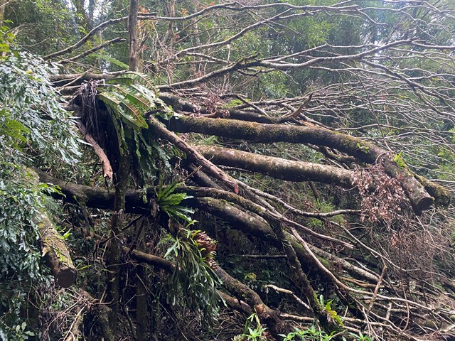
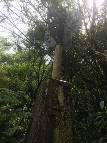
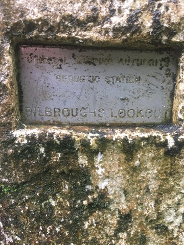
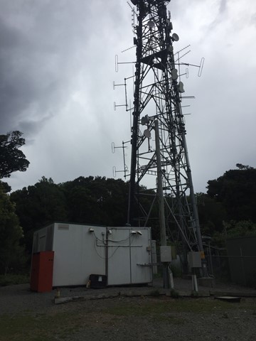
Mount Thillinmam (Bilbroughs Lookout)
A 4wd track through rainforest to Mount Thillinmam (958m). Mount Thillinmam has multiple repeater towers and limited views.
 10
km
5
hrs
10
km
5
hrs
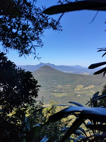
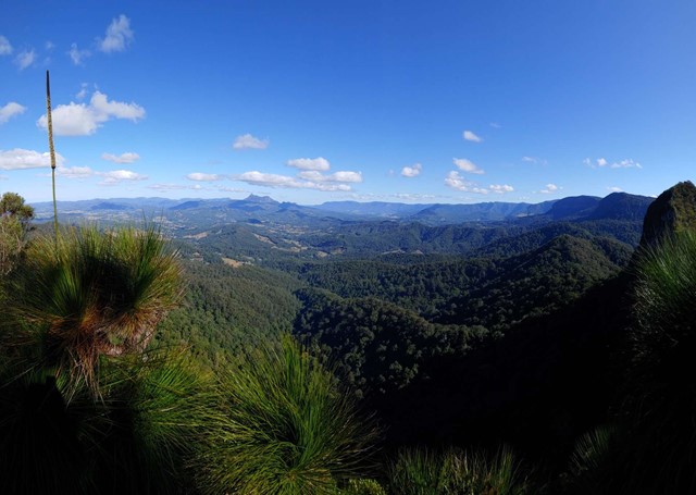
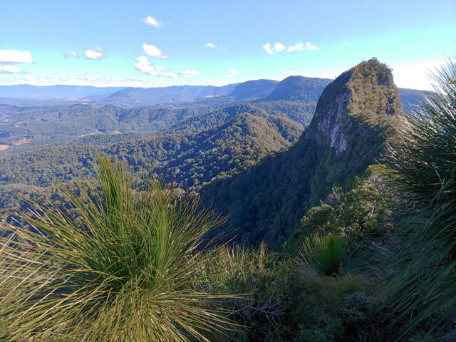
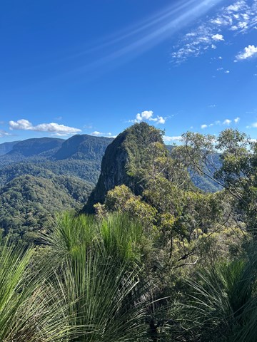
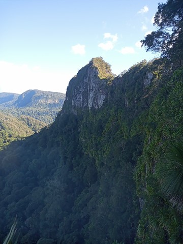
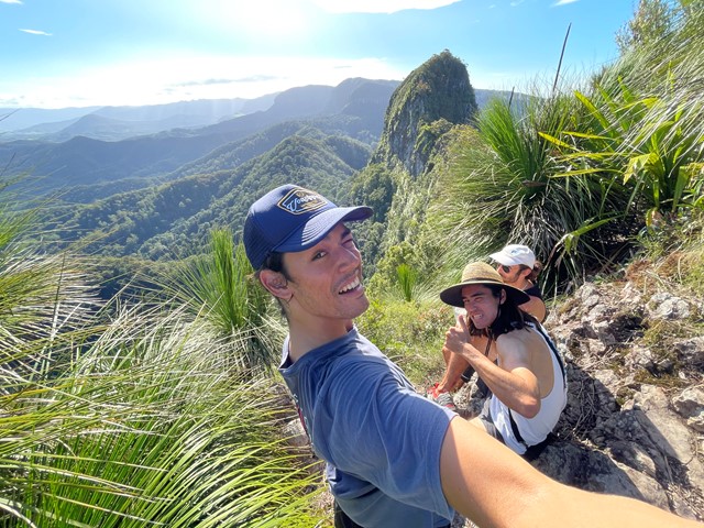
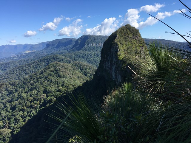
Mt Cougal
A walk along the border fence line to the twin summits of Mt Cougal. There are excellent views from the top!
It is hard for beginners. Make sure you check weather. Finding location is a little hard. When arrive see steel gate that states ‘please keep gate clear ta’ On side of gate you can enter, when pass the gate look to your left and see sign with with instructions. Don’t be discouraged when you start, it is a little scary, but it gets easier, but still lots of hill. Follow the barbed wired fence on your left the whole way. The track will go from very narrow to comfortable in some places. Once you reach the last 700 metres or so... it becomes much harder. You will see a thin rope to guide you - do not use this to pull you up as it will break!! You will come to a spot where the track will seem to end. Look for a tree that has arrows etched into it to guide you where to go. There’s also a small pink ribbon tied to a tree branch Up further. You have to go up! It’s hard but worth it.
 1
km
return
30
mins
1
km
return
30
mins
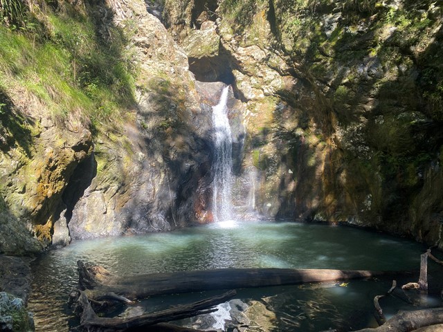
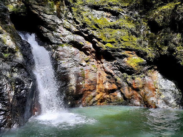
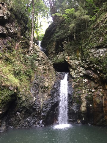
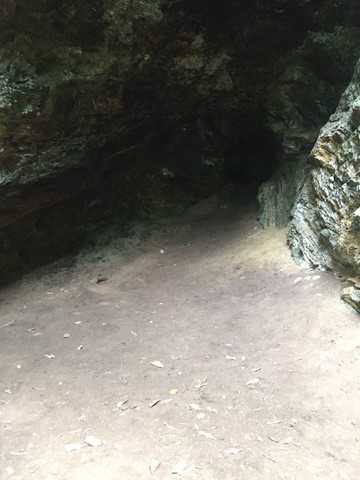
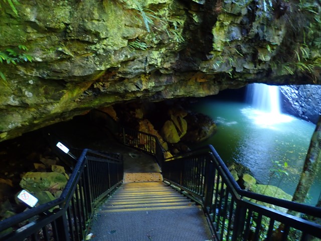
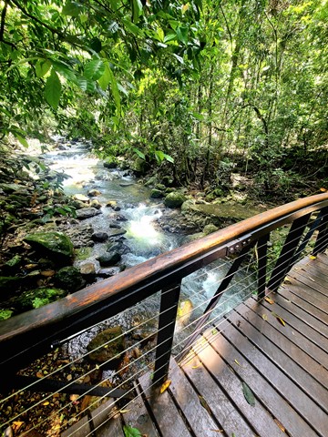
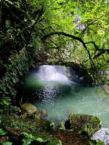
Natural Bridge
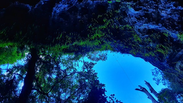
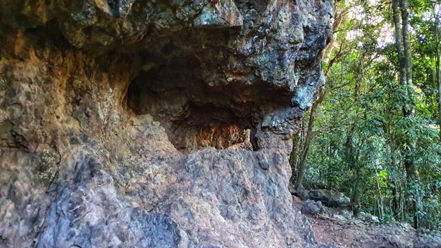
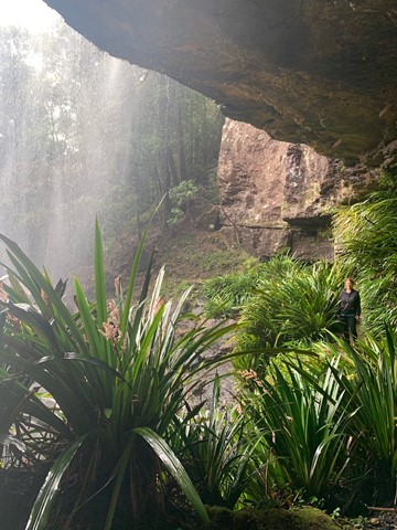
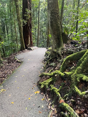
A sealed circuit track takes you through the forest, across Cave Creek, and into the arched cave to witness the waterfall plunging from above. At night the cave is illuminated by thousands of glow-worms' tiny green lights. While glow-worms are visible year-round, their display is significantly reduced during the winter months. Interpretive signs along with the circuit highlight the park's special features. The hoop pines Araucaria cunninghamii that emerge through the thick greenery of the surrounding rainforest are living relics of the Jurassic Age—the age of the conifers—about 180 million years ago. These pines are 'living dinosaurs'—they are among the most primitive of conifers.