
Menu
Popular Walks
-
Mt Ngungun
(1156 ticks) -
Mount Coolum
(872 ticks) -
Mt Cordeaux
(668 ticks) -
Twin Falls Circuit
(636 ticks) -
Purling Brook Falls Circuit
(611 ticks)
Summary
The Sunshine State
Queensland has a wealth of bushwalking opportunities including multiple World Heritage Listed rainforests such as the Daintree and Lamington National Park, great coastal and island parks like Fraser Island and Hinchinbrook Island.
Popular Walks
-
Mt Ngungun
(1156 ticks) -
Mount Coolum
(872 ticks) -
Mt Cordeaux
(668 ticks) -
Twin Falls Circuit
(636 ticks) -
Purling Brook Falls Circuit
(611 ticks)
Sub-Regions
Other Information
World Heritage Areas
- Fraser Island
- Gondwana Rainforests of Australia (Lamington NP, Springbrook NP, Mount Chinghee NP, Mount Barney NP, Main Range NP)
- Great Barrier Reef
- Riversleigh
- Wet Tropics (Daintree NP, Barron Gorge NP, Cedar Bay NP, Girringun NP, Wooroonooran NP)
Contact details
Queensland Parks and Forest:
https://parks.des.qld.gov.au/
Regions
The link below provides a region map of QLD as a reference to what council zones are included in the 7 geographic regions of QLD.
https://en.wikipedia.org/wiki/Regions_of_Queensland#/media/File:Qld-regions-map.gif
- Far North Queensland
- North Queesnland
- Central Queensland
- Mackay, Isaac and Whitsunday
- Wide Bay Burnett
- Darling Downs South West
- South East Queensland
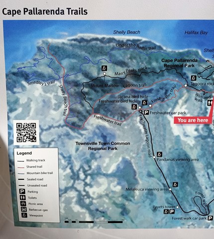
Walks in Pallarenda Conservation Park
(North Queensland)
 9.2
km
return
9.2
km
return
 2.5
hrs
2.5
hrs
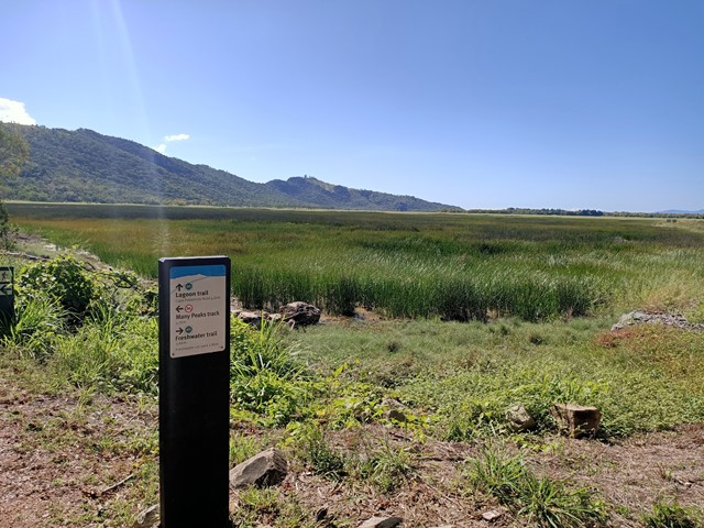
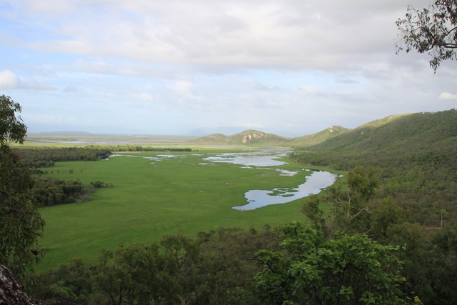
Lagoon Circuit
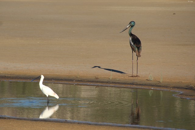
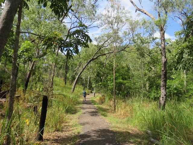
An outstanding walk for exercise, bird-watching, or just taking in the expansive views across the wetlands of the Townsville Town Common. Combining the Lagoon Trail and the Freshwater Trail allows you to circumnavigate the freshwater lagoon. There are excellent opportunities for viewing both wetland birds (Brolgas are frequently seen), and open forest birds. Part of the Freshwater Track traverses the top of an old earthen dam through the centre of the wetlands. The track is mostly flat and does not involve any climbing. The route is a shared walking/cycling track, and is mostly open with good visibility. Winter months, and mornings and afternoons are best.
 10.3
km
return
3.5
hrs
10.3
km
return
3.5
hrs
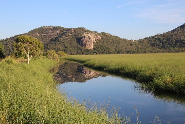
Mt Marlow
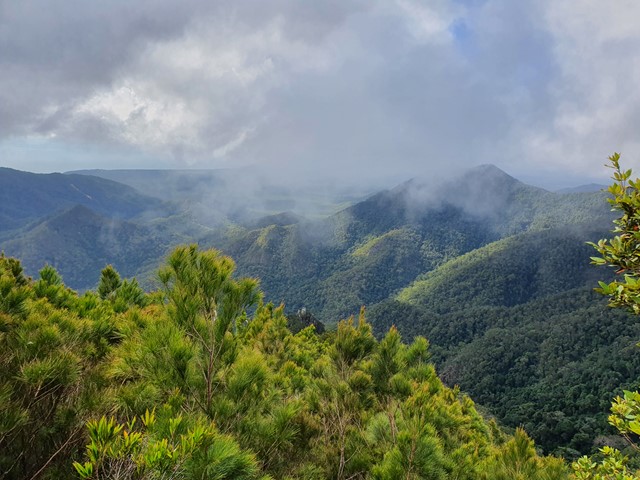
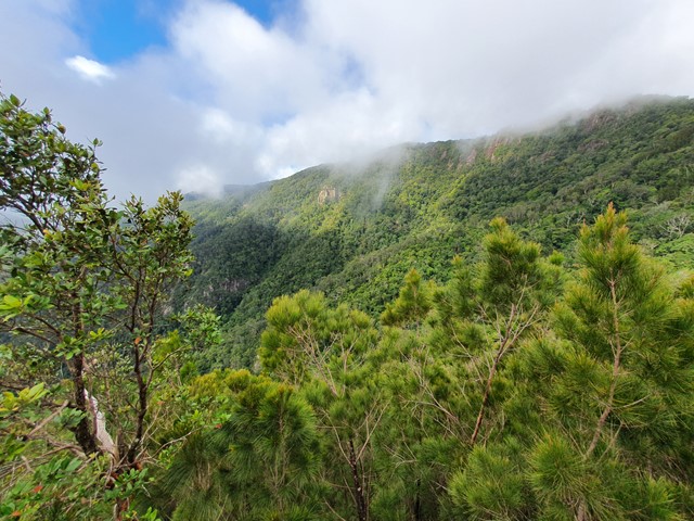
Excellent walk for the views, traverses open forests and semi-deciduous vine thickets along the side of the peaks. The summit of Mt Marlow provides superb 360 degree views of the wetlands and coastline. You can complete a circuit by returning via the Lagoon Trail or the Freshwater Trail through the wetlands. These trails provide excellent opportunities for viewing wetland birds.
Only the middle sections of the Many Peaks Track are considered hard. The other sections are medium, and the Lagoon and Freshwater Trails are easy shared bicycle/walking trails. Mosquitoes can be a problem at certain times of the year, so bring some repellent. Winter is the best season. Refer to the track notes below.
 1.5
km
return
40
mins
1.5
km
return
40
mins
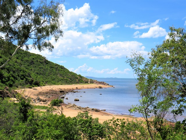
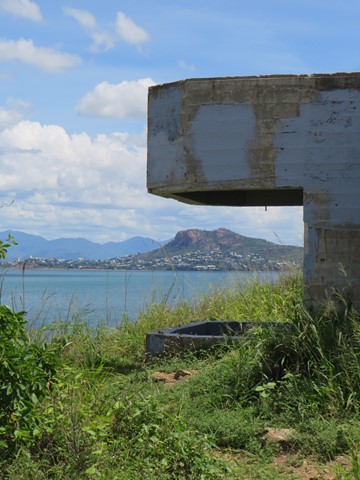
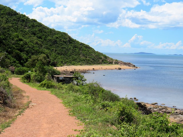
Shelly Cove Trail
A beautiful coastal walk through Cape Pallarenda Conservation Park to Shelly Cove, 1.5km return overlooking Cleveland Bay and across to Magnetic Island.
Walks in Paluma Range National Park
(North Queensland)
3
km
1
hr
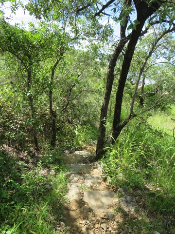
Cloudy Creek Walk
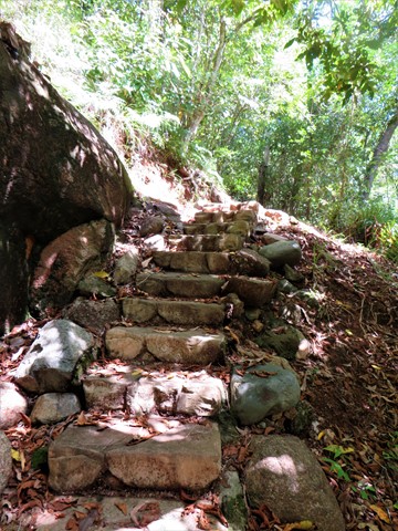
A short walk through the Paluma rainforest to cloudy creek, expect stairs.
1
km
return
20
mins
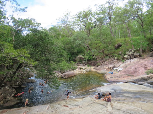
Crystal Rockslides
Crystal Rockslides is a great spot for cooling off, having fun and enjoying the Paluma Range National Park experience. A short 500m walk on sealed surfaces, with an uphill section before taking the shady path to reach the Rockslides.
 3
km
return
1
hr
3
km
return
1
hr
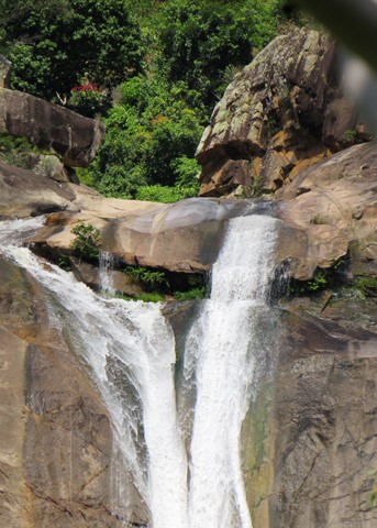
Jourama Falls
Jourama Falls is located within Paluma Range National Park. The 3km return trail follows a path along Waterview Creek, with plenty of fresh water swimming holes along the way.
 11.3
km
return
6
hrs
11.3
km
return
6
hrs
Mt Halifax
A tranquil walk alongside a gently flowing stream followed by a diobolically steep and slippery 1km vertical ascent!
Walks in South East Queensland
3.74
km
return
1
hr
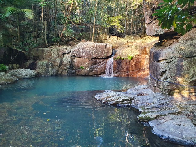
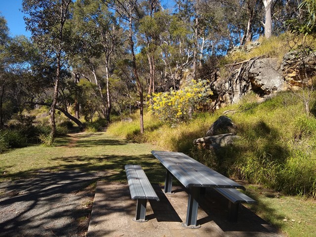
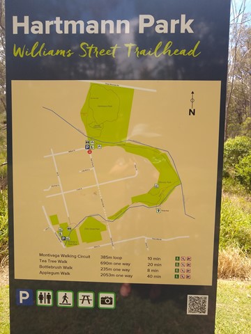
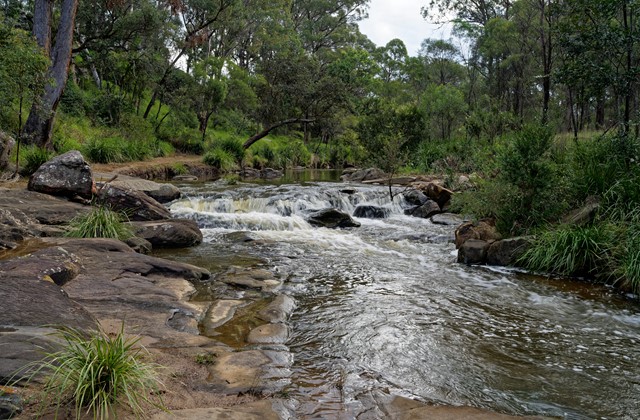
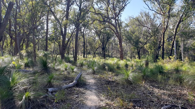
Applegum Walk and Hartmanns Park Circuit
A creek-side track connecting Bullocky's Rest Park with a network of trails through Hartmann Park in Crows Nest. Includes a short side-track to the Pump Hole, a deep waterhole that is home to long-necked turtles, and includes a small waterfall after rain.
Officially marked Grade 3/Medium (some uneven/rocky/slippery surfaces, especially after rain) this trail is manageable for walkers of most ages and fitness levels.
 2.2
km
return
30
mins
2.2
km
return
30
mins
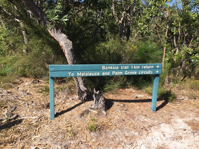
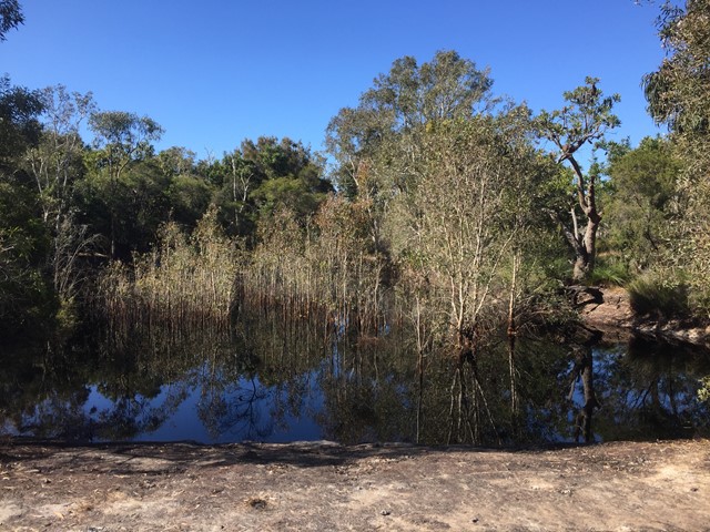
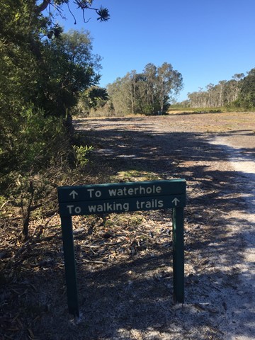
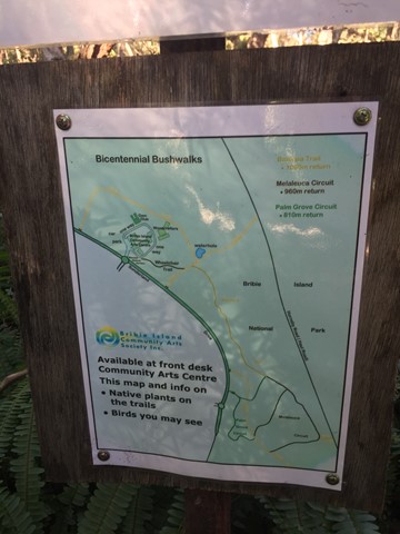
Banksia Bicentennial Bushwalk
Explore remnant wallum heathlands and spot colourful birds and other wildlife on this delightful bushwalk in a corner of the Bribie Island National Park.
 5
km
return
90
mins
5
km
return
90
mins
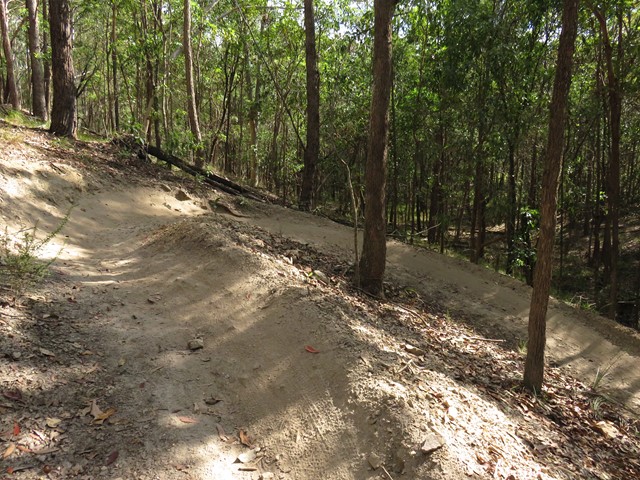
Bayview Conservation Area (German Church Road Main Entrance)
Many trails through the bush area for walkers, bikes and horses. There are a few areas with healthy mozzie populations so be prepared!