


 11.3
11.3 6
6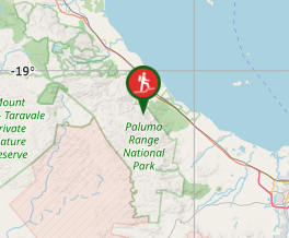
Aussie Bushwalking can keep track of your bushwalks.
Login/signup to tick this walk off.Mt Halifax
Paluma Range National Park
Menu
A tranquil walk alongside a gently flowing stream followed by a diobolically steep and slippery 1km vertical ascent!
Waterfalls
Swimming
Scrambling or Climbing
Camping Permitted
Rainforest
1063m
Maximum Elevation
Getting there
Drive to the end of Pace Road at Rollingstone. You will see a spot you can park on the right side of the road before the gate.
Route/Trail notes
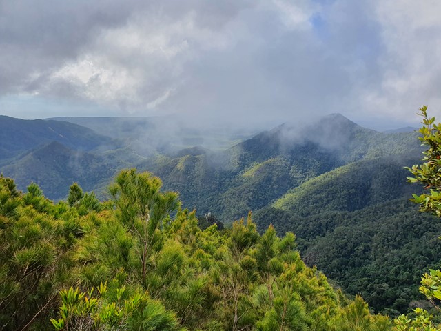
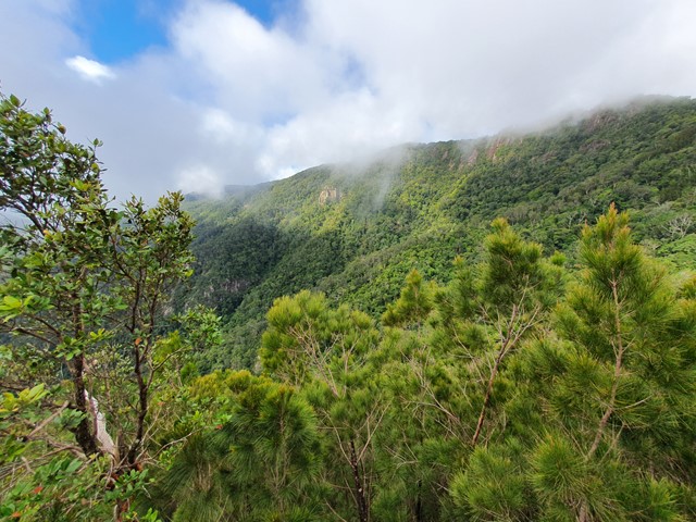
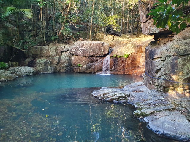
Just before the gate leading into private property you will see a wooden box with a visitor book in it. From here look for the signs to the right and follow a well marked trail along a small stream. As you go you will encounter a series of waterfalls and swimming holes which are a great place to cool off on when you finish your hike. There is a rope allowing you to hug the wall and safely ascend the rocks to the right of the final waterfall (pictured). The next portion of the walk involves a lot of rock hopping as you slowly ascend towards the beginning of the steep section. The track is well signed with heaps of waypoints along the way. From the area marked Flat Rock expect things to take a turn for the difficult as you begin to head to the summit. There are scramblings sections, rock hopping sections, and a number of extremely steep sections with fixed ropes you can use to drag yourself up. The walk begins to shallow out when you reach the first outlook which affords you views of the coastline, and the distant summit. Walk a bit longer and you will eventually arrive at the top which has a rocky outlook to the east with nice views on a clear day.
Permits/Costs
No cost.
Other References
https://www.alltrails.com/trail/australia/queensland/mount-halifax
GPS Tracks
- No GPS available for this walk yet.
Comments