
Menu
Popular Walks
-
Mt Warning Summit Trail
(760 ticks) -
Minyon Falls Loop
(119 ticks) -
Bald Rock Summit
(113 ticks) -
Fingal Head Lighthouse Walk
(73 ticks) -
Grand Canyon Track
(55 ticks)
Sub-Regions
- Bald Rock National Park
- Barren Grounds Nature Reserve
- Barrington Tops National Park
- Basket Swamp National Park
- Blue Mountains National Park
- Boonoo Boonoo National Park
- Border Ranges National Park
- Cathedral Rock National Park
- Dorrigo National Park
- Gibraltar Range National Park
- Greater Sydney
- Gundabooka National Park
- Guy Fawkes River National Park
- Hat Head National Park
- Koreelah National Park
- Kosciuszko National Park
- Ku-ring-gai Chase National Park
- Kwiambal National Park
- Lord Howe Island
- Morton National Park
- Mount Kaputar National Park
- Mt Jerusalem National Park
- Mt Kosciusko
- Mt Warning National Park
- Mutawintji National Park
- New England National Park
- Nightcap National Park
- Oxley Wild Rivers National Park
- Pilliga Nature Reserve
- Royal National Park
- Warrumbungle National Park
- Wollumbin National Park
Summary
New South Wales (NSW), is a state found on the east coast of Australia.
Popular Walks
-
Mt Warning Summit Trail
(760 ticks) -
Minyon Falls Loop
(119 ticks) -
Bald Rock Summit
(113 ticks) -
Fingal Head Lighthouse Walk
(73 ticks) -
Grand Canyon Track
(55 ticks)
Sub-Regions
- Bald Rock National Park
- Barren Grounds Nature Reserve
- Barrington Tops National Park
- Basket Swamp National Park
- Blue Mountains National Park
- Boonoo Boonoo National Park
- Border Ranges National Park
- Cathedral Rock National Park
- Dorrigo National Park
- Gibraltar Range National Park
- Greater Sydney
- Gundabooka National Park
- Guy Fawkes River National Park
- Hat Head National Park
- Koreelah National Park
- Kosciuszko National Park
- Ku-ring-gai Chase National Park
- Kwiambal National Park
- Lord Howe Island
- Morton National Park
- Mount Kaputar National Park
- Mt Jerusalem National Park
- Mt Kosciusko
- Mt Warning National Park
- Mutawintji National Park
- New England National Park
- Nightcap National Park
- Oxley Wild Rivers National Park
- Pilliga Nature Reserve
- Royal National Park
- Warrumbungle National Park
- Wollumbin National Park
Other Information
...
Contact details
NSW National Parks and Wildlife Service
https://www.nationalparks.nsw.gov.au/
Regions
...
Walks in New South Wales

 17
km
return
17
km
return
 4
hrs
4
hrs
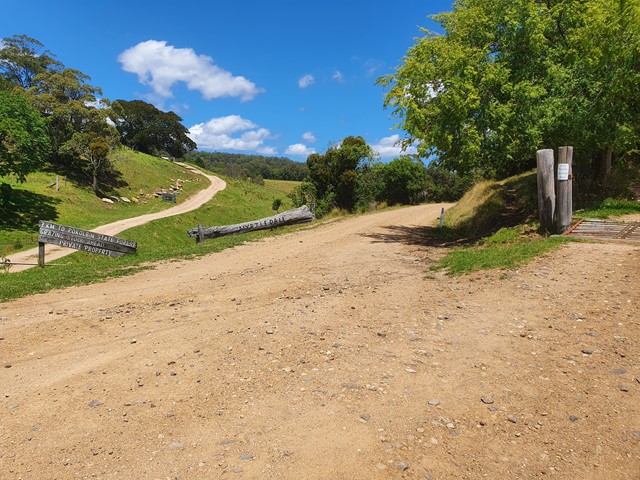
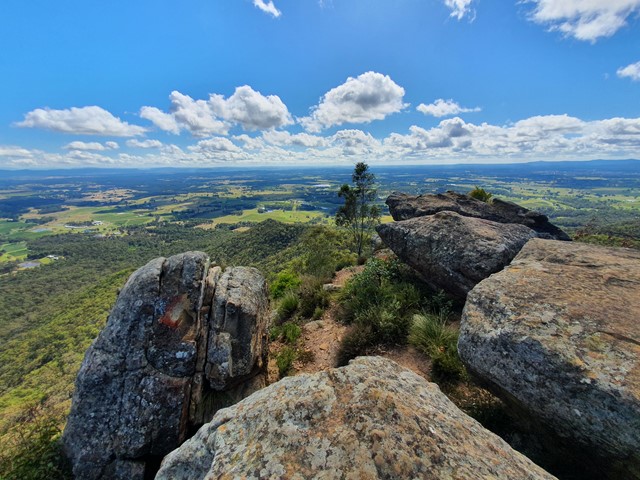
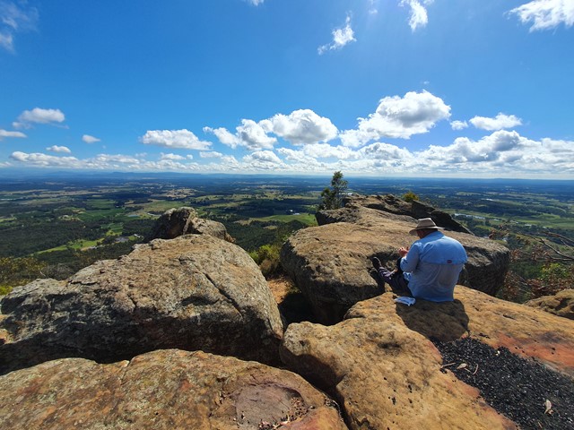
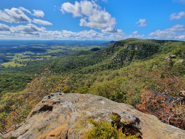
Mt View - Pokolbin Lookout
A nice gradual walk up well graded fireroads to the top of Mt View and the Pokolbin lookout - probably the best lookout in the Hunter valley region.
 7.7
km
return
2
hrs
7.7
km
return
2
hrs
Mt Wondabyne
A nice easy stroll through the Brisbane Waters National Park followed by a short scramble to the summit marker.
 500
m
return
30
mins
500
m
return
30
mins
Mumbulla Falls
A (very) short walk to a beautiful gorge and waterhole on the south coast, with Aboriginal significance.
 3
km
return
3
km
return
Murrays Beach and Governor Head
Murrays Beach is a sheltered and very scenic beach in Booderee National Park (Jervis Bay), a short walk from the car park,
 2.5
km
return
45
mins
2.5
km
return
45
mins
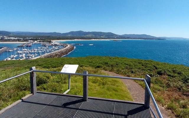
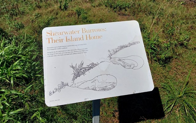
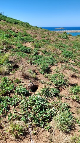
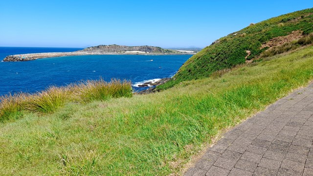
Muttonbird Island Nature Reserve
Explore Muttonbird Island with spectacular views in every direction and an abundance of wildlife.
 1
km
return
30
mins
1
km
return
30
mins
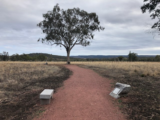
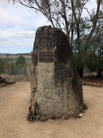
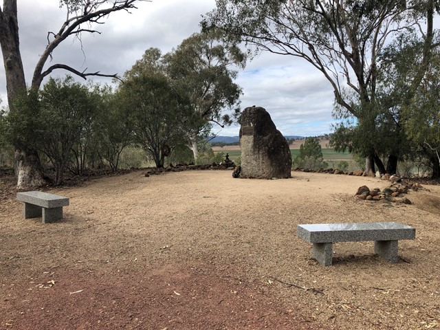
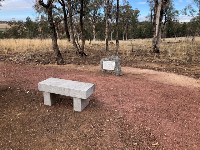
Myall Creek Massacre
A short walk of about 500m to the site of the massacre.
Just before sunset on 10 June 1838, while the Wirrayaraay people were preparing for their evening meal, a group of convicts, former convicts and one settler arrived at the station fully armed. The group tied up the frightened Wirrayaraay people and led them away from their campsite.
Two women and a young girl were set aside, while another young girl was given to Yintiyantin, an Aboriginal stockman whose country was further south and who worked on the Myall Creek station. Two boys escaped by jumping into the creek.
George Anderson, hut keeper at Myall Creek station, later described the terror of the Wirrayaraay people as they were led away and slaughtered. Afterwards, their bodies were piled up and burned. The remains of at least 28 corpses were later observed at the site, but the final death toll has never been confirmed.
 800
m
return
40
mins
800
m
return
40
mins
Myles Dunphy Bushland Reserve
Myles Dunphy Bushland Reserve has a few short and easy trails to enjoy. Located close to Oatley train station it is easily accessible by public transport. The reserve is named after Myles Dunphy, the father of conservation in NSW and former Oatley resident.
Lots of wildflowers are visible on the track and it is a great short walk to do before enjoying a lunch in one of the many cafes in Oatley.
its a great walk for kids under 5 to do.
2.6
km
return
90
mins
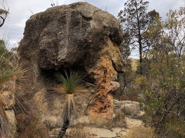
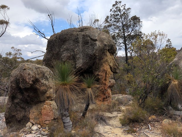
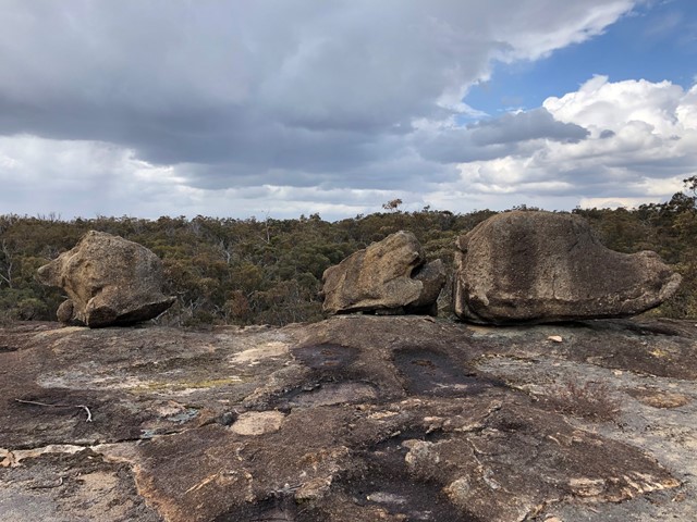
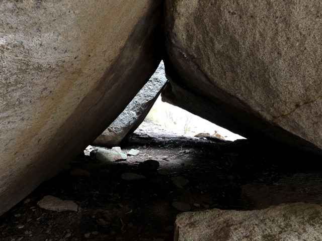
Mystery Face walking track
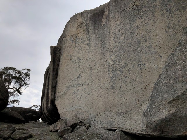
Mystery Face Walking Track is located in Torrington State Conservation Area and provides views of spectacular rock formations
 8
km
return
2
hrs
8
km
return
2
hrs
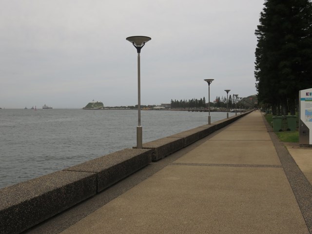
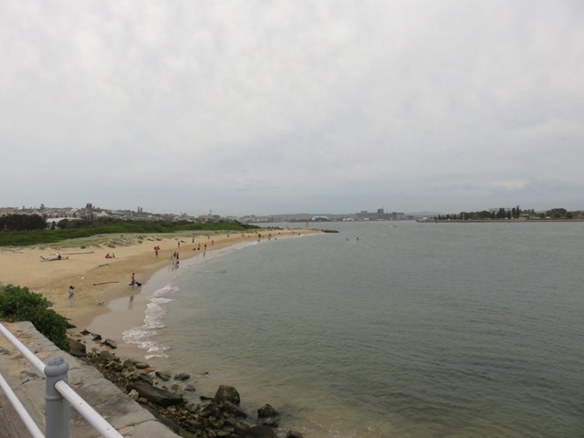
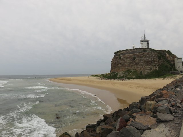
Newcastle Foreshore to Nobbys Head
This relaxing walk explores the Newcastle foreshore (a great place for lunch) and continues along beaches, past Nobby's Lighthouse and to Nobby's Head.
 2.1
km
return
1
hr
2.1
km
return
1
hr
Newnes Plateaus Cliffs
A short walk along a rutted 4wd track to a nice clifftop viewpoint within the Gardens of Stone National Park.