
Menu

 3.3
km
return
3.3
km
return
 90
mins
90
mins
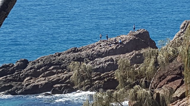
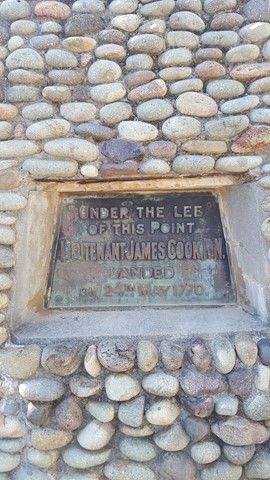
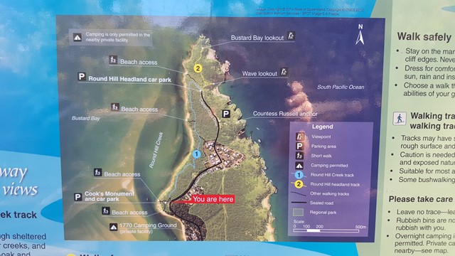
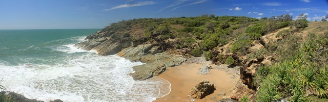
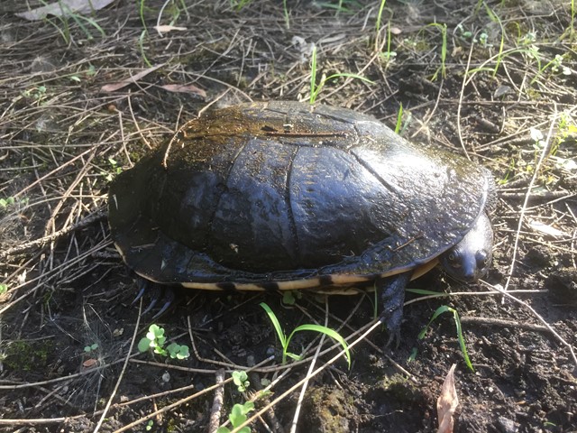
Round Hill Creek & Headland Track
This walk combines both the Creek and Headland Tracks and provides a great little stroll from Captain Cook's Landing Memorial, along the foreshore via the 1770 Butterfly Walk to Round Hill's Bustard Bay and Wave Lookout's with splendid views in all directions.
It's worth planning for a swim along the calm shoreline of Round Hill Creek. Look out for the Blue Tiger Butterflies especially in autumn.
 3.6
km
return
2.5
hrs
3.6
km
return
2.5
hrs
Mt Woowoonga
A rough trail leads through thick vine forest to the lookout before opening up into open hoop pine forest with some vine forest sections in the understory. Towering hoop pines greet hikers at the summit of Mt Woowoonga. A high level of fitness is required to make the final ascent to the summit as it is a steep and strenuous climb suitable for experienced bushwalkers only.
 4.3
km
return
1
hr
4.3
km
return
1
hr
Mookin-bah Reserve
There are a number of trails in the Mookin-bah Reserve. All relatively short but can be combined to walk a little over 5km. This walk started at the Greencamp Road entrance and took the Lorikeets then h9neyeater tracks before merging onto the Fairy wren track and walking to Chelsea Road.
The track is signposted and straightforward with the only tricky part at the start of the walk. The walk starts in just a mown grassy track which quickly reaches an a junction that has no signs. Go left and you will quickly be on the bitumen path.
The return journey is approximately 4.3 km
 2
km
one-way
1
hr
2
km
one-way
1
hr
Jerusalem Creek Track
A walk through dry rainforest near Jerusalem Creek, in the southern part of Barrington Tops National Park.
3.5
km
return
90
mins
Blue Gum Loop Track
An easy loop track in the Williams River area of Barrington Tops National Park that takes you over a couple of bridges that cross the William's River as well as a small water hole.
41
km
return
1
days
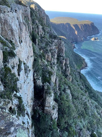
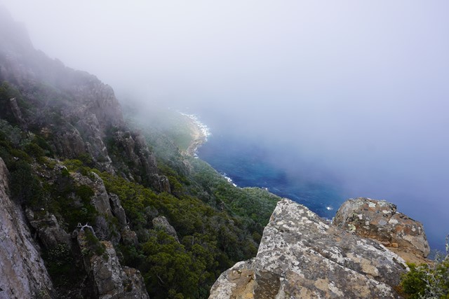
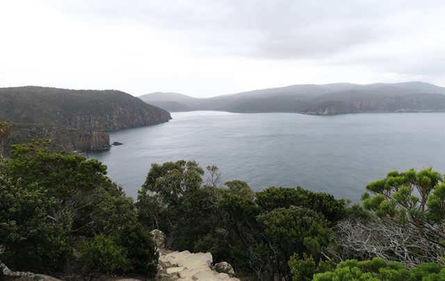
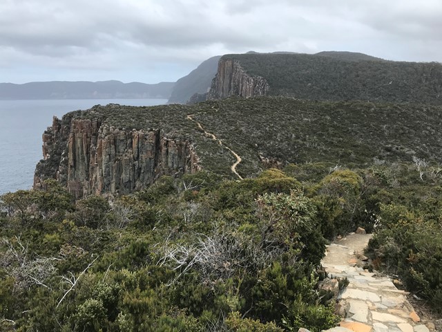
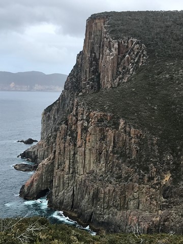
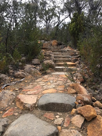
Three Capes
A one day “express” version of the new Three Capes Track in Tasmania, on the Tasman Peninsula - this route covers 90% of the official "Three Capes Experience" track, and could also be done over two days camping at he only designated campsite.
 4.5
km
return
2
mins
4.5
km
return
2
mins
Cape Raoul Lookout
A shorter walk instead of the big one just to the lookout of Cape Raoul.
 200
m
return
15
mins
200
m
return
15
mins
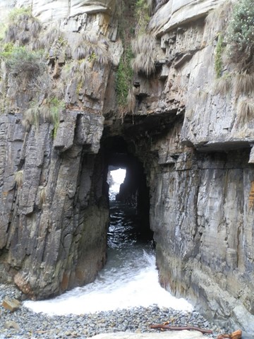
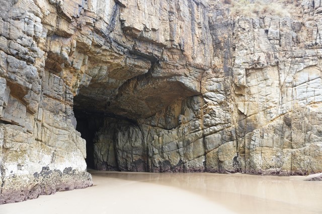
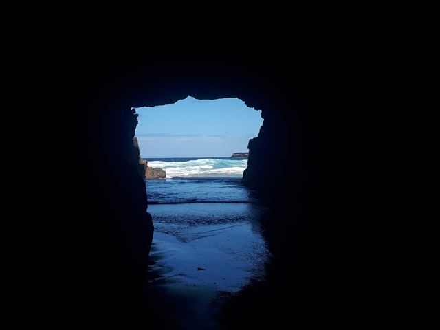
Remarkable Cave
A short boardwalk to a lookout over a tunnel/cave that leads out to sea.
 10
km
4
hrs
10
km
4
hrs
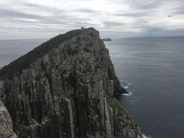
Cape Hauy
The walk provides some magnificent views of the Tasman Peninsula Coast with high cliffs and spectacular rock formations. A very enjoyable walk from Fortescue Bay on a well marked track
 17
km
one-way
7
hrs
17
km
one-way
7
hrs
Fortescue Bay Hike
This is day two of the three capes hike. Today the group will hike 17 Klm's and take up to 7 hours. You will see great views from cliff tops go through rain forests and if your lucky see a water fall. By the end of the day you will need a long soak but feel elated with what you have accomplished.
6.6
km
return
3
hrs
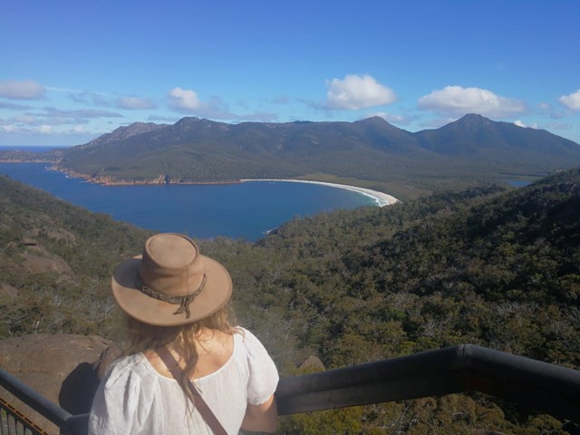
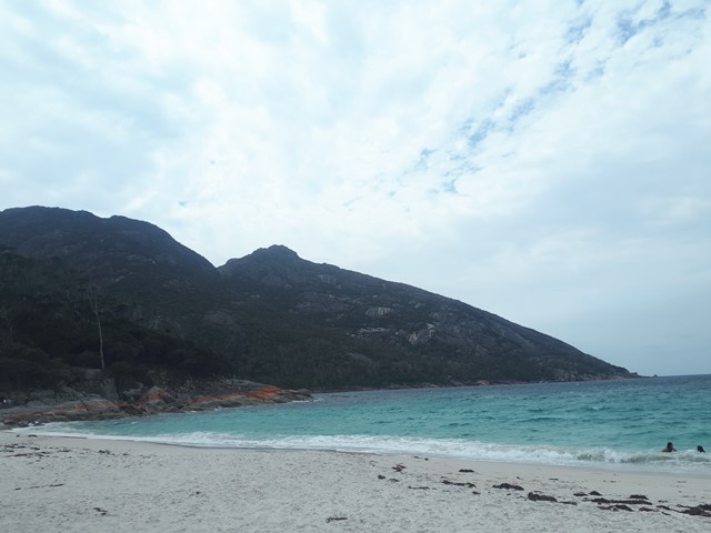
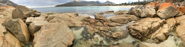
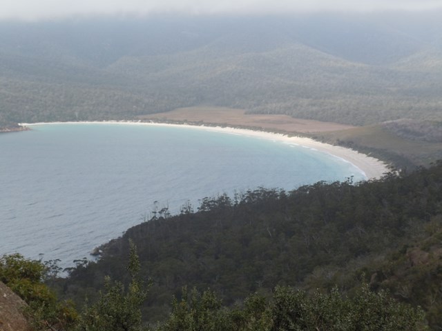
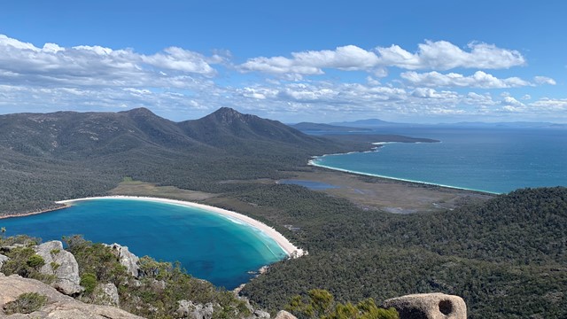
Wineglass Bay
This walk provides spectacular views of Wineglass and other bays on the peninsular from the half way point lookout on the ridge between Mt Amos and Mt Mayson, before descending to the white quartz sands of Wineglass Bay.
 4
km
return
3
hrs
4
km
return
3
hrs
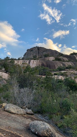
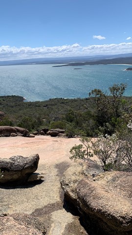
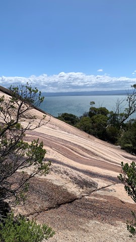
Mount Amos
Mount Amos is a brilliant challenge set in the stunning Freycinet National Park. You'll have to have a good head for heights, have shoes with good grip & be willing to scramble the whole way up & down again. Despite the difficulty, the reward is spectacular at the top with unmatched views of Wineglass Bay & surrounds. An exceptional climb! Don't forget to stop & enjoy the view.
 700
m
one-way
30
mins
700
m
one-way
30
mins
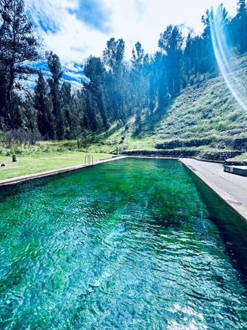
Yarrangobilly Caves Thermal Pool
Yarrangobilly Caves thermal pool, fed by a natural spring, is a magical swimming spot that’s easily combined with a picnic and walk in the Yarrangobilly area of Kosciuszko National Park.
 10
km
6
hrs
10
km
6
hrs
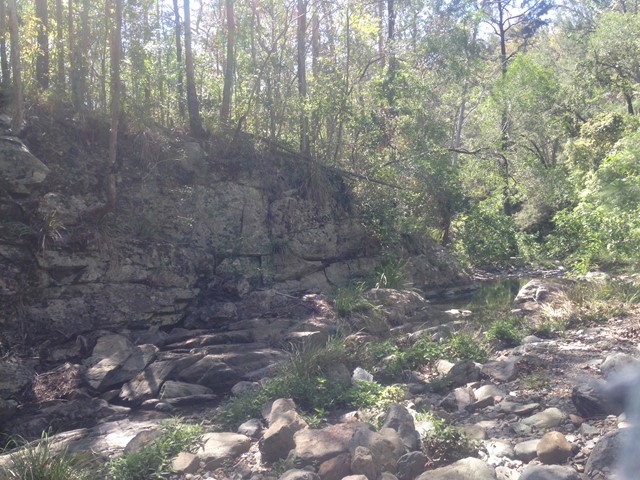
South Kobble bush camp walk
Remote bush camping in open forest beside Kobble Creek.
 8
km
2.5
hrs
8
km
2.5
hrs
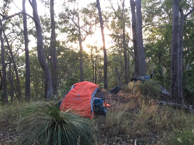
Scrub Road bush camp walk
Remote bush camping in open eucalypt woodland among magnificent spotted gums, ironbarks and grey gums.
 10.4
km
4.5
hrs
10.4
km
4.5
hrs
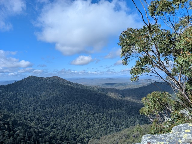
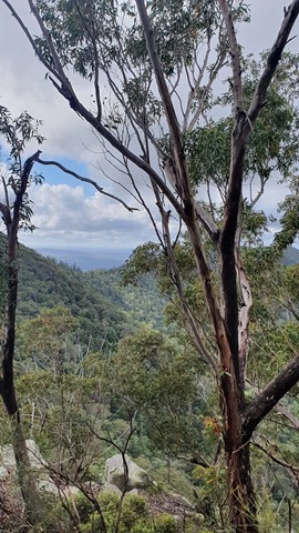
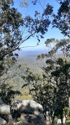
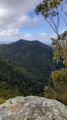
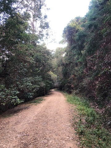
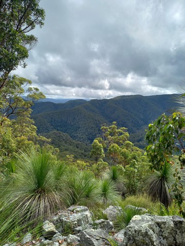
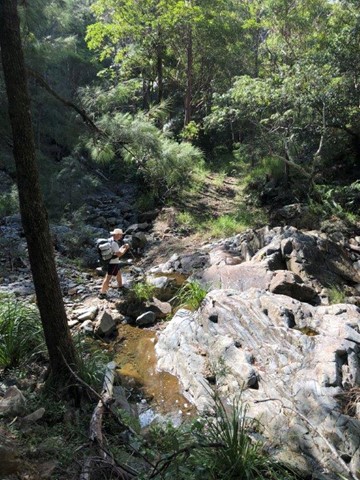
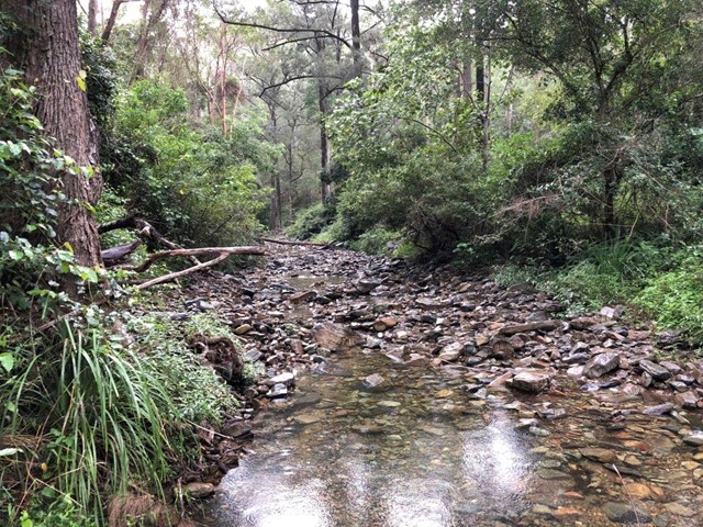
Northbrook Mtn bush camp walk
Remote bush camping on a high ridge overlooking Kipper Creek in wet sclerophyll forest. Northbrook Mountain summit is approximately a 15-minutes walk from the campsite. The summit affords extensive views looking south across the England Creek catchments and is covered in mountain heath, where wildflowers bloom between winter and spring.
Some areas thick with bell miners but away from them plenty of other species.
There is a much nice alternate, albeit less obvious or well trodden route to the lookout near the camp.
Follow the path as normal - once you see the sign AS0361 there is a steep(ish) oot track on the left. If you download What3words the exact location (revisited.sharks.silent). This route is slower going and often quiet steep but considerably more scenic off the 4wd 🚙 track.
If taking it from the lookout, just follow the ridge line at the lookout and you’ll notice a footpath. The Initial descent is tricky but don’t let that scare you off. Once you get going the scenery is great.
 20
km
return
8
hrs
20
km
return
8
hrs
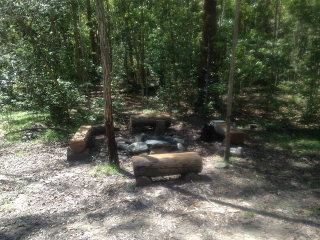
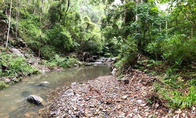
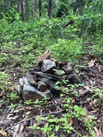
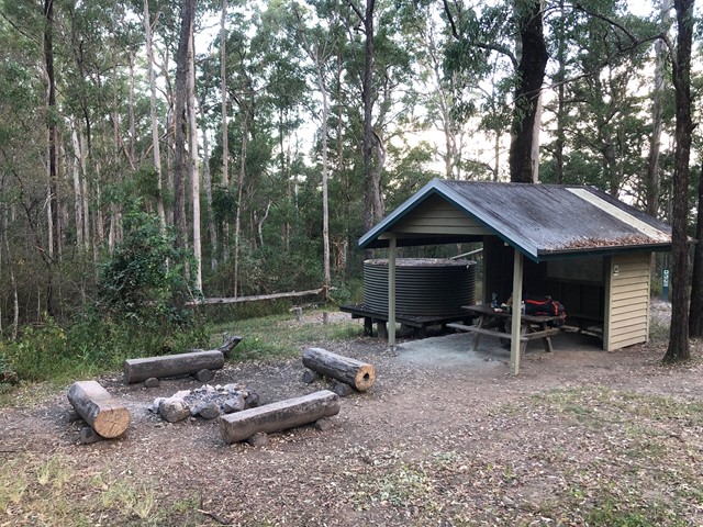
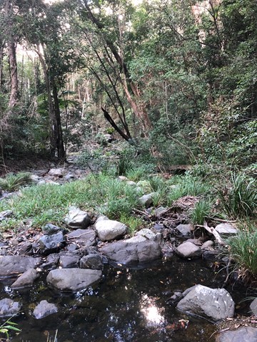
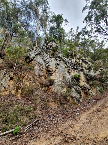
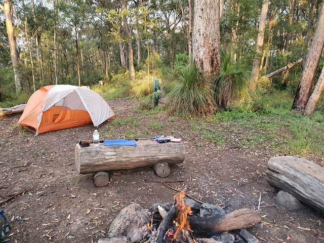
North Kobble bush camp walk
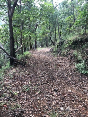
Remote bush camping in open eucalypt forest adjacent to Kobble Creek. The campsite has no facilities other than a fire pit and some log seating. The campsite's access from Lepidozamia Road is by walking along a wide 4wd track. Navigation is relatively easy but you will need to be physically fit for the return journey as the terrain is steep in sections. The walk in from Lepidozamia Road will take approximately 3 hours, and the walk out approximately 4 hours. Distance is is approximately 10km each way. An emergency plan should be in place with a responsible friend or family member. A topographic map is required to find the campsite — map grid reference: 778 856.
 3.6
km
3.5
hrs
3.6
km
3.5
hrs
Light Line bush camp walk
Remote bush camping in open eucalypt woodland surrounded by bloodwoods, grey gums and tallowwoods. The uncommon shrub, Goodenia ovata, shows off its yellow flowers in spring and autumn along the road edge on the walk in.