
Gloucester Falls Walk
Barrington Tops National Park


Menu
A loop track in the Gloucester Tops section of Barrington National Park that takes you to a lookout over the Gloucester Falls.

Getting there
Travel south from Gloucester and turn right into Gloucester Tops Rd. This road is partly gravel and crosses a number of flood ways. After you drive through the National Park campsite, travel another 18km to the top of the plateau. This walk begins at the back of the day use area.
Maps
Which maps cover the area?
Route/Trail notes
This track begins and ends on the same track. Taking the track in a clockwise direction you will come to a lookout over the valley before descending to a lookout over the waterfall. There is an unmarked side upstream from the waterfall that takes you down to the River.
Permits/Costs
No cost
Other References
How can I find more info? Any guide books?
GPS Tracks
- No GPS available for this walk yet.
 1.5
1.5 1
1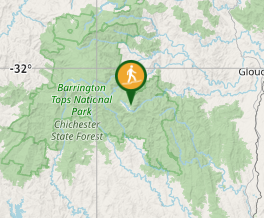
Comments