Spicer's peak

Main Range National Park

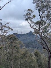
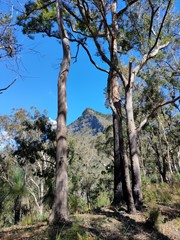
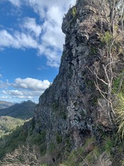
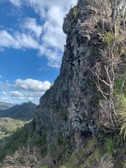
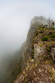
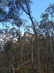
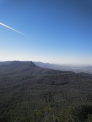
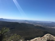
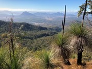
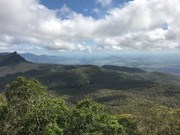
A steep and loose ascent from Governor's Chair. The views are great over the Fassifern Valley.

Scrambling or Climbing

Getting there

Find your way to Aratula and keep going towards cunninghams gap for about five kilometres from elizabeth street, where the fruit barn is and turn left at Lake Moogerah road follow this Road for almost six kilometres to Spicer's Gap Road which you turn right into. After about 3km it turns to gravel and a gate is there that can be closed when wet. 4km from here is the Campground and another 2km will put you at the Governor's Chair.

Maps

Sunmap Cunningham's Gap 1:25000

Route/Trail notes

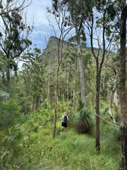
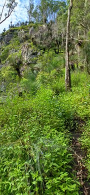
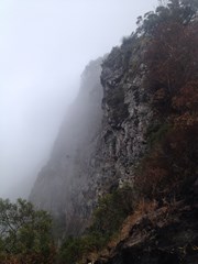
From the Govenor's Chair walk towards the peak and find a well defined foot path heading towards the peak. you should meet a fence, follow this upwards. When the fence ends head twards the cliffs and be rewarded with a great view North and South. Keep following the footpad uphill steep and loose in places and there should be an old fallen fence to follow. Keep going upagoing around any rocky out crops to the right (west) till you reach a cliffline. Turn west (or right) and contour around till abreak is found. about 5 min or so. A steep slab of rock is here climb this till you reach the base of the next cliff line. Turn left and follow the path till the next break is found. Follow the path upwards. it veers to the right through grass and loose steep rock to rainforest. Beware there are stingers here. Follow up through a gully till the trail levels turn Left and walk towards the east or left till you reach an obvious lookout.

to return CAREFULLY retrace your steps.   

Permits/Costs

To camp at Spicer's Gap campground is $5 per night and you need to talk to Ranger's for any other camping.

Other References

John and Lyn Daly: Take a Walk in South -East Queensland.

Comments

This was my third attempt. My last two attempts failed because we contoured 'right' (west) around the cliff looking for a break as per the notes but found it unsafe or hard to navigated. The second time it was also very wet which did not help and ended up on completely the wrong part of the mountain. I don't think I am the only one either even on the days I went quite a few people turned back at the cliff. On the third (successful) attempt we tried to go straight up the cliff next to the precipice and found the path up very obvious, clean, and safe. I understand why the recommended route is to the West but there was no point on the way up next to the drop-off that it felt unsafe - you are in a sheltered gully. There is some rock scrambling. Not for anyone who does not like the thought of being close to the edge. I don't need to state the obvious that extreme care needs to be exercised that close to the cliff, but I felt that overall this was clearly the safest and easiest way up.

Dan456 on 5 Nov, 2016

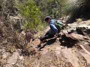
Fairly rough dirt road that leads up to Governers Chairs to begin the hike. Wouldn't recommend taking a normal 2WD if it is wet. There is a noticeable trail that leads to the footpad and from there the trail is very easy to follow, orange talk is scattered at random intervals too. If all else fails aim for the peak. The walk to the edge of the summit gets steep quickly which then leads to two distinct scrambling sections to the peak. The first section is loose rocks and dirt and if you look hard enough you will see the obvious route up, I didn't see this route as I decided to 'try' and climb up a small rock face. Once you get up this section you will hit the near vertical rock wall, if you head left you will come to the second scramble point which will take you to the summit. This section is quite challenging and is somewhat exposed, however as previously mentioned in no way unsafe. Good way to work up an appetite for Ze Pickle.

kvvs on 5 Nov, 2016

1hr 40min ascent, 5hrs round trip as we headed west along the ridge most of the way to west peak before dropping down and bushwacking (through far too much thorny and stinging stuff!) our way back across to the escarpment. No navigation challenges from Governor's Chair through to the first cliff band, just keep the escarpment within view.

The trail notes above are outdated - there is no fenceline (probably burnt out).

Michael on 2 Oct, 2016

Short but steep hike, Bit of scrambling but a great view

Peteski on 18 Jun, 2016

Awesome hike! Great challenge! Not much of a trail so you do need navigational skills and it's fairly overgrown so if your not afraid to bush bash this one is a good adventure! Loved the rock scrambles and cliff climbing 💪

kyles36 on 2 Jan, 2016

A fantastic walk with Brilliant views almost the entire way. Great for pack training.

Alice on 20 Jun, 2015

Beautiful views, worth the effort

drewmac on 13 Aug, 2014

Returned to Spices peak today with a new team, it was hot, dusty and dry, the walk seem to take it out of me today, and just below the last section to the summit cliffs i had problems and had to continue almost one legged to the summit, this was a great accomplishment but the though of the return journey not being able to put too much pressure on my left leg was daunting....after having lunch we decided to decend, it was slow going for myself but i made it back to the carpark coverd in dirt, ash, and a limp.......later we found a few ticks attached to us to our horror..... but nothing a shower and a few beers cant fix..

Walkinghawk on 22 Sep, 2012

Hot and dusty walk today. Fun scrambles, can be loose in parts.

WorldWalker on 22 Sep, 2012

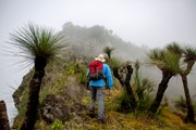
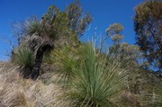
What a great day for a walk....fairly windy today and there's a chill in the air, walked up from governors chair along the cliff ... Then found the main track, continued onward and upward, gets steep in parts and the loose dirt under foot makes it a little harder, there is a few scrambles nothing to difficult, loved walking through the tussocks of grass and the grass trees as I was nearing the summit cliff, at this point I was by myself as the rest of the party didn't continue with me, it's kinda eerie up here by yourself cause it's so quiet and the wind had stilled, I continued on towards the cliffs, and found the track the follows the cliffs to the right and made my way up thought the forest via the loose dirt track that cuts through towards the top, then followed the trail to the summit and the cairn of rocks, there's a good view through the trees looking out to the east..the return journey was quiet fast and met another group heading towards the summit on the way down.... Glad I continued on today and reached the peak...met up with the others half way down....this is one of the better walks I've done in this area, enjoyed every moment of it..

Walkinghawk on 23 Jun, 2012

Very loose and has been burnt so track at times hard to find. Cold this morning at 6.30 am on summit.

Laurence Hallam on 20 Aug, 2011

Very loose and has been burnt so track at times hard to find. Cold this morning at 6.30 am on summit.

Laurence Hallam on 20 Aug, 2011

A steep and loose offtrack walk. Great views but challenging.

Laurence Hallam on 9 Oct, 2010

One of the most fun treks we have done. The first walking part is a bit dull but once you get to the first ridge, some of the best rock scrambling we’ve done. The summit view was narrow but the views on the previous ridge were fantastic.

Tim on 20 May, 2008

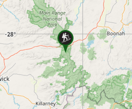
Where

Click here to load this map.

Nearby Walks

Done this walk?

This walk has been ticked 77 times

Aussie Bushwalking can keep track of your bushwalks.

Login/signup to tick this walk off.

Tick walks to keep track of where you've been. You must Login to tick walks. Accounts are 100% free so sign up if you don't have one.