
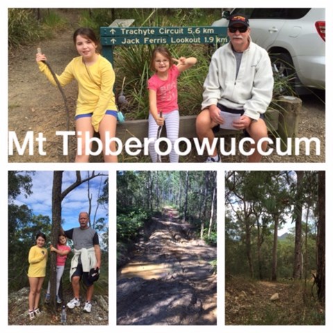
Mt Tibberoowuccum
Glass House Mountains National Park


Menu
GPS Tracks
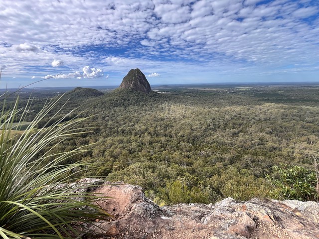

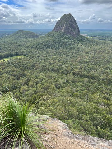
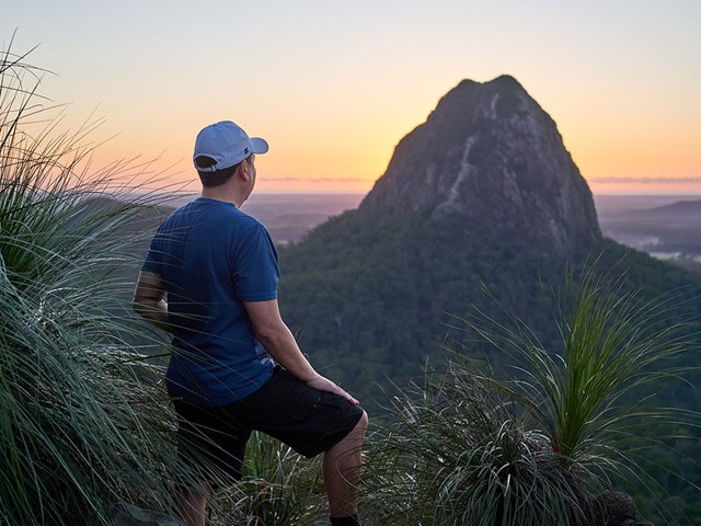

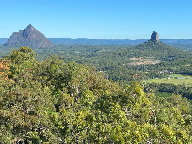
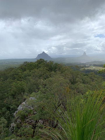
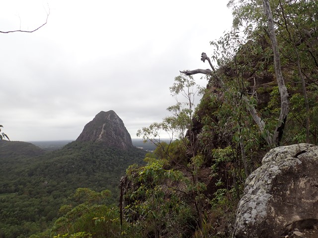
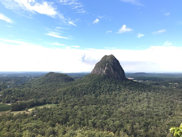
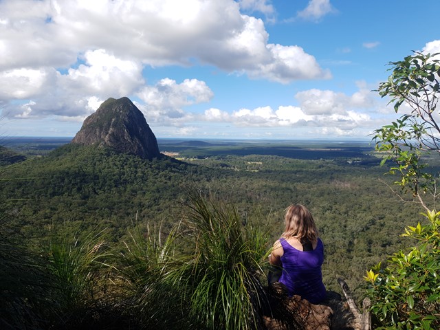
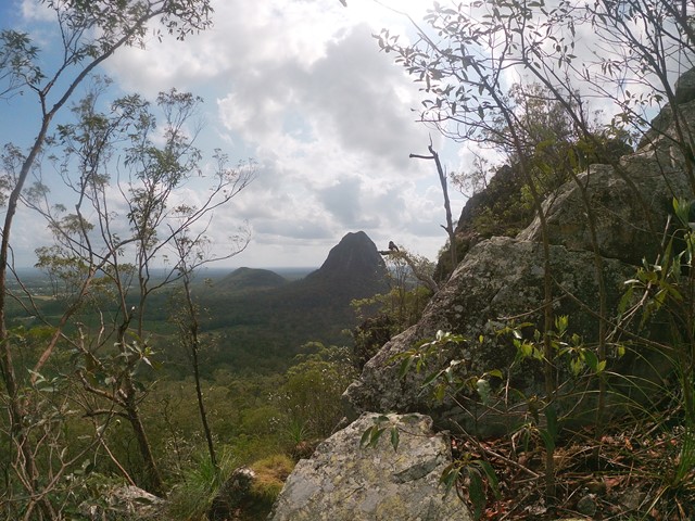

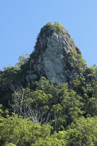

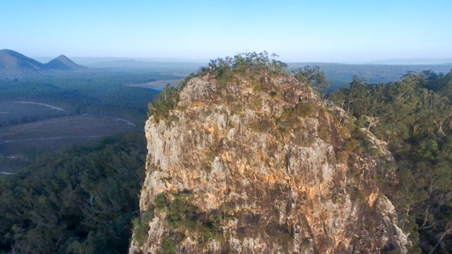

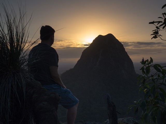
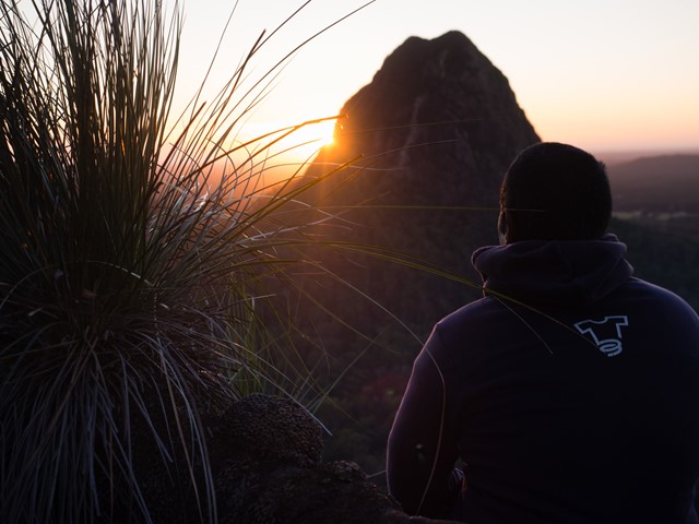


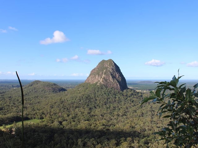
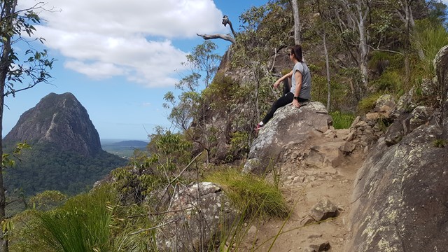
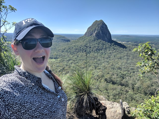

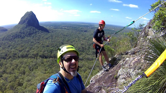
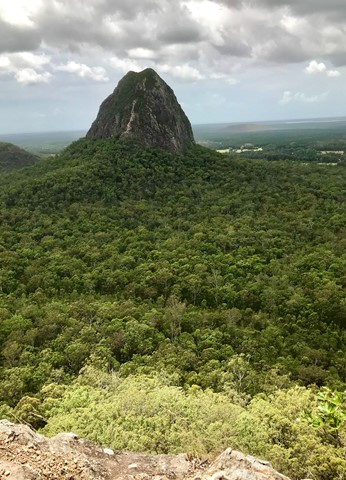
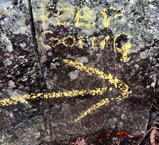


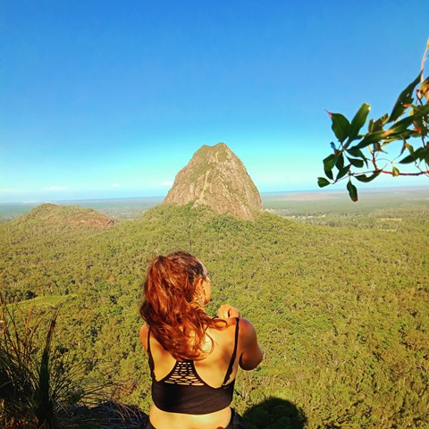
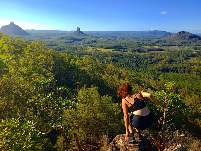

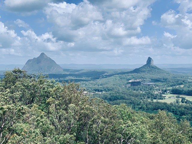
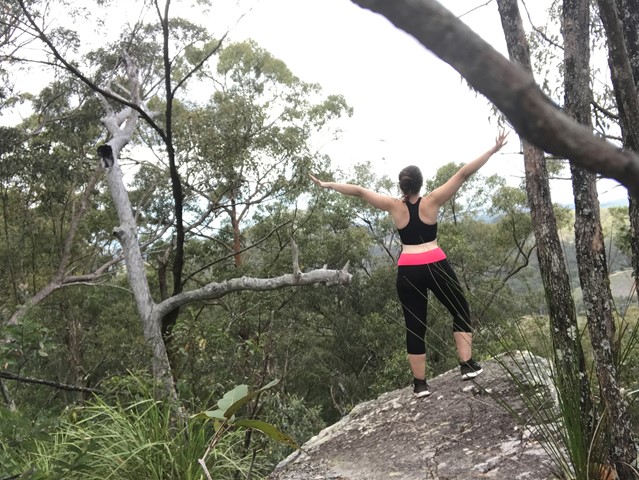
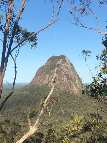
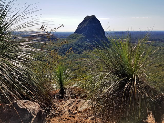

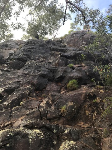
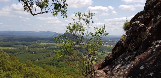
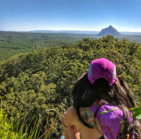
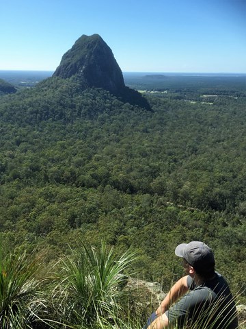

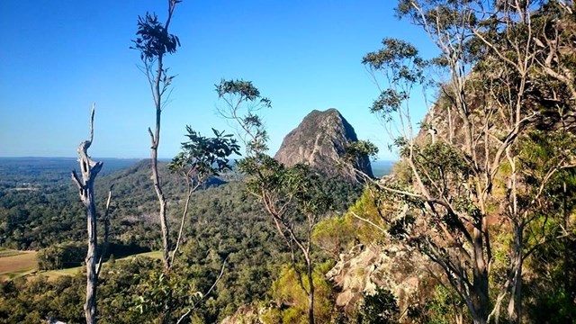
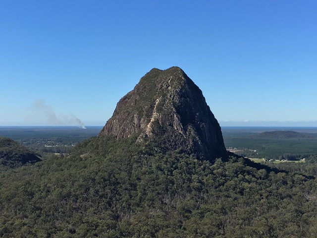
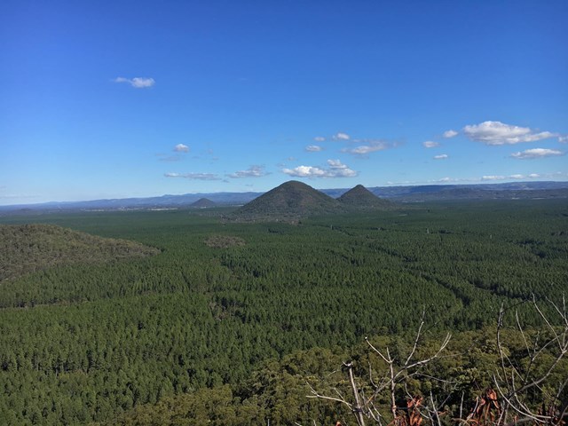
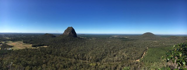

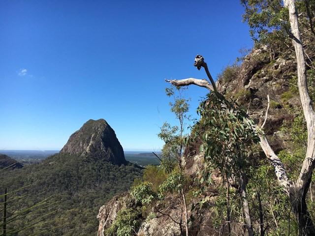


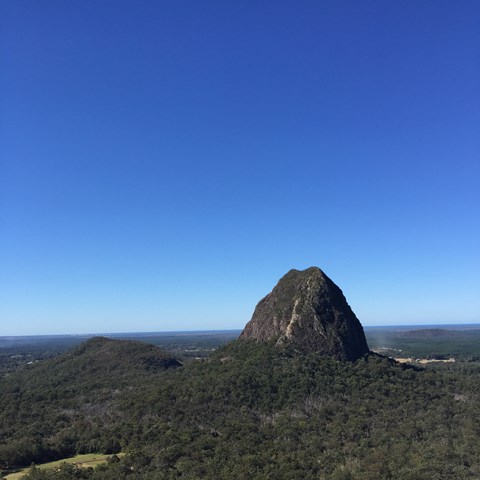

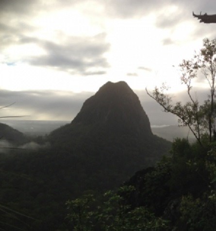
A steep walk to the summit of the mountain, a bit of an uneven but level scramble along the ridge for about 50m with a small 6-8m steep scramble to get to the peak at the end of it. Summit has spectacular views of the surrounding mountains and north to the Sunshine Coast. There are two alternative tracks which meet at the the top of the ridge at a point where an arrow painted on a rock directs you along the ridge to the summit. Take care as both tracks can be slippery after rain due to wet clay/ tree roots and loose shale at the top of the tracks can be a concern in any weather as well.

Getting there:
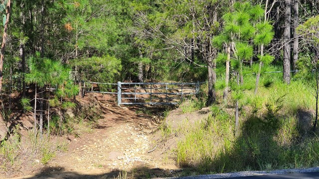
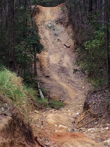
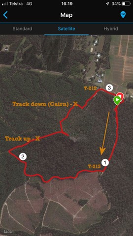
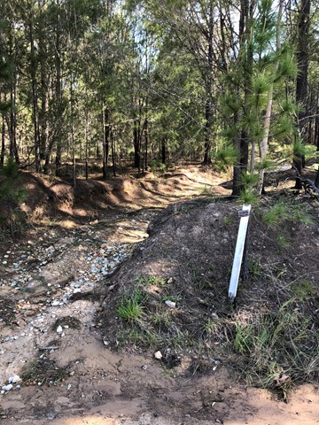
From the Bruce Highway travelling north turn into Steve Irwin Drive and turn left just after Mt Tibrogargan over some railway lines into Barrs Rd (which eventually becomes Marsh's Rd). Follow this to the new Mt Tibrogargan carpark, or park 200 metres further along, across the road from a gated 4WD track designated T-312, which is the start of the track up the Northern face. A second track up the South-Western face can be accessed by turning left at the intersection of Marsh's Rd and Old Gympie Rd and then taking the second gated 4WD track on the left off Old Gympie Rd. Drive towards the base of Mt Tibberoowuccum until you find a safe place to park on the side of the 4WD track. The road has recently been graded (August 2019) and is suitable for conventional vehicles. Several off-road parking spaces have also been created right at the start of the track. You will find the start of the SW track where the the 4WD track takes a sharp bend to the left (North) and also intersects with one coming up a steep gully from the right. Alternatively, you can access this same track from the Tibrogargan car park by following the service roads and 4WD tracks around the Eastern and Southern sides of the mountain for a little over 2 km. For more detail, see the following Route/Trail notes.
Maps:
Route/Trail notes:
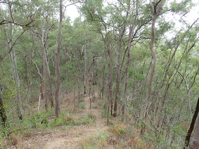
Northern track:
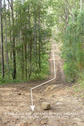
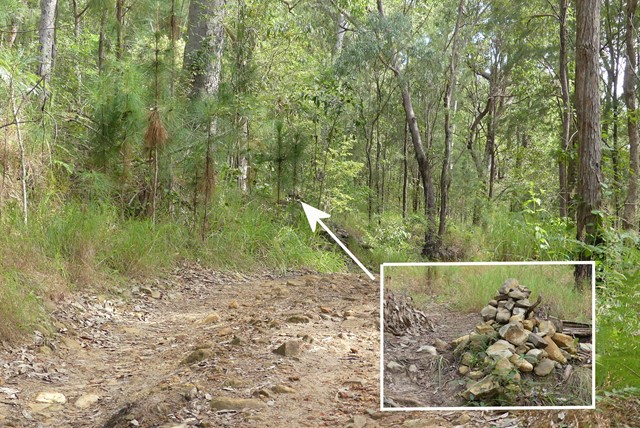
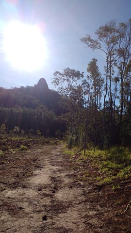
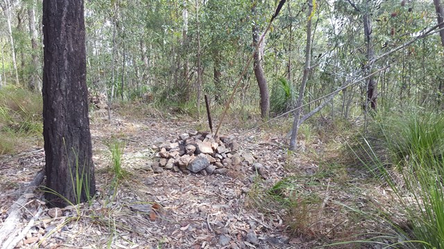
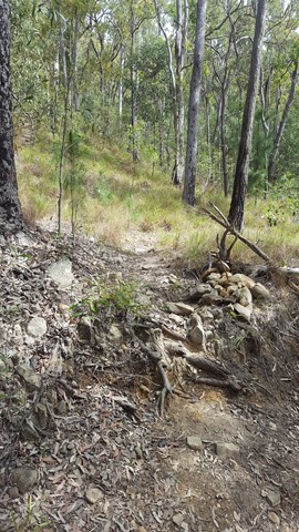
From the new Mt Tibrogargan car park go back out to Marsh's Rd and head left. Continue for 200 m along the road before entering the gated 4wd track marked as T312 on your left. Head right at each fork and follow the track for about 300m. After coming up a large dip in the track, keep a lookout on the left side of the track for a small cairn marking the start of the climb. From here it is easy to keep to the track all the way to the top. When you reach what appears to be the summit that is obscured by trees (and both trails converge) follow the ridge towards Mt Tibrogargan (East) and scramble up a 6-8m knob to the absolute summit. Retrace your steps to the bottom or descend via the south ridge to the 4WD trails as detailed below.
South Western track:
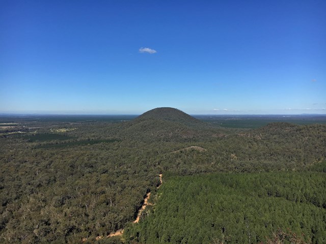
Follow the gated service road at the southern end of the new Mt Tibrogargan car park for 500-600m and then take the first 4WD track to the right (designated T-215 if the sign is there). Follow this for a a further 1.5 km, keeping the mountain on your right. Follow the 4WD track till you get to the south western side of the mountain and look for an intersecting 4WD track on your left coming from Old Gympie road heading up a moderate incline. When you get to the top of the incline you will see the track ascending the mountain straight ahead. It is marked with a couple of 600mm high Koppers logs set in the ground. Follow this up for about 15-20 minutes until it levels out and keep walking carefully East along the ridge till you get to a rocky bluff and an relatively safe and easy scramble to the top. Excellent views from here. To descend retrace your steps or come down the Northern track to meet up with the T-312 4WD track and back to Marsh's Rd and the nearby Tibrogargan carpark. If you elect to retrace your steps down the mountain, when back at the 4WD track at the foot of the mountain, you can either turn left or right and follow the 4WD trails around the base in either direction till you are back at either the start of T-212 or T-215 and continue back to the car park. The North Western 4WD track around the base is much more difficult than the one around the South of the mountain which is really just an enjoyable walk with nice views across to Mt Beerburrum and the Jack Ferris lookout.
The South western track can also be accessed by turning left at the intersection of Marsh's Rd and Old Gympie Rd and then taking the second gated 4WD track on the left off Old Gympie Rd and driving / walking back east toward the foot of the mountain. You will need to park off-road.
Permits/Costs:
None.
Other References/Comments:
The Peak Baggers Guide to the Sunshine Coast ( although parking information out of date)
 23 Mt Tibberoowullum (GPX)
 1.7
1.7 1
1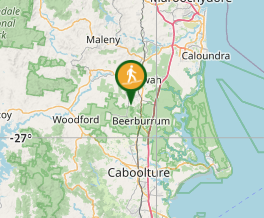
Comments