
Menu
Popular Walks
-
Mt Ngungun
(1155 ticks) -
Mount Coolum
(872 ticks) -
Mt Cordeaux
(668 ticks) -
Twin Falls Circuit
(636 ticks) -
Purling Brook Falls Circuit
(611 ticks)
Summary
The Sunshine State
Queensland has a wealth of bushwalking opportunities including multiple World Heritage Listed rainforests such as the Daintree and Lamington National Park, great coastal and island parks like Fraser Island and Hinchinbrook Island.
Popular Walks
-
Mt Ngungun
(1155 ticks) -
Mount Coolum
(872 ticks) -
Mt Cordeaux
(668 ticks) -
Twin Falls Circuit
(636 ticks) -
Purling Brook Falls Circuit
(611 ticks)
Sub-Regions
Other Information
World Heritage Areas
- Fraser Island
- Gondwana Rainforests of Australia (Lamington NP, Springbrook NP, Mount Chinghee NP, Mount Barney NP, Main Range NP)
- Great Barrier Reef
- Riversleigh
- Wet Tropics (Daintree NP, Barron Gorge NP, Cedar Bay NP, Girringun NP, Wooroonooran NP)
Contact details
Queensland Parks and Forest:
https://parks.des.qld.gov.au/
Regions
The link below provides a region map of QLD as a reference to what council zones are included in the 7 geographic regions of QLD.
https://en.wikipedia.org/wiki/Regions_of_Queensland#/media/File:Qld-regions-map.gif
- Far North Queensland
- North Queesnland
- Central Queensland
- Mackay, Isaac and Whitsunday
- Wide Bay Burnett
- Darling Downs South West
- South East Queensland
Walks in Toowoomba
(Darling Downs South West)
 900
m
return
900
m
return
 30
mins
30
mins
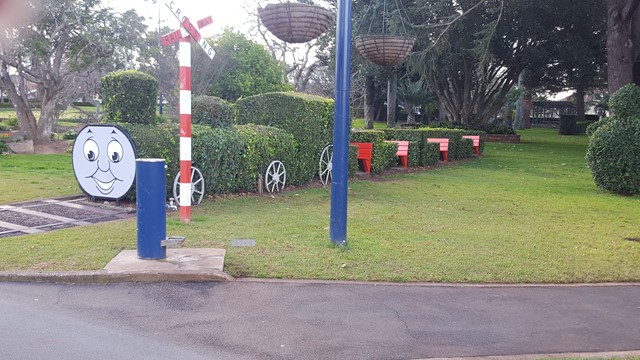
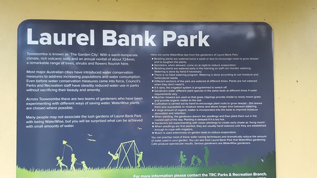
Laurel Bank Park
This well groomed park is a site to behold in spring and summer with its pathways in and around the various flowerbeds and ornamental areas.
 1
km
return
20
mins
1
km
return
20
mins
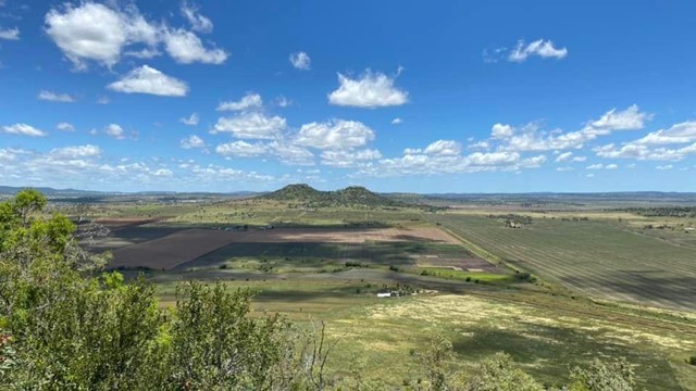
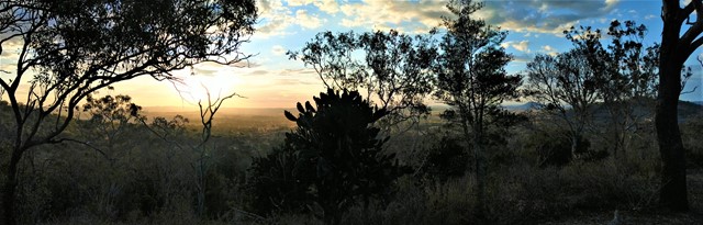
Mount Kingsthorpe
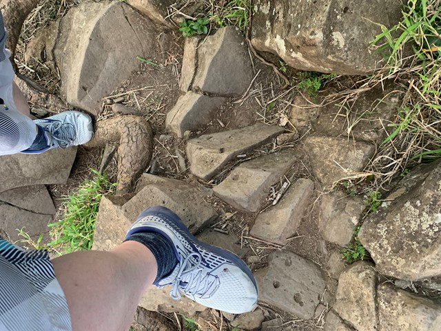
A short walk zigzagging to the summit of Mt Kingsthorpe with panoramic views over the town of Kingsthorpe and surrounding farmland. The trail is unsealed and contains several natural stone steps. There are a few bench seats along the trail to rest but no other facilities.
Officially listed as Grade 4/Hard (loose/uneven surface, natural steps), this track is suitable for walkers of all ages and most fitness levels.
 3.4
km
return
90
mins
3.4
km
return
90
mins
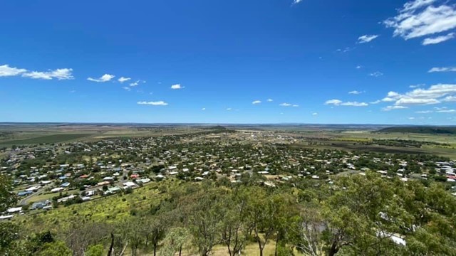
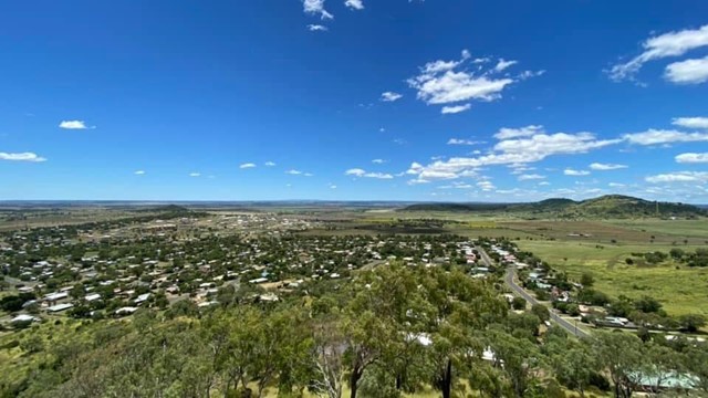
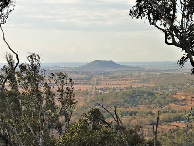
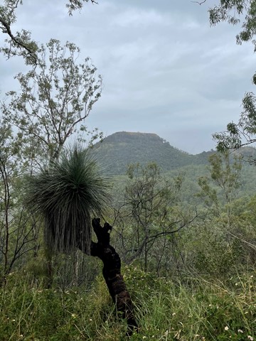
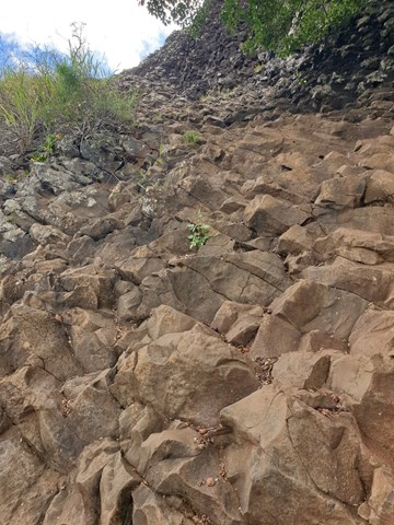
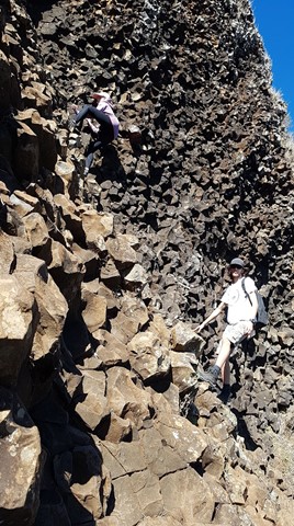
Mt Peel Walking Tracks
A network of walking circuits and firebreak trails through eucalypt forest. There are two main summits that include scrambling sections, and the lookout from the South Summit gives walkers 360° views of Toowoomba and its surrounds.
The trails at Mt Peel are officially listed as Grade 3/Medium - Grade 4/Hard (some steep inclines, rough surfaces + scrambling sections). These tracks are interesting for walkers of all ages, though a moderate fitness level is required.
 1
km
return
30
mins
1
km
return
30
mins
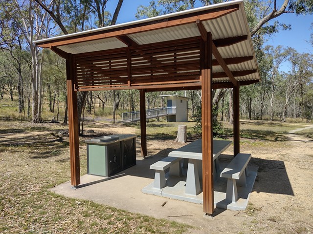
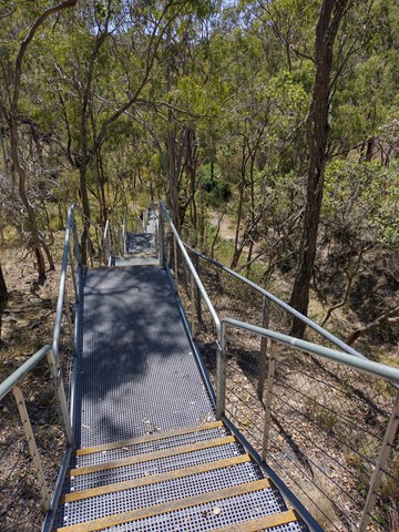
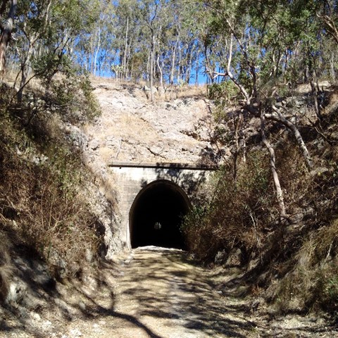
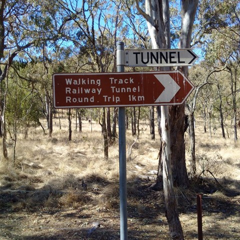
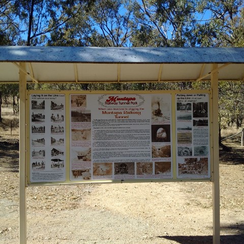
Muntapa Railway Tunnel
Two short walks through eucalypt bushland, leading to both ends of a historic, disused railway tunnel - Queensland's lonest straight railway tunnel. You can enter the tunnel at each end, but cannot walk all the way through as it is fenced off to protect a colony of small native bats.
Interpretive signs give a comprehensive history of the tunnel, and provide details about the resident bat colony.
Officially marked as Grade 3/Medium difficulty (many stairs down to the northern entrance), this track is manageable for most ages and fitness levels.
 1.5
km
return
30
mins
1.5
km
return
30
mins
Nielsen Park Walking Circuit
A short, shady walking trail through urban bushland. The dirt track is flat and well maintained but may be muddy after rain. This park is being regenerated by volunteers and has some interesting bird and plant life.
Officially listed as Grade 2/Easy, this track is suitable for walkers of all ages and fitness levels.
 12
km
return
4
hrs
12
km
return
4
hrs
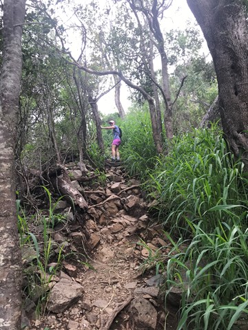
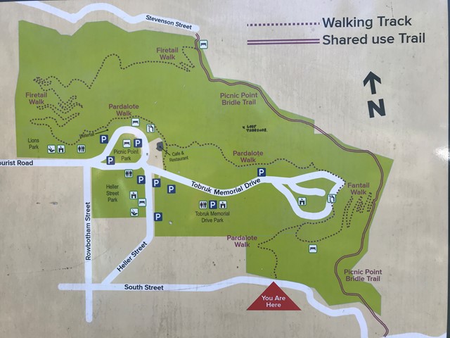
Picnic Point to Table Top
A terrific hike from the waterfall at Picnic Point to Table Top Mountain and return. Challenging in some sections of Table Top with rock scrambling and lots of gravel. The return trip to Picnic Point is also hilly. 12k is an approximate distance. You can add to this or shorten the walk with a few different options.
 400
m
return
25
mins
400
m
return
25
mins
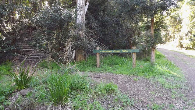
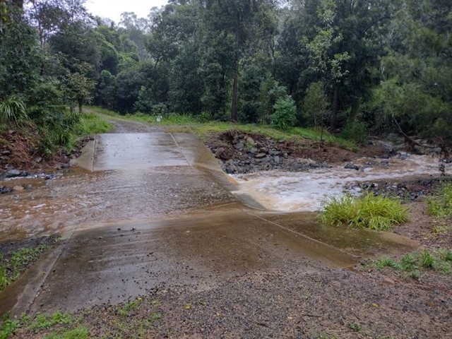
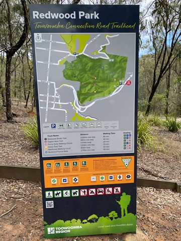
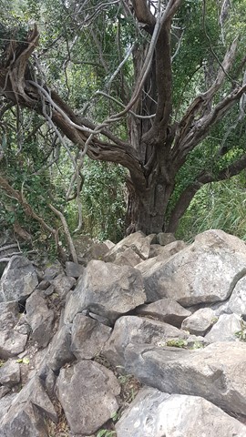
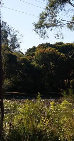
Rainforest Walking Circuit - Redwood Park
This short loop starts from the Redwood Park picnic area near the bottom of the Toowoomba Range. It is a narrow, winding track the leads through a pocket of dry rainforest and along the bank of Gatton Creek. Caution: the causeway can be slippery/flooded after rain.
Officially listed as Grade 3/Medium difficulty (includes some natural stairs + uneven surfaces), this track is suitable for walkers of all ages and most fitness levels.
 11.6
km
return
3.33
hrs
11.6
km
return
3.33
hrs
Redwood and Jubilee Parks Loop
Experience this 11.6-km loop trail through eucalypt forest along the Toowoomba escarpment. This is a popular trail for hiking, mountain biking, and trail running, but you can still enjoy some solitude during quieter times of day. Starting from the Grasstree Track trailhead at the bottom of Redwood Park, this challenging circuit combines tracks from Redwood Park and Jubilee Park.
This route features a decent incline that is sure to get the heart pumping! Can become quite muddy in places, especially after rain.
The trails that make up this loop are officially listed as Grade 3/Medium - Grade 4/Hard (steep inclines, loose/uneven surfaces + limited signage). This track is suitable for walkers/joggers with a moderate-high fitness level.
 2
km
return
2
hrs
2
km
return
2
hrs
Table Top Loop
Table Top mountain on the edge of Toowoomba, provides views of the Lockyer Valley and surround. The climb itself can be quite demanding with a lot of large steps over the Camel's Hump and a scramble just before the summit. But the reward at the top, with a circuit all the way around, provides a spectacular vista.
Table Top is an area of high significance to the Traditional Owners, recognised in the Aboriginal Cultural Heritage Register and protected under the Aboriginal Cultural Heritage Act 2003. You are respectfully requested to consider your decision to climb this mountain.
 4.7
km
return
90
mins
4.7
km
return
90
mins
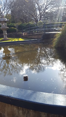
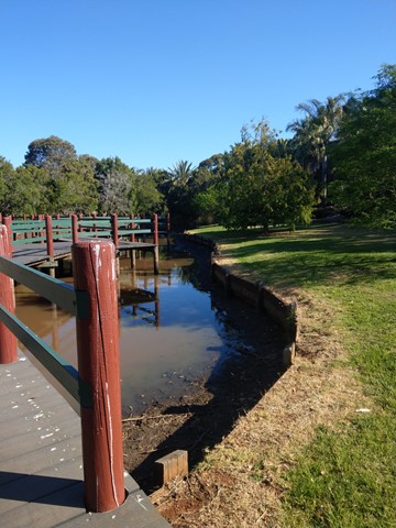
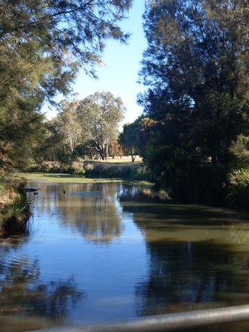
West Creek Reserve
A casual stroll in and around West Creeks lakes and ponds out to Kearney Springs Wetlands Historic Park.