
Picnic Point to Table Top
Toowoomba


Menu
A terrific hike from the waterfall at Picnic Point to Table Top Mountain and return. Challenging in some sections of Table Top with rock scrambling and lots of gravel. The return trip to Picnic Point is also hilly. 12k is an approximate distance. You can add to this or shorten the walk with a few different options.

Getting there:
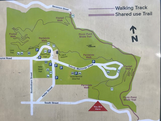
Start the walk anywhere at Picnic Point which is on the Eastern escarpment of Toowoomba. Plenty of free parking, toilets, cafe.
Maps:
None found.
Route/Trail notes
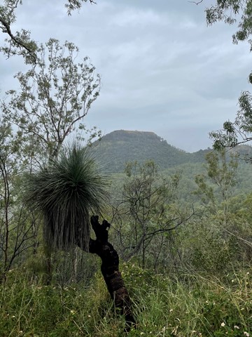
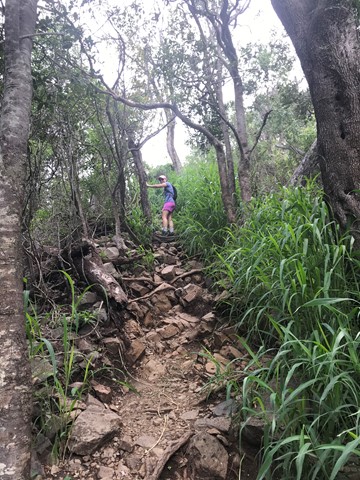
Follow the signs to the Picnic Point waterfall and start heading East on the Pardalote Walk. Follow the Pardalote Walk to South Street Car Park then walk downhill on South Street for a couple of kms until you reach the base of Table Top Mountain. The track then starts immediately uphill over a rocky path. Be prepared to scramble over a lot of rocks and boulders as well as large gravel. It's not an easy hike but can be negotiated by anyone with a good level of fitness and enthusiasm. You can either return the same way via South Street or go a different way via a wide track in the middle of private land. A sign to this track is at the Table Top carpark on the left hand side at a gate. The track is really well signed all the way back to Picnic Point. You end up back at the base of Picnic Point and have a choice to take the Bridle Trail or the Fantail Walk back to the circular roadway around picnic areas which then takes you back to the waterfall.
Permits/Costs:
No costs.
Other References/Comments:
https://www.qt.com.au/news/your-say-best-walks-toowomba/2665888/#/0
GPS Tracks
- No GPS available for this walk yet.
 12
12 4
4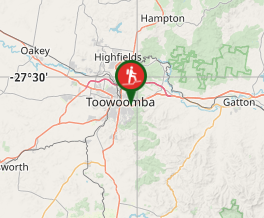
Comments