
Menu
Popular Walks
-
Mt Ngungun
(1145 ticks) -
Mount Coolum
(864 ticks) -
Mt Warning Summit Trail
(759 ticks) -
Mt Cordeaux
(659 ticks) -
Twin Falls Circuit
(630 ticks)
Popular Walks
-
Mt Ngungun
(1145 ticks) -
Mount Coolum
(864 ticks) -
Mt Warning Summit Trail
(759 ticks) -
Mt Cordeaux
(659 ticks) -
Twin Falls Circuit
(630 ticks)
Sub-Regions

 8.2
km
return
8.2
km
return
 100
mins
100
mins
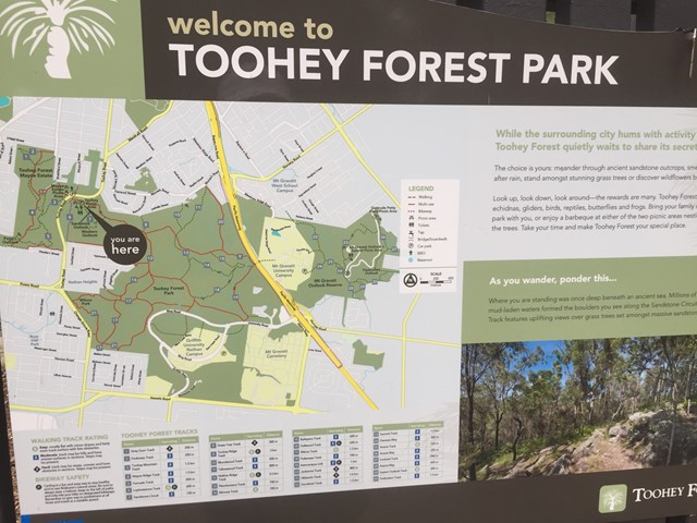
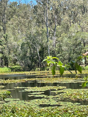
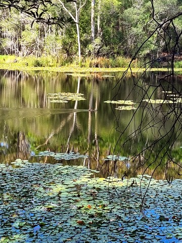
Toohey Forest Park Loop
This is a nice loop of Toohey Forest Park. Beautiful bushland, but not really fond of the paved path. I guess it does support erosion control though. Otherwise, great ecosystems throughout, going from the dry Eucalypt forest, down to the riparian system at lower elevation.
Great native flora and fauna everywhere.
 5
km
2
hrs
5
km
2
hrs
Toohey Forest to Mt Gravatt
The track is paved then bitumen to wide track. This walk can be completed in almost all conditions.
 3
km
return
45
mins
3
km
return
45
mins
Toohey Mountain Track & Mayne Ridge Track
A short walk in Toohey Forest Park from the Mayne Estate Picnic Area to the top of Toohey Mountain and to Pegg's Outlook.
 2
km
40
mins
2
km
40
mins
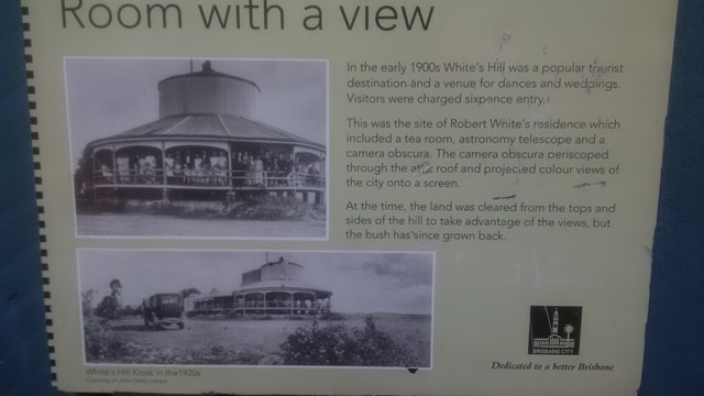
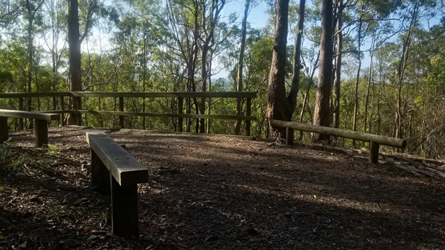
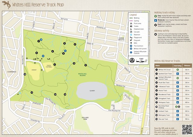
Whites Hill Circuit
A nice urban bushland walk to a peak and lookout to Brisbane's CBD. A few tracks that can be combined to a loop.
 500
m
return
30
mins
500
m
return
30
mins
Windaroo Mountian
Short walk, one route is steep the other isn't not the best views on top but not bad. There are a number of trails and tracks. Nothing marked.
 1.5
km
return
40
mins
1.5
km
return
40
mins
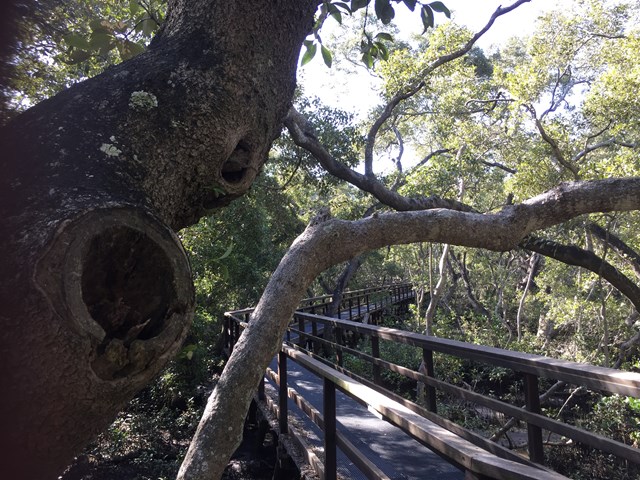
Wynnum Mangrove Boardwalk
Walkway and boardwalk circuit that pass through the mangroves.
 1.5
km
27
mins
1.5
km
27
mins
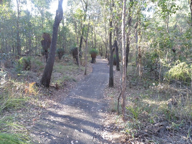
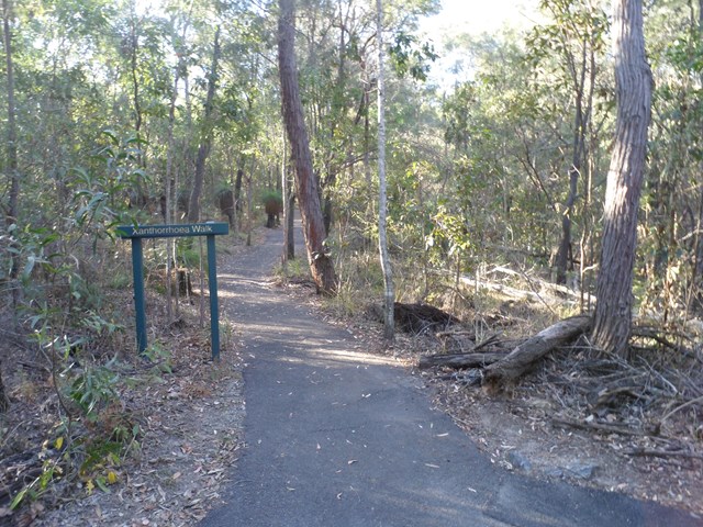
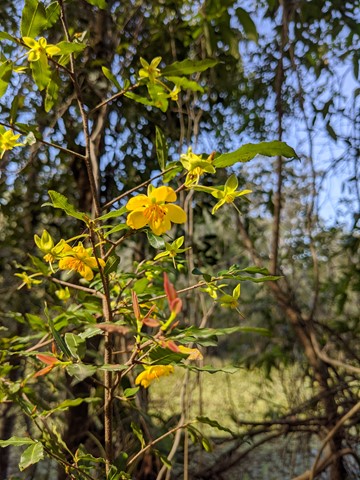
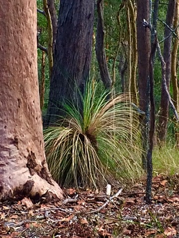
Xanthorrhoea Track
This track passes through mixed heath and woodland species including banksias, grass trees and heath peas. You are likely to see kookaburras, forest kingfishers, red-backed wrens, dollarbirds, lizards and geckoes.
Picnic area available at entrance.
Grade: easy, but it’s hilly
Suited to: birdwatching and flora walks
Habitat: heathland
Must: walk this track in September or at dusk
Recommendation: combine this track with the Banksia Track for a two hour circuit walk, Pomax Track for another two hour walk or all three for a three hour walk
 5
km
90
mins
5
km
90
mins
Araucaria Track
This walk begins off downhill, soon there are some views of the reservoir then the track begins to wind its way along the edge of the reservoir keep an eye out for different water birds.
I would advise taking you camera equipment as well as a pair of binoculars for some good bird watching. After approx 1.7km you come to a Y junction go straight ahead and some more views of the Enoggera weir come into sight. There seems to be alot of bellbirds and a few whipbirds around here.
From here the track winds into some bush some small reminent of rainforest. And from here it gets a bit "are we there, yet" but keep on going up and over the ridge and back down again and you rejoin back at the Y junction.
Now the return route can be a little problem if you leave it late to do this walk because on your return from the Y junction. You will meet alot of people along the way.
Some signs have been errected "brown snakes" in the area. So watch your step when walking around the exposed hot ridge areas.
Also this track can be combined with the Corymbia Circuit to add a bit of distance for you walk.
 5.2
km
return
90
mins
5.2
km
return
90
mins
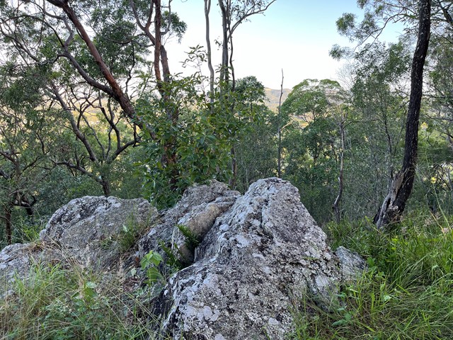
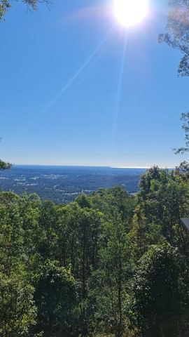
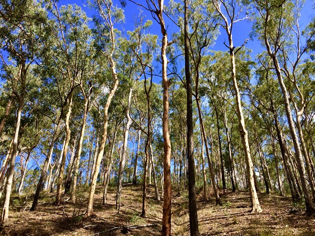
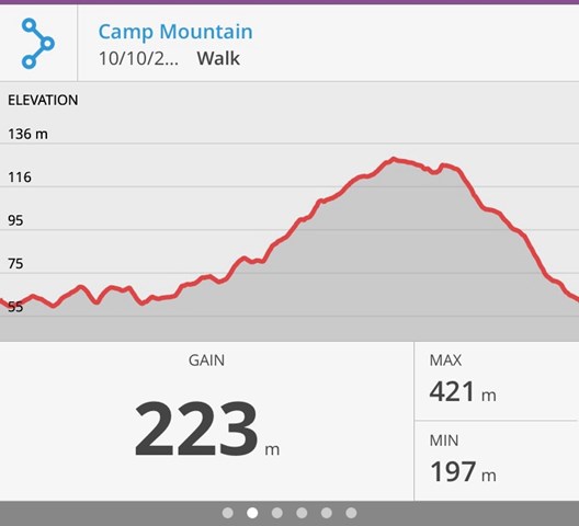
Camp Mountain Lookout
Beautiful walk through eucalypt forest along a well maintained fire trail. We parked at the junction of Suttons Road & Suttons Court, Camp Mountain, parked the car at the horse step through and headed up the hill. It's a steep walk up to the lookout where you will find spectacular views of Brisbane City and Moreton Bay. Wander a little further and you can see the beautiful Samford Valley and Glass House Mountains in the distance. You can also drive into the lookout from Mt Nebo Road.
If you are feeling energetic and want to add an extra hour to your walk, head down the hill towards Bellbird Grove - the trail splits just after the water tank, instead of going left to do the circuit, go straight ahead. Follow the trail and you will come into the back of Bellbird Grove - have a toilet stop, a little rest and then turn around and head back the same way to join back onto the circuit.
 18
km
7
hrs
18
km
7
hrs
Cedar Creek to White Cedar Picnic Ground
A Walk over the D'Aguilar Range via Maiala Picnic Ground.