
Menu
Suggested searches
Your search found 2400 results...

 5.8
km
return
5.8
km
return
 4
hrs
4
hrs
Gorge Hike
South Australia
This trail descends from the Sundews Lookout along a contoured walking trail to the bottom of the gorge, and then follows the river downstream for 1.6km before returning via a steep fire track to the ridge and the car park.
The walk takes in two perennial waterholes, and a lookout. There are numerous glimpses into the river gorge from various parts of the trail.
The 1.6km of trail along the river is not well-formed, and involves some short rock scrambling. Current water levels and recent rainfall can impact on how hard this river section of trail is to follow. The trail is easiest to navigate when walking clockwise, as the fire trail exit is easily spotted, whereas when walking anticlockwise the walking trail exit may be harder to find.
Begins from the carpark at Gate 11 on Piggott Range Road (near junction of Upper Penneys Hill Road).
 2
km
return
1
hr
2
km
return
1
hr
Punchbowl Lookout Walk
South Australia
A new trail opened in Spring 2017 as part of the Government of South Australia’s $10 million upgrade of the Adelaide’s national parks.
The 1km (2km return) trail visits a new lookout above The Punchbowl, where you can see spectacular views into the Onkaparinga Gorge. The trail is a consistent one metre wide and made of compacted gravel, and with gentle contoured gradients, so as such is suitable suitable for people of all abilities, including those with mobility access issues, wheelchairs and prams. There is some seating mid-way along the trail.
Some people using wheelchairs may require assistance on the way back up the trail to the car park.
The Hike begins from the new carpark constructed in 2017, between gates 8 and 9 on Piggott Range Road. There are toilets at the nearby Sundews Carpark, near Gate 11 on Piggott Range Road.
 2.5
km
return
30
mins
2.5
km
return
30
mins
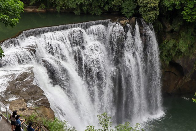
Shifen Waterfall 十分瀑布 (New Taipei City)
Taiwan
This is not much of a hike. There is a solid concrete path and road that takes you directly from the train station at Shifen to the waterfall. The viewpoints around the waterfall are incredibly crowded and can somewhat disrupt the view. I recommend going early to beat the tourists.
 4.5
km
return
2
hrs
4.5
km
return
2
hrs
Mount Campbell
Cradle Mountain-Lake St Clair National Park
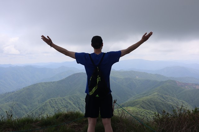
A short but steep walk to a broad summit with uninterrupted 360 degree views of the area.
15
km
one-way
5
hrs
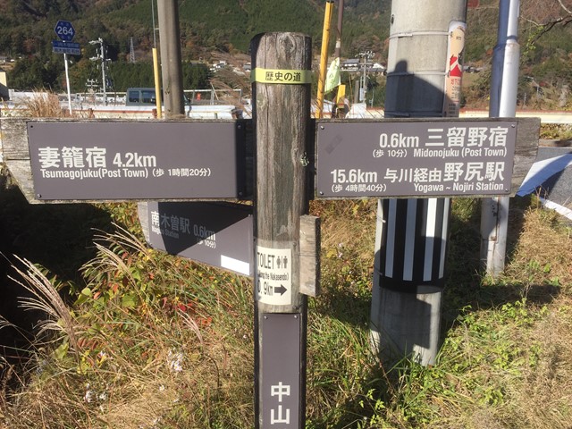
Nakasendo Trail (Nagiso to Nojiri section, Nagano Prefecture)
Japan
Traverse a section of the old road between Tokyo and Kyoto, dating back to the Edo Period.
Enjoy villages and landscapes in their natural beauty.
This section of the Nakasendo Trail was used when the more direct route along the Kiso river was flooded.
 1.3
km
one-way
20
mins
1.3
km
one-way
20
mins
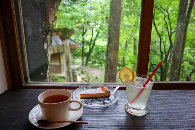
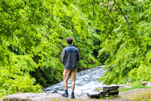
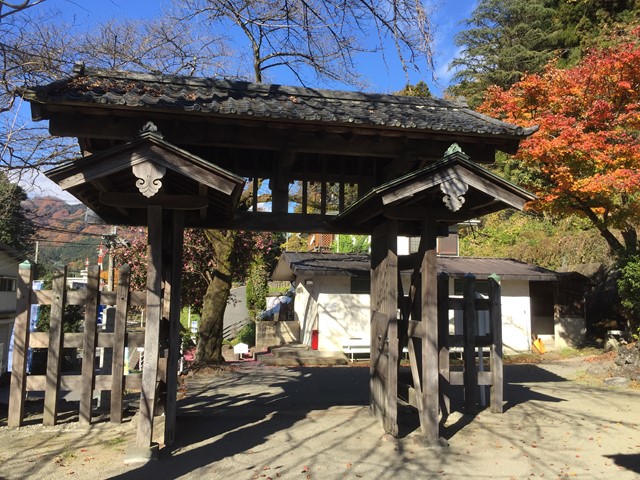
Kakusenki Gorge 鶴仙渓 (Yamanaka Onsen-Ishikawa Prefecture)
Japan
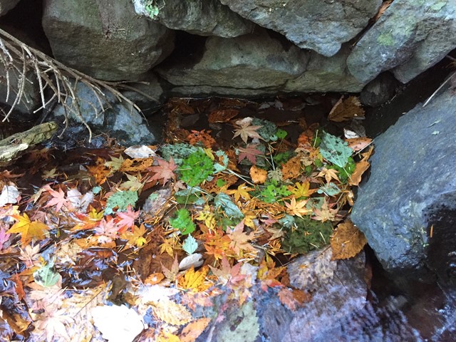
Kakusenki Gorge is located along the Daishoji River near the village of Yamanaka Onsen. The 1.3km Gorge runs from Korogi Bridge to Kuratani Bridge.
This is a luscious, serene walk in Ishikawa Prefecture. It is very easy and anyone can do it. Follow the river and take in the sights. There are some cool bridges along the way and some cute cafes in the forest.
 17
km
one-way
6
hrs
17
km
one-way
6
hrs
Nakasendo Trail (Yokokawa to Karuizawa section, Gunma/ Nagano Prefecture)
Japan
Traverse a section of the old road between Tokyo and Kyoto, dating back to the Edo Period.
Enjoy villages and landscapes in their natural beauty.
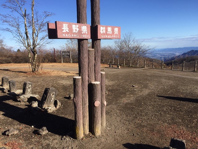
This section of the Nakasendo Trail crosses the Usui pass (1200m), marking the border between Gunma and Nagano.
 16
km
one-way
6
hrs
16
km
one-way
6
hrs
Nakasendo Trail (Nakatsugawa to Nagiso section-Gifu/ Nagano Prefecture)
Japan
Traverse a section of the old road between Tokyo and Kyoto, dating back to the Edo Period.
Enjoy villages and landscapes in their natural beauty.
This section of the Nakasendo Trail includes the villages of Magome and Tsumago, known for their meticulous restauration.
 27
km
return
11
hrs
27
km
return
11
hrs
Mount Field West via Newdgate Pass
Mount Field National Park
A full-day hike (loop) past the Mount Mawson Ski Field, the summit of Naturalist Peak and Mount Field West. Great variation of vegetation and scenery along the way.
12.6
km
return
6
hrs
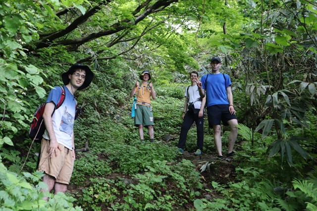
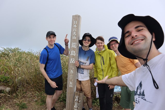
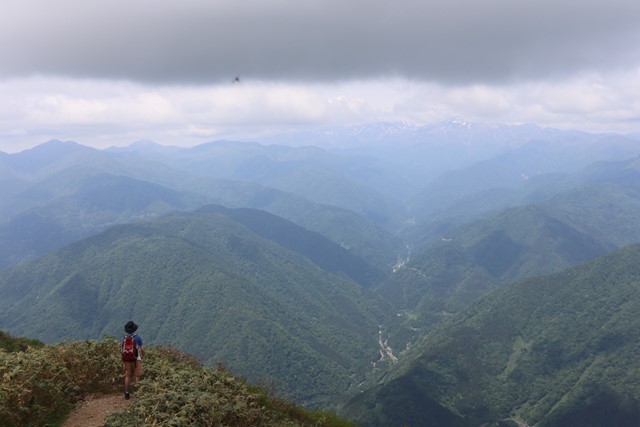
Arashimadake 荒島岳 (Fukui Prefecture)
Japan
Arashimadake is one of the 100 famous mountains of Japan. It is a long hike that takes you through luscious forest and provides sweeping 360 views over the surrounding mountains and Mount Hakusan.