


 12.6
12.6 6
6Aussie Bushwalking can keep track of your bushwalks.
Login/signup to tick this walk off.Arashimadake 荒島岳 (Fukui Prefecture)
Japan
Menu
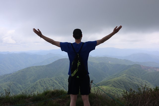
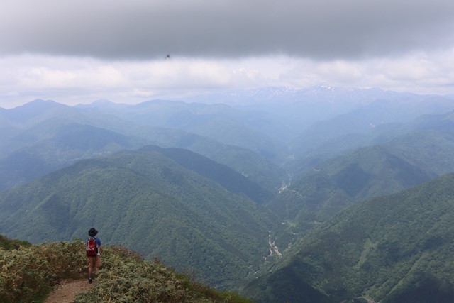
Arashimadake is one of the 100 famous mountains of Japan. It is a long hike that takes you through luscious forest and provides sweeping 360 views over the surrounding mountains and Mount Hakusan.
Lookouts
Bird Watching
Toilets
Public Transport
Alpine
1535m
Maximum Elevation
Getting there
There are multiple tracks up to Arashima-dake, my recommendation is doing the 中出(nakande) course as it takes on a loop through ko-arashima-dake and arashima-dake. If doing the other routes, you have to take a detour to be able to do this.
To get to the Nakande course, you require a car. It is located off the shiratori IC highway exit in Ono city, Fukui. Continue straight along the road and there will be a turn off to the hike. There will be a rather narrow road and a car park. Park at the Nakande course car park and start the hike from there.
If going via public transport, there are other options available that are possible via bus and car.
Maps
Yamap
Route/Trail notes
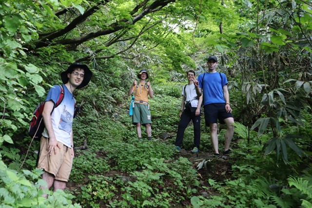
The hike begins from the carpark. Walk up the concrete path. This concrete path will eventually turn into a fire trail and then thin out into a proper hiking trail surrounded in trees. Continue hiking up the path and look out for signs pointing you towards 荒島岳. Follow this trail for about 2 hours and you will reach a fork in the path. Take the left fork which takes you up to the summit of ko-arashima-dake 子荒島岳. This is a minor peak that has 360 views of the surrounding and gives you great views of Arashimadake. From ko-arashima-dake, hike back down to the fork.
Once back at the fork, continue straight along the path and you will reach a second fork. Here, also continue straight. There will be a small post in the middle of the fork, one will have directions, taking you down the mountian, the other leads to the peak. Lookout for signs reading 荒島岳. Here the path will lead you straight and then up. The path up here is tight and quite steep. It is the steepest section of the hike. There are chains and ropes to assist you going up and down.
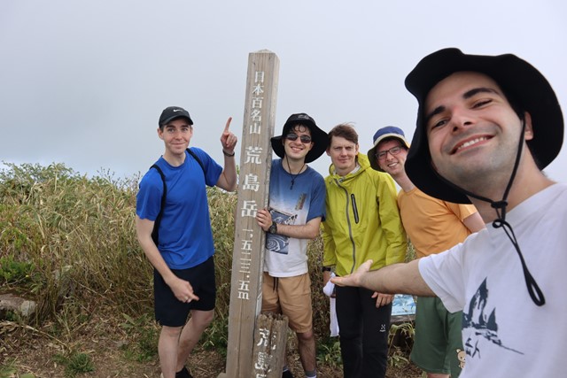
It will take you about an hour to reach the peak. You will know that you have neared when the tree line has thinned out and the views start opening up.
The view from the top is incredible and worth it. Have lunch here and then come back down the same way (without re-summitng ko-arashima-dake).
Permits/Costs
Do you need any permits? What's the cost?
Other References
How can I find more info? Any guide books?
GPS Tracks
- No GPS available for this walk yet.
Comments
Nobody has commented on this walk yet. If you've done it then tick it off and add a comment.