
Menu
Popular Walks
-
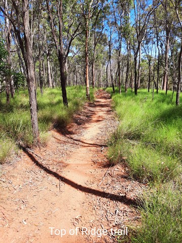
White Rock Ridge Hike
(318 ticks) -
White Rock Multi-User Trail
(201 ticks) -
Bluff Lookout Circuit
(54 ticks) -
Little White Rock Track
(50 ticks) -
Little White Rock Lookout Circuit
(44 ticks)
Parent Regions
Summary
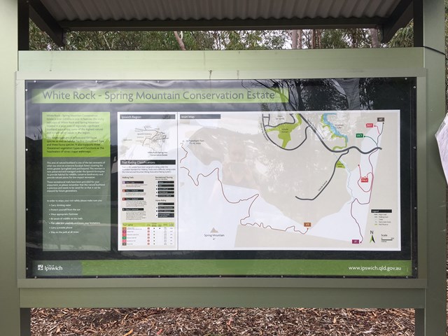
Based in Ipswich this estate provides a heap of walks with a variety of lengths. Here you are also allowed to ride horses or mountain bikes as well. This estate is also home to a park run group and rock climbers come to do some bouldering too.
Popular Walks
-
White Rock Ridge Hike
(318 ticks) -
White Rock Multi-User Trail
(201 ticks) -
Bluff Lookout Circuit
(54 ticks) -
Little White Rock Track
(50 ticks) -
Little White Rock Lookout Circuit
(44 ticks)
Parent Regions
History
Any interesting history for the region?
Features
Combined Walks
You can easily combine 4 of these walks into some form of a circuit, approxmatly 2km.
- SMCB - Six Mile Creek Boardwalk
- BLC - Bluff Lookout Circuit
- LWRT - Little White Rock Track
- LWRL - Little White Rock Lookout Circuit
*Note The lengths (start and end points) of each indivdual walk provided on this website has this circuit in mind. So when ticking your walks you'll have to tick all 4 to have the true length.
Access (Car Park)
There are 3 main areas from which walks start
1. Paperbark Flats Picnic Area
Turn East onto Redbank Plains Rd from the Cunningham Hwy. Turn right onto School Rd and drive South until you reach the Paperbark Flats Picnic Area. The final part of the road is unsealed but in very good condition. Ignore the horse float parking area on your left and proceed to the Paperbark Flats Picnic Area carpark. Weekends can get quite busy so you may have to park in the horse float parking area, if so park in the centre so horse floats can park near the fence on the sides.
Tracks Starting from here
- White Rock
- ...
2. Main Road (Springfield Greenbank Arterial),
Springfield Greenbank Arterial, Springfield Lakes QLD 4300. Ironbark Trail Conservation Estate. Cordinates [-27.685271, 152.927633]
Tracks Starting/Accessed from here
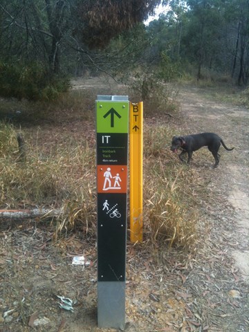
- IT - Ironbark Track
- FNLC - Frilled Neck Lizard circuit
- BT - Boronia Trail
- OCT - Opossum Creek Trail
- SGT - Spotted Gum Trail
3. Residentail streets (Springfield Lakes)
These are 4 different residentail streets where you can access the other end of certain tracks.
25 Wild Iris Terrace, Springfield lakes, 4300.
Tracks Starting from here
18 Norfolk St, Springfield lakes, 4300.
Tracks Starting from here
- Opossum Creek Trail
33 Wanderer Cres, Springfield Lakes, 4300.
Tracks Starting from here
- Spotted Gum Trail
14 Speckled Cct, Springfield Lakes, 4300.
Tracks Starting from here
- Boronia Trail
107 Angelica Ave, Ipswich QLD 4300. (Grech Park)
Tracks Starting from here
Maps
See the Council Map
Accommodation
Camping
No camping permitted
Other
Where can I stay there? or near there?
Contact details
This estate is maintained by City of Ipswich.

 5
km
return
5
km
return
 90
mins
90
mins
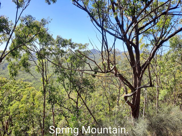
Balancing Rock (Ben Nevis Park trailhead)
Discover this 5.0-km out-and-back trail near Spring Mountain, Queensland. Generally considered a moderately challenging route, it takes an average of 1 h 29 min to complete. This is a popular trail for hiking, running, and walking, but you can still enjoy some solitude during quieter times of day.
ATTENTION; As of August 2024, there is no trail signage that takes you to "Balancing Rock". Do your homework!
200
m
one-way
15
mins
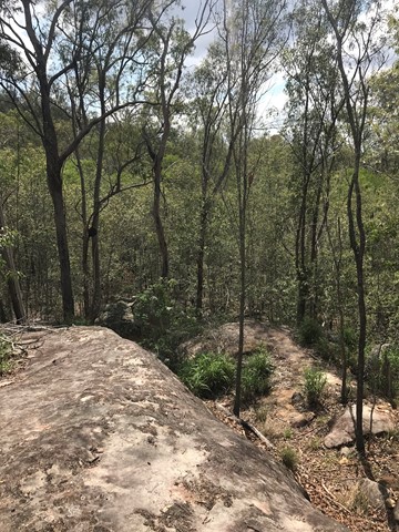
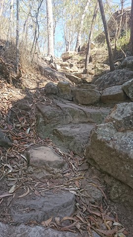
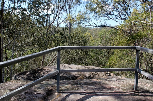
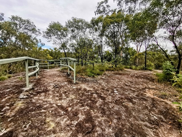
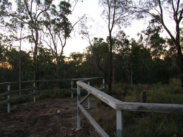
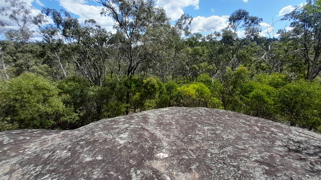
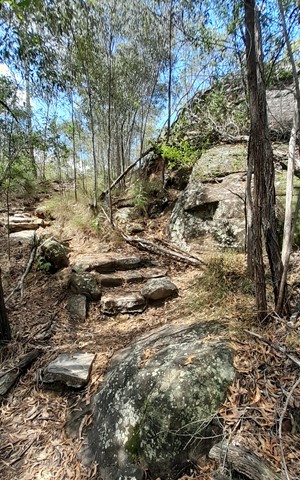
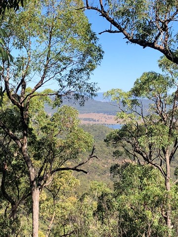
Bluff Lookout Circuit
A short walk to a lookout on a sandstone bluff. Tree top views over Six Mile Creek and the conservation area.
 2.5
km
return
30
mins
2.5
km
return
30
mins
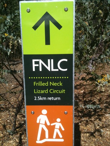
Frilled Neck Lizard Circuit
Frilled Neck Lizard Circuit is located just north of the Spring Mountain Forest Park. It is a mild to moderate 2.5 km return circuit that links up with the Ironbark Track. The map for this track is annexed as White Rock - Spring Mtn Conservation Estate.
 6
km
return
2
hrs
6
km
return
2
hrs
Ironbark Track
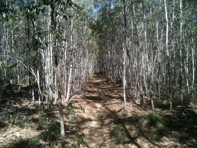
Ironbark Track is an old lumber road turned into a hiking track. It cuts behind Springfield Lakes to the edge of Spring Mountain Forest park.
 200
m
one-way
15
mins
200
m
one-way
15
mins
Little White Rock Lookout Circuit
Take a detour from the Little White Rock Track along a moderate level track for a view over the forest at the lookout.
 600
m
one-way
30
mins
600
m
one-way
30
mins
Little White Rock Track
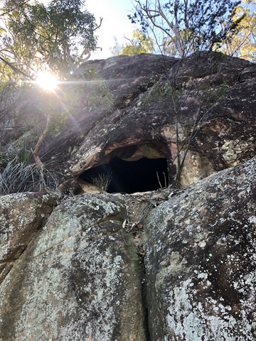
Moderate level track suitable for average fitness levels. Pass along the base of a rocky ridge where you will see caves and relics of a World War 2 training bunker. The spotted gum forest supports a local koala population.
 19.07
km
one-way
4
hrs
19.07
km
one-way
4
hrs
Paper Back Flats Picnic Area to Spring Mountain
A varied terrain walk. Sandy in parts, then really rocky in some. The first part of the walk I followed mainly the Spring Mountain fire trail which was mostly flat. When I got to Back Alley trail it started inclining for about 2kms till I got to the Spring Mountain. I climbed as far as the first cave I came across then didn’t climb the rest... although it looked doable, I was by myself and didn’t want to push my luck. It was about 10km on the way up. Return trip I went down the Daisy trail which seemed to be an old mountain bike trail. It descends quickly and is rocky, eroded in parts and hard to walk on and requires a lot of scrambling and concentration. I then got to Narelle’s Climb, this terrain has been gravelled at some stage. I also saw a red belly black snake!! I decided to bypass White Rock as I’d seen it enough times and head back to where I started. Was about 9km on the way back. If I do it again I will do it in reverse and go via White Rock.
 10.6
km
return
3
hrs
10.6
km
return
3
hrs
Pyros Loop
This is another walk in the White Rock Conservation park which has quite a few ups and downs, so does get the heart pumping. It also has quite a few good views to Spring Mountain, White Rock and Flinders Peak at various stages of the walk.
 1
km
return
30
mins
1
km
return
30
mins
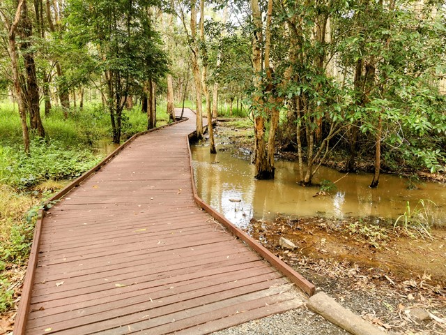
Six Mile Creek Boardwalk
Wander along the boardwalk in the cool shade of the Blue Gum forest. Keep an eye out for a koala resting in a large gum, scratches and droppings at the base of the tree will point you in the right direction. Access can be had to Bluff Lookout from the boardwalk
 1.4
km
return
30
mins
1.4
km
return
30
mins
Six Mile Creek Track
A moderate level trail that leads you into a world of large swamp box and blue gums, and if you are lucky enough, you may even see a shy lace monitor. Cool down as you cross Six Mile Creek and inspect a number of revegetation areas Council has been working to restore.