
Menu
Popular Walks
-
White Rock Ridge Hike
(328 ticks) -
White Rock Multi-User Trail
(202 ticks) -
Bluff Lookout Circuit
(57 ticks) -
Little White Rock Track
(52 ticks) -
Little White Rock Lookout Circuit
(45 ticks)
Parent Regions
Summary
Based in Ipswich this estate provides a heap of walks with a variety of lengths. Here you are also allowed to ride horses or mountain bikes as well. This estate is also home to a park run group and rock climbers come to do some bouldering too.
Popular Walks
-
White Rock Ridge Hike
(328 ticks) -
White Rock Multi-User Trail
(202 ticks) -
Bluff Lookout Circuit
(57 ticks) -
Little White Rock Track
(52 ticks) -
Little White Rock Lookout Circuit
(45 ticks)
Parent Regions
History
Any interesting history for the region?
Features
Combined Walks
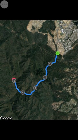
You can easily combine 4 of these walks into some form of a circuit, approxmatly 2km.
- SMCB - Six Mile Creek Boardwalk
- BLC - Bluff Lookout Circuit
- LWRT - Little White Rock Track
- LWRL - Little White Rock Lookout Circuit
*Note The lengths (start and end points) of each indivdual walk provided on this website has this circuit in mind. So when ticking your walks you'll have to tick all 4 to have the true length.
Access (Car Park)
There are 3 main areas from which walks start
1. Paperbark Flats Picnic Area
Turn East onto Redbank Plains Rd from the Cunningham Hwy. Turn right onto School Rd and drive South until you reach the Paperbark Flats Picnic Area. The final part of the road is unsealed but in very good condition. Ignore the horse float parking area on your left and proceed to the Paperbark Flats Picnic Area carpark. Weekends can get quite busy so you may have to park in the horse float parking area, if so park in the centre so horse floats can park near the fence on the sides.
Tracks Starting from here
- White Rock
- ...
2. Main Road (Springfield Greenbank Arterial),
Springfield Greenbank Arterial, Springfield Lakes QLD 4300. Ironbark Trail Conservation Estate. Cordinates [-27.685271, 152.927633]
Tracks Starting/Accessed from here
- IT - Ironbark Track
- FNLC - Frilled Neck Lizard circuit
- BT - Boronia Trail
- OCT - Opossum Creek Trail
- SGT - Spotted Gum Trail
3. Residentail streets (Springfield Lakes)
These are 4 different residentail streets where you can access the other end of certain tracks.
25 Wild Iris Terrace, Springfield lakes, 4300.
Tracks Starting from here
18 Norfolk St, Springfield lakes, 4300.
Tracks Starting from here
- Opossum Creek Trail
33 Wanderer Cres, Springfield Lakes, 4300.
Tracks Starting from here
- Spotted Gum Trail
14 Speckled Cct, Springfield Lakes, 4300.
Tracks Starting from here
- Boronia Trail
107 Angelica Ave, Ipswich QLD 4300. (Grech Park)
Tracks Starting from here
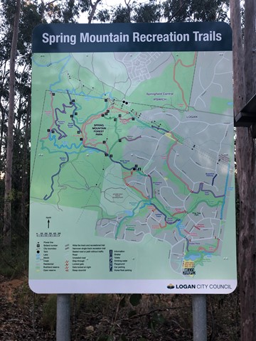
Maps
See the Council Map
Accommodation
Camping
No camping permitted
Other
Where can I stay there? or near there?
Contact details
This estate is maintained by City of Ipswich.

 11
km
return
11
km
return
 4
hrs
4
hrs
Spring Mountain (Angelica Ave trailhead)
Spring mountain from Angelica St, Springfield Lakes.
 11
km
return
4
hrs
11
km
return
4
hrs
Spring Mountain (Thornbill Drv trailhead)
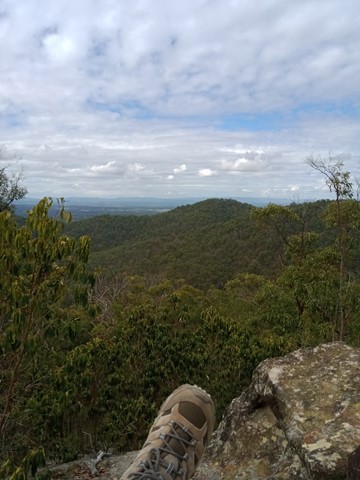
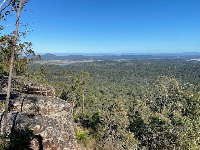
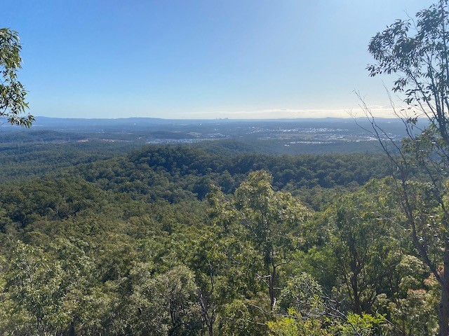
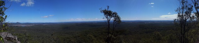
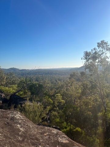
Spring Mountain from Thornbill Drive, Greenbank. Walk is a bit of a hard slog but the views from the different points on the trek are really spectacular.
 14
km
return
5
hrs
14
km
return
5
hrs
Spring Mt Caldera (Thornbill Drv trail head)
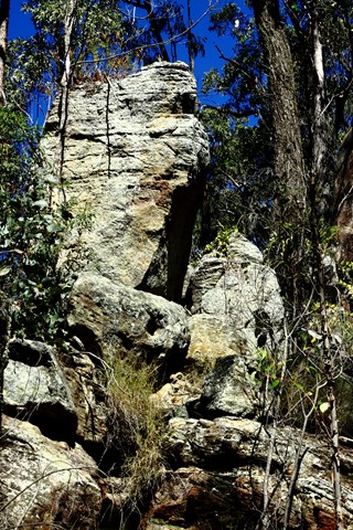
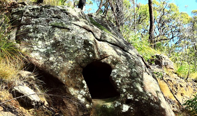
A great walk. Starting at the end of Thornbill Drive, Greenbank. 60 degree views atop Spring Mountain. Caves and cliffs along with some off track navigation along the aptly named Dragons Spine Trail!
 6.5
km
return
2
hrs
6.5
km
return
2
hrs
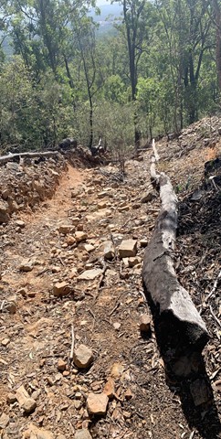
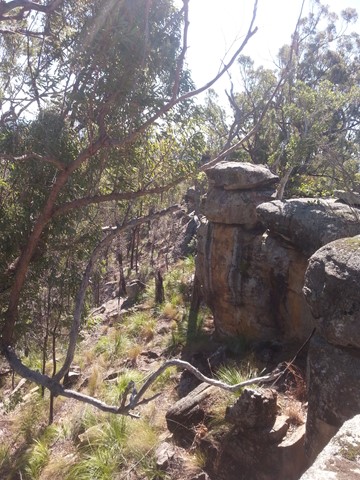
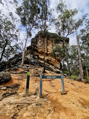
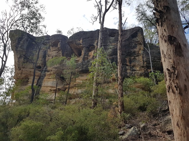
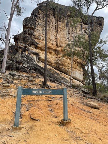
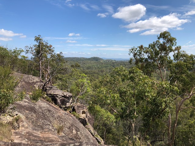
White Rock Multi-User Trail
A level track with some rough surfaces and stairs at the end.
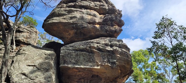
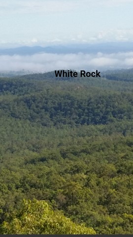
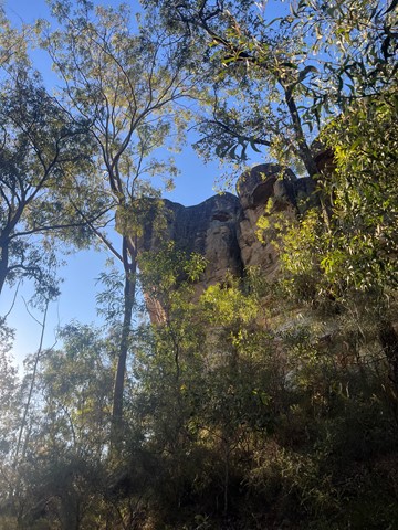
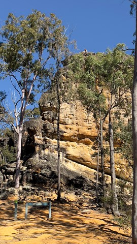
Leading to the base of the culturally significant White Rock this trail goes through a mix of vegetation types and sceneries from riparian to open eucalypt forest and rocky ridges. Climb the stairs to gain views to Spring Mountain and the surrounding area.
Access to the top of White Rock is not allowed. Please respect the original Ugarapul custodians of the land.
 6.5
km
2
hrs
6.5
km
2
hrs
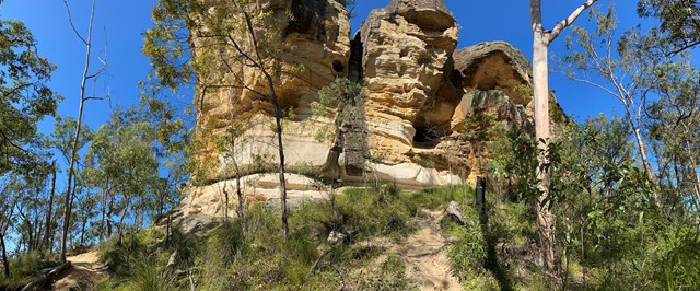
White Rock Ridge Hike
A pleasant walk with a short bit of scrambling up to the impressive White Rock. A sacred site for local indigenous people, the custodians of the site request that you do not climb White Rock.
 22
km
return
6
hrs
22
km
return
6
hrs
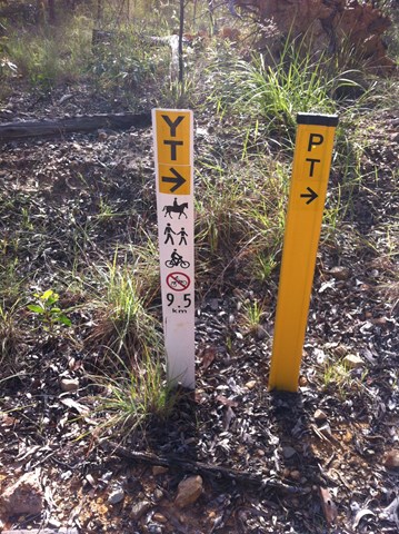
Yuddamun Trail
The Yuddamun Trail contains some steep inclines and rough surfaces. It crosses the northern section of the estate giving spectacular glimpses of Ipswich, Brisbane City and towards Moreton Bay. If you are planning to go for a leisurely mountain bike ride or hike, then access this trail from the Paperbark Flats Picnic Area car park. Horse riders can access the trail from the recently constructed facilities as you immediately enter the estate. A horse float parking area, hitching rails, water trough and picnic table will support all your riding needs.
Please note that water for horses is only available within the Horse Float Parking Area. Prior to your ride please ensure you read and follow Council’s Trails Guidelines