


 10.6
10.6 3
3- Paper Back Flats Picnic Area to Spring Mountain (White Rock - Spring Mountain Conservation Estate)
- Yuddamun Trail (White Rock - Spring Mountain Conservation Estate)
- Six Mile Creek Boardwalk (White Rock - Spring Mountain Conservation Estate)
- Bluff Lookout Circuit (White Rock - Spring Mountain Conservation Estate)
- Little White Rock Track (White Rock - Spring Mountain Conservation Estate)
Menu
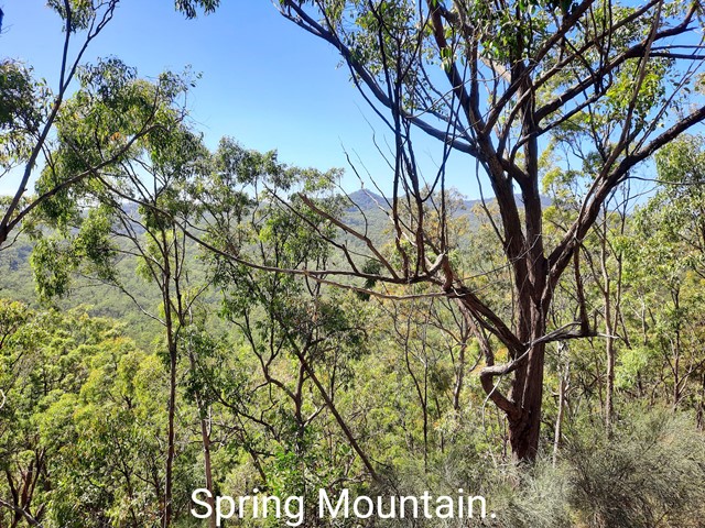

This is another walk in the White Rock Conservation park which has quite a few ups and downs, so does get the heart pumping. It also has quite a few good views to Spring Mountain, White Rock and Flinders Peak at various stages of the walk.
Bird Watching
Picnic Facilities
Toilets
No Dogs Permitted
Cycling Permitted
No Trail Bikes Permitted
No Camping Permitted
Eucalypt Forest
235m
Maximum Elevation
249m
Total Climb
Getting there:-
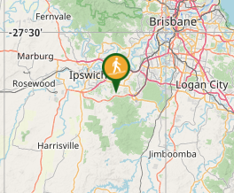
White Rock Conservation is at the end of School Road in Redbank Plains. Once you turn onto School Road, follow the signs to either of the 2 carparks. The first carpark on your left is the largest, but mainly fully exposed to the sun. The lower carpark is smaller and a little more protected and is usually full unless you get there early.
Maps:-
Redbank Plains area.
Route/Trail notes:-
Follow the main fire access road from the carpark by following the White Rock signs (ignore the White Rock Ridge Trail signs) until you reach the sign where you have to turn left to continue on to White Rock (approx 2.5K from carpark). Instead of turning here, continue straight at this junction and you should see a sign posted as "Gun Pit Ridge Trail". This is the beginning of Pyro's loop. About 200 metres after this junction there is a track leading off to your left (also signposted the same). From here you can go either way.
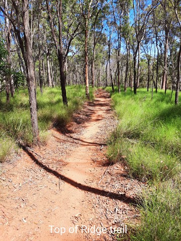
I chose to go straight ahead (counter clockwise) and followed the fire access road. From here there is a lot of ups and downs (mainly ups) and the route is well signposted. At just over half way, the fire track continues on to an area that is only for authorised persons access. Off to the left of this (signposted) is where the ridge trail actually starts. From here it is a well worn and well signposted foot pad climbing to the highest point. The track has a few wash outs, exposed tree roots and the occasional rock, but nothing too difficult. This is the most scenic part of the track. The track eventually comes out at the junction I mentioned earlier where you can either way. From here follow the signs back to the carpark.
Permits/Costs:-
No permits required and no costs involved. The carparks get closed at night, so check the times on the way in.
Other References
Ipswich City Council has some basic maps available on line that can downloaded and/or printed.
GPS Tracks
- No GPS available for this walk yet.
Where
Click here to load this map.
Comments