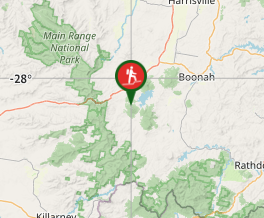
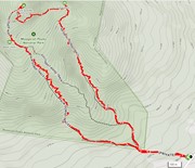
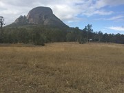
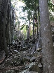
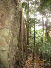
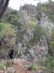
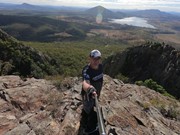
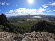
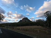
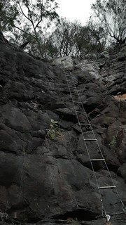
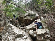
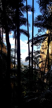
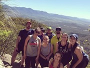
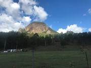
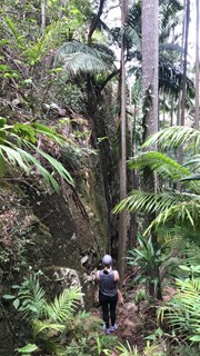
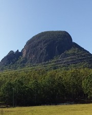
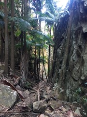
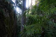
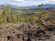
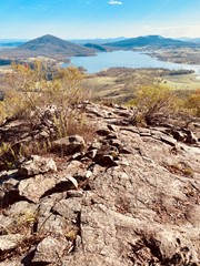
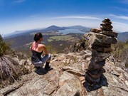
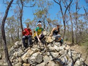
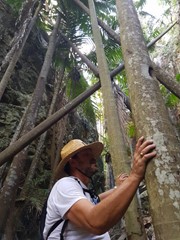
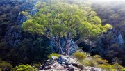
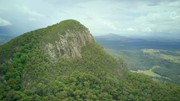
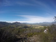
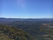
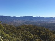
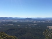
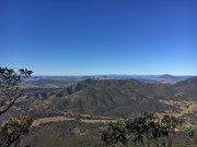
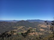
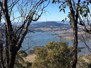
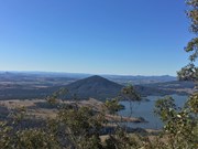
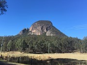
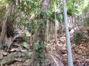
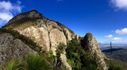
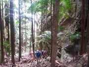
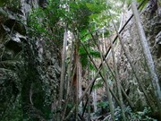
A walk up to the top of Mt Greville circa 770m. Up the waterfall gorge, then visit viewing platform rock slab near top of waterfall gorge. Alternatively, ascend via SE Ridge. Continue to summit then return via Palm Gorge.

Waterfalls
Lookouts
Bird Watching
Scrambling or Climbing
Navigation Required
No Dogs Permitted
Eucalypt Forest
767m
Maximum Elevation
610m
Total Climb

Getting there

 From Aratula drive towards Cunningham's Gap and turn off at the Spicers Gap Rd. Follow this road for about 8 km( it does become dirt for a while) then turn into Mt Greville Rd find the start after about 800m driving or so along Mt Greville Rd.

Maps

Sun maps Mt Edwards

Route/Trail notes

From the gate walk uphill to the sign posts about 400m, there are three alternatives Waterfall Gorge, South East Ridge and Palm Gorge. This walk goes up SE Ridge and comes down Palm Gorge.

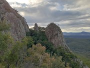
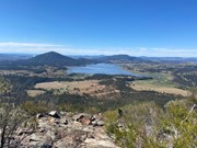
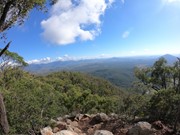
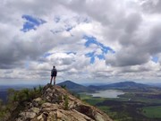
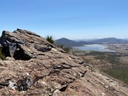
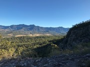
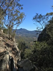
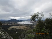
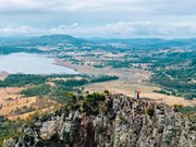
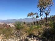
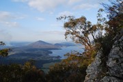
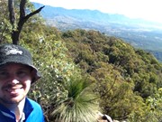
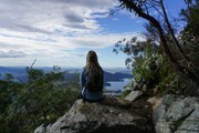
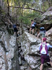
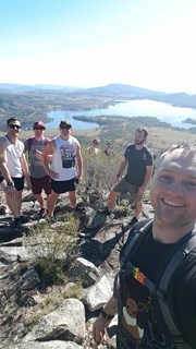
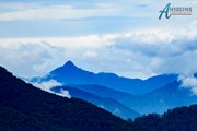
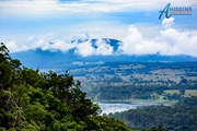
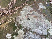
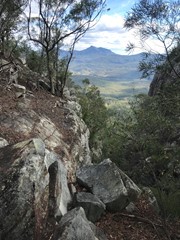
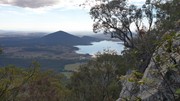
Follow the rough track up SE ridge lots of scree at the bottom and a few cairns on the way up. There are some rocky slabs to scramble on and through and if you lose the rough trail then keep heading up through the grass trees. Eventually you will come to a second wide rocky slab with great views of the southern Fassifern valley and the southern Mountains of the Main Range, Mt Ballow, Mt Barney, Mt Edwards, Mt Moon, Mt Maroon and Moogerah Dam. There is a lower rocky slab with the same view. Keep tracking up to the left through the Grass Trees till you enter forest again near another cairn note a well trevelled footpath that descends into Palm Gorge, it is about 30m up from the cairn for easier access. Keep following the trail up hill to the summit where there are good views to the North and views of the Ramparts of The Main Range and Mistake and Little Liverpoool Mountains.

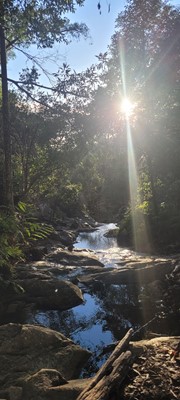
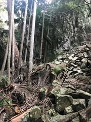
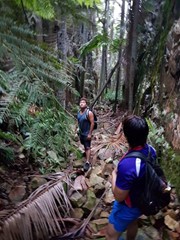
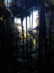
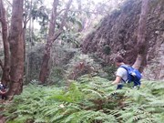
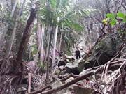
On the Descent look for a rough trail that heads up hill about 10 min from the summit. it leads to the head of a steep rocky Gorge that has a stunning view of Spicers Peak framed in its middle. About 10 min again from here locate the cairn and footpad that descends into Palm Gorge. Just keep following this down and take your time. There are loose rocks and slippery palm fronds on the ground but is well worth it. Pictures are necessary just to prove how beautiful this place is. Follow the rough footpad all the way back to the signposts and turn downhill to the carpark.

Altenate walks can include going up Waterfall Gorge and Traversing to the start of Palm Gorge across the Rock slab very enjoyable after summitting!

Permits/Costs

There is no camping in the Park.

Other References

Take A walk in the Sout East Queensland ; Chapman.

Comments

Went to waterfall gorge and back down south east ridge. Seems the easiest routes to take. Stunning views and took our time all up about 6 hours including many breaks. Next time would like to try palm good 6

icanfly on 5 Jul, 2020

Glorious day at Mt Greville. Up Palm, down Waterfall gorge. A couple of wrong turns. Nearly went down the last waterfall but thought there must be an easier way. I missed the right hand turn. Found this hike tough on the knees. First in the car park but it was full by the time i finished. youtube https://youtu.be/uS4YPN3rNFQ

Grunter on 1 Jul, 2020

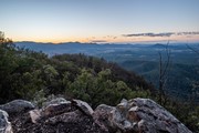
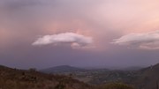
This is a totally fantastic hike, and I highly recommend it. You climb up through Palm Gorge, South East Ridge, or Waterfall Gorge to a plateau with generous easterly views before realizing you're still not on the top! The summit is a spectacular spot for watching the horizon glow, and the valleys haze with mist.

There is lots of scrambling to access the top but no rock climbing.

I'd certainly go back!

basalamant on Jul, 2020

We get lost already at the beginning and we went through the top of the waterfall gorge. At the summit, we get proper info and return via the Waterfall gorge. Probably would be easier other way, but still manage to see the best highlights of the mountain and have a lot of fun. We meet a lot of people who get lost, so definitely is not well marked. Better get proper info before going there.

Asha on 28 Jun, 2020

Started at around 9.30 am the car park was already full. We went up waterfall gorge which was also full of palms. very beautiful. Even though we had the instructions not to leave the gorge to get to the view area before the summit, we went right just before the end and scrambled to an inaccessible end so back tracked. Found the view described in others descriptions - fantastic and definitely better than the summit. Got lost on the way to the summit - luck there were plenty of people around. Not as fit as i needed to be and thought we would skip the palm gorge and descend via the SE ridge. No luck. Found a few markers but ended up walking up and down for another hour before we decided that the only way we would be safe to descend without getting lost was palm gorge! Absolutely knackered by the time we hit the Car park around 3pm. All in all a great day. Would love to know where the SE ridge is. maybe next time.

Mark Whitford on 20 Jun, 2020

A very pleasant walk as always. Went up palm gorge and down the ridge this time. Both gorges are beautiful but personally I prefer the ridge for the descent - good views and easier down hill.

Heather T on 13 Jun, 2020

Hiked up Palm Gorge and descended via SE Ridge.
The views from the rocky slab at morning tea were better than those from the summit.
Commenced hike at 8am and finished approx 1:15pm, with generous stops for morning tea, lunch and general chat.

Cyn on 7 Jun, 2020

Climbed up for 3hours (lost for about half an hour) then go down for 1 hour and 45 mins.

Indah Cox on 22 May, 2020

Had an awesome hike! Went up a totally different way, through a gorge. was crazy, a bit scetchy too.

Michael Richards on 4 Apr, 2020

Wow, this was our favourite hike yet! Got lost twice, saw a snake, but had so much fun scrambling over the rocks in Waterfall Gorge. We accidentally made a right when there was a split in waterfall gorge. After climbing up and over some rocks, this took us to the top of the gorge wall, which came to a dead end cliff edge so we had to back track and follow the gorge the whole way through. Wasn't annoyed about the set back as it was a pretty fun climb.
Rock slab was amazing and the comments about the view being better here than at the top of the summit is absolutely correct in my opinion. Also got lost trying to find the summit from Rock Slab. We came to an intersection just before the rock wall and turned right, followed this a fair way around the mountain, which came to a dead end cliff edge next to a giant crevice. So if you come to this intersection from Rock Slab/Waterfall gorge way, turn left and that's the way up to the summit.
Descending down Palm Gorge was a little rough like someone had mentioned to us at the summit. Due to all the leaf litter it was quite slippery and the moss rocks were too. Pretty steep descent but fun, this is where we saw the snake sunbathing on the track.
Overall was a very fun and interesting hike and it's now my new favourite so far.

tarashae on 15 Mar, 2020

5/5 stars, 3hrs return at relaxed pace. Going via. Waterfall Gorge route is one of my favourite SE QLD hikes, the trail involves mostly rock hopping through the gorge (pretty much devoid of water) most of the way. The gorge is fairly spacious in terms of width, with tall palm trees having grown throughout. The walls of the gorge are quite high; combined with the shade from the palms the temperature in the gorge is quite comfortable (the sun won’t be shining directly into the gorge). Changes in elevation are fairly gradual and aren’t too difficult. Exiting the gorge and following the narrow dirt trail for a few minutes will take you to the Rock Slab, providing a clear view to Lake Moogerah. If you follow the trail and reach a small clearing (where it seems the trail dead ends) that has a view of the mountains on the opposite side of Mt Greville (compared to the Lake Moogerah side), you’ve gone too far. The turnoff to the Rock Slab is on the left side of the trail if you’re coming from Waterfall Gorge and is easy to miss due to the slightly overgrown vegetation, but still follows a definite trail. I've done this hike 2 times.

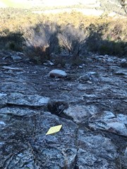
3.5/5 stars, 3.5hrs return at relaxed pace. The SE Ridge route is easy to follow when ascending, with relatively clear dirt trails through the bush sections and small arrows drilled into the rock plain sections where there are otherwise no tracks. Even if you can’t find the small arrows on the ground in the open rock plains, if you keep heading in a straight direction (not turning too far left or right) then you’ll eventually find the dirt trail again. However, descending the rock plains can get a little tricky as going downhill, it's not as easy to spot the markers from your elevated angle. Scrambling and climbing is not really necessary, it’s mostly just walking. Scenery in the bush sections is quite mundane, but the views from the rock plains of the surrounding mountains are decent. The true summit (marked by a pile of rocks about 1.5m high) view is blocked by trees, and does not offer a great view. Would recommend ascending and descending via. Waterfall Gorge instead - scenery and ambience is far superior and very hard to get lost since it's mostly just a straight trail through the gorge; there aren’t many branches off to the sides. I've done this hike 1 time.

Sam on 9 Oct, 2019

We did the hike with our 12 and 16 year old following the directions provided by Matthew Hae. These were invaluable! The two gorges are great fun and offer lots of opportunities for rock hopping and clambering. The view from the summit is not nearly as good as the view from the flat rock escarpment after Waterfall Gorge. Will definitely do again!

Monstar on 10 Aug, 2019

Surprisingly a very interesting and really enjoyable climb. The highlights are the 2 gorges and views from the rock slab at the top of waterfall gorge. Go up one gorge and come down the other, forget about south east ridge which is basically a steep, dry and dusty track with no highlights to mention . Use the 2 gems of this mountain (the gorges) as one for your track up and one your track down. On a hot day, choose to come down waterfall gorge and finish your hike with a refreshing dip in the lower rock pools at the end of the gorge.
Navigation can be abit confusing because there are multiple trail paths. There are clear tracks from the car park to the gorge entrances. Once you enter the gorges they are narrow so you cant get lost in them. Literally stay in the gorge and follow it until you run out of cliffs either side of you. The way i enjoy going is up waterfall gorge, when you climb out the top of this gorge walk to the right of the mountain on a flat path heading horizontally around the mountain until you come out at the big sloped pitched rock slab that you can walk out onto and get the best views, better than the summit. Then follow a path from here heading vertical again towards the summit, once you hit the smooth rock face of the mountain, start heading left and follow the bottom of this rock face horizontally back around to the other side of the mountain untill the track naturally starts taking you vertically again towards the summit. You will come to a ovious T junction in the red dirt track, turn right continuing vertically to the top. This fork is your turning point on the way back down. The last vertical climb to the summit is steep and gives a solid cardio workout. In my opinion the summit views aren't the best. To desend leave the summit the same track you entered, however about 100meters back down the summit track at the fork in the path , left is the way back to waterfall gorge and right takes you down to south-east ridge and palm gorge. *NOTE: this unmarked but distinct fork in the path is your critical turning point for choosing your return path down the mountain*. On the way down to palm gorge there is a little track off to your right with some nice veiws from the top of a inaccessible skinny gorge. A couple of hundred meters further down the main track there is a fork in the path, right is an ovious start to decend into palm gorge and left is a path that takes you to south-east ridge. Its worth taking a short 2min walk to the left over to the top of south east ridge for the moonrock gardens and the panorama, but apart from that, go back and head down palm gorge which is magic. You cant go wrong from there, hiking down palm gorge and following the track out the other end back to the car park. If however you went up palm gorge, and down waterfall gorge, remember when you get to the begining of the rock pools at the end of waterfall gorge you must scramble up the soft dirt embankment on your right to leave the gorge and then follow a small path downhill to connect with the main track returning you to the Carpark. The whole climb is a steep walk/hike with some boulder hopping and low level rock scrambling scattered throughout. Hope this helps.

Matthew Rae on 1 Aug, 2019

Went up and down South-East ridge. Got lost twice, almost walked off a cliff. Good fun. The rock gardens are where you're most likely to get lost. The paths are hidden by small palms, so check behind them if you're not sure where to go. There's also small arrows in some places pointing you in the correct direction, I didn't notice them on the way up but they helped me at one point on the way back down. Pro-tip: If you're walking on leaves, you've gone off the footpad.

Himalayan Pack Yak on 11 Jul, 2019

Very proud of our 4 year old girl who got us up via SE Ridge in 2 1/2 hours. Planned to go down same way after a late start but started down Palm Gorge by mistake - totally a must do but less fun with fading 4yo and light. Just got to easier ground by dark which was a relief. We love this mountain - will be back.

David on 30 Jun, 2019

A challenging incline and a rocky/palmy descent, but well worth it for the views and sense of pride in making the summit. I lost the track a few times during scrambles on the ascent and where palms covered the track on the descent, but calmly re-found it relatively easily. If you are a person who likes constant signage, this may not be the walk for you.

Bing Vandergraaf on 14 Jun, 2019

Amazing walk up the Waterfall Gorge

Kelvin Archer on 30 May, 2019

Nice place. I went up Palm Gorge and returned via SE Ridge Track

Glenn on 26 May, 2019

Great walk with my two teenage boys. Came down the palm gorge which is very cool. Got a little lost at the end but ended up finding the trail agin.

Ben Farley on 18 May, 2019

Did the classic: up SE Ridge and down Palm Gorge. Nice views on the way up. Palm Gorge is very pretty. Overall this is a very nice walk.

Brendan on 29 Apr, 2019

Where
Click here to load this map.
Nearby Walks

Done this walk?

This walk has been ticked 324 times

Aussie Bushwalking can keep track of your bushwalks.

Login/signup to tick this walk off.

Tick walks to keep track of where you've been. You must Login to tick walks. Accounts are 100% free so sign up if you don't have one.