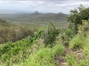
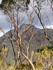
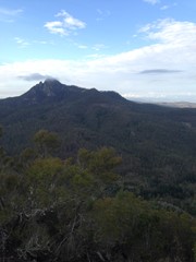
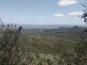
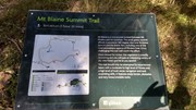
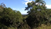
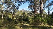
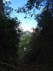
Needing a moderate level of fitness you will pass through Spotted Gum and Ironbark forests, Brushbox and heathland. Keep an eye out for koalas, wallabies and the magnificent Red-tailed Black Cockatoos that call this area home.

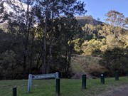
Entry is from Flinders Plum Picnic Area

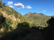
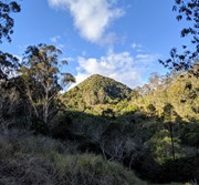
Take a short hike to the foot of Mt Blaine.

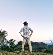
Lookouts
Eucalypt Forest

Getting there

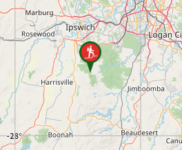
Follow the unsealed Mt Flinders Rd, PEAK CROSSING until the end.  There are a few water crossings so you may not be able to make it through if it has rained heavily in the last couple of days

Directions

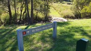
Walk North of the toilet block and you'll see a sign for Mount Blaine which crosses as small creek. Follow the fire trail up for about 1km until you get to a sign for the Mount Blaine Summit Trail. The path to the summit is right next to this sign, don't keep walking along the fire trail at this point.

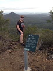
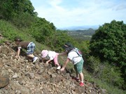
Follow this path to the summit being careful not to slip on the scree or loose dirt. You can return via this path, or you can also descend on the Eastern side of the mountain. The path down is a bit harder to find, but there are some large prickly pear cacti on the Eastern side and make you way down and around these and you'll find something that resembles a track. Eventually this joins another fire trail that leads back to the carpark.

Other References

http://www.ipswich.qld.gov.au/about_ipswich/parks_reserves_precincts/parks_search/index.php?id=89

http://www.ipswich.qld.gov.au/documents/health/flinders-goolman_trails_guide.pdf

GPS Tracks

Comments

Great little walk. Nice strenuous walk - we didn't have a lot of time so this fit into our morning perfectly. The rock scrambling was fun - glad we had our hiking boots on! Didn't see the golden orb spider someone mentioned (thank God - I've had a fear of them for 30 years when one fell on me hiking!) Didn't get to check out a lot of wildlife since we were so busy watching our feet!

Madonna Guy on 28 Sep, 2018

Walked this one second on the same day as doing Sandy Creek, not realising that they joined together if you keep going past the saddle. As others have said, it's steep going up, and rocky and slippery. We took our two kids with us and they had a blast, although the younger one needed a bit of help in some of the really steep places. Swarms of beautiful blue and black butterflies all around us in some parts of the walk. We were keen to try the summit but definitely doesn't seem suitable for children so we will have to do that another day without them.

eiscaer on 15 Apr, 2018

Walked to the saddle, a little too hot during the middle of the day.

Deb on 14 Dec, 2017

This hike leaves from the same carpark as Flinders Peak - Flinders Plum Picnic area. We went up in poor weather: rain; wind; low cloud, and had a blast. The approach is steep forest trails, then there's rocky slopes with some tangled foliage. We went up one path and came down another, but the routes both led back to the start.

Flinders Peak is still my favorite of the walks here, but Blaine is 2nd, over the Flinders Goolman trail.

Rey Leon on 14 Oct, 2017

This is a fire trail that was freshly mowed that leads to the summit trail. It wouldn't really be worth doing on its own; just as a way to access the summit trail for Mt. Blaine.

Juiced Pixels on 28 Nov, 2016

now I know what is rock scrambling!!

andre on 13 May, 2016

Harder than we expected considering the beautiful new signage at the base of Mt Blaine. The walk up to it is a little steep but an easy, wide fire road. Once you start up the mountain however it is a different story. There are very loose rocks for the most part and it is quite overgrown. (Lots of large golden orb spiders too) We followed the cairns on the way up which is possibly not the official track up but, considering the crazy descent which followed the 'official' orange tape markers, the climb was easier than the descent. The descent included a lot of very large and very loose boulders, so if you are walking with a group make sure you let each person get out of the way of potential falling boulders from the walkers behind. Once back on the Sandy Creek fire road it is an easy 2k walk back to the carpark but beware that the hike to the top and back is more difficult than you are led to believe by the maps and classification (considering it is only one class more than the fire roads!). Beautiful 360 view at the top though and the butterflies and other flying insects seem to love swarming around the top too. Not recommended for young kids. (P.S. Look for a geocache box at the top - we only found out about it after our walk and are kicking ourselves!)

Emily on 2 May, 2016

A bit overgrown, nice steep walk to saddle, then follow the trail to the top (not sign post)

Shell on 1 Feb, 2015

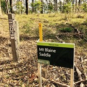
The track takes you to the Mt Blaine saddle. Due to time we quickly went up the smaller peak but not the larger. The view was blocked by trees but it seems someone's tried to make a small cairn there. Good walk for fitness, not so much for views.

Alice on 13 Aug, 2014

A little steep in places, but very easy.

Alexandra on 1 Feb, 2014

Was a bit steep for the first 200-300m or so. The signage is not very good. There is no indicator to indicate you have reached the end of the walk. We kept on going for two hours and decided we must have missed the end and decided to walk back. The Boonah to Ipswich Trail shares the same route so it is possible to keep going.

rob.bushman on 14 Jul, 2013

A bit of bushwhacking as you climb the steepest part about 100m short of the summit, but very nice 360 degree views from this small but open and grassy summit

RobboShoe on Aug, 2011

Where

Click here to load this map.

Nearby Walks

Done this walk?

This walk has been ticked 82 times

Aussie Bushwalking can keep track of your bushwalks.

Login/signup to tick this walk off.

Tick walks to keep track of where you've been. You must Login to tick walks. Accounts are 100% free so sign up if you don't have one.