
Menu
Popular Walks
-
Mt Ngungun
(1156 ticks) -
Mount Coolum
(872 ticks) -
Mt Cordeaux
(668 ticks) -
Twin Falls Circuit
(636 ticks) -
Purling Brook Falls Circuit
(611 ticks)
Summary
The Sunshine State
Queensland has a wealth of bushwalking opportunities including multiple World Heritage Listed rainforests such as the Daintree and Lamington National Park, great coastal and island parks like Fraser Island and Hinchinbrook Island.
Popular Walks
-
Mt Ngungun
(1156 ticks) -
Mount Coolum
(872 ticks) -
Mt Cordeaux
(668 ticks) -
Twin Falls Circuit
(636 ticks) -
Purling Brook Falls Circuit
(611 ticks)
Sub-Regions
Other Information
World Heritage Areas
- Fraser Island
- Gondwana Rainforests of Australia (Lamington NP, Springbrook NP, Mount Chinghee NP, Mount Barney NP, Main Range NP)
- Great Barrier Reef
- Riversleigh
- Wet Tropics (Daintree NP, Barron Gorge NP, Cedar Bay NP, Girringun NP, Wooroonooran NP)
Contact details
Queensland Parks and Forest:
https://parks.des.qld.gov.au/
Regions
The link below provides a region map of QLD as a reference to what council zones are included in the 7 geographic regions of QLD.
https://en.wikipedia.org/wiki/Regions_of_Queensland#/media/File:Qld-regions-map.gif
- Far North Queensland
- North Queesnland
- Central Queensland
- Mackay, Isaac and Whitsunday
- Wide Bay Burnett
- Darling Downs South West
- South East Queensland
Walks in Sunshine Coast
(South East Queensland)
 2.1
km
return
2.1
km
return
 1
hr
1
hr
Heath Track
A short walk through the coastal heath of Currimundi Lake (Kathleen McArthur) Conservation Park, with many flora and fauna informative signs along the way.
 5.4
km
return
90
mins
5.4
km
return
90
mins
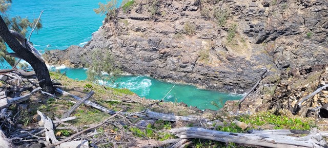
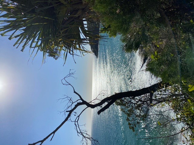
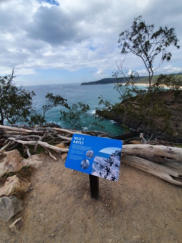
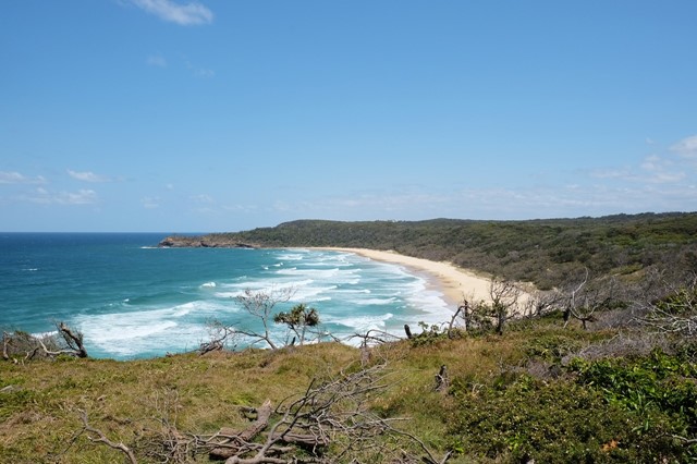
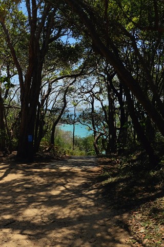
Hell's Gates walk
Coastal track on the northern side of Noosa National Park with great ocean views before returning over the hill on the Tanglewood track.
 9.6
km
return
3
hrs
9.6
km
return
3
hrs
Imbil Brooloo Rail Trail
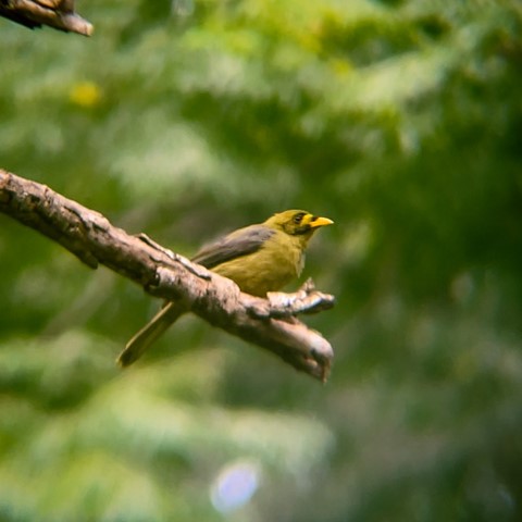
Opened in July 2019, this rail corridor has thankfully been restored to provide a beautiful track for walkers, cyclist and horse riders. A highlight is its passage through Bell Bird Park, where a colony of more than 120 Bell Birds provide a continual chorus for visitors.
 6
km
return
4.5
hrs
6
km
return
4.5
hrs
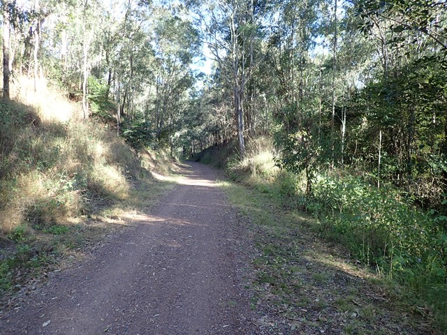
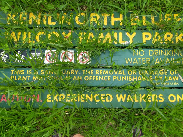
Kenilworth Bluff - Wilcox Family Park Trail
A seldom used trail through a mixture of woodland and rainforest to the top of the bluff. Make your way up and across to numerous lookout points with spectacular views..
 14
km
return
3.5
hrs
14
km
return
3.5
hrs
Kin Kin Countryside Loop
Good comfortable hike through picturesque landscape
 1
km
return
30
mins
1
km
return
30
mins
Koala Park
A short easy walk down and up the hillside. It will get the heart pumping if you choose to go up the steps. Great for kids too as there is a playground at the top with BBQs.
1.6
km
return
1
hr
Lagoon Walk
A circular walk in the Maroochy Botanic Garden, this popular natural terrain bush track follows the banks of the lagoon. The open forest ecosystem has remnants Bloodwood, Blue Gum and Tallowwood in the canopy, while Piccabeen Palm and Tree Ferns fringe the rocky gullies and bridges along the track.
 1
km
one-way
45
mins
1
km
one-way
45
mins
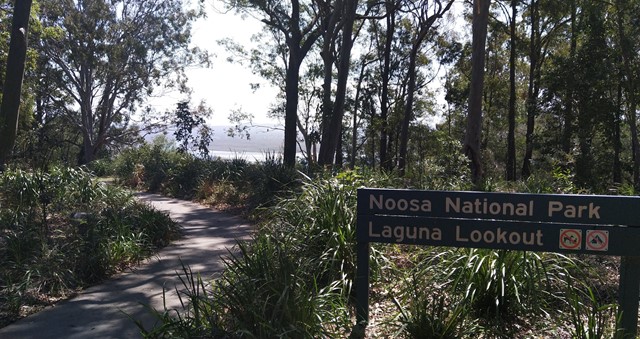
Laguna Lookout
Laguna Lookout, very easy walk for adult/kids
https://goo.gl/maps/ZARnXdNyks25tvSb8
 200
m
return
5
mins
200
m
return
5
mins
Lara Steps
148 concrete steps on part of Mount Buderim, with trees surrounding. It is short with no particular features and used mainly by people of all ages keeping fit.
 30
km
return
5
hrs
30
km
return
5
hrs
Mac N Back
Trail 7 of the Noosa Trail Network; a relatively flat picturesque trail that crosses Six Mile Creek and traverses the Yurol State Forest from Lake MacDonald to Pomona.