
Menu
Popular Walks
-
Mt Ngungun
(1156 ticks) -
Mount Coolum
(872 ticks) -
Mt Cordeaux
(668 ticks) -
Twin Falls Circuit
(636 ticks) -
Purling Brook Falls Circuit
(611 ticks)
Summary
The Sunshine State
Queensland has a wealth of bushwalking opportunities including multiple World Heritage Listed rainforests such as the Daintree and Lamington National Park, great coastal and island parks like Fraser Island and Hinchinbrook Island.
Popular Walks
-
Mt Ngungun
(1156 ticks) -
Mount Coolum
(872 ticks) -
Mt Cordeaux
(668 ticks) -
Twin Falls Circuit
(636 ticks) -
Purling Brook Falls Circuit
(611 ticks)
Sub-Regions
Other Information
World Heritage Areas
- Fraser Island
- Gondwana Rainforests of Australia (Lamington NP, Springbrook NP, Mount Chinghee NP, Mount Barney NP, Main Range NP)
- Great Barrier Reef
- Riversleigh
- Wet Tropics (Daintree NP, Barron Gorge NP, Cedar Bay NP, Girringun NP, Wooroonooran NP)
Contact details
Queensland Parks and Forest:
https://parks.des.qld.gov.au/
Regions
The link below provides a region map of QLD as a reference to what council zones are included in the 7 geographic regions of QLD.
https://en.wikipedia.org/wiki/Regions_of_Queensland#/media/File:Qld-regions-map.gif
- Far North Queensland
- North Queesnland
- Central Queensland
- Mackay, Isaac and Whitsunday
- Wide Bay Burnett
- Darling Downs South West
- South East Queensland
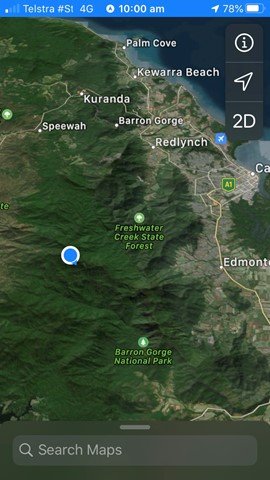
Walks in Far North Queensland

 800
m
return
800
m
return
 1
hr
1
hr
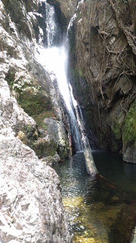
Fairy Falls - Cairns
An isolated bushwalk through the rainforest, ending in a waterfall and small swimming hole.
 7.5
km
return
87
mins
7.5
km
return
87
mins
Hartleys Creek Falls
A 7.5 km out and back hike with some undulations .
10.8
km
5
hrs
Island Circuit
A lovely scenic walk around Dunk Island - not too strenuous, lots of wildlife!
 17.5
km
return
7
hrs
17.5
km
return
7
hrs
Kahlpahlim Rock Circuit,
Dinden national Park, Cairns
Steep climb to top of rock
Very challenging
Also hard walk down
 1.5
km
return
45
mins
1.5
km
return
45
mins
Lacey’s Creek Walk
Easy going walk through tropical rainforest with the chance to see a cassowary.
12.6
km
return
5
hrs
Lamb's Head and Kahlpahlim Rock
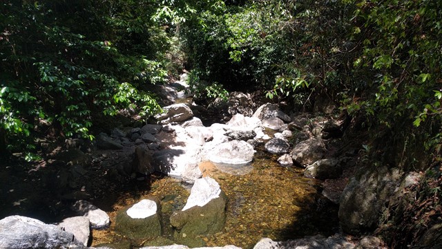
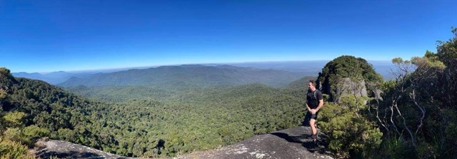
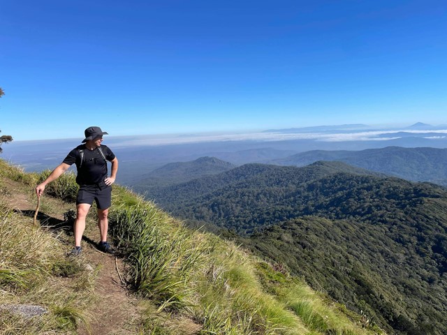
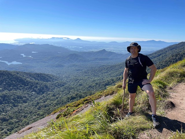
This a a fantastic and varied hike to the summit of Lamb's Head. Walk would range between 4-6hrs depending on fitness levels and stoppages. I recommend taking a few litres of water and some snacks. It is best during the dry winter season. The views at the top are absolutely amazing and there are several viewing points if you follow the 'sometimes hard' to see small pink ribbons. One view faces north/north-east over Cairns and the other is west/north-west. It truely is the one of the best hikes in the region. Afterwards you can find many beautiful rock pools at Davies Creek to swim in.
 400
m
return
30
mins
400
m
return
30
mins
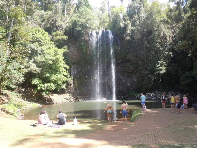
Millaa Millaa Falls
Millaa Millaa Falls is the most beautiful and iconic waterfall of the waterfall-laden Atherton Tablelands region. What the falls has going for it, is a lush rainforest setting fringed with broad ferns, colourful flowers and a plunge pool suitable for swimming. Even though the size of the falls is modest, at 18.3m, it possessed a photo-friendly classical rectangular shape, which complements the idyllic scenery well.
 8.6
km
return
2.5
hrs
8.6
km
return
2.5
hrs
Mount Baldy and Yabi Mountain
Nice 3hr walk with two summits and views back over Atherton and the tablelands.
If you're looking for something longer then the 3km circuits but shorter then the multi-day hikes!
Very well maintained track, well signed with options of doing this full circuit or just one summit.
Range of plant life from bush to tropics, we saw hundreds of birds including lots of cockatoos.
Walk is dog friendly.
 6.4
km
return
3
hrs
6.4
km
return
3
hrs
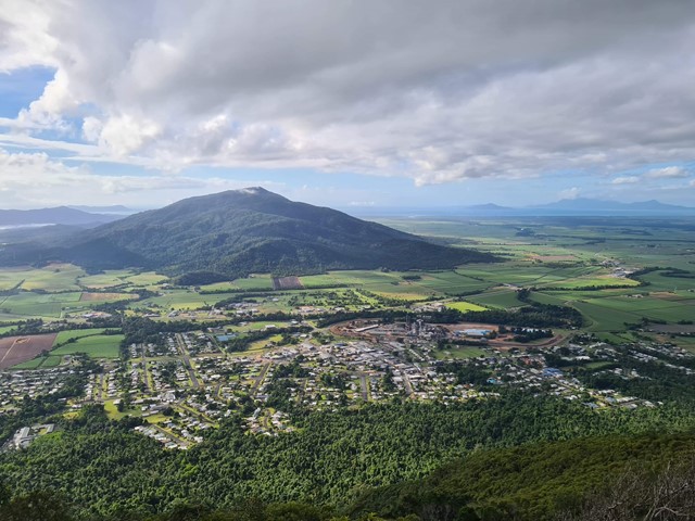
Mount Tyson
Based in Tully Gorge National Park. This is a steep hike to the top. Watch out for bladed or needled plants. Great view of Tully and the surrounding sugarcane fields. You can see the ocean from the top.
 6
km
3
hrs
6
km
3
hrs
Mount Whitfield Conservation Park
Mount Whitfield Conservation Park Red and Blue Circuits including Summits of Mount Whitfield and Lumley Hill.