
Menu
Popular Walks
-
Mt Ngungun
(1156 ticks) -
Mount Coolum
(872 ticks) -
Mt Cordeaux
(668 ticks) -
Twin Falls Circuit
(636 ticks) -
Purling Brook Falls Circuit
(611 ticks)
Summary
The Sunshine State
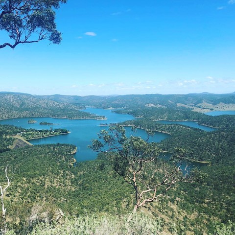
Queensland has a wealth of bushwalking opportunities including multiple World Heritage Listed rainforests such as the Daintree and Lamington National Park, great coastal and island parks like Fraser Island and Hinchinbrook Island.
Popular Walks
-
Mt Ngungun
(1156 ticks) -
Mount Coolum
(872 ticks) -
Mt Cordeaux
(668 ticks) -
Twin Falls Circuit
(636 ticks) -
Purling Brook Falls Circuit
(611 ticks)
Sub-Regions
Other Information
World Heritage Areas
- Fraser Island
- Gondwana Rainforests of Australia (Lamington NP, Springbrook NP, Mount Chinghee NP, Mount Barney NP, Main Range NP)
- Great Barrier Reef
- Riversleigh
- Wet Tropics (Daintree NP, Barron Gorge NP, Cedar Bay NP, Girringun NP, Wooroonooran NP)
Contact details
Queensland Parks and Forest:
https://parks.des.qld.gov.au/
Regions
The link below provides a region map of QLD as a reference to what council zones are included in the 7 geographic regions of QLD.
https://en.wikipedia.org/wiki/Regions_of_Queensland#/media/File:Qld-regions-map.gif
- Far North Queensland
- North Queesnland
- Central Queensland
- Mackay, Isaac and Whitsunday
- Wide Bay Burnett
- Darling Downs South West
- South East Queensland
Walks in Bunya Mountains
(Wide Bay Burnett)
 4.8
km
return
4.8
km
return
 75
mins
75
mins
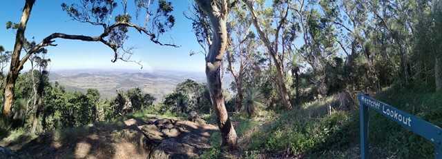
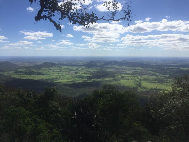
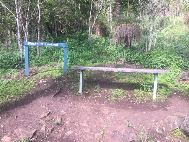
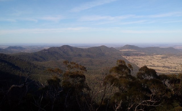
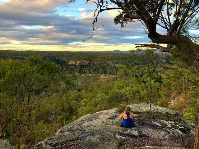
Westcliff Lookout
This track follows part of the cliff-line on the mountain's western side with Westcliff lookout providing clear views over the open plains of the Darling Downs. Soon after leaving the Paradise car park, the track passes through Little Pocket, one of the small natural clearings or 'balds' scattered over the Bunya Mountains.
 4.8
km
one-way
90
mins
4.8
km
one-way
90
mins
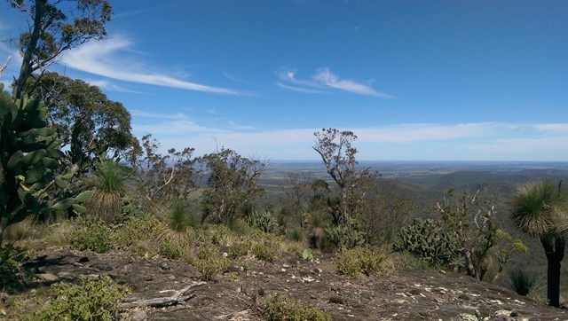
Westcott to Cherry Plain
The second section of track along the western side of the Bunya Mountains with views over the plains.
Walks in Burrum Coast National Park
(Wide Bay Burnett)
11
km
return
4
hrs
Melaleuca Circuit
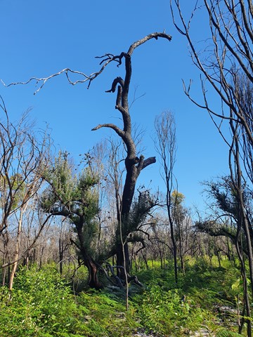
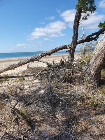
A nice walk, just 45 minutes drive from Bundaberg. Walk through the trees to come out to a beautiful mangrove and continue on to an 4WD/walk in only camp-site. A short sandy section along the beach, leads you back to the start of the circuit. Official signage says 12km return, but my GPS only measured around 11km.
 500
m
return
10
mins
500
m
return
10
mins
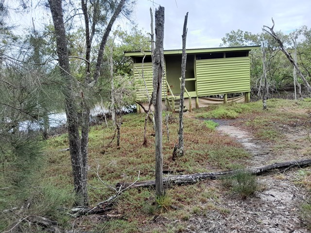
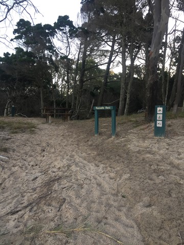
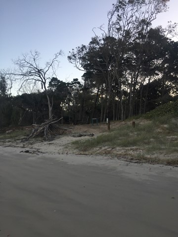
Russells Rest Track
Reward yourself with a picnic and endless ocean and estuary views at the end of this pretty walk.
After you’ve set up camp in the Burrum Point camping area, pack a picnic and meander through cypress pine and tea-trees to a small rest area on the beach. Soak up endless views of the ocean and the Burrum and Gregory river mouths.
Unwind to the sound of the wind in the trees and watch brahminy kites circle overhead. Look for shorebirds—resting here during long migratory flights. If you visiting during winter, keep your eyes glued to the horizon, you might be lucky enough to see whales breaching and playing in the offshore waters of the Great Sandy Marine Park.
Walks in Cania Gorge National Park
(Wide Bay Burnett)
1.2
km
return
30
mins
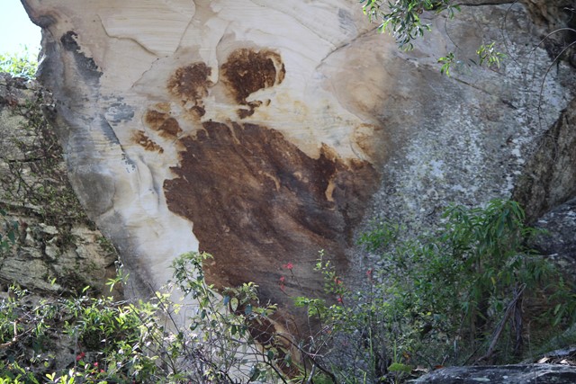
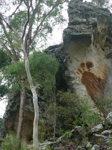
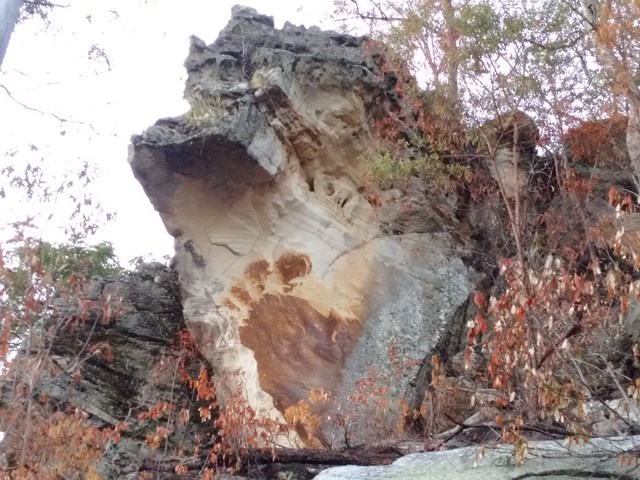
Big Foot Walk
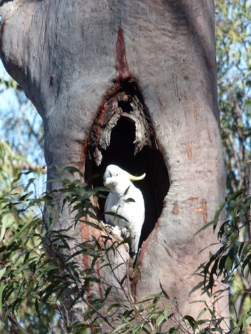
Short trail featuring a large brown image of a four-toed foot on the white sandstone cliff.
 16
km
2
days
16
km
2
days
Cania Gorge
Seven walks all well signposted, covering a distance of 16km, with photo opportunities and better after a wet season. Biggest walk 22kms return.
 24
km
return
6
hrs
24
km
return
6
hrs
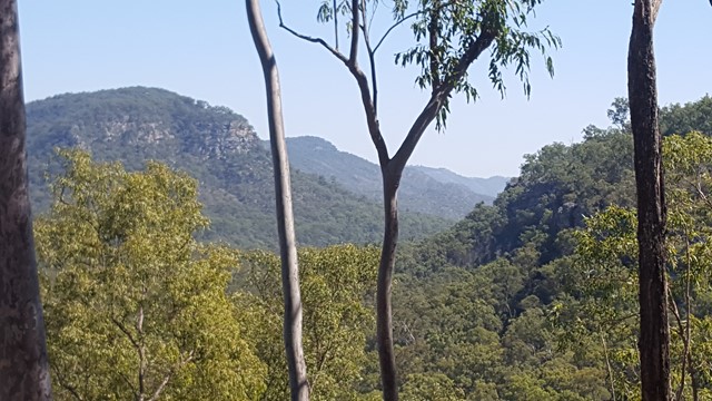
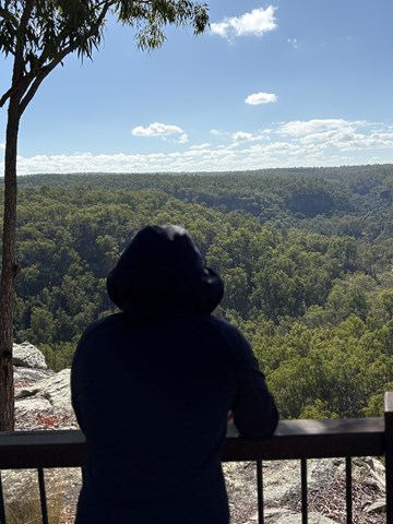
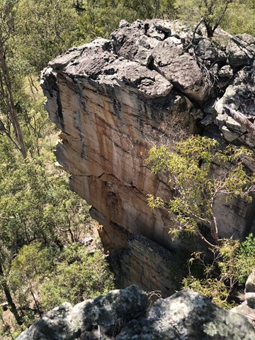
Castle Mountain Lookout
This walk start from the main car park. Head off toward the Gorge lookout then it continues on from there to a fire trail that runs up the eastern side of the range. Fairly easy going and slowly works uphill with a steeper section at the end to get the heart pumping. Along the fire trail there are the odd resting chair and glimpse of views off to the east. Take plenty of water as there is no water anywhere on the trail or lookout. The maps at the start said 22km return but I had 24km on my return.
 4.2
km
return
2
hrs
4.2
km
return
2
hrs
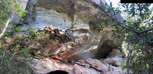
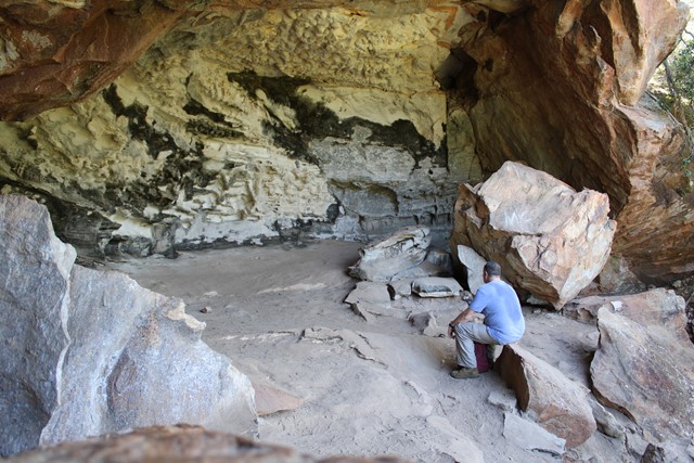
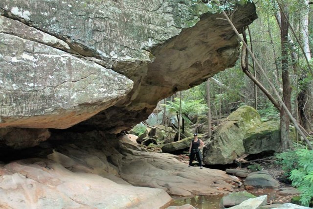
Dragon and Bloodwood Caves
A moderate steep track leading to and along the cliff face, where a sidetrack branches north to Dragon Cave. The southern branch leads to Bloodwood Cave and then a steep stepped section to the Gorge Lookout.
 3.2
km
return
90
mins
3.2
km
return
90
mins
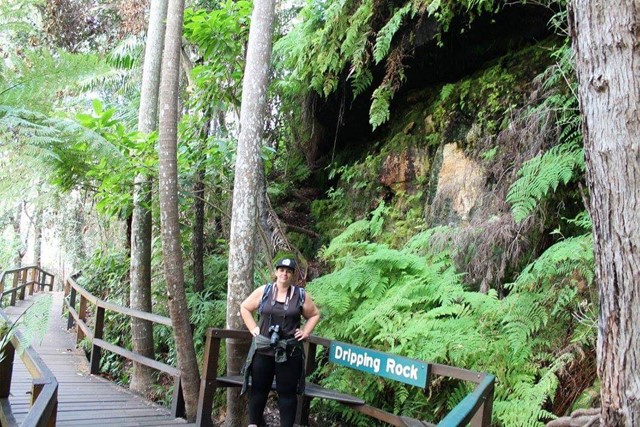
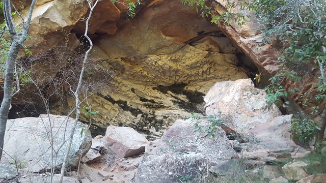
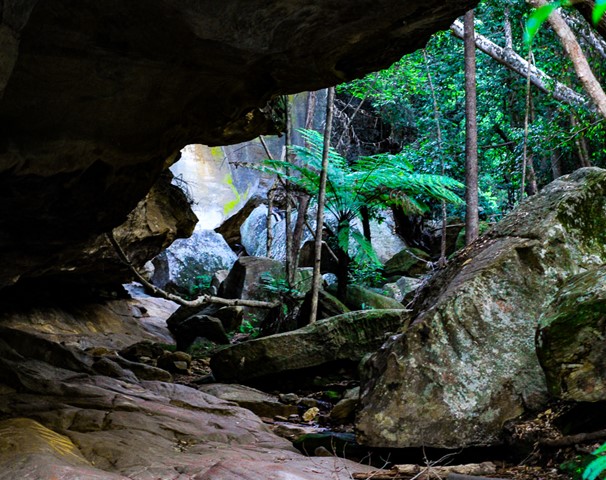
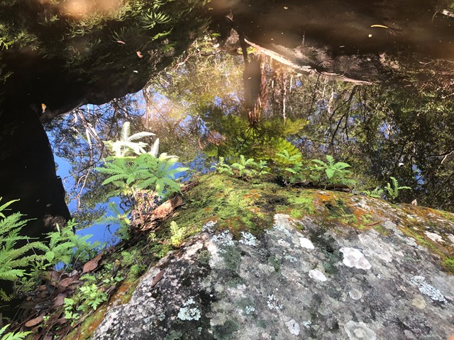
Dripping Rock and The Overhang
Nice easy walk through bit of rainforest to Dripping Rock and further to The Overhang where water has eroded the base of the sandstone cliff.
 5
km
return
2
hrs
5
km
return
2
hrs
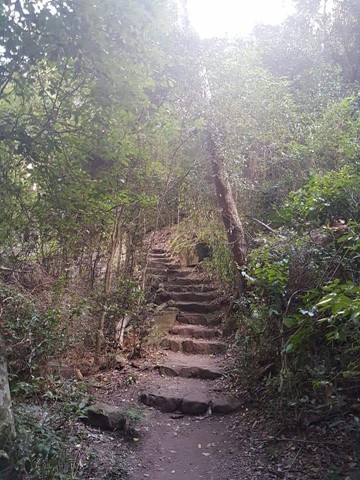
Fern Tree Pool and Giant's Chair Circuit
A circular walk, that takes a steep climb the Giant's Chair lookout and then down to Fern Tree Pool and back along Doctors Gully. An ever changing environment from boulder to eucalypt to rainforest.