
Menu

 8
km
return
8
km
return
 2
hrs
2
hrs
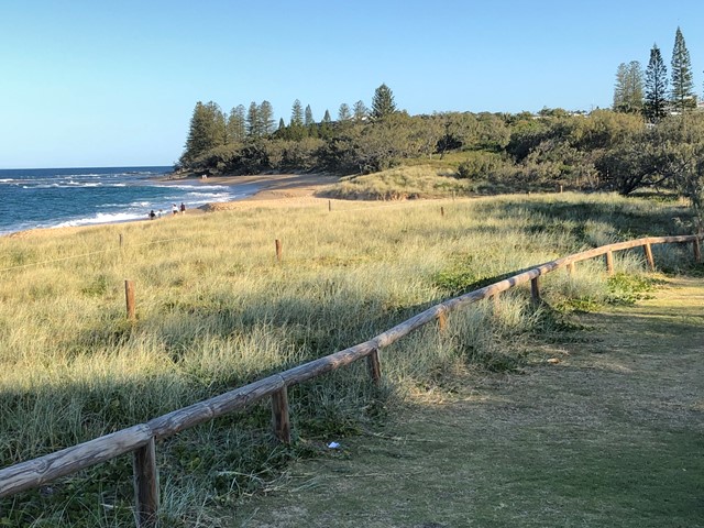
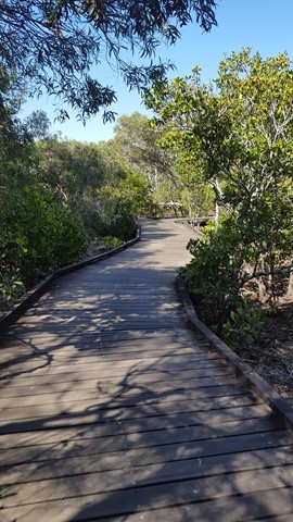
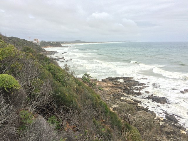
Bulcock Beach to Moffat Beach (SCCP 3)
Enjoy a challenging part of the Sunshine Coast Coastal Pathway, as it winds above cliffs and round Caloundra Head, with fantastic views of the Glass House Mountains, Bribie and Moreton Islands to the south and to the north the beach all the way to Point Cartwright, with Mount Coolum in the distance.
 6
km
return
90
mins
6
km
return
90
mins
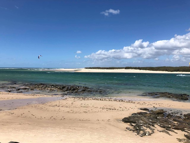
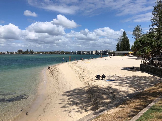
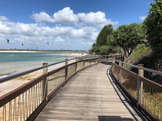
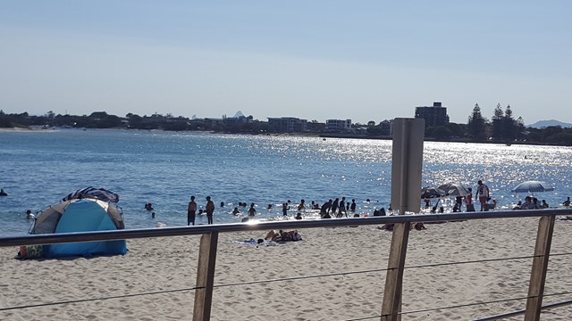
Golden Beach to Bulcock Beach (SCCP 2)
This 2nd section of the Sunshine Coast Coastal Pathway (SCCP) is always busy with people taking a stroll or enjoying the beaches, water activities and the views across to Bribie Island.
 4
km
return
90
mins
4
km
return
90
mins
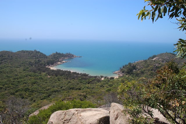
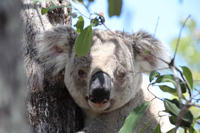
The Forts Walk
This walk has it all - spectacular coastal views, WW2 history, and possibly the best walk in Australia for spotting Koalas in the wild and close up!
The walk leads to WW2 fortifications built to guard the entrance to the Townsville Port, and consequently they provide spectacular and un-interrupted views of the bay and surrounding coastlines. Along the way, the walk passes through the old encampment areas which has great interpretive signage to explain how the area looked during the war. It is in this area that walkers are almost guaranteed to spot a wild koala lounging low in the trees.
 6.2
km
return
4
hrs
6.2
km
return
4
hrs
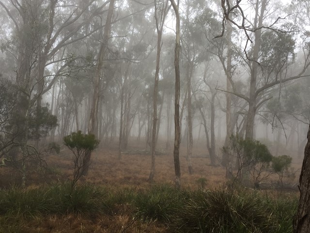
Mount Gillies [Private Property]
Permission from Mt Barney Lodge needed as well as a small fee to access this route up Mount Gillies. Walk starts out through a field before entering the Mount Gillies section of the Mount Barney National Park.
20
km
return
5
hrs
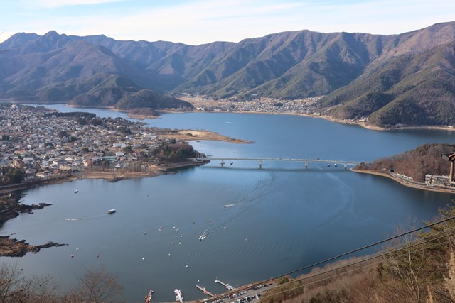
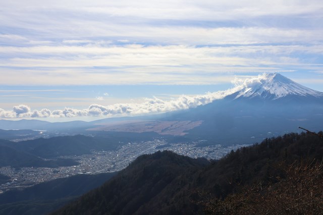
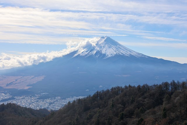
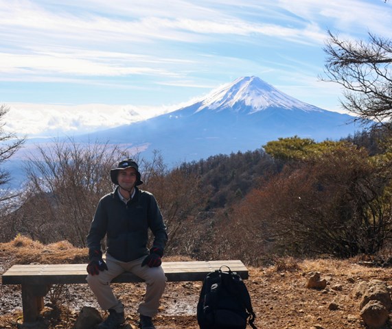
Mt. Mitsugetouge 三つ峠山 Grand Loop (Yamanashi Prefecture)
Easy access from Lake Kawaguchiko for non-touristy as well as unbridled views of Mt. Fuji.
 6
km
return
2
hrs
6
km
return
2
hrs
Nerang National Park Ridge Loop
A walk in Nerang National Park ascending via the Nerang Break to the highest point in the National Park and then following the ridge North till dropping down to the Western Break via the steep 400 Break. Then following the Western Break to the start.
 5.5
km
return
2
hrs
5.5
km
return
2
hrs
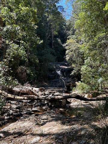
Threlfall Walk (Gara Gorge)
The track explores the former site and few remnants of the first commercial hydroelectric scheme in Australia.
 1.5
km
return
30
mins
1.5
km
return
30
mins
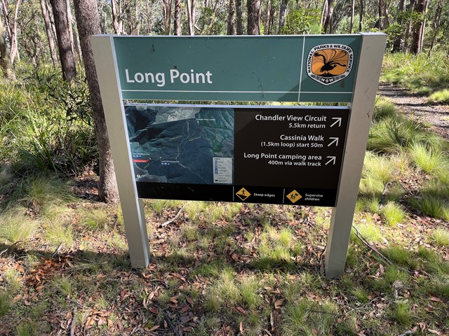
Cassinia Walk
"Little Brother" of the Chandler View Circuit. Named after the striking yellow flowering shrub, obvious in November.
 5.5
km
return
100
mins
5.5
km
return
100
mins
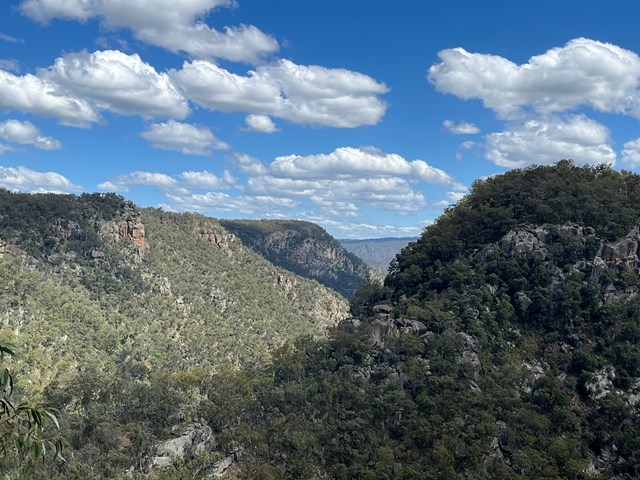
Chandler View Circuit
A walk through the Long Point section of Oxley Wild Rivers National Park
including a lookout over the Chandler River.
 3.1
km
return
1
hr
3.1
km
return
1
hr
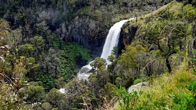
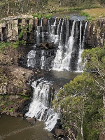
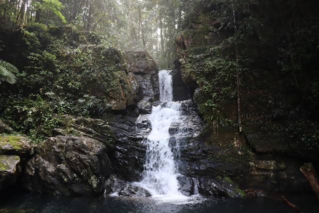
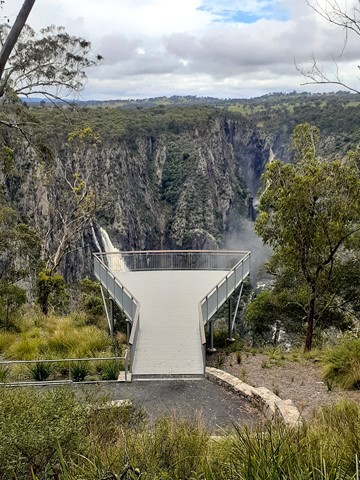
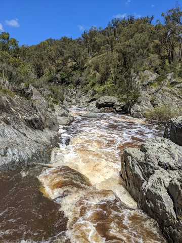
Ebor Falls Lookout
Easily one of the most beautiful waterfalls in Australia, Ebor Falls cascade over 100 metres down tiered columns of graphite coloured rock. In fact, there are at least two waterfalls to see, all within walking distance of the car park. Big waterfalls, cascading through ferns and rainforest, down to the valley floor, with spectacular views down the Guy Fawkes River National Park.
 5.5
km
return
2
hrs
5.5
km
return
2
hrs
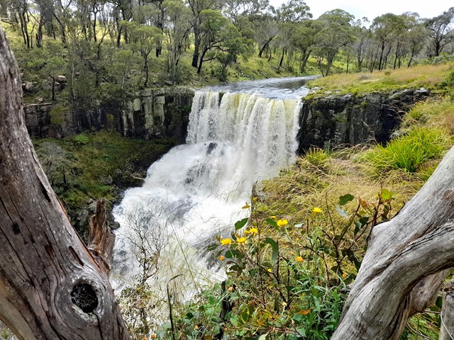
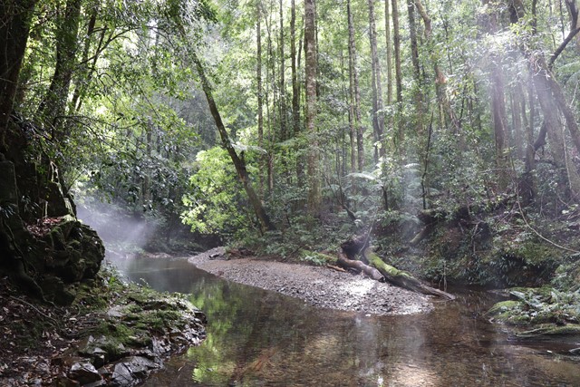
Rosewood Creek Circuit
Rosewood Creek walking track meanders through stunning World Heritage-listed rainforest, offering places to picnic, birdwatching, waterfalls, and access to a crystal-clear river.
Best taken in an anti-clockwise direction, the peaceful Rosewood Creek walking track loops through astonishing World Heritage-listed rainforest, waterfalls, and creeks. Beginning and ending at Never Never picnic area, it offers a moderate walk for a leisurely afternoon.
You’ll pass some of the largest blackbutt and tallowwood trees you’re likely to ever see. The occasional giant stump acts as a reminder of earlier logging history in the area. You’ll also pass through coachwood, crabapple and sassafras trees on your way to Coachwood Falls.
Rosewood Creek offers sparkling pools and cascading waterfalls for budding photographers. Find a shady spot on the bank for a picnic snack, or pull out some binoculars for birdwatching. In spring, the area also blooms with flowering trees such as the famous Dorrigo waratah. To extend your walk, turn at the Red Cedar Falls junction, and return via a spectacular route.
 4.8
km
return
90
mins
4.8
km
return
90
mins
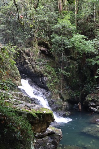
Casuarina Falls Circuit
Enjoy the views of Dorrigo National Park and a series of waterfalls and creeks during a hike along Casuarina Falls circuit.
 4.5
km
one-way
70
mins
4.5
km
one-way
70
mins
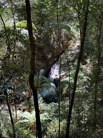
Mihi Falls Lookout
A walk to a lookout over Mihi Falls on the opposite side of a gorge in Oxley Wild Rivers National Park.
 3.2
km
return
90
mins
3.2
km
return
90
mins
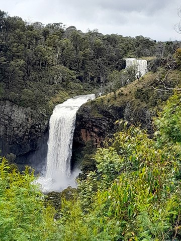
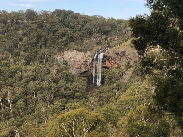
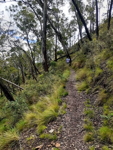
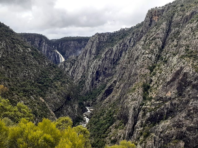
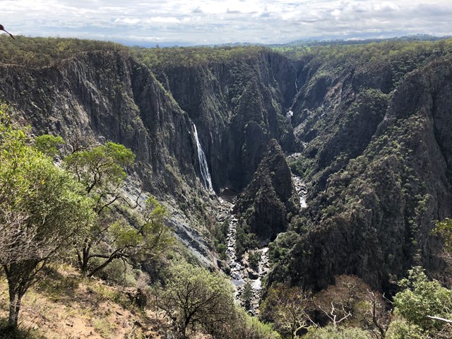
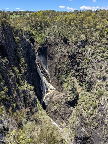
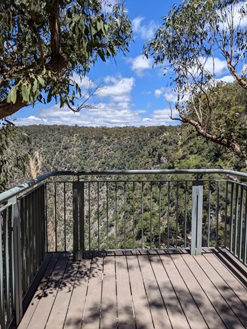
Chandler Walk to Chandler Viewpoint
This walk is a part of Oxley Wild Rivers National Park and gives spectacular views of Wollomombi and Chandler Gorge and Falls. The three lookout allows you to gaze out over the highest waterfall in New South Wales at 220m.
 4.1
km
return
90
mins
4.1
km
return
90
mins
Wollomombi Walk to Chandler Falls Lookout
This walk is a part of Oxley Wild Rivers National Park and gives spectacular views of Wollomombi and Chandler Gorge and Falls. The three lookout allows you to gaze out over the highest waterfall in New South Wales at 220m.
 6
km
return
2
hrs
6
km
return
2
hrs
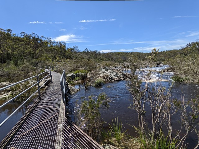
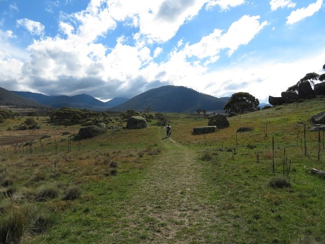
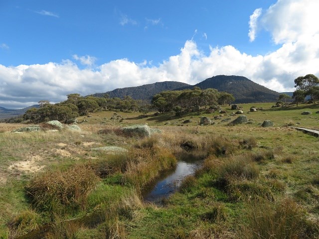
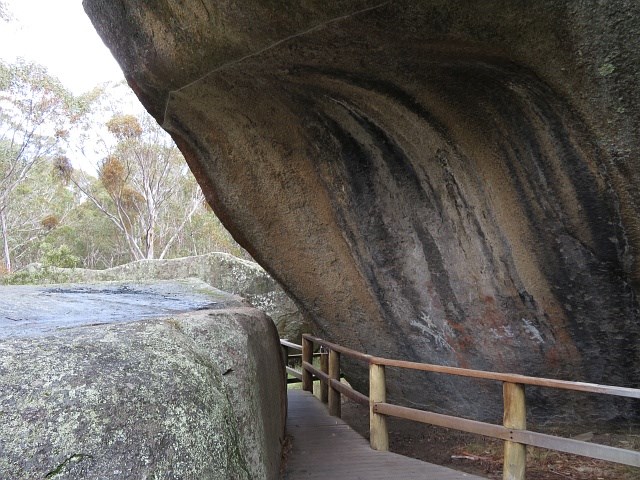
Yankee Hat
6 km return through open plains with Aboriginal rock paintings at the end
 2
km
return
1
hr
2
km
return
1
hr
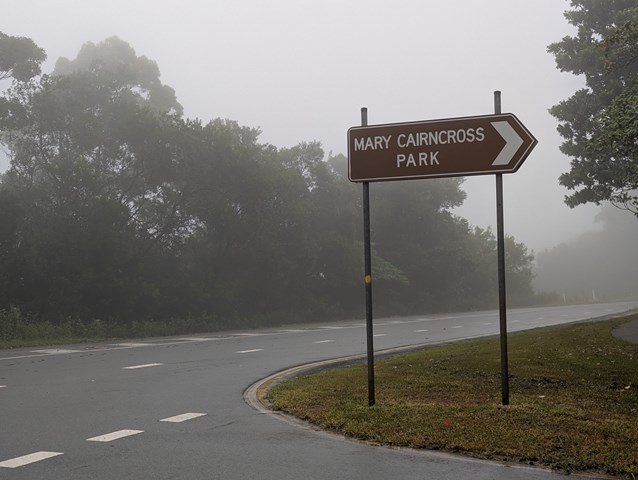
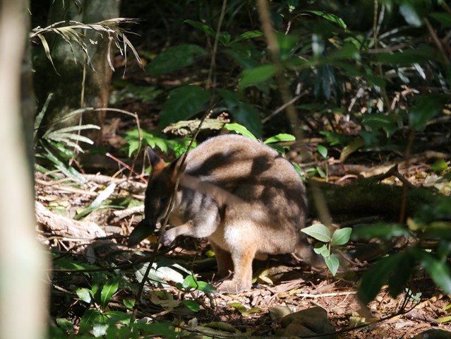
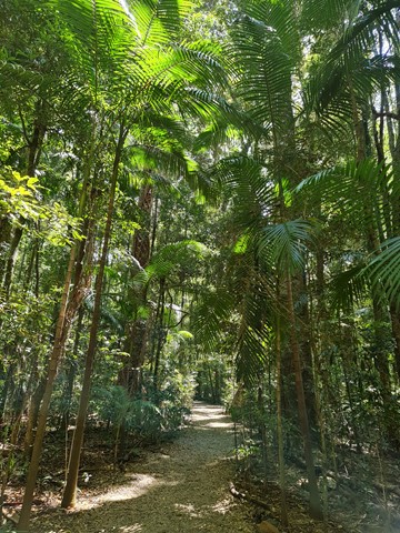
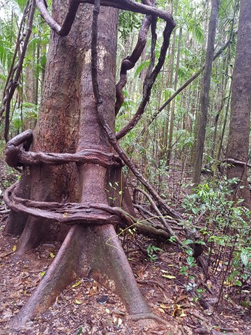
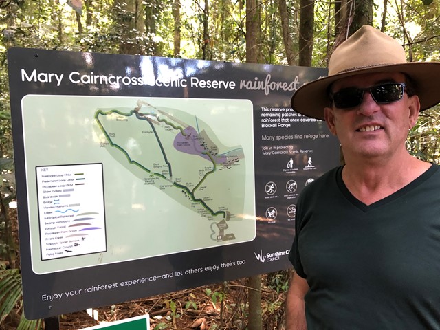
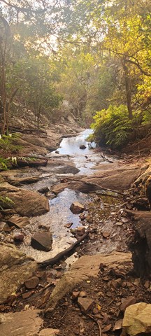
Mary Cairncross Reserve
This walk never fails to please. At a very leisurely stroll you can stop and enjoy the rainforest and spot the pademelons hidden in the bush. Best time to do the walk is early in the morning to get the pademelons and birds and to avoid the tourist buses.
Views across the road overlooking the Glass House Mountains on a clear day are spectacular.
 17.5
km
return
6
hrs
17.5
km
return
6
hrs
Cabbage Tree Range Loop
A longer walk that can be done in one day by those who can push the pace, or done over two for those choosing a more relaxing pace or with young children. Some steep sections in the latter half of the walk before reaching the Light Line Road bush camp; the campsite of choice for those doing it over two days.
 6
km
return
3
hrs
6
km
return
3
hrs
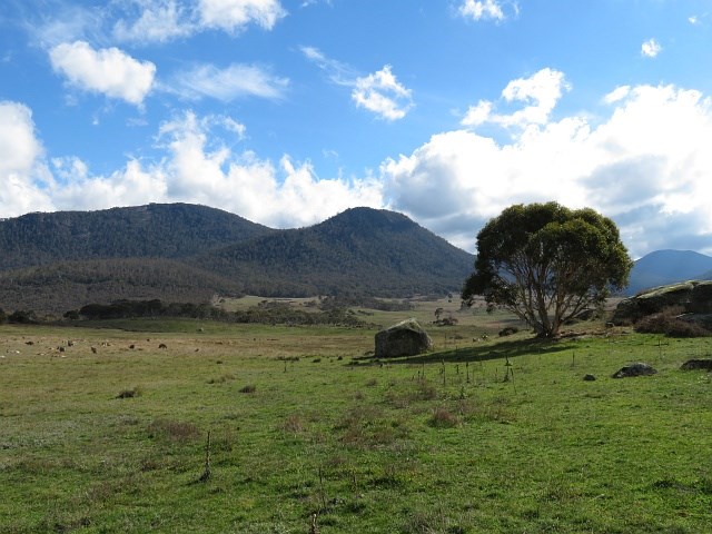
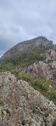
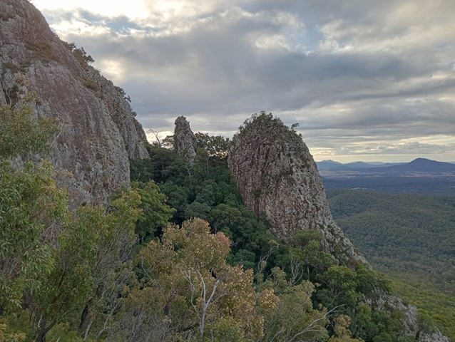
Mt Greville
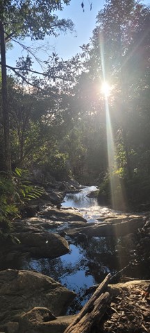
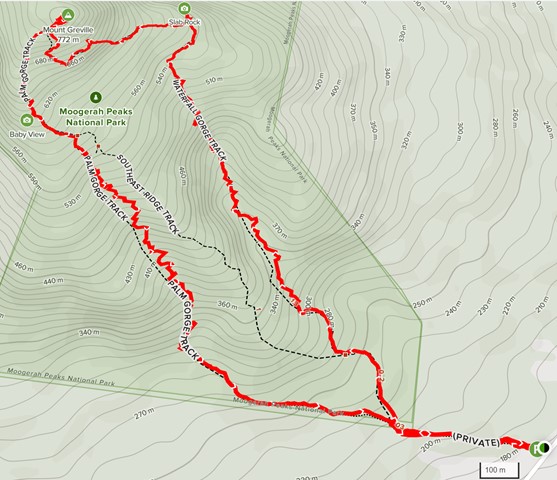
A walk up to the top of Mt Greville circa 770m. Up the waterfall gorge, then visit viewing platform rock slab near top of waterfall gorge. Alternatively, ascend via SE Ridge. Continue to summit then return via Palm Gorge.