
Menu

 1
km
return
1
km
return
 15
mins
15
mins
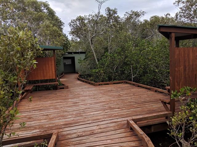
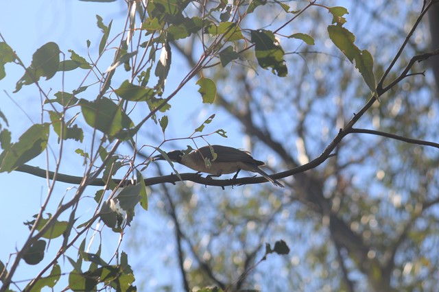
Mangrove Boardwalk
A short walk through the mangroves. At the end there is a bird tower that overviews the Coombabah lake.
 10
km
return
3
hrs
10
km
return
3
hrs
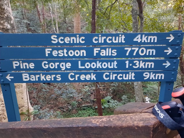
Barker Creek Circuit
A very scenic walk leaving from the Dandabah Camping area, Bunya Avenue. The walk joins up with the shorter Tim Shea Falls walk. Best walked in an anti-clockwise direction for the views and less incline. A couple of side tracks to lookout points. Rainforest, grassy knoll and woodlands
 3
km
return
4
hrs
3
km
return
4
hrs
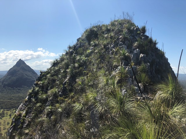
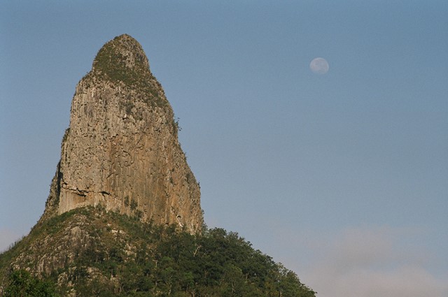
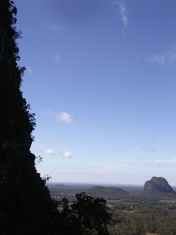
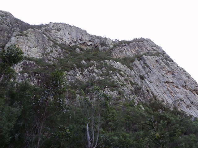
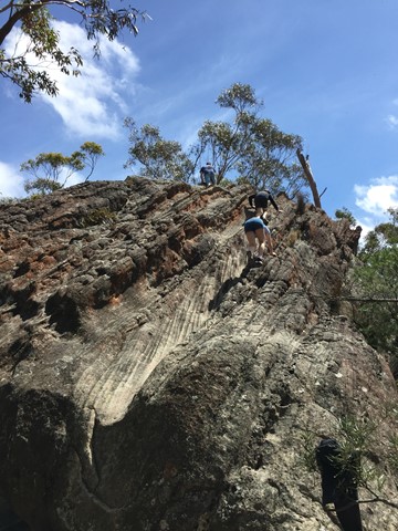
Mt Coonowrin Summit
This climb has been closed since the late 90's when I last climbed this mountain.QPWS have banned public access to Mt Coonowrin due to unstable rock and safety concerns. I have included these notes in the hope that QPWS will one day reopen this mountain.
WARNING: Any one caught walking or climbing this mountain faces a minimum $440 fine.
This track requires rock climbing experience and is extremely exposed and WILL result in death or serious injury if attempted by the inexperienced.
 8
km
return
4
hrs
8
km
return
4
hrs
Ruined Castle Walking Track
The Ruined Castle Walking Track takes you to the iconic Ruined Castle located on the middle of the ridge between Mt Solitary and Castle Head. You will travel down the Golden Stairs and encounter beautiful rain forest full of bird life before arriving at this natural rock formation. The Ruined Castle itself is a great spot for lunch and photos as it boasts 360 degrees views of the surroundings (including the Three Sisters).
 7
km
one-way
3
hrs
7
km
one-way
3
hrs
Kambah Pool to Pine Island
A scenic and rewarding trail which includes views over Red Rock Gorge on the Murrumbidgee River. This walk is one part of the longer Murrumbidgee Discovery Track from Casuarina Sands to Point Hut Crossing.
 2.4
km
return
1
hr
2.4
km
return
1
hr
Burbie Canyon
Avid birdwatchers will love Burbie Canyon walking track, which offers a gentle stroll along the creek and through a narrow sandstone gorge. Indeed, the birdlife is so varied here, you can’t help but go bird watching. This is a terrific track for families, the kids will love it.
 7.7
km
3
hrs
7.7
km
3
hrs
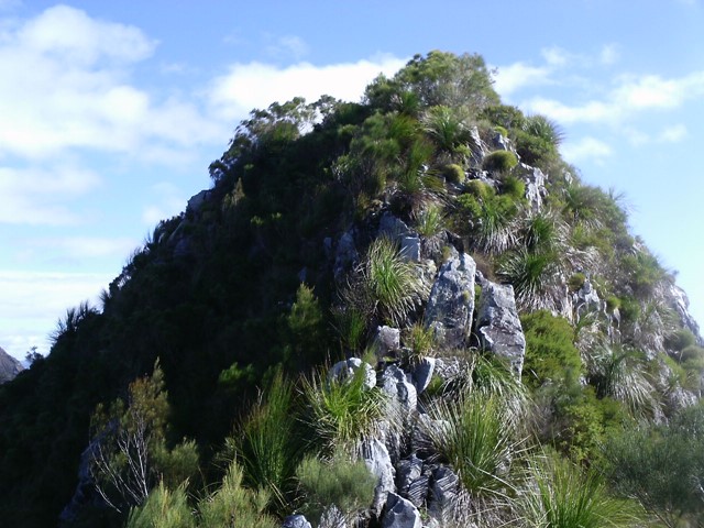
Gibraltar Peak
Gibraltar Peak (1,038m), is a rocky outcrop with extensive views over the ACT, including Canberra and Black Mountain to the east. It's accessible via a walking trail or fire trail, or combine the two to form a loop. Locatted in the Tidbinbilla Nature Reserve, it's only 45min from the Canberra city centre.
 600
m
return
15
mins
600
m
return
15
mins
Coachwood Glen Nature Trail, Megalong Valley
Short walk through Megalong Valleys rain forest
 1.4
km
return
45
mins
1.4
km
return
45
mins
Shamrock Mine Site
The track meanders along the creek before passing into eucalypt woodland. At the former Shamrock Gold Mine site, there is a self-guided walk with information about the life on the Cania Goldfields.
 1.5
km
return
1
hr
1.5
km
return
1
hr
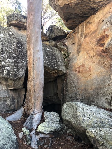
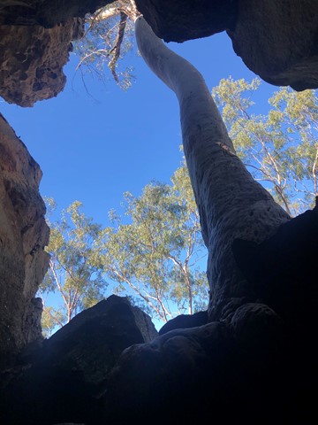
Two Storey Caves Circuit
An easy loop walk that takes in King Orchid Crevice and the Two Storey Caves.
 4.2
km
return
2
hrs
4.2
km
return
2
hrs
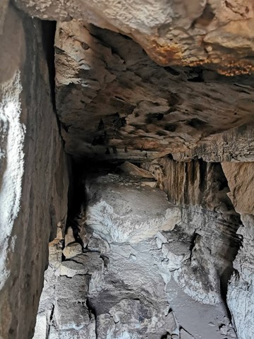
Dragon and Bloodwood Caves
A moderate steep track leading to and along the cliff face, where a sidetrack branches north to Dragon Cave. The southern branch leads to Bloodwood Cave and then a steep stepped section to the Gorge Lookout.
 3.2
km
return
90
mins
3.2
km
return
90
mins
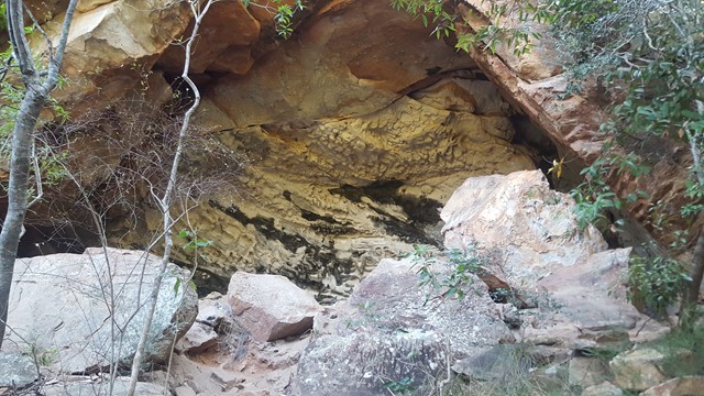
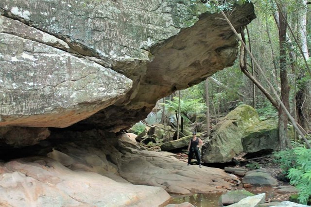
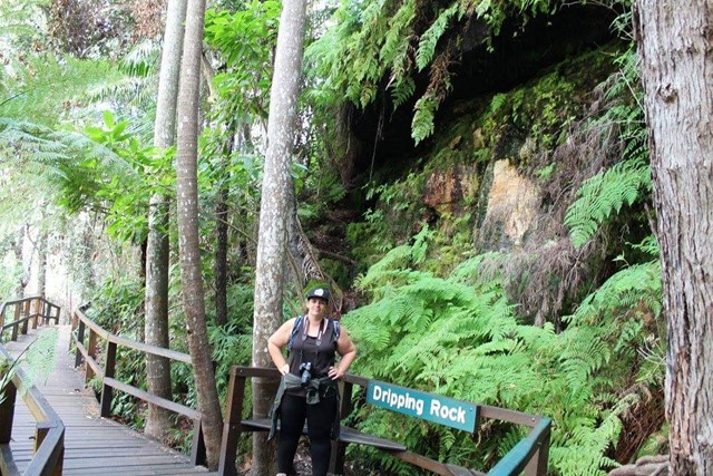
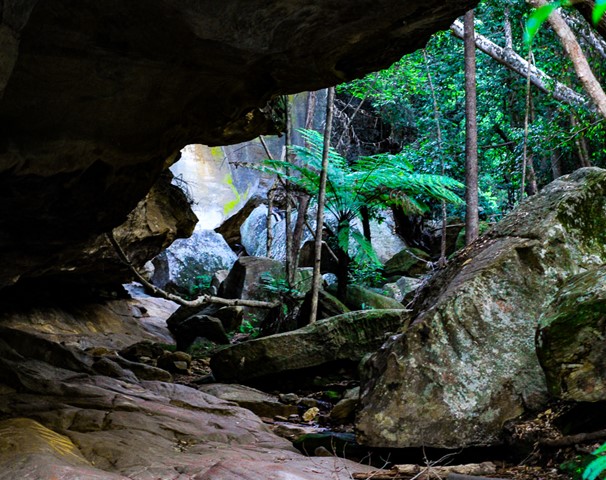
Dripping Rock and The Overhang
Nice easy walk through bit of rainforest to Dripping Rock and further to The Overhang where water has eroded the base of the sandstone cliff.
 1.2
km
return
30
mins
1.2
km
return
30
mins
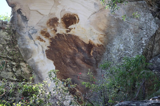
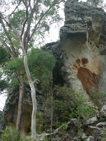
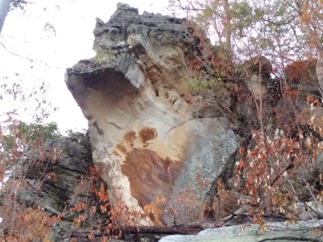
Big Foot Walk
Short trail featuring a large brown image of a four-toed foot on the white sandstone cliff.
 18.4
km
return
6
hrs
18.4
km
return
6
hrs
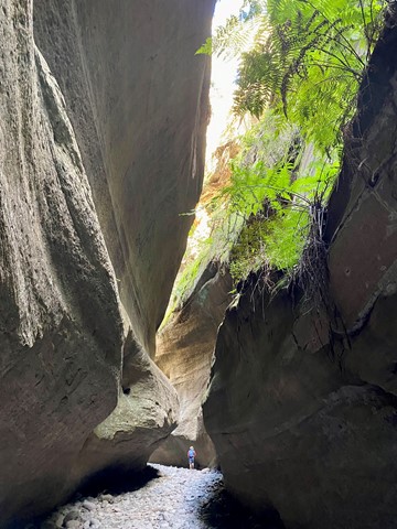
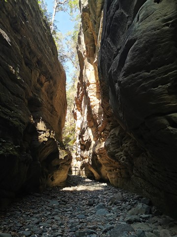
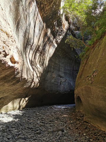
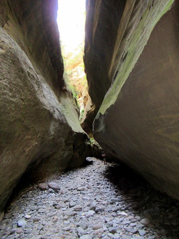
Boowinda Gorge
Boowinda Gorge—18.4km return (5–6 hours) Class 4
Rock-hop into this sculpted side-gorge, 100m upstream of Cathedral Cave. The first kilometre of this boulder-strewn gorge is the most spectacular.
 18.2
km
return
6
hrs
18.2
km
return
6
hrs
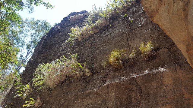
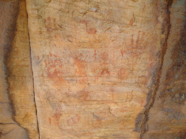
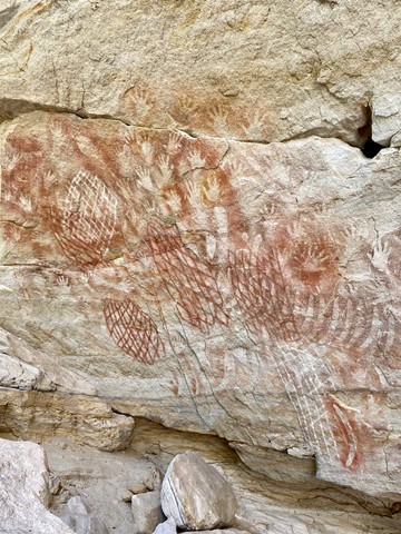
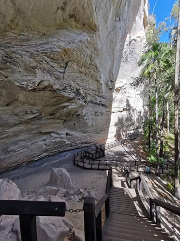
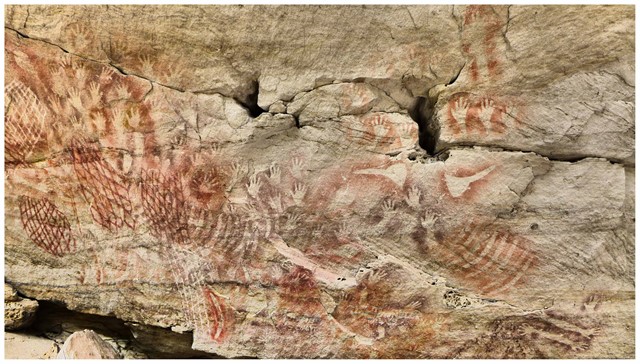
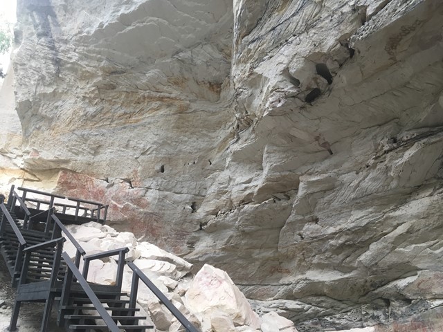
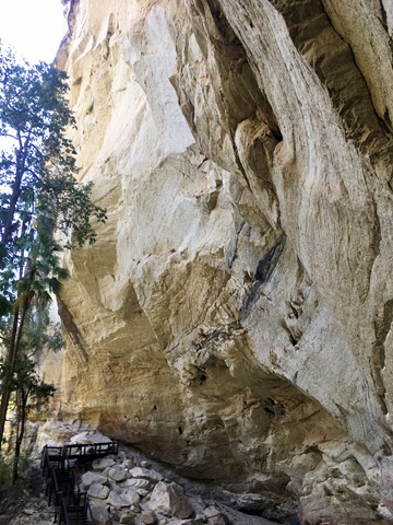
Cathedral Cave
This massive, wind-eroded overhang sheltered Aboriginal people for thousands of years. A panorama of rock art reflects the rich cultural life of those who gathered here.
 2
km
one-way
30
mins
2
km
one-way
30
mins
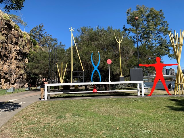
The Cliffs Boardwalk
The area between the cliff face and the river, called The Cliffs Boardwalk, has been beautifully landscaped with walkways, including a boardwalk through the mangroves, barbecues, picnic areas and gardens.
Scattered along the walk are colourful artworks that were originally commissioned for the riverside promenade at World Expo 88 at nearby Southbank.
 32
km
return
2
days
32
km
return
2
days
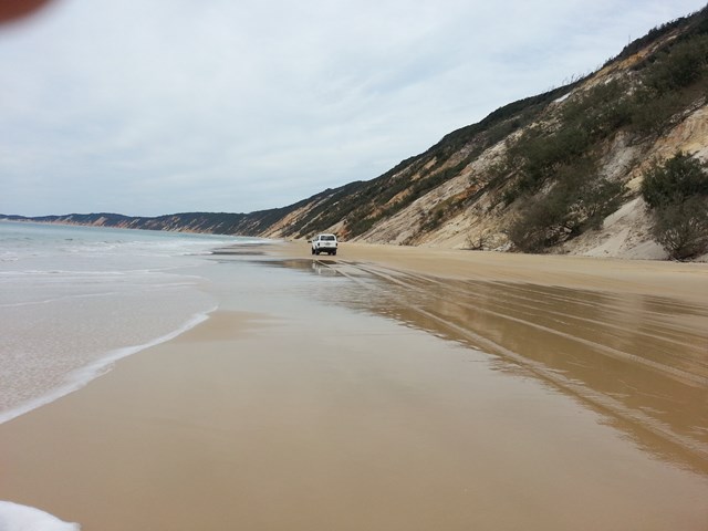
Rainbow Beach to Double Island and return by Lake Poona
A beach walk from rainbow Beach to Double Island Point then onto Freshwater Camp Ground and an inland bushwalk back to Rainbow Beach.
 14.7
km
return
4
hrs
14.7
km
return
4
hrs
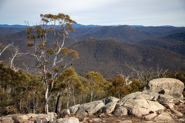
Mount Tennent
A 30min drive from Canberra, Mount Tennent is a great half-day walk that incorporates part of the Australian Alps Walking Track and offers expansive views from the summit. Parts of its are fairly steep, as you are climbing about 800m to the summit (elevation 1,375m asl).
 4.5
km
return
4
hrs
4.5
km
return
4
hrs
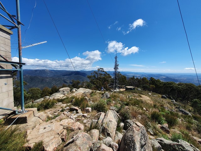
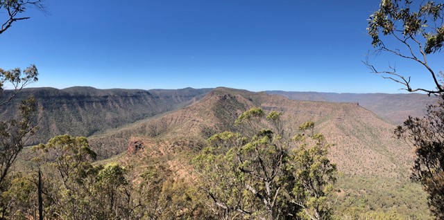
Mt Philp
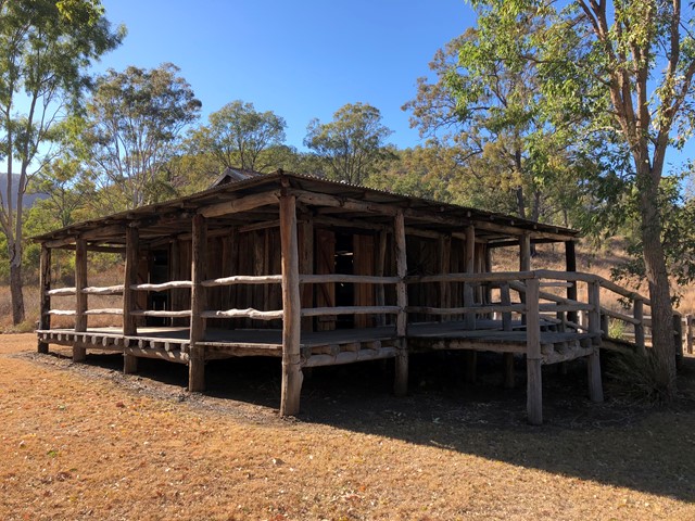
Mt Philp is located in GlenRock Regional Park and sits to the north of the ridge of Glen Rock.
There is no distinct track to the summit so you will have to navigate your way starting from the information shed opposite the day use area.
This climb can be steep in areas and will require some scrambling approaching the summit but you are rewarded with amazing views of Glen Rock and the ridge lines of the sorrounding area.
 5.1
km
return
2
mins
5.1
km
return
2
mins
Ingliston Gorge/Sloss's Gully
Hike the less well-known gorge in Werribee Gorge State Park.