
Menu

 5.1
km
return
5.1
km
return
 2
mins
2
mins
Ingliston Gorge/Sloss's Gully
Hike the less well-known gorge in Werribee Gorge State Park.
3
km
return
2
hrs
Falcons Lookout
Falcons Lookout provides scenic views of Werribee Gorge and beyond.
4
km
return
2.5
hrs
Centenary Walk
Walk through to the James Whyte Island Reserve for panoramic views over Werribee Gorge and beyond.
5
km
return
2
hrs
Werribee Gorge Short Circuit Track
A shorter form of the Werribee Gorge Circuit Walk.
10
km
return
4.5
hrs
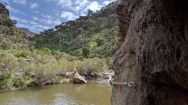
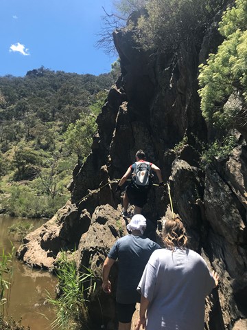
Werribee Gorge Circuit Walk
Explore the length of Werribee Gorge with spectacular views and rock hopping, all only an hour from Melbourne's CBD.
 1.6
km
return
1
hr
1.6
km
return
1
hr
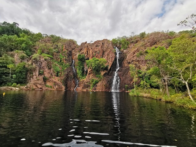
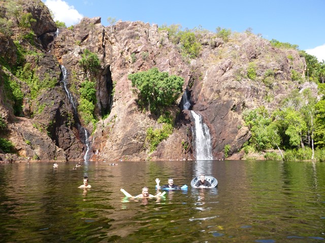
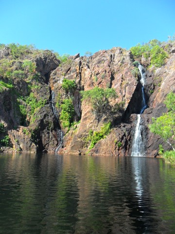
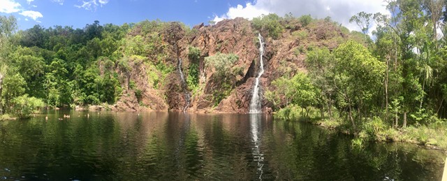
Wangi Falls Loop Walk
Wangi Falls is one of Litchfield’s most popular and easily accessible attractions. It is open all year round, however swimming is not always possible due to water levels. This place is simply magic in the Wet Season, with the walk to the top of the falls offering a great opportunity for photography.
 42
km
one-way
3
days
42
km
one-way
3
days
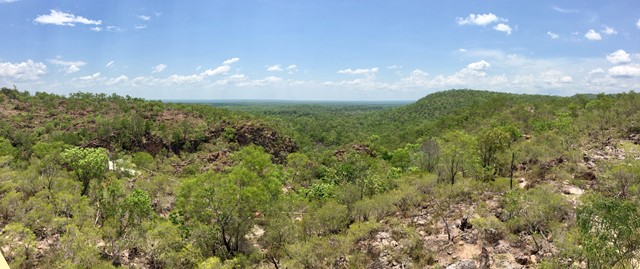
Tabletop Track
A 40-50km circuit in Litchfield National Park in the Northern Territory: the length depends on which access track is used to access the circuit. The walk goes through an arid and often burnt landscape, but is punctuated by beautiful waterholes and creeks. There's a pretty good chance you'll have one of the three camping sites to yourself.
 1.6
km
return
45
mins
1.6
km
return
45
mins
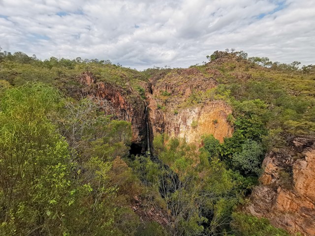
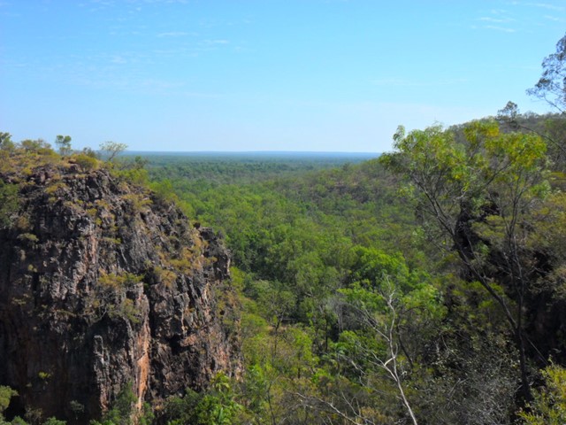
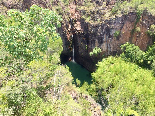
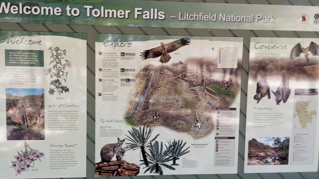
Tolmer Falls
Tolmer Falls is one of the most spectacular falls in Litchfield National Park. The falls cascade over two high escarpments into a distant, deep, plunge pool. The bottom of the falls is home to several colonies of rare Ghost Bats and Orange Horseshoe Bats.
 2.4
km
90
mins
2.4
km
90
mins
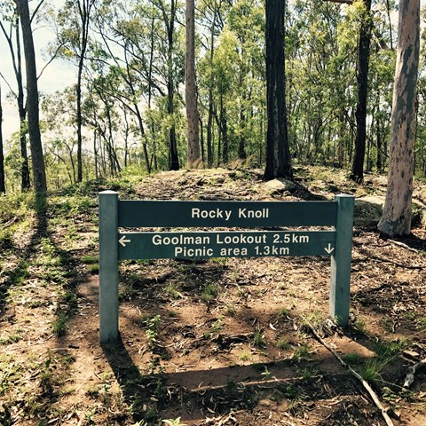
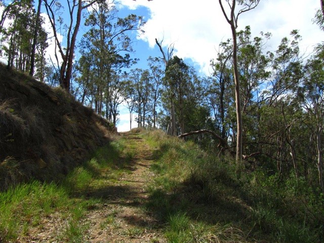
Rocky Knoll Lookout
Entry is from Hardings Paddock Picnic Grounds -
A moderate level hike through eucalypt woodlands to
Rocky Knoll lookout. Glimpses of the scenic rim and the
surrounding Ipswich area are provided along the way.
 2.3
km
return
90
mins
2.3
km
return
90
mins
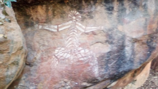
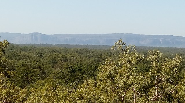
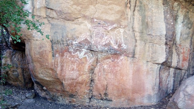
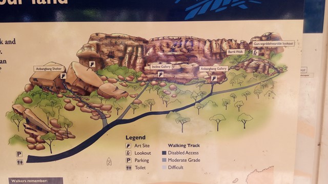
Nourlangie (Burrungkuy)
A circular walk that takes you past an ancient Aboriginal shelter and several outstanding World Heritage rock art sites, that includes an impressive 'Lightning Man' image. A short climb to Gunwarddehwardde Lookout provides impressive views of Kakadu's escarpment and extensive savannah woodlands below.
 3.6
km
2
hrs
3.6
km
2
hrs
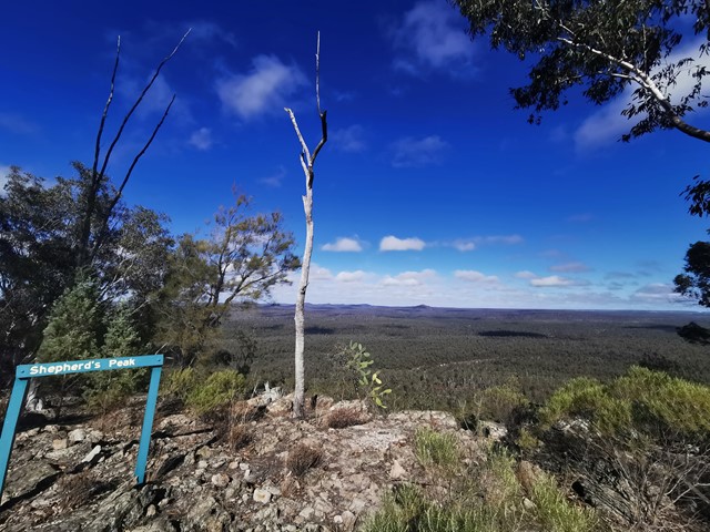
Shepherds Peak
This walk begins at Starkvale camping area and goes through open woodland with a well-defined trail. The first part of the walk is easy with a slight incline which changes once you get to the start of the climb up Shepherds Peak. Parts of this climb are very steep although there are some steps on the steeper parts but a fair level of fitness is required to get to the top. Care should be taken once at the top as the edges of the cliffs are unfenced. But the panoramic view of the gorge is breathtaking, especially early in the morning.
 4
km
90
mins
4
km
90
mins
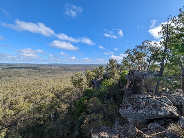
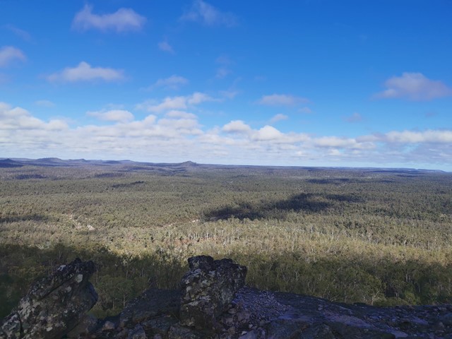
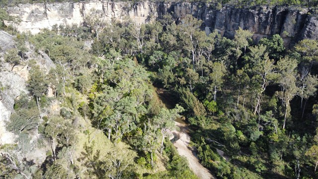
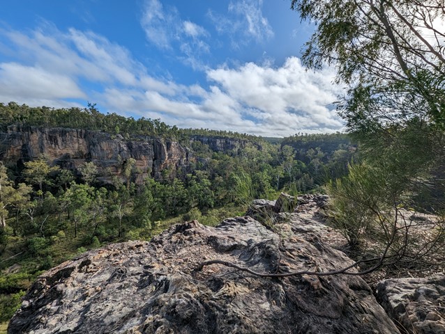
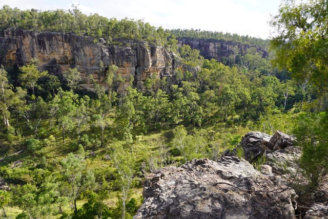
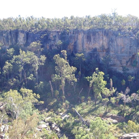
Robinson Gorge Lookout
An easy walk from Starkvale camping ground, through open woodland on a well-defined track to get views of the sheer sandstone cliffs of Robinson Gorge. Look down into the gorge from unfenced cliff edges - care is needed.
 10.9
km
3
hrs
10.9
km
3
hrs
James Mcane Lookout to Mothar Mtn Rock pools
This walk will take you from the James Mcane Lookout just out of Cooran to the Mothar Mtn Rock pools day use area. The track I took is mainly a 4WD track but in the whole day I saw 1 4X4. The track winds its way over the Mothar Mtn range in the Woondum NP, and the walking is not to hard with gentle slopes going up and down. This walk however is listed as 1 way. If you wish to return you must go back the way you came, or if enough with transport a vehicle can be left at either end to ferry you back. The return trip by foot would be 21.8klms back to the lookout.
6.1
km
return
2.5
hrs
Viaduct Track Loop
Visit the old railway tunnel and viaduct remains in Shepherds Hill Recreation Park and adjacent Watiparinga Reserve. The walk starts on the River Red Gum Loop before branching onto the Viaduct Track.
2.2
km
return
1
hr
Seaview Loop
Capture views across of the Adelaide Plains and the coast on this loop through Sheperds Hill. The fire trail is popular with dog walkers and running groups though it does have some steep and loose sections.
1
km
return
90
mins
Fort Nepean
Explore this 19th century fort that fired the first shot of the British Empire in WWI and the first Australian shot of WWII. Visitors can investigate the tunnels, forts and gun emplacements.
800
m
return
45
mins
Pearce Barracks, Fort Pearce and Eagles Nest
Explore some of the fortifications built in the early 20th century while enjoying stunning views of Bass Strait and Port Phillip.
750
m
return
30
mins
Cheviot Hill and Harold Holt Memorial
Visit the World War II fortifications on Cheviot Hill, the highest point in Point Nepean National Park, and a memorial to Harold Holt, Australia's 17th Prime Minister who disappeared at nearby Cheviot Beach in 1967.
 1
km
return
30
mins
1
km
return
30
mins
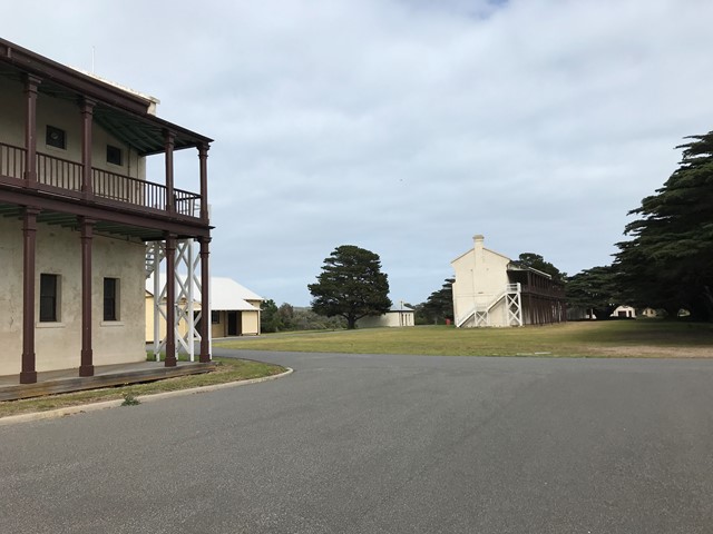
Quarantine Station
Tour the historical precinct of Point Nepean which hosted a Quarantine Station and an Army OFficer Cadet School.
 1.8
km
one-way
45
mins
1.8
km
one-way
45
mins
Range Area Walk
Explore the rifle range used to train army cadets in firing rifles, grenades and machine guns - don't worry... they don't use it anymore :). The walk links the Quarantine Station with Cheviot Hill and passes through coastal scrub. Pause to climb the Monash Light tower to take in views of the park and coastline.