
Werribee Gorge Circuit Walk
Werribee Gorge State Park


Menu
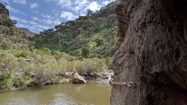
Explore the length of Werribee Gorge with spectacular views and rock hopping, all only an hour from Melbourne's CBD.

Getting there
Follow the Western Freeway (M8) past Bacchus Marsh and take the Myrniong exit. Turn on to Pentland Hills Road then right onto Myers Road. Follow this to the Meikles Point Picnic Area. The walk can also be started from the Quarry Picnic Area if you prefer.
Maps
Vicmap 1:25000 Ingliston 7722-1-3 or Vicmap 1:30000 7722-1-3-1
Route/Trail notes
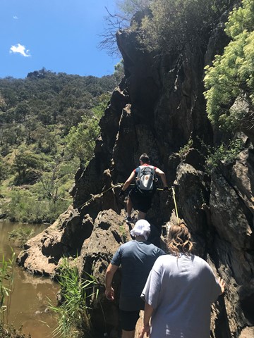
This is a circuit track that can be walked in either direction, however anti-clockwise seems to be the more common recommendation. The track is steep in places with scrabmbling along the river section, but it is suitable for fit kids. There is a handrail for one section of the walk which is on a narrow sloping section above the river.
This track may become impassable after heavy rain.
Other References
http://parkweb.vic.gov.au/explore/parks/werribee-gorge-state-park
GPS Tracks
- No GPS available for this walk yet.
 10
10 4.5
4.5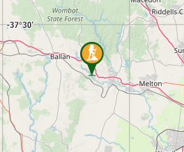
Comments