
Menu

 9.64
km
return
9.64
km
return
 3.5
hrs
3.5
hrs
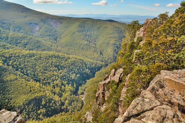
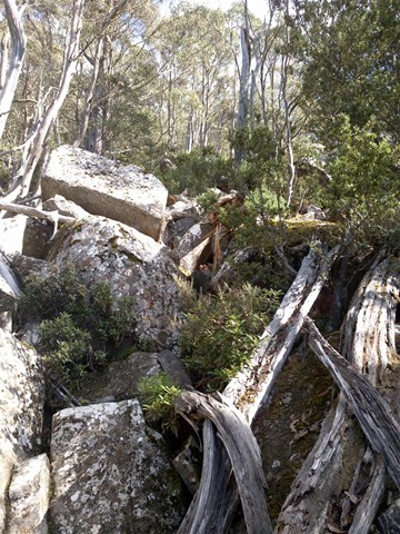
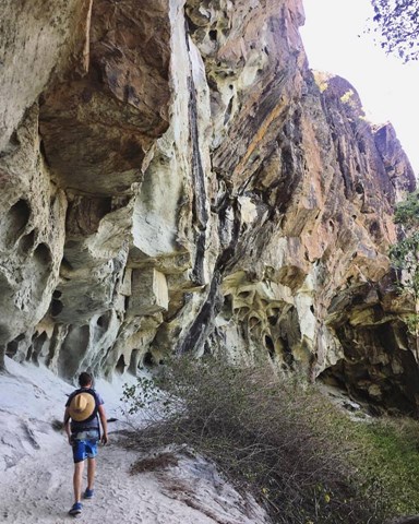
Cathedral Rock
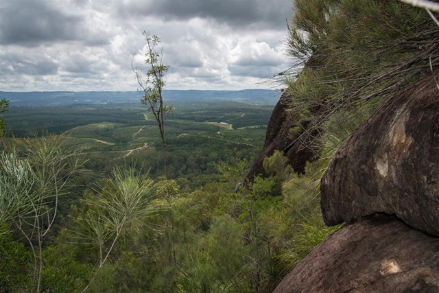
Moderate hike. Starting on private property gate, through magnificent myrtle forest alongside a creek, to a steep zigzagging fire trail to a fun top scramble to the summit. Fantastic views and a fairly sheltered hike until you hit the top. Return the same way or alternatively keep walking along the ridge to the Montague Thumb and come back in a long loop across the valley.
 9
km
one-way
3
hrs
9
km
one-way
3
hrs
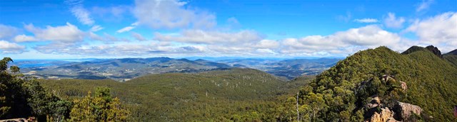
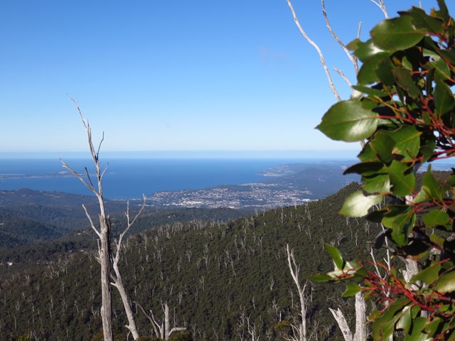
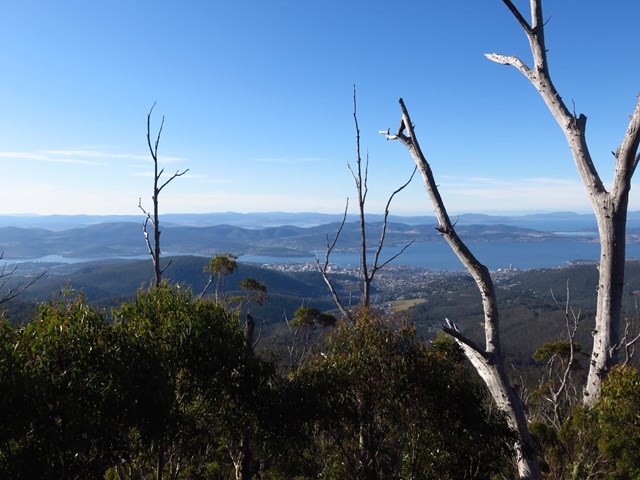
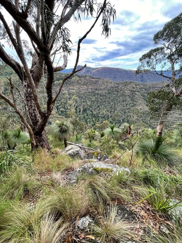
Mt. Wellington - Cascade to Lost World
An amazing hike through a variety of scenery and terrain until you get to the lost world track where things get a bit tricky. The best way to explore the complexity of Mt. Wellington through the changing altitude environment.
 3.5
km
return
1
hr
3.5
km
return
1
hr
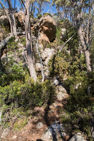
Sphinx Rock
Take the Lenah Valley Track from The Springs for just over 1km. Sphinx Rock is signposted on the right. Be warned that there are no railings at the lookout, although there is a childproof gate on the approach. Children should be supervised. To explore the base of the rock take the Sawmill Track downhill from the junction a few metres further along. Return by same route.
 135
km
one-way
6
days
135
km
one-way
6
days
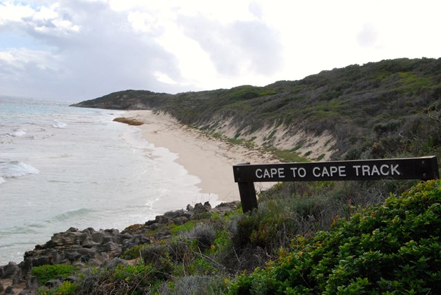
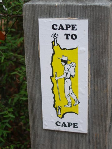
Cape to Cape Track
The track runs between the lighthouses of Cape Naturaliste and Cape Leeuwin. 135km. End to End 5-7 days. Hike all year round. Best time to hike Spring.
 12.5
km
return
7
hrs
12.5
km
return
7
hrs
The Steamers Via Creek
A mostly offtrack walk navigating a picturesque creek, The Stern, The Mast and The Funnel.
 9
km
return
5
hrs
9
km
return
5
hrs
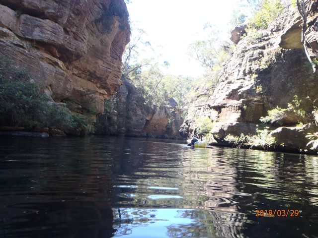
Wollangambe Canyon (Upper Section)
An "easy" canyon in the Blue Mountains - requiries no abseils, but you need basic navigation skills and you need to take note of where to exit. The Upper Section (or Wollangambe One) is (arguably ) slightly shorter and easier than the Lower Section.
 13
km
one-way
9
hrs
13
km
one-way
9
hrs
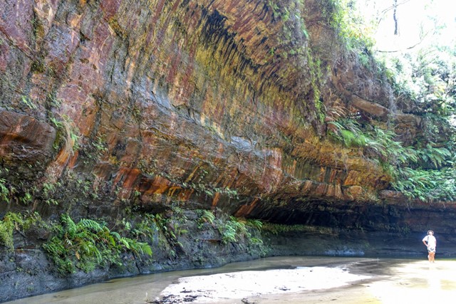
Warrimoo to Glenbrook
A mostly off-track hike from Warrimoo in the Blue Mountains down Glenbrook Creek to Glenbrook station via Duck Hole and the Blue Pool. Hard work but great for a hot day as you'll get pretty wet!
 3
km
return
90
mins
3
km
return
90
mins
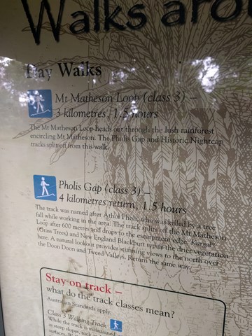
Mt Matheson Loop Walk (from Mt Nardi)
Starting at Mount Nardi picnic area, the Mount Matheson loop takes you on a short walk through rainforest. You can combine this hike with other tracks for a longer day walk.
 4
km
return
90
mins
4
km
return
90
mins
Pholis Gap (from Mt Nardi)
Sets out from the Mt Nardi carpark and follows the Mt Matheson walk till the track branches to the left at the 1.5km mark. There are alot of steps to get to the Pholis Gap lookout, however when you arrive there a plaque explains the Gap look out. The lookout is virtually over grown and all that can be seen is a distant view.
 2.2
km
return
75
mins
2.2
km
return
75
mins
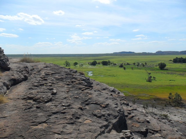
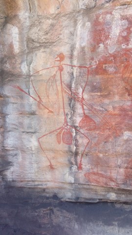
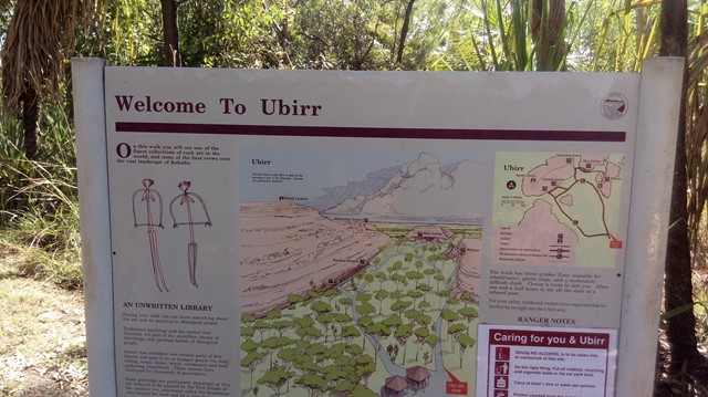
Ubirr Rocks
A circular track that takes you past several fascinating Aboriginal rock art sites. A moderately steep 250m climb takes you to Nadad Lookout that offers a 360° view of the surrounding floodplain, with the Arnhem Land escarpment to the east.
 3
km
return
90
mins
3
km
return
90
mins
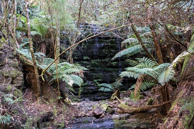
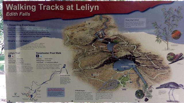
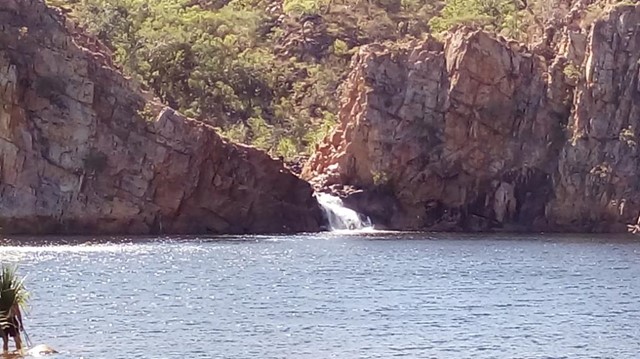
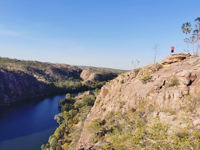
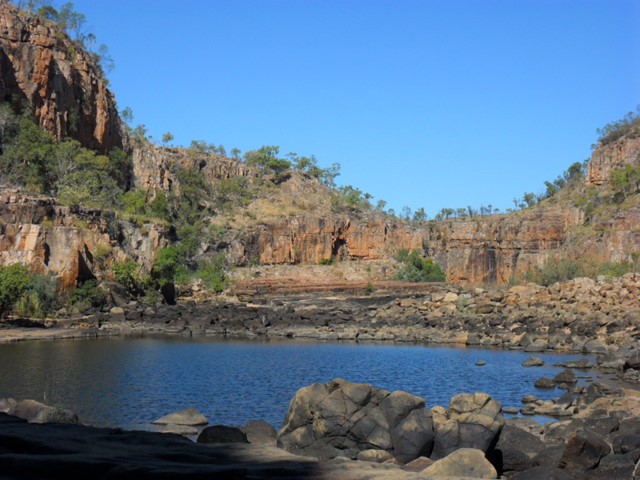
Leliyn Trail (Edith Falls)
The Leliyn Track provides a unique opportunity to experience the escarpment country. The main features are a series of pools and waterfalls created when the Edith River plunges over the escarpment. Several lookouts along the walk provide excellent views.
 1.6
km
return
30
mins
1.6
km
return
30
mins
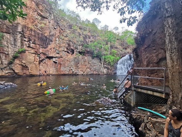
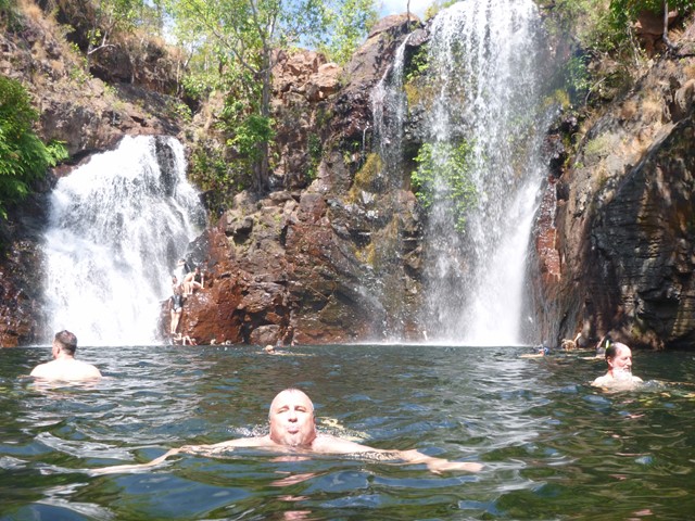
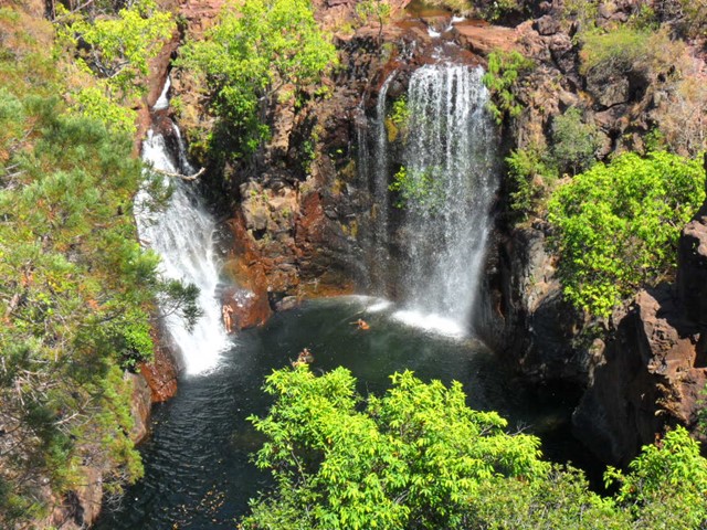
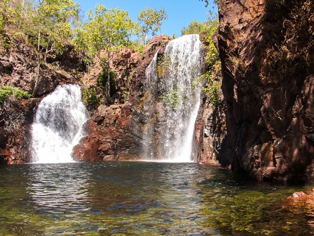
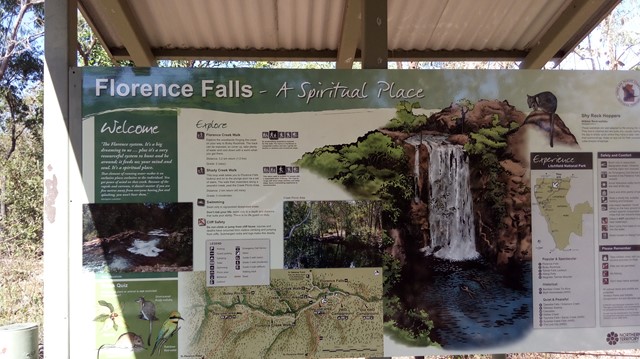
Florence Falls
Spectacular double waterfall, set amid the monsoon forest, cascades into a swimming hole. A lookout proving a panoramic view.
 4.8
km
return
90
mins
4.8
km
return
90
mins
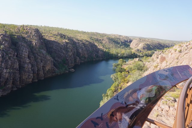
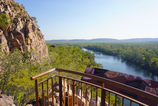
Baruwei Loop Walk
Experience the western end of the Katherine Gorge System and escarpment as well as 17 Mile Valley via the Baruwei Lookout and loop walk.
 2.8
km
return
1
hr
2.8
km
return
1
hr
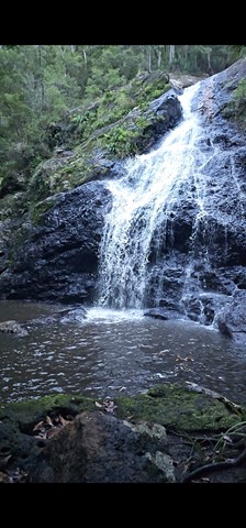
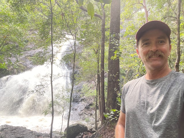
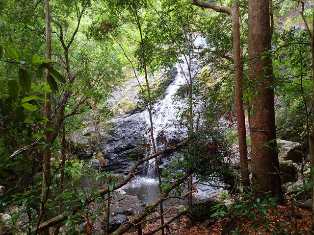
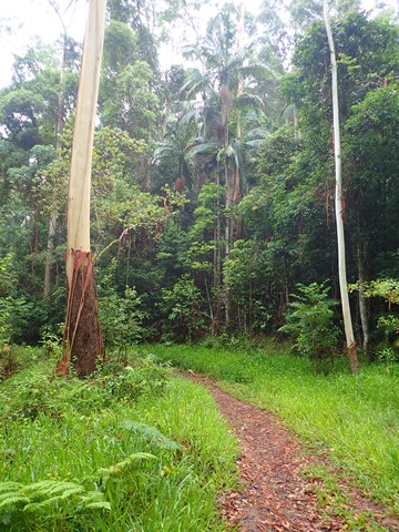
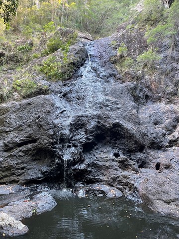
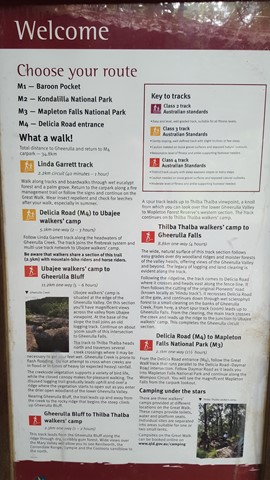
Gheerulla Falls
A lovely short, but fairly steep walk down an overgrown track to the creek bed and hidden water fall.
 1.2
km
return
30
mins
1.2
km
return
30
mins
Border Loop Walk
A short walk through wet eucalypt and rainforest close to the Queensland/New South Wales border in the Border Ranges National Park.
 700
m
return
15
mins
700
m
return
15
mins
Linda Garrett Circuit
A very short walk dedicated to Linda Garrett, who donated lands for the benefit of the community.
 3.4
km
return
1
hr
3.4
km
return
1
hr
Python Rock
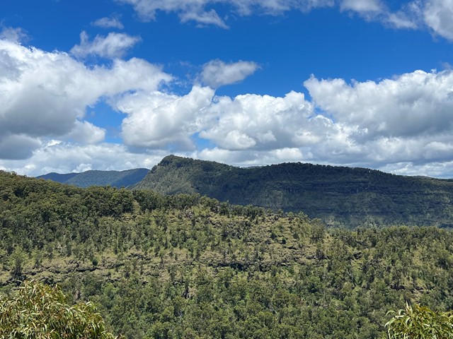
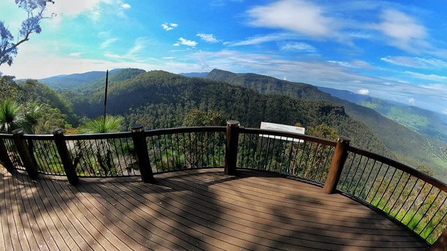
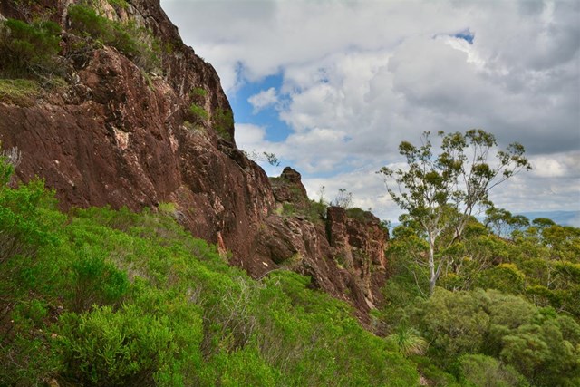
The track to Python Rock has even grades, suitable for older people and young children. The booyongs and figs near the West Cliff turn off are impressive as are the large New England Blackbutt as you enter the open forest for the first time. The view from Python Rock overlooks Castle Crag to the Lost World with Mount Throakban on the left and Moran's Falls. You can proceed up the hill from the lookout on a tough track and turn left for West Cliff.
 3
km
return
5
hrs
3
km
return
5
hrs
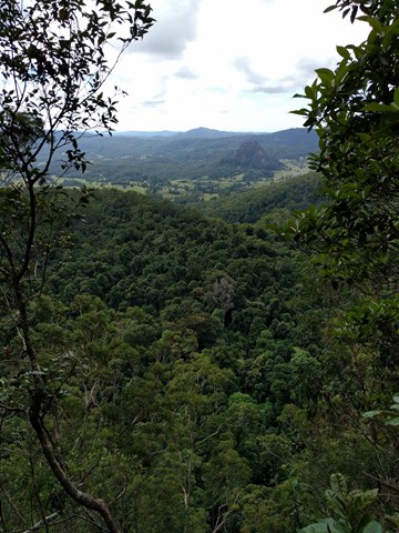
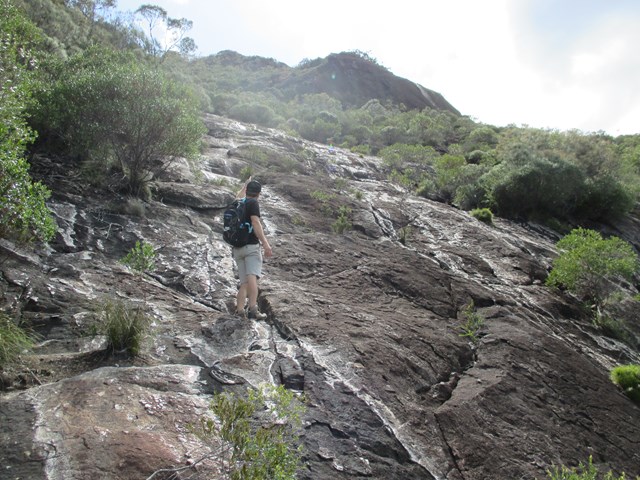
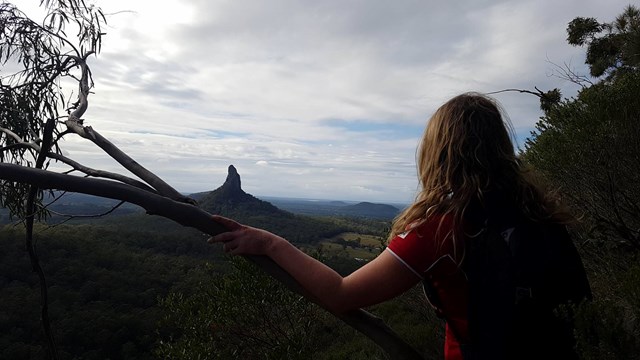
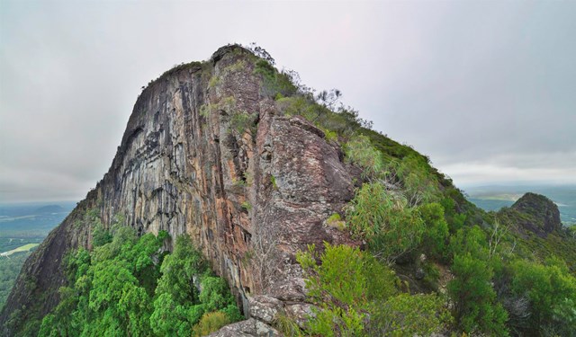
Mt Beerwah East Face
With the summmit track closed due to a massive rockfall in 2008 this is an alternative route to the summit. It is quite steep and exposed in places and not recommended if you don't have a head for heights.
 750
m
one-way
3
hrs
750
m
one-way
3
hrs
Mt. Beerwah - Alpine Route
Steep and tricky scramble followed by a nasty scrub bash section, climbing the North West side to join the upper tourist track. Basic rock climbing skills are needed to ascend the first 100m. Rope and some trad gear would be advisable on the lower section to lead a group.
A route of a strong wild environment and adventure character not to be taken lightly by inexperienced route finders.