
Menu

 600
m
return
600
m
return
 30
mins
30
mins
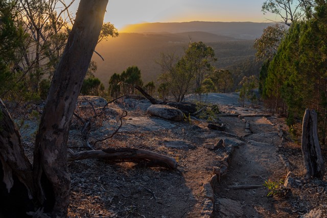
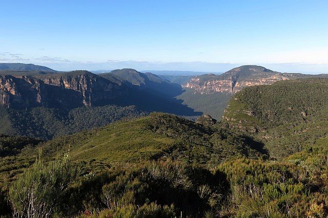
Mt Pilot
A short walk to the Mt Pilot Lookout affords sweeping views over the Chiltern-Mt Pilot National Park and surrounding area from the 545m summit. A great spot to catch sunrise.
 5
km
return
90
mins
5
km
return
90
mins
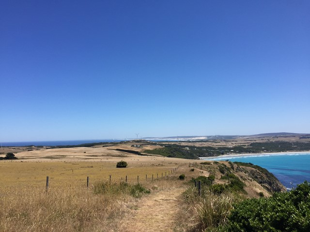
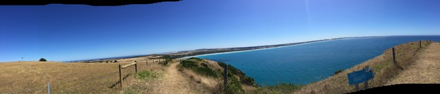
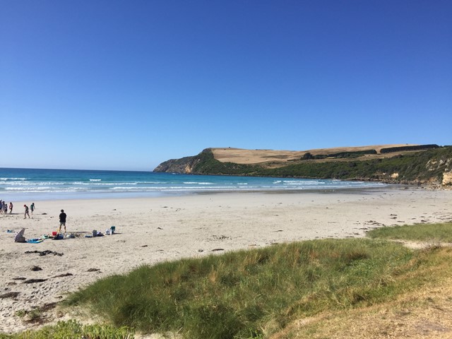
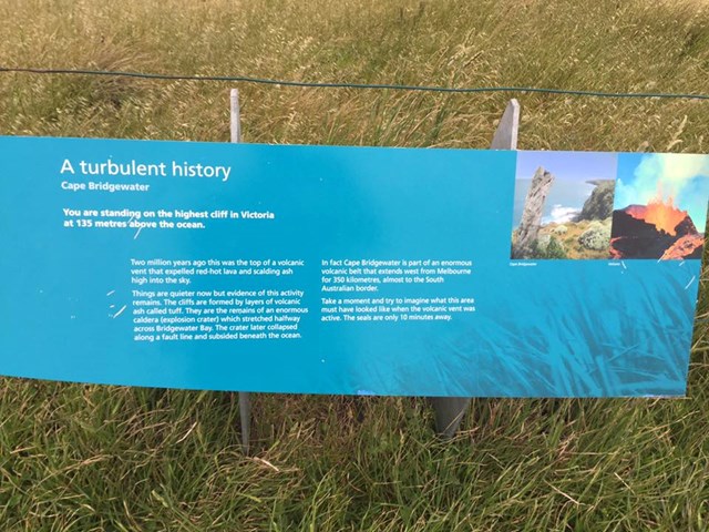
Cape Bridgewater Seal Walk
Walk. Bridgewater Bay Kiosk - Seal Viewing Platform
The seal viewing platform is 2.5km from the Bridgewater Bay Kiosk along a well-formed trail which offers striking views across Cape Bridgewater, once a volcanic island that is now joined to the mainland by calcified sand dunes. Some sections are fairly strenuous so allow 1 hour, one way.
Part of the 250km Great South West Walk
This section takes you along the highest cliffs in Victoria 135m
 645
m
return
45
mins
645
m
return
45
mins
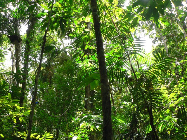
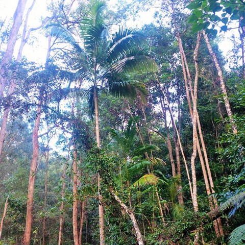
Jindalba Boardwalk
The Jindalba (meaning ‘foot of the mountain’) boardwalk explores tropical lowland rainforest. Quiet walkers may be lucky enough to see a tree-kangaroo or cassowary. Boardwalk transitions to gravel path through lush rainforest in the Daintree. This is quite close to the Daintree Discovery Centre which is well worth a visit also.
 52
km
2
days
52
km
2
days
Cooloola Widerness Trail
An interesting longer walk that can be done in two full on days or easy three days.
 18
km
return
2
days
18
km
return
2
days
The Steamers
Great classic walk to a beautiful bush feature and some fantastic views
 6
km
return
3
hrs
6
km
return
3
hrs
Rosewood Loop
Beautiful rainforest with examples of mature rosewood, flooded Gum and white Beech.
 800
m
return
30
mins
800
m
return
30
mins
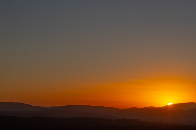
Pinnacle Walk and Lookout
“We’ve seen sunrises all around Australia – the one from Pinnacle lookout is our favourite and has to be one of the best, and the walk there is easy as.”
Without a doubt, the journey along the Pinnacle walk to Pinnacle lookout is one of the highlights of the whole park and not to be missed.
It’s a short walk through World Heritage-listed rainforest before the track reaches Pinnacle lookout. You’re bound to be mesmerised by uninterrupted views of the whole park along with spectacular 360° views all the way to the coastline, the crater escarpment and to Wollumbin-Mount Warning.
If you’re an early riser, and even if you aren’t, it’s definitely worth making the effort to see the silhouette of Wollumbin when the sun rises – it’s a completely inspiring way to start your day in Border Ranges National Park.
 650
m
return
30
mins
650
m
return
30
mins
Falcorostrum Loop Walking Track
Falcorostrum loop walking track winds its way through one of the largest stands of beech in Border Ranges National Park.
 800
m
return
40
mins
800
m
return
40
mins
Myles Dunphy Bushland Reserve
Myles Dunphy Bushland Reserve has a few short and easy trails to enjoy. Located close to Oatley train station it is easily accessible by public transport. The reserve is named after Myles Dunphy, the father of conservation in NSW and former Oatley resident.
Lots of wildflowers are visible on the track and it is a great short walk to do before enjoying a lunch in one of the many cafes in Oatley.
its a great walk for kids under 5 to do.
10
km
return
2
hrs
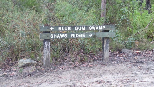
Blue Gum Swamp
A circuit which consists of Shaws Ridge to the east and Springwood Ridge on the west. The trail descends into the valley which separates the two ridges through an area known as Blue Gum Swamp.
 800
m
return
30
mins
800
m
return
30
mins
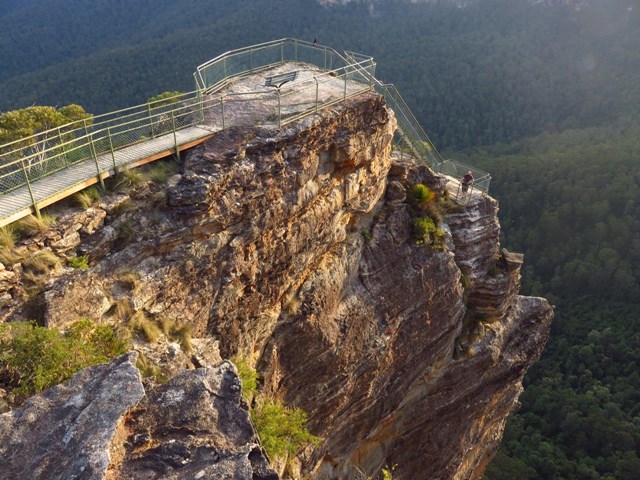
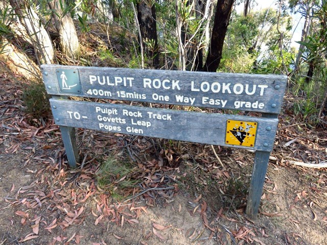
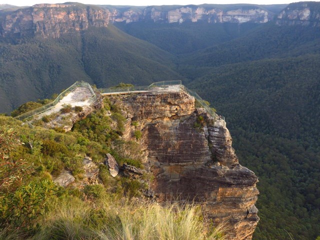
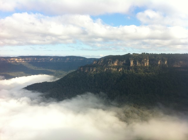
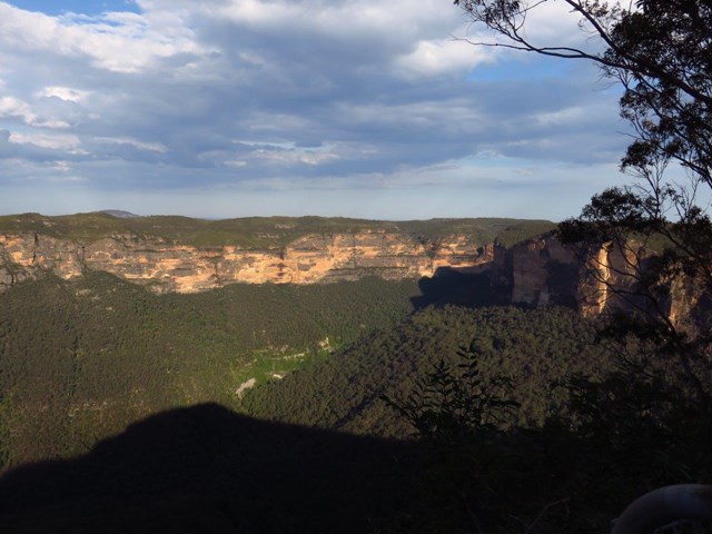
Pulpit Rock Lookout Walk
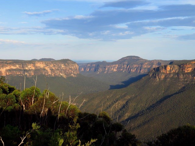
If you’ve got something to shout about, then head for Pulpit Rock lookout near Blackheath in Blue Mountains National Park. Jutting out on a dramatic blade of rock, you might be lost for words or end up singing the praises of the sweeping views of vast forested gorges and magnificent Grose Valley below.
Unpack the picnic basket and enjoy a remote lunch on this isolated pinnacle, far from the popular tourist spots. There are several lookouts from this prime position, affording an almost 360˚ panorama across the dramatic cliff lines to Mount Banks and distant mountains.
 200
m
return
10
mins
200
m
return
10
mins
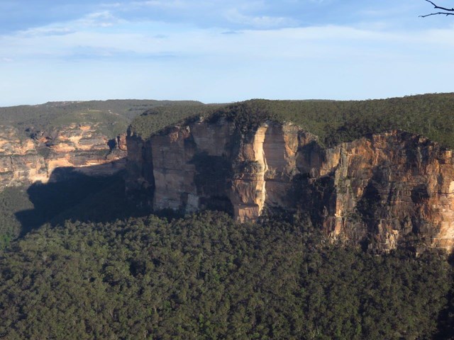
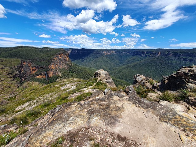
Evans Lookout
A brilliant introduction to the wonders of Blue Mountains National Park, Evans lookout offers breathtaking views over Grose Valley. Located near Blackheath, it’s a perfect day trip from Sydney, and a great base for adventurous bushwalkers who want to get amongst it.
Take in the clear mountain air as you unpack the picnic hamper. You’ll be able to see the line of Govetts Creek winding its way through the expansive valley floor.
 7
km
return
2
hrs
7
km
return
2
hrs
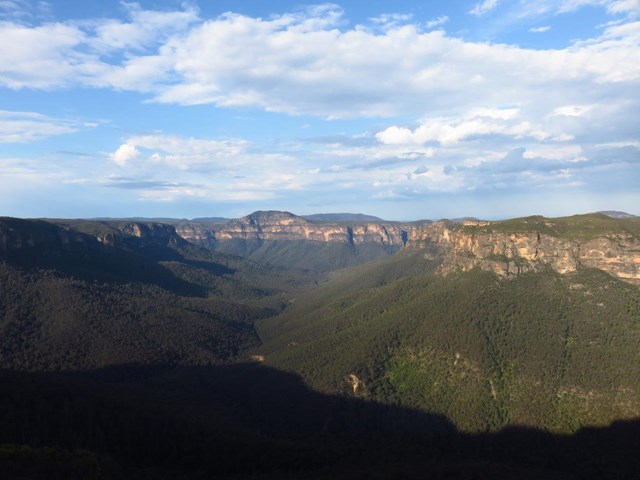
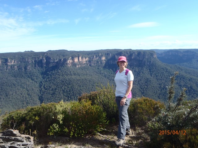
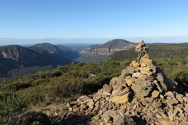
Lockleys Pylon
Lockleys Pylon walking track, just near Leura, is an easy walk offering scenic views, outstanding photography opportunities, wildflower displays and birdwatching. It's possible to extend this walk by taking a (steep) track down to the Blue Gum Forest.
 2.6
km
one-way
30
mins
2.6
km
one-way
30
mins
Iluka Nature Reserve
Iluka Nature Reserve walk is an easy stroll through the rainforest on a well maintained track. It is scattered with information signs along the way giving you a great insight to the forest and its flora and fauna. It comes out at the bluff picnic grounds where you can continue either up to the lookout, or explore around the headland or both. Take your swimmers and a picnic and spend some time on the beach.
 3.6
km
return
1
hr
3.6
km
return
1
hr
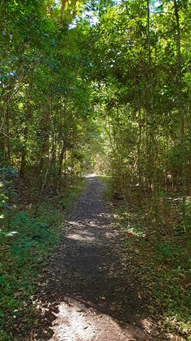
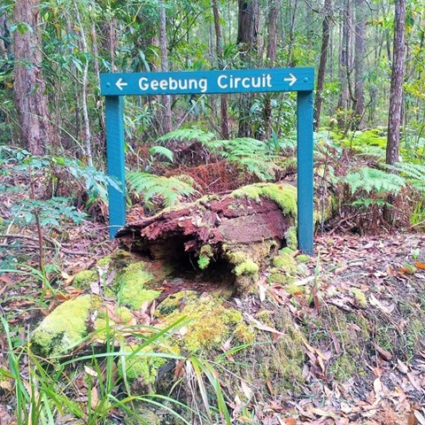
Geebung Circuit
A hilly landscape with grassy open forest features in this park. Along creeks and sheltered gullies, tall wet eucalypt forest and rainforest grows. Horse riders, mountain bike riders and walkers can enjoy the tranquillity of this park on shared wide trails, natural surfaces and gentle gradients.
 10.2
km
return
2
hrs
10.2
km
return
2
hrs
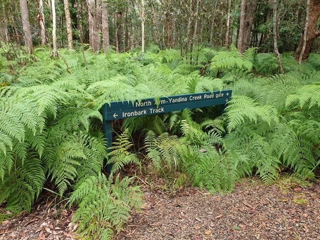
Ironbark Trail
A hilly landscape with grassy open forest features in this park. Along creeks and sheltered gullies, tall wet eucalypt forest and rainforest grows. Horse riders, mountain bike riders and walkers can enjoy the tranquillity of this park on shared trails, natural surfaces and gentle gradients.
 10
km
return
3
hrs
10
km
return
3
hrs
Mount Superbus
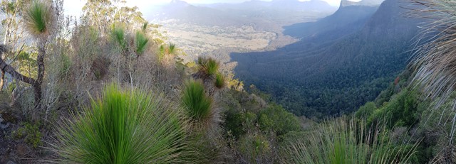
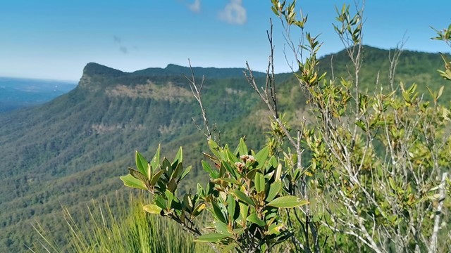
It may not provide any views from the summit, but at 1,375m above sea level Mount Superbus is the highest mountain in southern Queensland. By virtue of that fact, it's a must for any local peakbaggers.
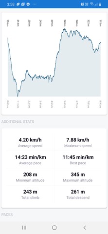
 12.4
km
8
hrs
12.4
km
8
hrs
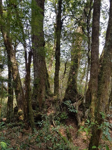
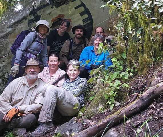
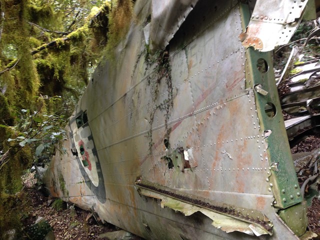
Lincoln Wreck Circuit
A very tough and steep, almost trackless walk to the summit of South-East Queensland's tallest mountain with a stop by the wreck of a plane from 1955.
 19.4
km
return
8
hrs
19.4
km
return
8
hrs
Big Bend
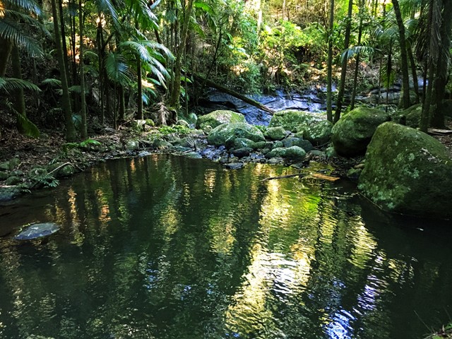
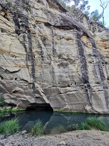
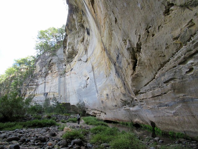
A natural pool in Carnarvon Creek lies in an elbow of the gorge beneath looming sandstone walls. Rest here in the shade of large spotted gums and watch catfish and turtles swim in the tranquil waters of the upper reaches of Carnarvon Creek. A composting toilet and picnic table is located here. If you are planning to stay overnight at Big Bend, visit the park's visitor centre before you start, to record your trip details in the registration book, and log out of the book when you have completed your walk.
 12.49
km
one-way
4
hrs
12.49
km
one-way
4
hrs
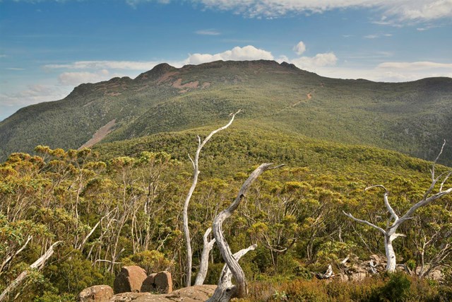
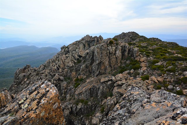
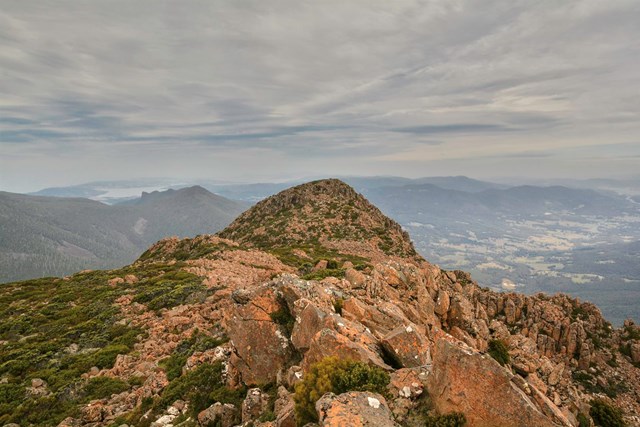
Collins Bonnet
The "Sleeping Beauty". Start at Collinsvale and finish at Big Bend (Mt. Wellington). This needs a drop-off and pick up.
A truly rewarding half day hike.
Overall a moderate walk but given the wet and slippery mud at the beginning and the nasty weather that can occur without warning it can be considered a difficult hike.