
Escarpment Walking Track
Guy Fawkes River National Park


Menu
Pass Chaelundi Falls. The first 6 km of the track is easy-medium. Much of the track is grass but isn't too hard to distinguish. Much of this area consists of tall gum trees etc. with blade grass below. The area is regularly maintained with controlled burning. Making the grass nice and fresh. The 9 km includes walking the last three km to the rest area continuing on the escarpment track. However the rest area can also be reached via Jordan's Trail which you have to cross. This trail is 1 km shorter to the rest area. The final three km of the escarpment track is rougher. There is evidence of echidnas raiding ant nests in many places along the track. Also leaves from the surrounding she oaks and sticks covering the track leaving the track quite loose in many sections. Walking the track in this direction includes much of the track being an uphill grade - particularly the last two or three km. You can return via the road which adds another 5 km to the track, or via Jordan's Trail, until you reach the escarpment track again, and then turn right to get back to camp. This walk would be a total of 17km and takes approximately four hours.

This walk starts from the Chaelundi Camp Ground at Guy Fawkes National Park. From Dundurrabin on the Grafton Armidale road, turn into Sheepstation creek Rd, then turn left into Chaelundi Rd. Follow that quite a way until you see the Guy Fawkes National Park sign at Misty Creek Rd. Follow that to the end. Most of the way is rough gravel road, and some is slippery in the wet.
How do you get to the start of the walk?
Maps
Which maps cover the area?
Route/Trail notes
A detailed description of the walk!
Permits/Costs
Do you need any permits? What's the cost?
Other References
How can I find more info? Any guide books?
GPS Tracks
- No GPS available for this walk yet.
 9
9 2.5
2.5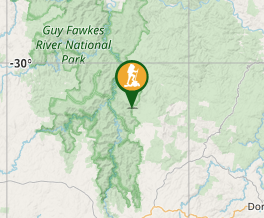
Comments