
Mt Dowe
Mount Kaputar National Park


Menu
This is just a quick walk up the road to the top of Mt Dowe, which is occupied by a communications station.
No Dogs Permitted
Eucalypt Forest
1460m
Maximum Elevation
43m
Total Climb

Getting there:
From Narrabri, take Old Gunnedah Road south and after about 2.5km, turn left onto Kaputar Road. Follow Kaputar Road for 27km to the entrance of Mount Kaputar National Park. The road from the park entrance is a steep, single lane road and caravans are not permitted.
You’ll find the Lindsay Rock Tops car park about 20km along on the left, before you start up towards Mt Dowe.
Maps:
Route/Trail notes:
From the car park, return to the road and walk up the tarmac to the top of Mt Dowe and back.
Permits/Costs:
None.
Other References/Comments:
With so many bushwalking options here and a length drive in, why not take advantage of the excellent camping facilities at Bark Hut or Dawsons Spring.
GPS Tracks
- No GPS available for this walk yet.
 1.3
1.3 30
30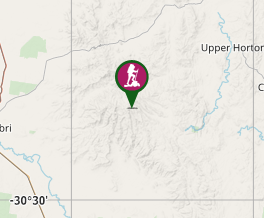
Comments