
Menu
Suggested searches
Your search found 2398 results...

 6
km
one-way
6
km
one-way
 3
hrs
3
hrs
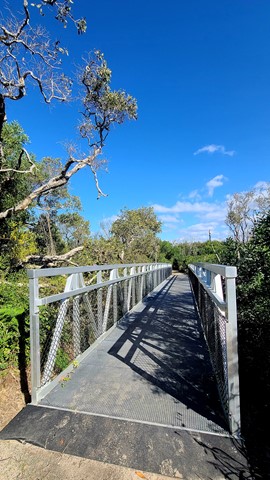
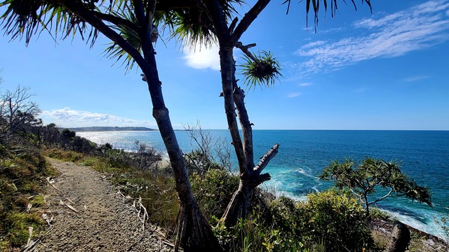
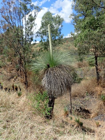
Shelley Head Camp Ground (From Angourie)
New South Wales
This campground is a lovely spot to walk to for a day picnic, swim and explore. It also has overnight walk in camps available if you wish to saty. You can access it from Angourie, heading south for 6km's or Lake Arragan, walking north for 7km's. This walk makes up part of the larger Yuraygir Coastal Walk.
 42
km
one-way
3
days
42
km
one-way
3
days
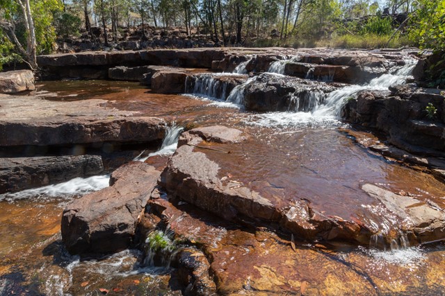
Tabletop Track
Litchfield National Park
A 40-50km circuit in Litchfield National Park in the Northern Territory: the length depends on which access track is used to access the circuit. The walk goes through an arid and often burnt landscape, but is punctuated by beautiful waterholes and creeks. There's a pretty good chance you'll have one of the three camping sites to yourself.
 19.07
km
one-way
4
hrs
19.07
km
one-way
4
hrs
Paper Back Flats Picnic Area to Spring Mountain
White Rock - Spring Mountain Conservation Estate
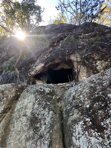
A varied terrain walk. Sandy in parts, then really rocky in some. The first part of the walk I followed mainly the Spring Mountain fire trail which was mostly flat. When I got to Back Alley trail it started inclining for about 2kms till I got to the Spring Mountain. I climbed as far as the first cave I came across then didn’t climb the rest... although it looked doable, I was by myself and didn’t want to push my luck. It was about 10km on the way up. Return trip I went down the Daisy trail which seemed to be an old mountain bike trail. It descends quickly and is rocky, eroded in parts and hard to walk on and requires a lot of scrambling and concentration. I then got to Narelle’s Climb, this terrain has been gravelled at some stage. I also saw a red belly black snake!! I decided to bypass White Rock as I’d seen it enough times and head back to where I started. Was about 9km on the way back. If I do it again I will do it in reverse and go via White Rock.
 13.9
km
one-way
13.9
km
one-way
Passage Peak and Escape Beach
Mackay, Isaac and Whitsunday
A combination of trails on Hamilton Island in the Whitsundays that combines sunrise from Passage Peak, a stop at the remote Escape Beach and views from the Resort Lookout. These can also be done as three separate walks. Stunning views from Passage Peak, which is the highlight of this walk.
 5.1
km
return
1
hr
5.1
km
return
1
hr
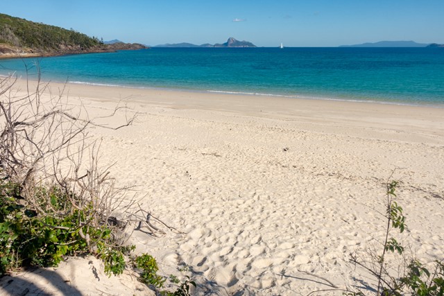
Chance Bay
Mackay, Isaac and Whitsunday
Chance Bay is a secluded beach and bay a short walk across the headland from the famous Whitehaven Beach. Add Solway Circuit for views over the area.
 19
km
one-way
5
hrs
19
km
one-way
5
hrs
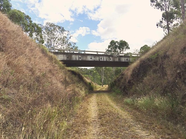
Esk to Toogoolawah - Part of BVRT
Brisbane Valley Rail Trail
The 19 kilometre Esk to Toogoolawah section of the Brisbane Valley Rail Trail is northwest of Brisbane along the Warrego and Brisbane Valley Highways. This section of the trail travels adjacent to Camp Creek and crosses Cressbrook Creek, a tributary of the Brisbane River, at Toogoolawah. The trail extends through farmland including lucerne, other pasture and small crops that are important to the local economy.
On trail signage indicates classifications between Esk and Toogoolawah. The distance and lack of trail facilities make this section suitable for people with a moderate to high fitness level. There are no drinking water or toilet facilities between Esk and Toogoolawah. Sufficient water must be carried.
 18
km
one-way
18
km
one-way
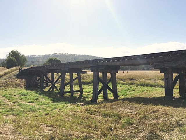
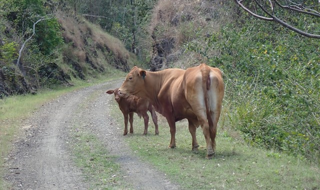
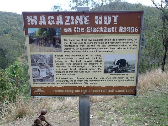
Benarkin to Linville- Part of BVRT
Brisbane Valley Rail Trail
The Benarkin to Linville section is 18km, downhill. The only inclines are crossings of Blackbutt Creek. Initially the walk is through gum forest, with stands of hoop pine and stands of silky oak. Then it opens up and runs through farm land for the last 4 or 5 km. There are plenty of birds, notably many brown doves, and flocks of quail. There is a bellbird colony near 130 kilometric mark. Blackbutt is a pretty creek if running. There is a bit of rainforest on the banks. Historical railway spots and information are signed and very interesting. Surface is good - no slippery bits. There are three shelters along the way. MacNamara's Camp. about half way, has a toilet and water tank. Take your own water. And maybe insect repellent.
 1
km
return
30
mins
1
km
return
30
mins
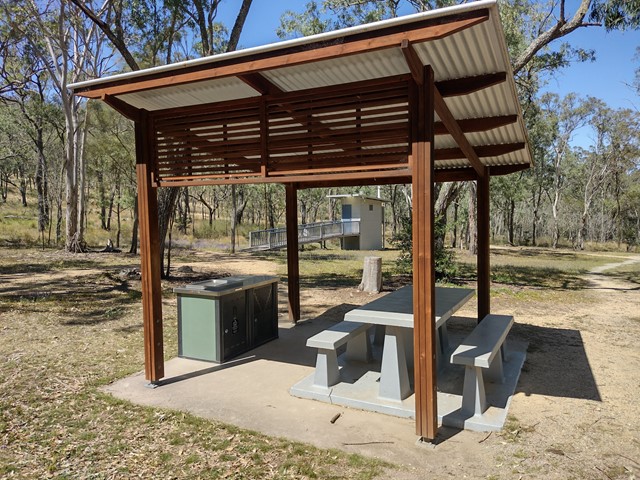
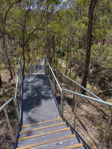
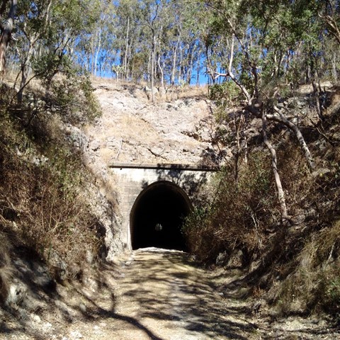
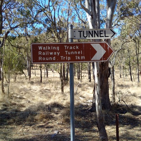
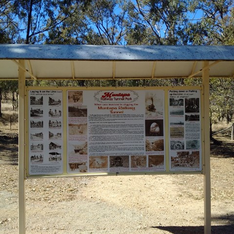
Muntapa Railway Tunnel
Toowoomba
Two short walks through eucalypt bushland, leading to both ends of a historic, disused railway tunnel - Queensland's lonest straight railway tunnel. You can enter the tunnel at each end, but cannot walk all the way through as it is fenced off to protect a colony of small native bats.
Interpretive signs give a comprehensive history of the tunnel, and provide details about the resident bat colony.
Officially marked as Grade 3/Medium difficulty (many stairs down to the northern entrance), this track is manageable for most ages and fitness levels.
 14.9
km
return
6
hrs
14.9
km
return
6
hrs
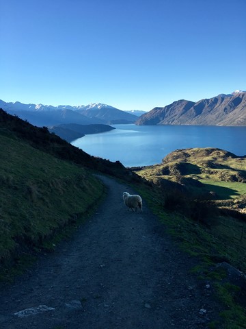
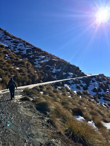
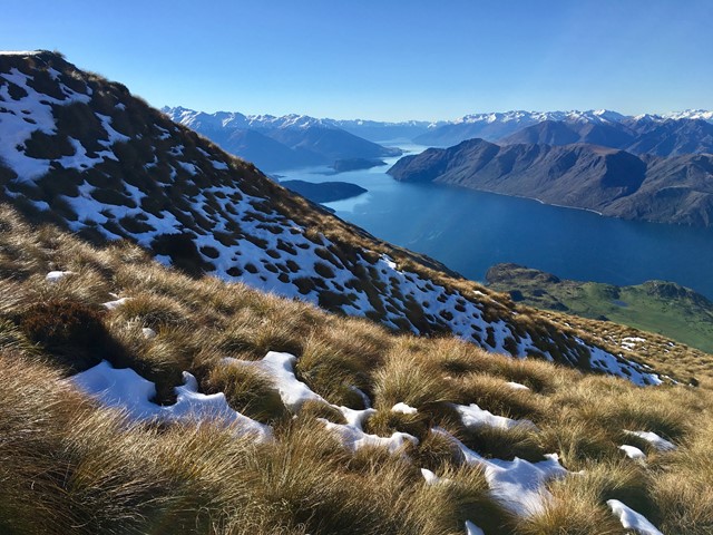
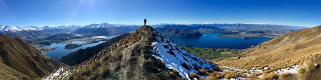
Roy's Peak
South Island NZ
A very worthwhile walk to get to that famous view! It's tough on the knees & quite relentless, but the outlook makes it all worthwhile. The lookout is where most hikers stop, but the actual peak is a further 40 minutes - 1 hour further on.
 10
km
return
4.5
hrs
10
km
return
4.5
hrs
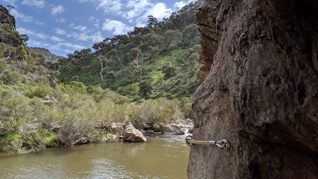
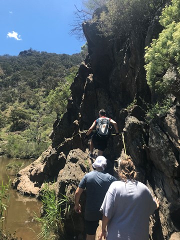
Werribee Gorge Circuit Walk
Werribee Gorge State Park
Explore the length of Werribee Gorge with spectacular views and rock hopping, all only an hour from Melbourne's CBD.