Mt Eerwah

Sunshine Coast

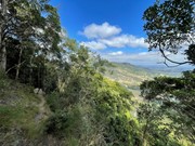
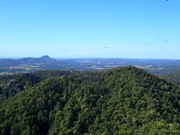
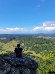
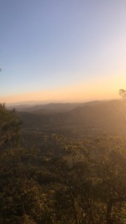
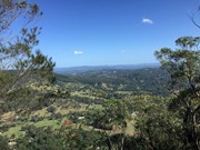
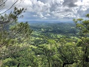
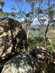
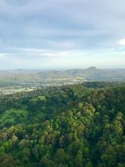
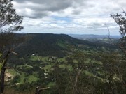
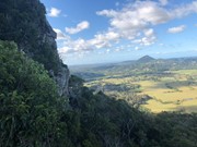
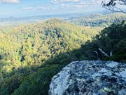
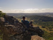
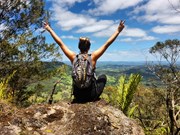
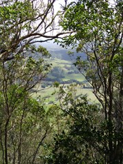
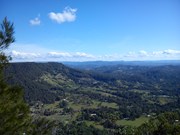
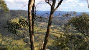
This is a seldom but fun mountain to climb and in places only has a faint trail to the top. Views from there are in a westerly direction and whilst spectacular, the views to the east across the coastal plain, would have been even better, but for the scrub and trees.

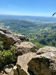
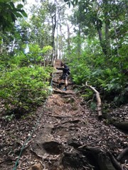
It's a steep and loose track, definitely not suited for those with balance issues, smaller children, etc. A section near the top has eroded/wasted away, leaving a significant drop off - be careful!
The track is very clear. At one point the description on this site indicates to turn right upon reaching a ridge. I think that’s a typo as the track continues up to the left.

Scrambling or Climbing
No Dogs Permitted
No Camping Permitted
Rainforest
422m
Maximum Elevation
294m
Total Climb

Getting there:

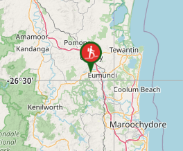
From the Bruce Highway, take the Kenilworth/Noosa exit; follow signs towards Kenilworth on the Eumundi Kenilworth Road; turn left into Browns Creek Road and then left again into Mt Eerwah Rd. After 0.5km at the letter boxes 75 and 79, there is a spot on the left to park 3/4 vehicles (at the beginning of the bamboo hedge) and it is here that the walk begins, even though the mountain is on your right.

Maps:

None found.

Route/Trail notes:

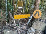
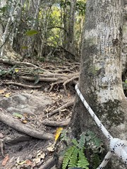
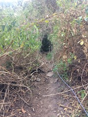
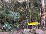
At the start of the track there is a roadworks sign that says “Pedestrians” which point to the start of the track. Follow the fence line across three gullies, the last of which has been kindly roped. A faint trail contours around some open land until it reaches a ridge that you turn right onto. Now follow the ridge up where the trail threads through some rather large lantana patches. 1/3 up, you can take either the right and left trail, which converge after 100m at the top of a rocky gully.

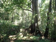
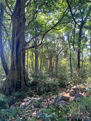
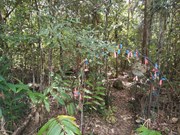
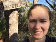
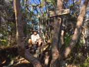
Follow through the rainforest where the path is steep, slippery and loose. Once you leave the forest, after a few twists and turns above the cliff line and a further roped (broken 2017) section where the trail is narrow, you will reach another steep, loose slope that will get you to the summit ridge. Once the ground levels out, follow the ridge uphill and down dale to the 'true' summit. At the 'welcome' sign, enjoy the view, a drink and a bite to eat.

Retrace your steps back down.

Permits/Costs:

None.

Other References:

Climb Mt Eerwah

The word 'eerwah' is apparently the indigenous work for 'death adder'. So watch out!

I have read that you can continue beyond the summit, down and back up to the second summit to the south east, but I understand this would take you onto private land.

GPS Tracks

Comments

Was a very slippery, wet climb into the cloud due to having lots of rain in the weeks prior.
Thankful for the ropes still available to use on some sections of the climb. Disappointed to see the welcome arch at the start of the track and the welcome sign at the top, had been removed. (Think they were replaced by a big, old brown goat that called out several times at the start and finish of the climb) :)

julieo on 29 Jun, 2019

Steep climb
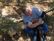
Helped be Charlie and Dusty

Kmxfitness on 24 Mar, 2019

This was really challenging and you need to go to the second summit to get the good views so add more time on to the recommended time. It is quite slippery on the way down so wear good trail shoes. In saying that it was really rewarding :))

MattyM on 19 Jan, 2019

Very well marked yet steep track. Not so bad on the way up but I challenge anyone to go down without falling over at least once - kind of a bit like Mt Blaine. View from the top is mostly obstructed but there are a few windows offering nice views. Saw a few people out and about and 2 dogs roaming the mountain guiding people up and down.

Vonsnrub on 13 Jan, 2019

did this a few years ago during rain absolute mud carnage but hilarous fun and misty views

mitchell baker on 7 Dec, 2018

Quite short but fairly steep walk near Noosa so the perfect excuse to have a swim afterwards :-]

We were fortunate enough to have the local dog Dusty take the trip up with us and he absolutely nailed it.

Not the most picturesque walk but gets the heart rate going and offers fairly nice views from the top. We ran into 3 or 4 goannas on the trip which is more than I have seen anywhere else. Trail is quite clear and easy to follow and does not take too long, you could knock it over in 2 hours up and down without much trouble I'd say.

Some have noted the trail has eroded slightly towards the top but my group didn't find it to be any great difficulty. However, due to the short steep climb, would not suggest someone lacking fitness does this and we were covered in mosquitoes the whole way and I landed myself a nice tick : <

In summary: Nice little mountain to knock off the list, close to beaches so you can make a day of it, trail is easy to follow and gives a good workout due to the gradient.

Matty Vee on Nov, 2018

Walked this one this morning with my son. Quite steep and relentless however it was not too difficult. After we reached the Welcome sign, we continued east following ribbons on trees and a faint track to the eastern summit (I think) Awesome view at the end.
Andreas on 22 Sep, 2018

The seventh of my mountains I have set for myself on the Sunshine Coast.
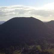
A little known about mountain, though often seen and remarked upon as resembling a woman's breasts as one travels in the North Arm area near Yandina. It means Death Adder to the Australian Aboriginals and one can only hope that there are no more in that vicinity.
Aussie Bushwalking.com is one of two sites many of us use to locate our way and research preparation.
As it is classified as twin mountains you need to know that it is 329 meters and 402 meters respectively.
Google or put in your Gps Mount Eerwah road, crossing at Brown creek rd off Kenilworth Rd. Take the left road at the intersection on the dirt road. Drive till you see a miniature car park area that might take two cars just before a bend on the left. There is now a sign some kind soul has left for us that says it is only one and half hours return. Take your own time to enjoy the journey and apex.
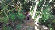
There is an almost invisible entrance to the track through the bushes that leads long and between two fences. When you have travelled up and down some gullies and reached the end of the fencing you will be sufficiently warmed up to tackle a medium to hard climb/walk. (Talking from a 69 year old point of view) You will eventually get to a mini climb that someone has kindly left a rope to haul yourself up on. Further clambering over fallen trees and up rocky tracks that often almost disappears it is so seldom used. Another rope helps again until a horizontal rope has been donated where the cliff face has fallen, so advise staying on the mountain side of the rope and using it for balance.
Quite steep and need to be moderately fit with reasonable joints, a bottle of water, sun hat, gloves, good grip shoes and perhaps sun screen and insect repellant at certain seasons. A back pack is wise to leave your hands free. It seems to get harder and harder and is a good work out for the legs and heart.
The bush obscures most of the views at the top but you might see many butterflies.
As with all climbs make sure your phone is fully charged both for photograph opportunities and for safety. It is always wisdom to inform someone of your intentions, your whereabouts, planned time and of your safe return.
Two hours return for this old fellow.

Paul on 8 Aug, 2018

A perfect day to summit Mt Eerwah.Blue skies and 21c max.The track is nice and dry and perfect for hiking.New ropes at the ridge near top and also at the lantana.The lantana is cut back now for easy access.A little disappointing on the view due to the trees but nice to see the 'welcome'sign at the summit.
I went solo today but would recommend not to as it can be quite slippery on descent.With both ascent and descent there was always a rock,root,tree,vine to help you.Nice and shady hike this one.To sum up Mt Eerwah..."ENCHANTING"🤗

KidBear on 1 Aug, 2018

A really good climb/hike, I throughly enjoyed it my favourite so far, whoever put the ropes there it is much appreciated.

Caleb J. Stanton on 3 Jun, 2018

Really appreciate that this track exists. Its one of my favourite climbs and all the little 'doodads' make it that much more enjoyable

Lawdaddy on 17 Jan, 2018

Hidden gem on the coast. We were the only ones there on a sunday morning climb. A dusty tree root steep scrambled track. Return trip in under 2 hours. Good hiking shoes a must, and a little confidence.

K & R on 27 Aug, 2017

Very considerable of the land owner to let people access, appreciate that mate

Evildingo on 5 Aug, 2017

Great mountain to climb! Walking through rainforest for the majority of the climb. Cool welcoming sign and prayer flags at the top. Got up in 30mins, 30mins at the top and then down in 30mins.

l3raeden on 21 May, 2017

A return visit with a group of friends to one of our favourite mountains.

F.A.B. on 4 May, 2017

There is NO chance this climb is easier than Tibro... sure Tibro is more dangerous, more intimidating, but as for exertion, WOW, this was a seriously steep climb. I've done Tibro a few times and was not even close to as tired as this climb.
In saying that, if you're after exercise, this climb ROCKED! I was so happy with it... all shaded, steep, clear enough marking, defo do it people.

Brad on 14 Feb, 2017

Cute scrubby random little hike, steep in sections I imagine it would be a total mission in the rain. Very enjoyable hike, that provides ample shade in the heat.

courtlalala on 22 Jan, 2017

Steep 1 hour climb to the top & very clear track all the way...
Great views to the West.
Very quiet & nice to have the mountain to ourselves!
Will try the rest (down to the saddle & Eastern track) next time.
Thank you for this little gem walk.

Christian on 15 Oct, 2016

Walked today. The track is more obvious than in the past but a section near the top has eroded away and has a huge drop off / cliff below it so caution is advised. Check for ticks after walking.

Matt on 14 Sep, 2016

Nice challenging walk. The ropes were really appreciated though you could definitely climb it without them. Some parts are really loose and slippery so care is needed. It wasn't as bad coming back down as we thought it might be. The Apple Watch tracked the walk at 4km return but we walked it in 2 hours 40 minutes including a 25 minute break at the top.

Ian and Sue on 2 Sep, 2016

Where

Click here to load this map.

Nearby Walks

Done this walk?

This walk has been ticked 132 times

Aussie Bushwalking can keep track of your bushwalks.

Login/signup to tick this walk off.

Tick walks to keep track of where you've been. You must Login to tick walks. Accounts are 100% free so sign up if you don't have one.