


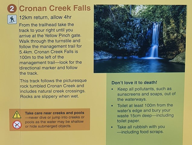
 Cronan Creek Falls (GPX)
 13
13 5
5- Mount Ernest (Mt Barney National Park)
- Mt Barney East peak south east ridge (Mt Barney National Park)
- Mt Barney - East Peak - South Ridge (Mt Barney National Park)
- Mt Barney - East Peak - Up South-East - Down South (Mt Barney National Park)
- Mt Barney East Peak - South-East Ridge up and South Ridge down (Mt Barney National Park)
Cronan Creek Falls Track
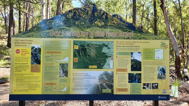
Mt Barney National Park
Menu
GPS Tracks


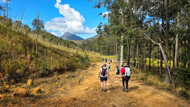


From Yellow Pinch car park, a pleasant walk along the fire trail leads you past the base of South Ridge into green rainforest. (Note: the climb up South Ridge is rugged and steep and for experienced walkers only).
Waterfalls
Swimming
440m
Total Climb
Getting there
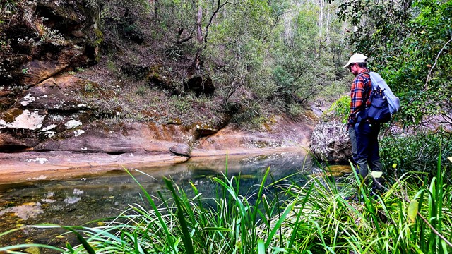
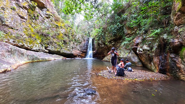
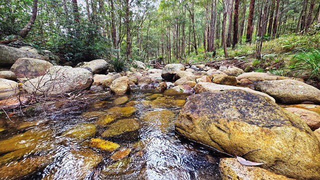
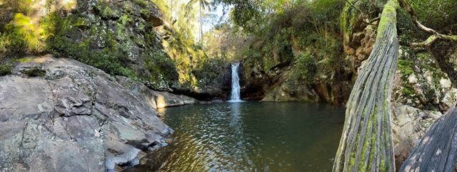
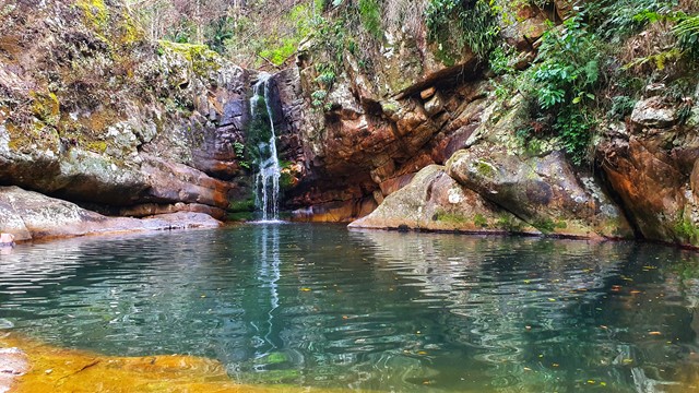
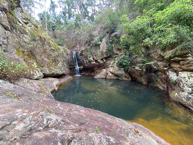
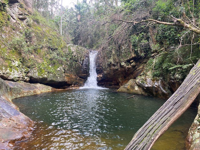
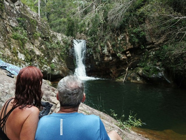
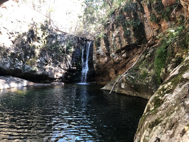
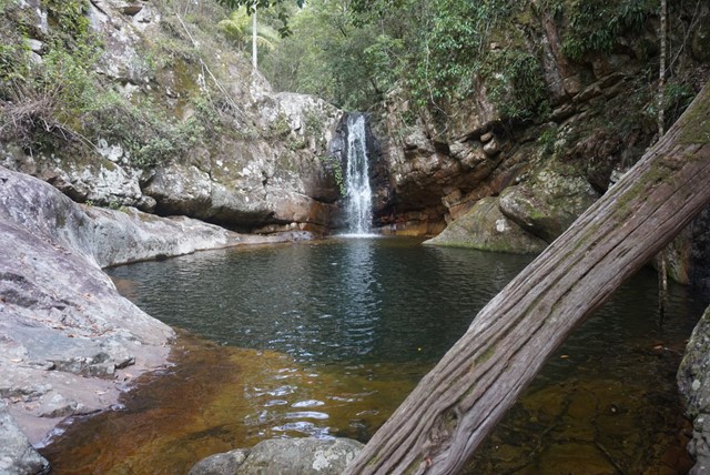
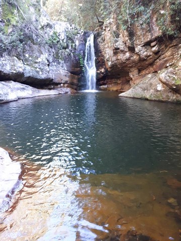
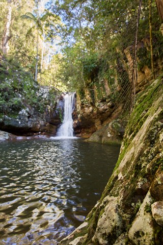
These fall's get their 'secret' name because Cronan Creek Track does not lead directly to the fall's. To get to the fall's you have to find nearly a hidden little entry way off the main track and make your way through a thicket for about 100m before coming out onto the creek and then a short rock hop to the fall's.
Take the trail from Yellow Pinch Carpark and go through the turn style and head right.
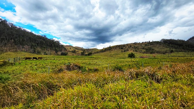
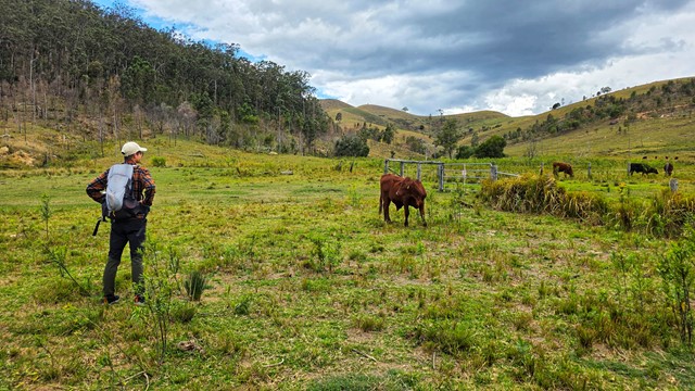
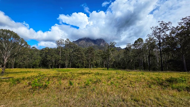
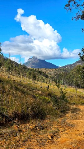
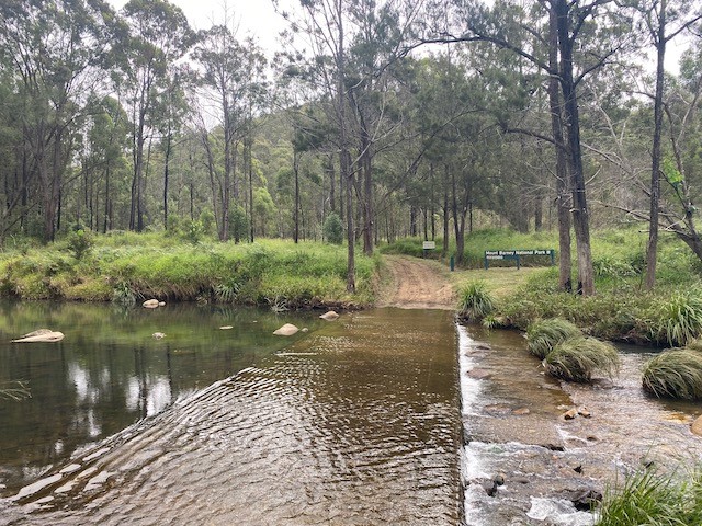
Follow this fire trail straight ahead until you reach a gate with a cattle grid. You will pass beautiful countryside, mountainous view's and an open field that would be just spectacular when the wild flower's are out 🌻
Once through the gate, just keep following the fire trail. There are up and down part's to get the old heart pumping but nothing overly strenuous.
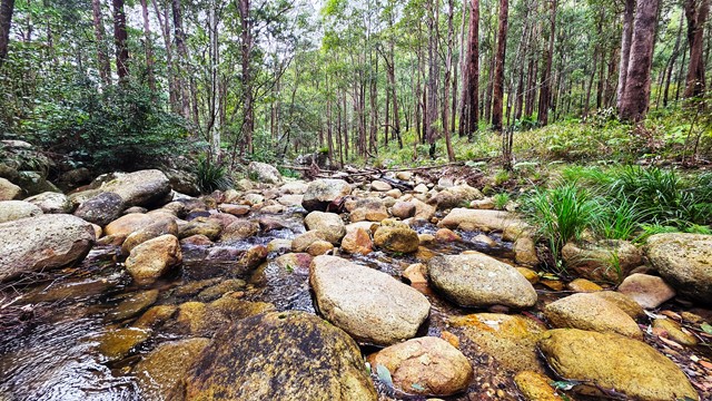
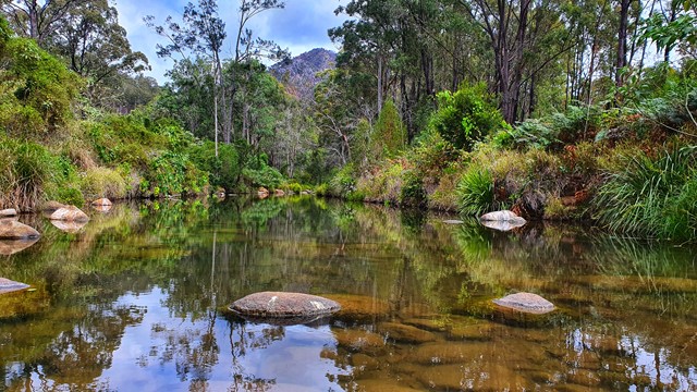
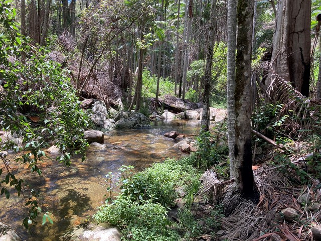
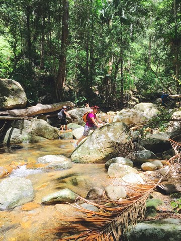
You will have 6 creek crossings to go through that after some rain can be quite deep. We took our boot's off once we were through the gate and put our water shoe's on until we returned back through 👟
Go past two camp site's and when you come to a fork in the trail, vere left. The right trail clearly mark's the way to Mt Barney summit.
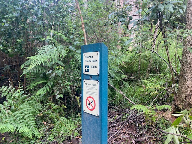
When you hit the 6km mark keep an eye out on your left for a green post that mark's the entryway into the fall's.
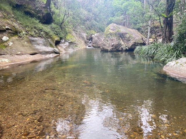
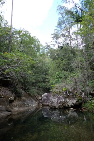
From here make your way through the jungle and you will come out along the side of the creek. From here rock hop over to the other side and make your way down to the fall's and the amazing swimming hole 🏞
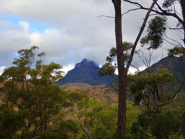
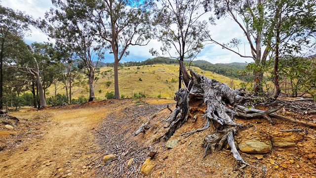
On the way back we detoured up to Yellow Pinch Lookout that gives you spectacular view's of Mt Barney.
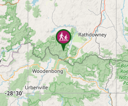
Maps
You can't really go wrong - but there are a few wikilocs with this hike
Route/Trail notes
Keep hiking along the main track past South Ridge and you'll cross about 6 creeks and come to a small official sign on your left pointing towards the falls. It's 100m along a track to get to the creek and a small amount of rock hopping to the actual falls. Excellent swimming but the water is cool even in summer
Permits/Costs
Do you need any permits? What's the cost?
Other References
Track notes: https://hikingtheworld.blog/2018/07/08/cronan-creek-falls-secret-falls/
GPS Tracks
Where
Click here to load this map.
Comments