


 Mt Barney West Peak (GPX)
 17
17 8
8- Mt Barney West Peak from Rum Jungle (Mt Barney Summit)
- Mt Barney East peak south east ridge (Mt Barney National Park)
- Mt Barney East Peak via SE Ridge, traverse North Pinnacle to Leaning Peak, descend to Barney Gorge and Lower Portals (Mt Barney National Park)
- Mt Barney North Peak (Mt Barney National Park)
- Mt Barney via Logans Ridge and return via Gorge (Mt Barney National Park)
Mt Barney West Peak
Mt Barney National Park
Menu
GPS Tracks
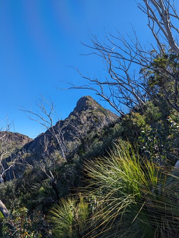
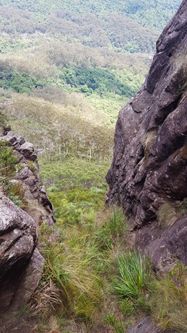

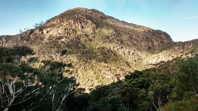
Straight up the west peak. The track is a goat track at best. There is the occasional piece of tape in a tree. You probably will get lost. But its not that hard to find your way. One tip is at the big rock face, aim towards the left end (south but not to south as there is a very big cliff). Also a good idea to take a compass bearing on the way up, as white outs are common up here.
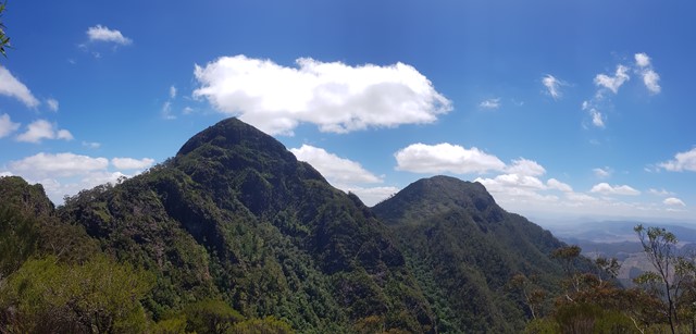
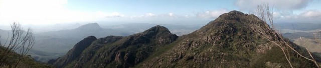
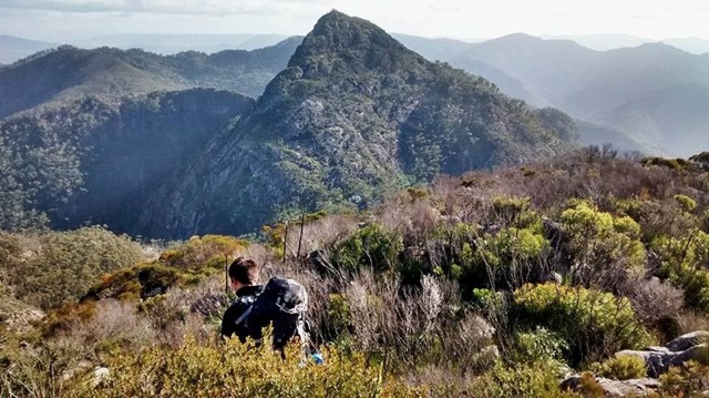
The summit is scrubby, with a pile of rocks to mark the highest spot on Mt Barney (its higher than east peak). Head to the the northern end of the peak for amazing views to the north and west.
Even if you dont intend on climbing the whole way up. Do yourself a favour and go a little way, as the veiw up East peak is amazing. Totally different aspect of this incredible mountain.
Getting there
How do you get to the start of the walk?
Start up the slippery rock, directly behind the rum jungle camp site. Then follow your nose
Maps
Which maps cover the area?
Route/Trail notes
A detailed description of the walk!
Permits/Costs
Do you need any permits? What's the cost?
Other References
How can I find more info? Any guide books?
GPS Tracks
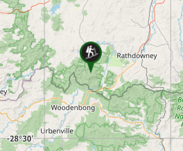
Where
Click here to load this map.
Comments