
Menu
Popular Walks
-
Mt. Coot-tha Summit Track
(333 ticks) -
Somerset Trail
(300 ticks) -
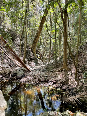
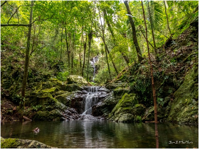
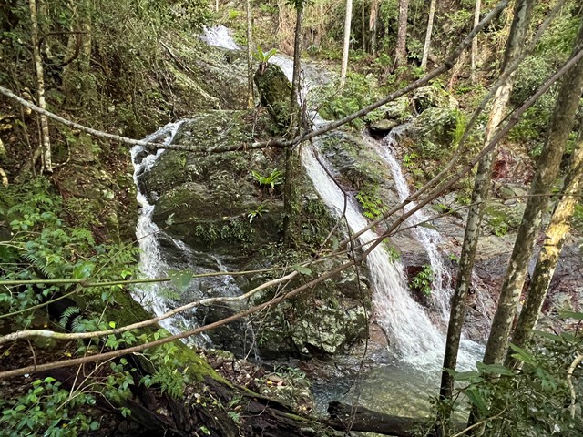
Greenes Falls via Rainforest Circuit + Cypress Grove Circuit
(232 ticks) -
The Northbrook River Trail (Northbrook Gorges)
(210 ticks) -
Enoggera Reservoir Circuit
(157 ticks)
Summary
Declared a national park in 1977 approx size 28 500 hectares second largest park in south east queensland. Originally settled by timber cutters approx 1870. Gold was discovered in mid 1800's there are many mines scattered throughout Cedar creek areas. The area is made up of D'Aguilar National Park, Jollys Lookout National Park, Maiala National Park, Boombana and Manorina National Parks. On Brisbanes door steep.
Popular Walks
-
Mt. Coot-tha Summit Track
(333 ticks) -
Somerset Trail
(300 ticks) -
Greenes Falls via Rainforest Circuit + Cypress Grove Circuit
(232 ticks) -
The Northbrook River Trail (Northbrook Gorges)
(210 ticks) -
Enoggera Reservoir Circuit
(157 ticks)
Parent Regions
Sub-Regions
History
The area has a history of Timber cutting, gold mining, farming, housing and eventually National Parks.
Features
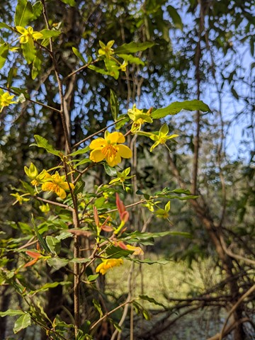
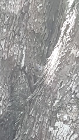
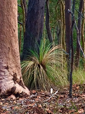
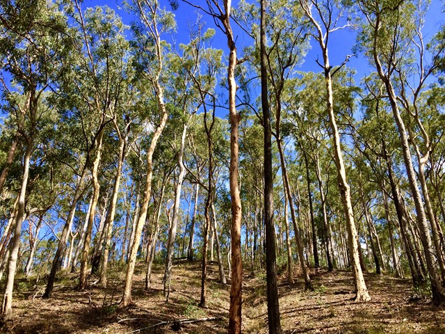
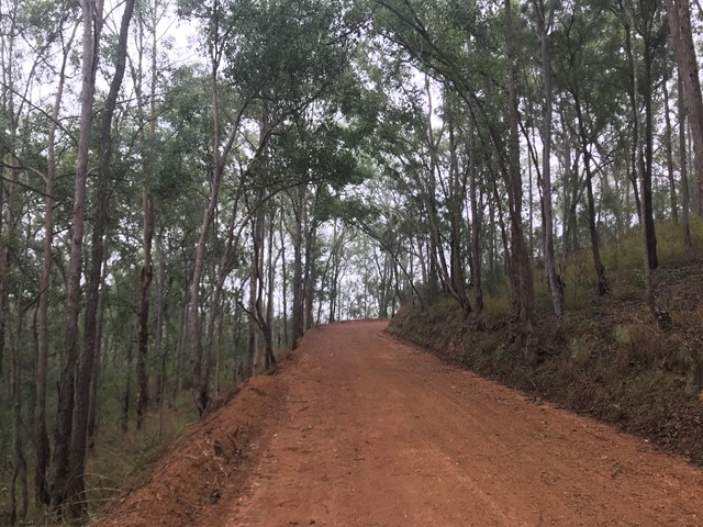
So many diverse areas ranging from rainforest to open eucalypt forest.
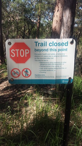
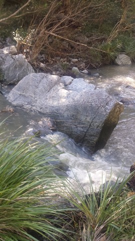
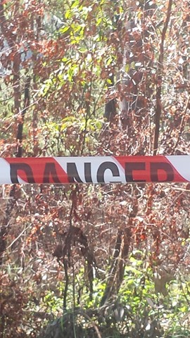
WARNING{ As at 13'1/11 there are many washouts of the fire trails. Lawnton Rd.and Eng;and Creek Road are cut in at least two places before the camp grounds!!
Access
Go along to 60 Waterworks Road. The Brisbane Forest Park information Centre is there. Also a Brisbane City Council bus goes right to the door of the Information Centre.
Maps
Maps are available from Brisbane Forest Park. D'Aguilar Range.
Accommodation
Bed & Breakfast on MT. Glorious, plus so close to Brisbane
Camping
Check with Brisbane Forest Park for further details
Contact details
Brisbane Forest Park 1300 130 372
Brisbane City Council 07 3403 8888
https://parks.des.qld.gov.au/parks/daguilar/

 5
km
5
km
 90
mins
90
mins
Araucaria Track
This walk begins off downhill, soon there are some views of the reservoir then the track begins to wind its way along the edge of the reservoir keep an eye out for different water birds.
I would advise taking you camera equipment as well as a pair of binoculars for some good bird watching. After approx 1.7km you come to a Y junction go straight ahead and some more views of the Enoggera weir come into sight. There seems to be alot of bellbirds and a few whipbirds around here.
From here the track winds into some bush some small reminent of rainforest. And from here it gets a bit "are we there, yet" but keep on going up and over the ridge and back down again and you rejoin back at the Y junction.
Now the return route can be a little problem if you leave it late to do this walk because on your return from the Y junction. You will meet alot of people along the way.
Some signs have been errected "brown snakes" in the area. So watch your step when walking around the exposed hot ridge areas.
Also this track can be combined with the Corymbia Circuit to add a bit of distance for you walk.
 5.2
km
return
90
mins
5.2
km
return
90
mins
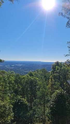
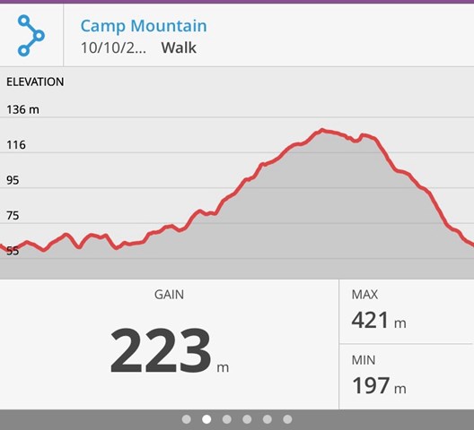
Camp Mountain Lookout
Beautiful walk through eucalypt forest along a well maintained fire trail. We parked at the junction of Suttons Road & Suttons Court, Camp Mountain, parked the car at the horse step through and headed up the hill. It's a steep walk up to the lookout where you will find spectacular views of Brisbane City and Moreton Bay. Wander a little further and you can see the beautiful Samford Valley and Glass House Mountains in the distance. You can also drive into the lookout from Mt Nebo Road.
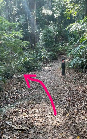
If you are feeling energetic and want to add an extra hour to your walk, head down the hill towards Bellbird Grove - the trail splits just after the water tank, instead of going left to do the circuit, go straight ahead. Follow the trail and you will come into the back of Bellbird Grove - have a toilet stop, a little rest and then turn around and head back the same way to join back onto the circuit.
 18
km
7
hrs
18
km
7
hrs
Cedar Creek to White Cedar Picnic Ground
A Walk over the D'Aguilar Range via Maiala Picnic Ground.
 1.5
km
30
mins
1.5
km
30
mins
Corymbia Circuit
A small walk in a cool area before going on to the Araucaria Track
 10
km
return
3
hrs
10
km
return
3
hrs
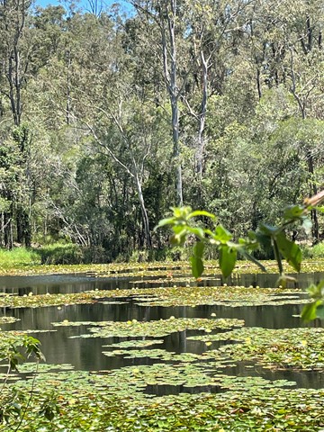
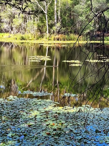
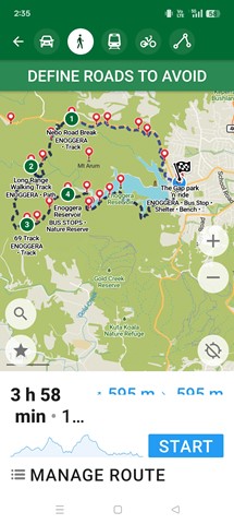
Enoggera Reservoir Circuit
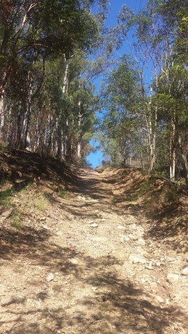
This is a great walk through mostly canopied forest that skirts around Enoggera Reservoir. There are some quite steep hills which will be a challenge if you are not very fit, but most of the walk is easy. Glimpses of the reservoir, lots of beautiful trees, the odd encounter with wildlife make for a very enjoyable couple of hours.
It is best to call into the Information Centre at Walk About Creek before starting this walk as they have detailed instructions on navigating the bit of suburb walking required to complete the circuit. It's also useful to have the topographical map as the hike isn't on marked trails - it would be difficult to get lost - but it's possible! If you are doing a circuit then just keep taking Left hand turns if going anti clockwise! After reaching the dam wall keep on the left until you reach the transport hub (The Gap), The parking area has an exit that leads to the Walkabout Creek area with proper walkways.
 4
km
return
90
mins
4
km
return
90
mins
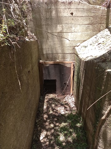
Enoggera Reservoir Tunnel
A short but rewarding walk to a piece of Brisbane's history. Built in 1928, along with an open viaduct, this tunnel moved water from Gold Creek Reservoir to Enoggera Reservoir. See https://historyoutthere.com/2018/09/23/the-secret-tunnel-to-australias-past/ for history.
 14
km
return
4
hrs
14
km
return
4
hrs
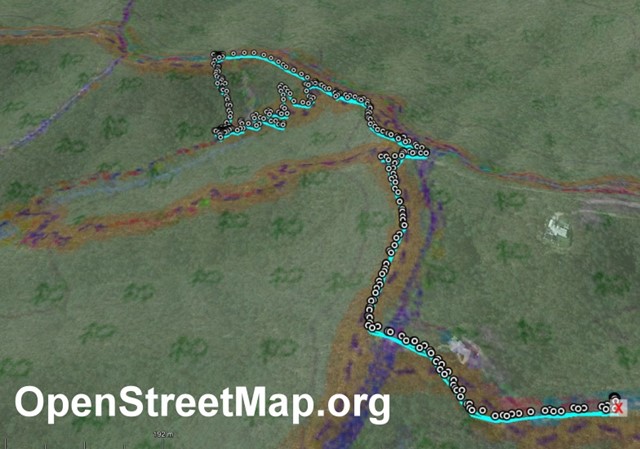
Holmans break
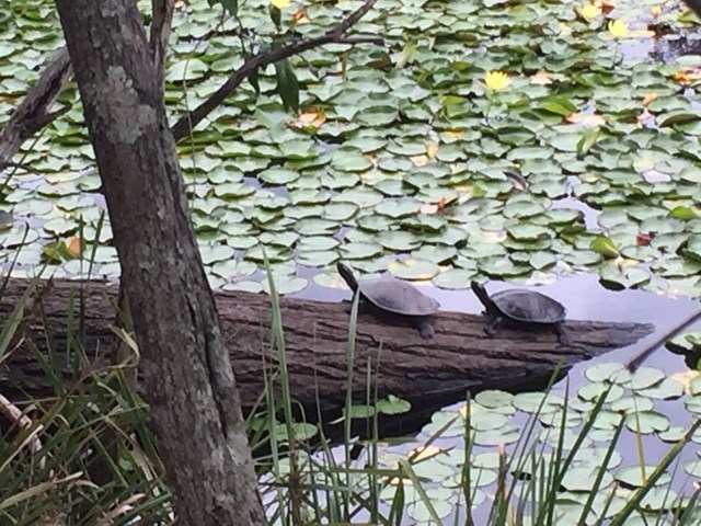
This is a beautiful walk around a large section of the bushland in which Enoggera Reservoir sits. You will walk through lots of varied vegetation, keep an eye out for goannas, lots of different birds and turtles sunning themselves on a log in the dam. A great way to spend 4 hours! I do recommend that you have a map - you can purchase the topographical map from Walkabout Creek.
Start out from the bottom carpark at Walkabout Creek, take the small track to the far right that follows Mt Nebo road. There is a very steep hill right in front of you! Follow this track for about 2 km, (turn around every now & again and you will catch glimpses of The Brisbane City skyline), The track will split - stay on the track that is to the right, still following Mt Nebo road, which is also on your right (you can't really see the road) for about another 1km. You will come to a bit of a clearing under the power lines - turn around and enjoy the view out over The Gap!
There are great views of Mt Cootha on your left and the mountain range in the distance (that I don't know the name of!). There is quite a steep descent down to a beautiful creek - take some time to enjoy a rest here as there is a VERY steep ascent ahead of you! It's probably about a 600 metre climb, which will bring you out under another power tower. Look over to the next tower - that is where you are heading! Continue along the trail for about another 1 km and you will come to a T junction, stay left for another couple hundred metres to another junction - go left again onto Fire Break 69. Don't forget to look over to your left when you reach the power tower and see how far you have come! Continue down Fire Break 69 until you reach another junction - this is McDonalds Loop. We went to the left and followed it down to the end where it hooks up to the Enoggera Reservoir loop - again we went left and followed the trail back along the reservoir to Walkabout Creek.
 17
km
5
hrs
17
km
5
hrs
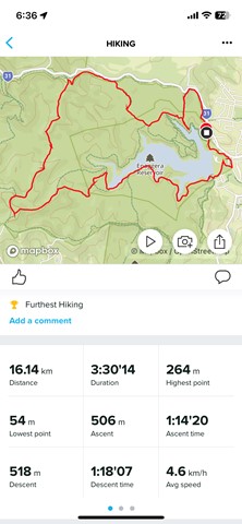
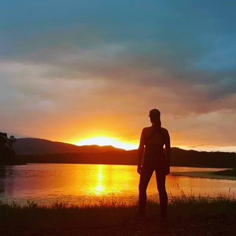
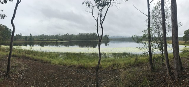
Lake Manchester loop
Starting and ending at the day use area, this is a clockwise loop in the hills around Lake Manchester through a conservation park adjacent to the D'Aguilar Range National Park (Brisbane Forest Park section).
 5.3
km
one-way
90
mins
5.3
km
one-way
90
mins
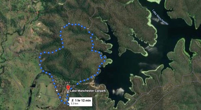
Lake Manchester Short Loop
A shorter way to see some of Lake Manchester without having to double back.