
Menu
Popular Walks
-
Mt Ngungun
(1156 ticks) -
Mount Coolum
(872 ticks) -
Mt Cordeaux
(668 ticks) -
Twin Falls Circuit
(636 ticks) -
Purling Brook Falls Circuit
(611 ticks)
Summary
The Sunshine State
Queensland has a wealth of bushwalking opportunities including multiple World Heritage Listed rainforests such as the Daintree and Lamington National Park, great coastal and island parks like Fraser Island and Hinchinbrook Island.
Popular Walks
-
Mt Ngungun
(1156 ticks) -
Mount Coolum
(872 ticks) -
Mt Cordeaux
(668 ticks) -
Twin Falls Circuit
(636 ticks) -
Purling Brook Falls Circuit
(611 ticks)
Sub-Regions
Other Information
World Heritage Areas
- Fraser Island
- Gondwana Rainforests of Australia (Lamington NP, Springbrook NP, Mount Chinghee NP, Mount Barney NP, Main Range NP)
- Great Barrier Reef
- Riversleigh
- Wet Tropics (Daintree NP, Barron Gorge NP, Cedar Bay NP, Girringun NP, Wooroonooran NP)
Contact details
Queensland Parks and Forest:
https://parks.des.qld.gov.au/
Regions
The link below provides a region map of QLD as a reference to what council zones are included in the 7 geographic regions of QLD.
https://en.wikipedia.org/wiki/Regions_of_Queensland#/media/File:Qld-regions-map.gif
- Far North Queensland
- North Queesnland
- Central Queensland
- Mackay, Isaac and Whitsunday
- Wide Bay Burnett
- Darling Downs South West
- South East Queensland

 750
m
return
750
m
return
 10
mins
10
mins
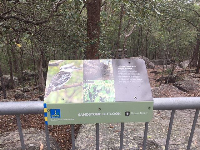
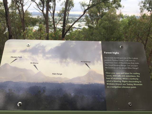
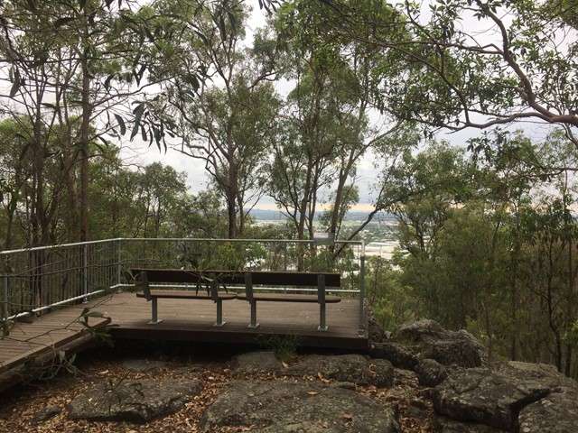
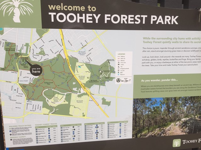
Sandstone Circuit
A short circuit in Toohey Forest Park that takes you to the top of a sandstone knoll the sandstone outlook (117m) and to the Western outlook which offers views of the Flinders Peak group and distant main range.
 4
km
return
1
hr
4
km
return
1
hr
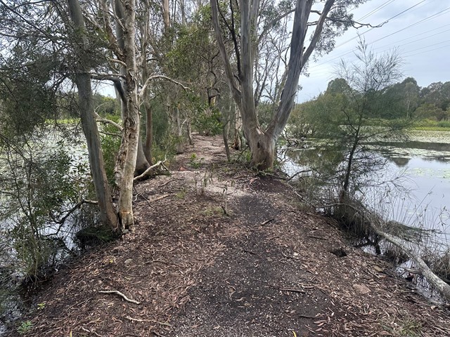
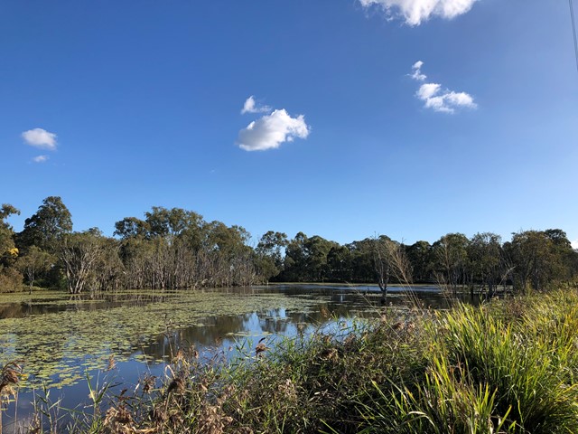
Sandy Camp Rd Wetlands
A flat walk through the lesser-known wetlands.
Wheelchair access is possible but not an easy walk
 4
km
return
1
hr
4
km
return
1
hr
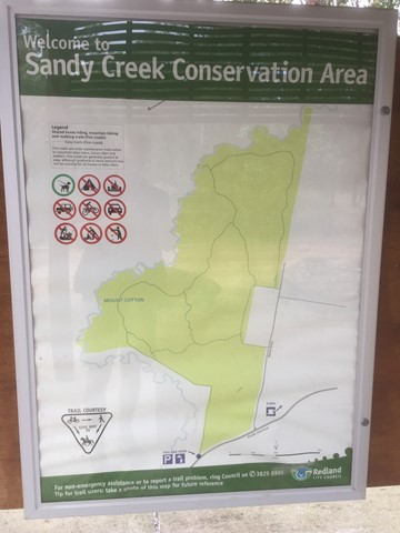
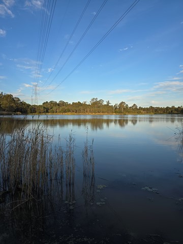
Sandy Creek Conservation Area (Redland Bay)
Management trail through eucalypt bush.
 3
km
return
45
mins
3
km
return
45
mins
Seven Hills Circuit
Sort circuit track that is intersected by the Seven Hills Ridge track and the Seven Hills Gully Track. Wide and clear well maintained track.
 2.8
km
return
40
mins
2.8
km
return
40
mins
She-Oak Track (Whites Hill Reserve)
Enter via Pine Mountain Road, Follow the signs to the summit and look at the views over South Brisbane
870
m
return
20
mins
Slacks Creek Environmental Park
Two loops - Open Forest Walk and Melaleuca forest walk join to make a 20 minute walk 870m long. Paperbarks and butterflies.
 1.4
km
return
30
mins
1.4
km
return
30
mins
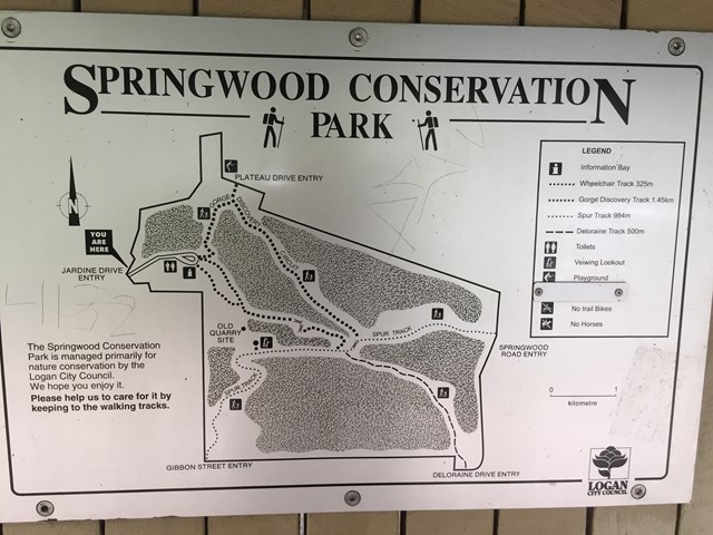
Springwood Conservation Park (Gorge Discovery Track)
Circuit around a wooded gorge. Entrance points from various residential areas.
 5
km
return
90
mins
5
km
return
90
mins
Springwood Conservation Park (Gorge Discovery Track, Spur Track, Deloraine Track and Wheelchair Track)
This walk has the stairs of death on the Gorge Discovery Track. We covered all the tracks, two are circuits and two end on a street, which we back tracked. There is a centre in the park where most tracks cross over. The tracks themselves are beautiful, with great views and man made. The stairs are do-able even for a gumbie like me and the Deloraine and Spur Track also have an good incline. There is a wheelchair track though very long but is beautiful asl well.
 2
km
return
30
mins
2
km
return
30
mins
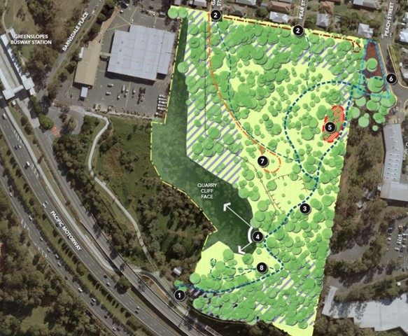
Stephens Mountain Reserve
Two connecting tracks that lead to a lookout platform. Old Quarry site.