
Menu

 300
m
return
300
m
return
 30
mins
30
mins
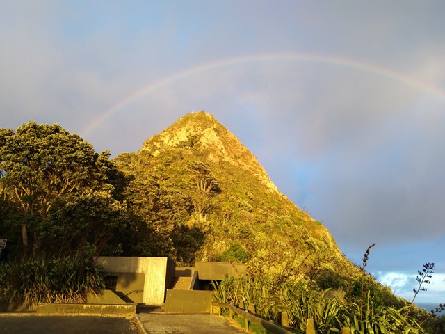
Paritutu Rock Summit
A short walk/scramble to the top of Paritutu Rock rewards you with premium coastal views perfect for watching the sunset. Located minutes from downtown New Plymouth.
 82
km
5
days
82
km
5
days
Heaphy Track
A 4-6 day walk linking Golden Bay and the West Coast crossing through part of Kahurangi National Park, the Heaphy Track is one of New Zealand's nine Great Walks.<br /><br />The Heaphy Track includes a great range of feature including Beech forests, iconic Nikau Palm groves and the Gouland Downs.
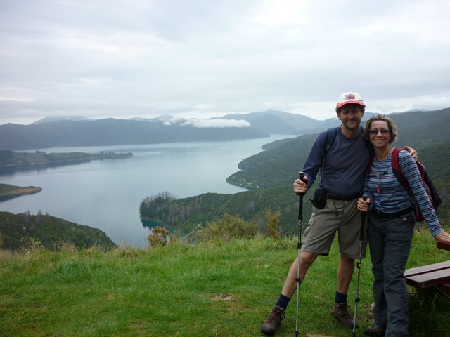
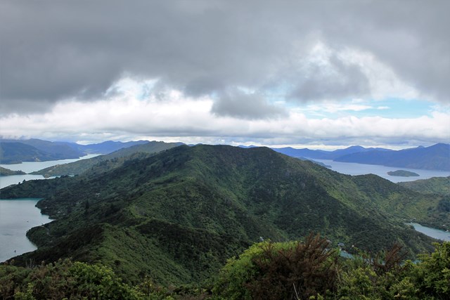
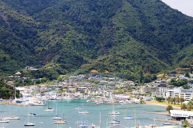
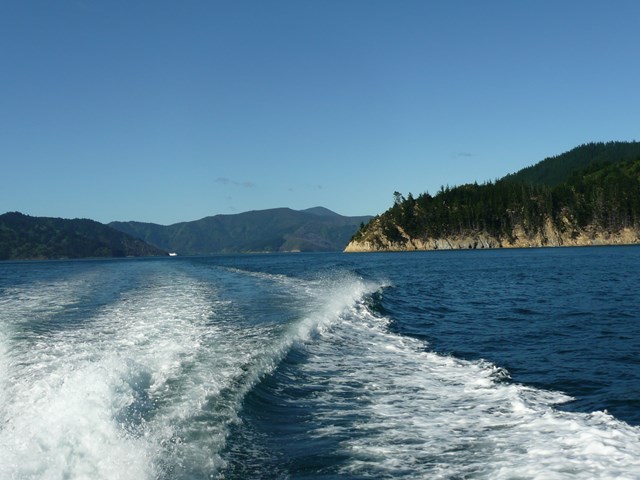
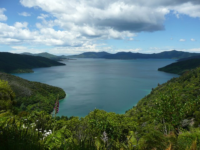
Queen Charlotte Track
Choice of multiple days or day walks in the Marlborough Region, South Island. The town of Picton is a good base to prepare or start of your adventure. You can decide to combine your walk with: a drop off and pick-up by water taxi, a mountain bike, a sea kayak or simply walk. Stunning scenery on both sides from the Queen Charlotte Sound and Kenepuru Sound. Walking on good track with some challenging climbs and sections.
 85
km
one-way
5
days
85
km
one-way
5
days
The Old Ghost Road
This is an excellent five day walk in the north-west of the South Island. track is very well maintained, huts are very well managed and have all you need for cooking, eating. I have done the Routeburn and would say this surpasses it easily for range of scenery, continually interesting walking, facilities etc. Only thing I would say is bring a lot of repellent. the sand flies are bad!
While it is also a cycle trail, there was very little evidence of bikes as we walked. Hardly met anyone on the trail, in fact, but lots of good company in the huts at the end of the day. I think this may become one of the must do walks of NZ as it becomes better known.
 2
km
return
30
mins
2
km
return
30
mins
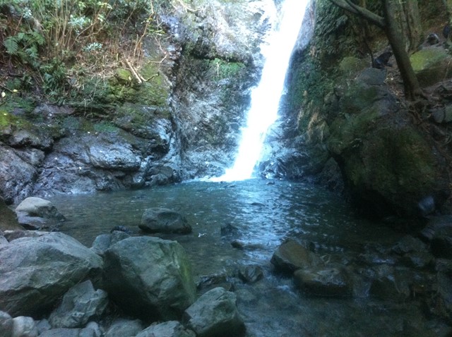
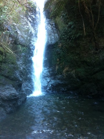
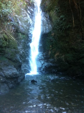
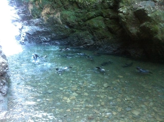
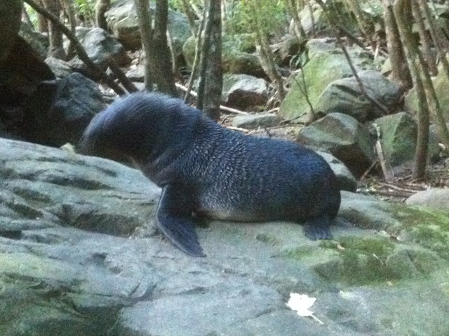
Ohau Stream and Waterfall
A stream and waterfall seal pups come to play in at certain times of the year.
Ohau Point Seal Colony, Kaikoura
 10.4
km
return
3.5
hrs
10.4
km
return
3.5
hrs
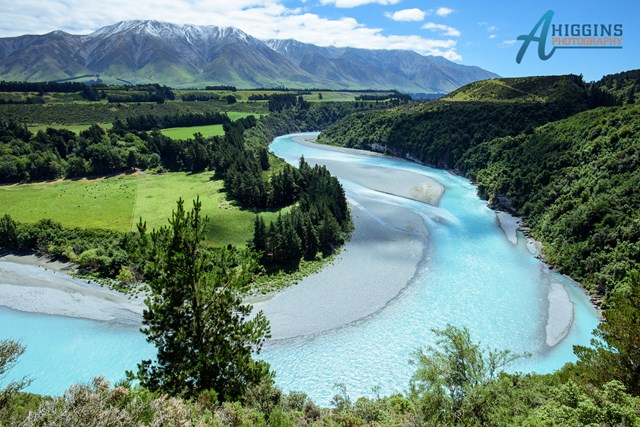
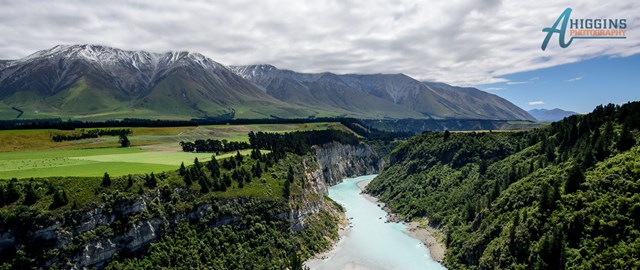
Rakaia Gorge Walkway
The walkway follows the rim of the gorge providing views of the Rakaia River and Mt Hutt. Along the way there are a number of historical points of interest.
 16
km
8
hrs
16
km
8
hrs
Welcome Flat
An interesting walk along the Karangarua and Copland Rivers. the walk is the western section of the Copland Pass track that is an alpine pass that must be completed by competent alpine hikers, or by hiring a guide out of Mt Cook Village. <br />The walk is reasonably easy with only about 600m elevation gained, though there are a number of river crossings all of which have some form of bridge. the best part about Welcome Flat is at the hut there are thermal pools which have been terraced all with different temperature pools.<br />The hut itself is also rather unique being one of only a few that are 2 storey, with the communal cooking and eating area downstairs and sleeping upstairs. During the peak tramping season the hut is manned by a DOC ranger which is a volunteer service, and I think it would be an awesome job spending a couple of months in this beautiful part of the world.
3.1
km
return
20
mins
Queenstown Gardens Foreshore Walk
A short walk around the Queenstown Foreshore.
2.1
km
return
1
hr
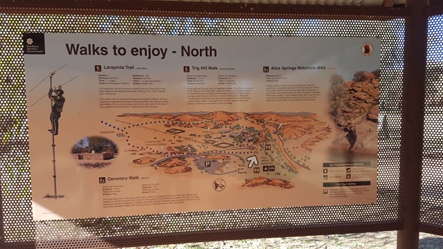
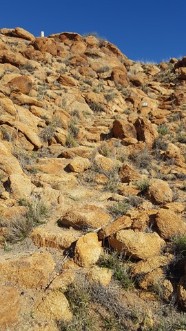
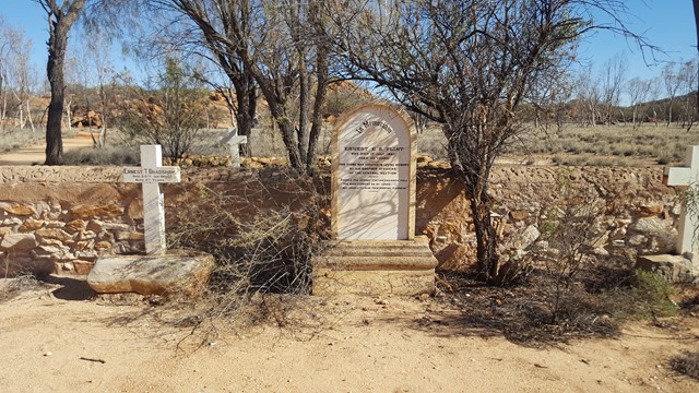
Cemetery & Trig Hill Loop
This is a hugely historic area and this walk, with its interpretive signs, takes you out to the cemetery and around the immediate area, up Trig Hill and back to the Telegraph Station.
 5.2
km
return
90
mins
5.2
km
return
90
mins
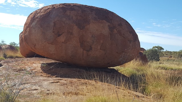
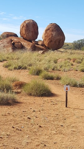
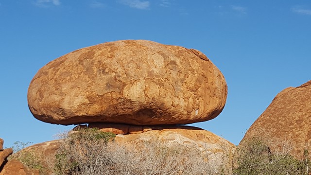
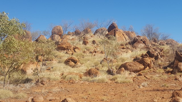
Nurrku Walk & Yakkula Loop
This walk provides visitors with a longer opportunity to experience the wider Reserve. These granite boulders, many of which are precariously balanced on top of one another are scattered across the wide shallow valley that makes up the Reserve.
 1.6
km
return
45
mins
1.6
km
return
45
mins
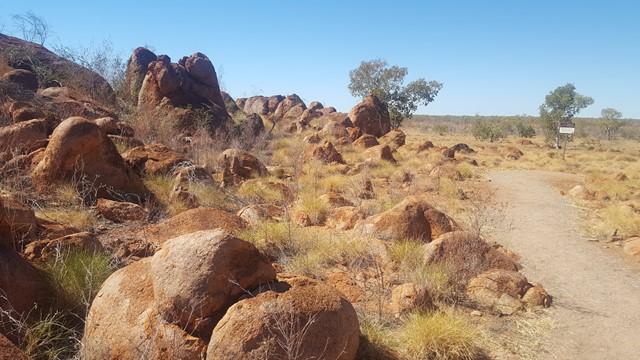
Mayijangu & Lookout Walk
Nyanjiki Lookout providing panoramic views of the Reserve and the opportunity to 'rock hop' the marbles. These granite boulders, many of which are precariously balanced on top of one another are scattered across the wide shallow valley that makes up the Reserve.
 600
m
return
15
mins
600
m
return
15
mins
The Pebbles
Kunjarra, The Pebbles are a natural rock formation surrounded by myth and legend; a women's place. Kunjarra is believed by the Warumungu Aboriginal people to be related to the Devils Marbles and are a sacred site where a number of dancing and healing rituals have been traditionally carried out.
Due to the significance of the site, visitors are asked not to climb on the rocks.
 200
m
return
5
mins
200
m
return
5
mins
Lara Steps
148 concrete steps on part of Mount Buderim, with trees surrounding. It is short with no particular features and used mainly by people of all ages keeping fit.
 3.7
km
return
90
mins
3.7
km
return
90
mins
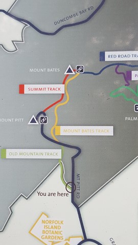
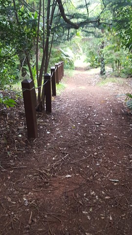
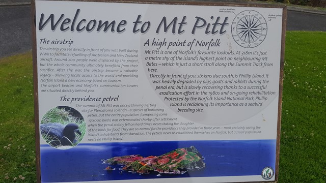
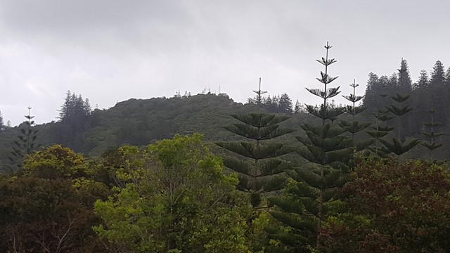
Mount Pitt
This walk takes you from the park entrance to the summits of Mount Bates and Mount Pitt, with its many heritage WWII remnants and expansive 360° views from Norfolk Island's highest peaks.
 2.3
km
return
1
hr
2.3
km
return
1
hr
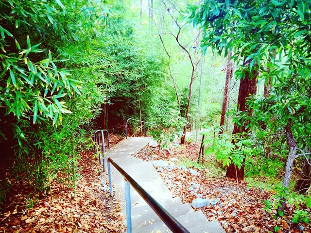
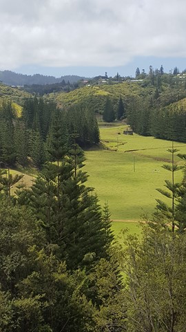
McLachlans Lane Loop
Follow the path from the park entrance on Red Road to the dry waterfall. Look closely to see McLachlan’s old house site among the Norfolk Pine and White Oak forest and discover a lush valley with a waterfall that flows after good rain.
 2
km
return
1
hr
2
km
return
1
hr
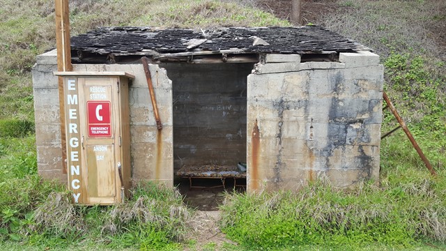
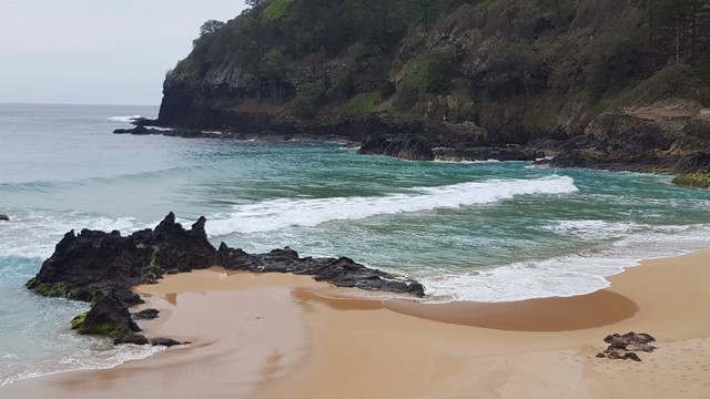
Anson Bay
A steep track down to this secluded surf beach with its crashing waves, where you are likely to have it all to yourselves with just the sea birds as company.
 800
m
return
45
mins
800
m
return
45
mins
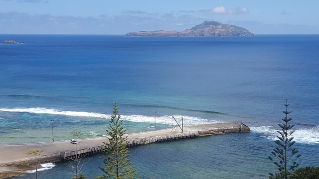
Flagstaff Hill
This short stepped walkway takes you to lookouts high above World Heritage Listed Kingston, with great views of Arthur's Vale, the Settlements, Pier, Slaughter Bay and beyond to Phillip Island.
 4
km
return
105
mins
4
km
return
105
mins
Palm Glen to Mount Pitt
This walk takes you up through Palm Glen to the summits of Mount Bates and Mount Pitt, with its many heritage WWII remnants and expansive 360° views from Norfolk Island's highest peaks.
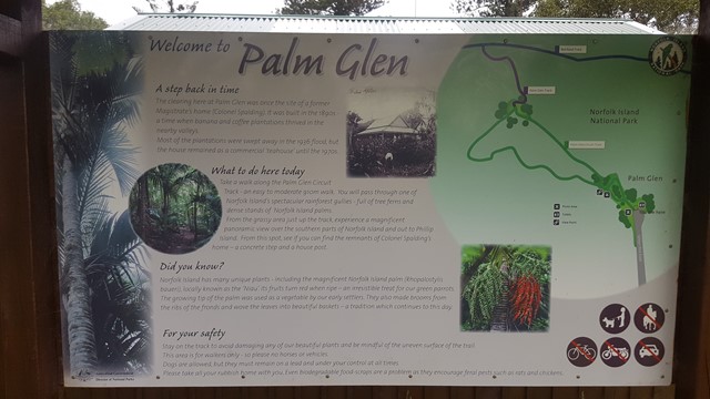
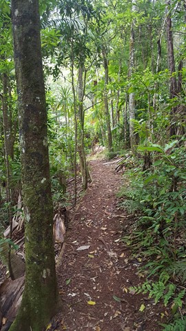
 2.3
km
return
1
hr
2.3
km
return
1
hr
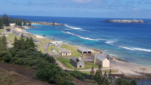
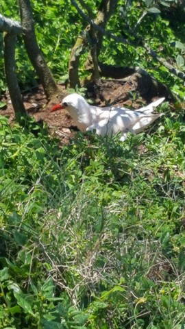
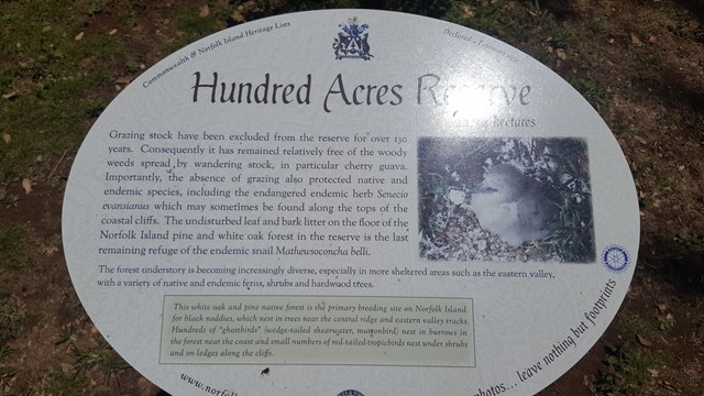
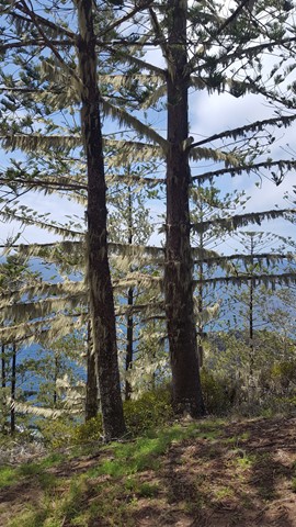
Hundred Acre Reserve
This acreage is the largest remaining coastal Norfolk Pine and White Oak Trees forest on the island. Undisturbed, the Masked Booby and Mutton Birds nest at your feet on the cliff edge and White Terns in the surrounding trees.
 4.7
km
return
2
hrs
4.7
km
return
2
hrs
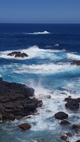
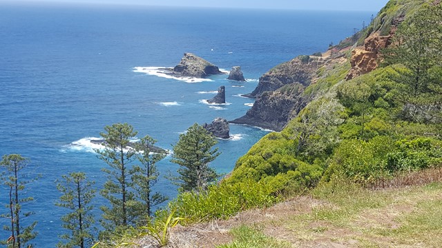
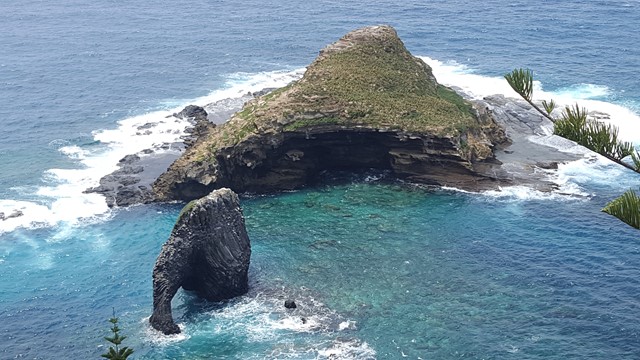
Bridle Track to Bird Rock
This spectacular walk takes you from Captain Cook Monument along the cliff top, with its crashing waves and azure waters below, to Bird and Elephant Rock, before heading on an inland loop, famed for its bird life. The largest pine trees on the island can be seen along Bridle Track.