
Kathleen Springs
Watarrka National Park


Menu
GPS Tracks
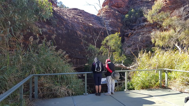
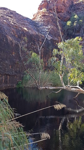

A delightful spring fed waterhole at the head of Kathleen Gorge, is a cool moist place to sit and enjoy the areas tranquillity. Many interpretive signs along the track tell the story of centuries of Aboriginal culture and the recent cattle industry.

Getting there:
Watarrka National Park is located southwest of Alice Springs and can be reached via a number of routes:
Via the Stuart Highway, Lasseter Highway and onto Luritja Road.
Via Larapinta Drive through the West MacDonnell NP (Mereenie Loop requires a permit and is 4WD only) and onto Luritja Road.
Via the Stuart Highway, Ernest Giles Road (4WD only) and onto Luritja Road.
The 700m signposted road to the car park, is off Luritja Road, midway between Kings Creek Station and Kings Canyon Resort.
Maps:
Watarrka National Park - Kings Canyon
Route/Trail notes:
From the car park, the track is signposted and meanders into the waterhole and back by the same route.
Permits/Costs:
None.
Other References/Comments:
With the option to also complete the various walks in Kings Canyon, both Kings Creek Station and Kings Canyon Resort provide a variety of accommodation for a stopover.
 244 Kathleen Springs (GPX)
 2.7
2.7 75
75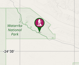
Comments