


 4
4 90
90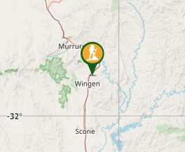
Aussie Bushwalking can keep track of your bushwalks.
Login/signup to tick this walk off.Burning Mountain
New South Wales
Menu
Burning Mountain is a unique natural phenomenon and a highlight of the region. The best way to discover this unusual nature reserve is a 4km return track that has some steep sections.
Lookouts
Bird Watching
Heritage Sites
Toilets
Arid or Desert
653m
Maximum Elevation
Getting there
The walk begins from the Burning Mountain Nature Reserve carpark.
From Scone:
- Follow New England Highway towards Tamworth
- Burning Mountain Nature Reserve is 20km north of Scone, on the right-hand side of the highway
From Tamworth:
- Follow New Wngland highway towards Scone
- Burning Mountain Nature Reserve is about 100km Southof Tamworth, on the left-hand side of the highway.
Trail Information
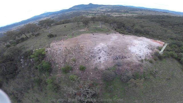
The trail is clear and easy but steep overall and strenuous, but worth it for the expansive views at the peak and the fascinating sulphur vent chimneys pouring out hot gas from the coal fire deep below. There's a lovely picnic shelter near the peak and plenty of wildlife along the way in warmer months. Very dry and arid, lots of water recommended. More information at:
https://www.nationalparks.nsw.gov.au/visit-a-park/parks/burning-mountain-nature-reserve
GPS Tracks
- No GPS available for this walk yet.
Comments