
Menu
Suggested searches
Your search found 2444 results...

 8
km
8
km
 3.5
hrs
3.5
hrs
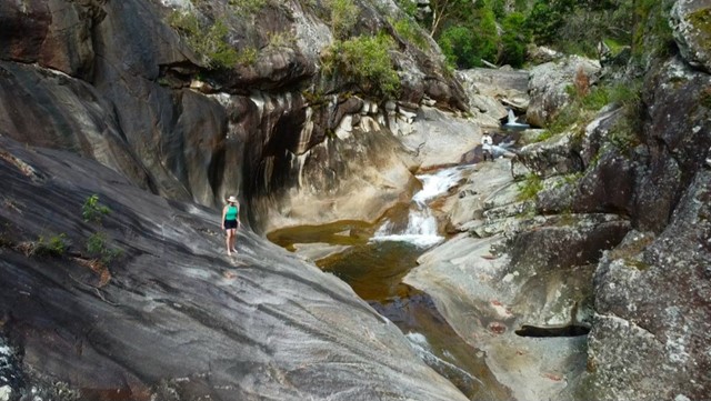
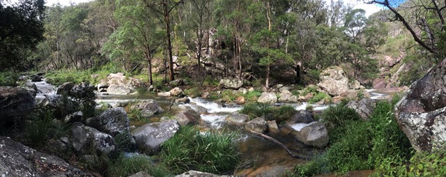
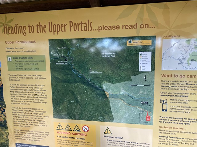
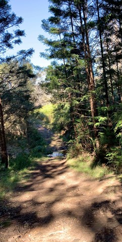
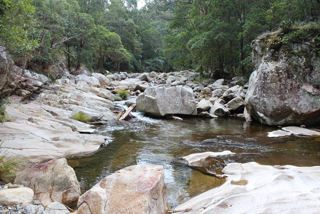
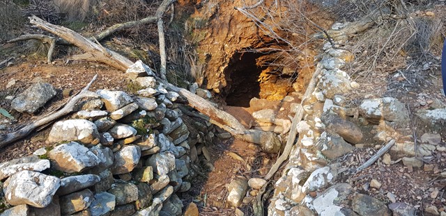
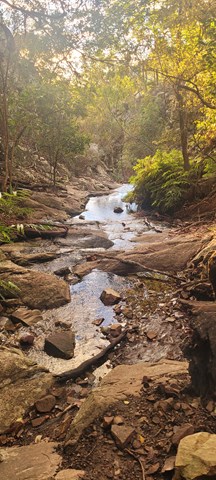
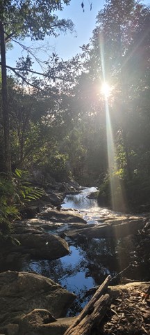
Upper Portals
Mt Barney National Park
Easy navigation but with a steep hill. A 4WD or at the very least a high clearance vehicle is required to make it up the road. It is rough going in 1st gear with a few extended steep/rough stretches.
 3
km
return
1
hr
3
km
return
1
hr
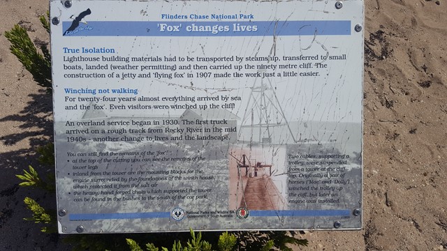
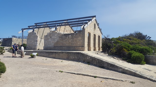
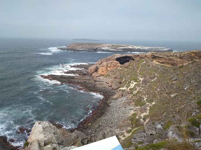
Weirs Cove Hike
Flinders Chase National Park
Imagine spending three months or more waiting for fresh supplies. Hike from Cape du Couedic Lighthouse to Weirs Cove to appreciate the life of the lightkeepers, not to mention their long walk to bringing the groceries home. Discover the method of landing people and supplies along this treacherous coastline.
 2.2
km
return
1
hr
2.2
km
return
1
hr
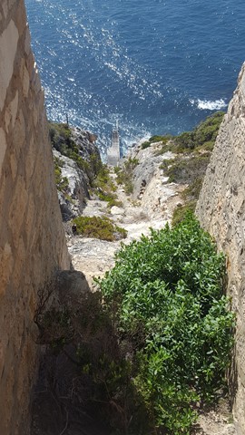
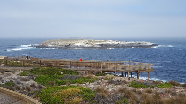
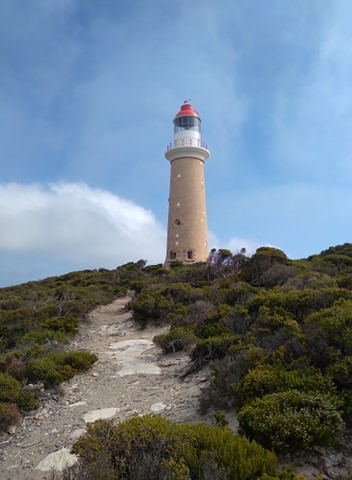
Cape du Couedic Hike
Flinders Chase National Park
Departing from Cape du Couedic Lighthouse, this hike provides spectacular coastal cliff top views as it meanders between the Lighthouse and Admirals Arch. Discover the varied and impressive techniques that plants use to grow here. Find out about Aboriginal connections with Cape du Couedic and how they survived in this harsh environment. Contemplate the drama of being shipwrecked here 110 years ago. Look for the water pool built by the lighthouse builders and watch for those who still use it today.
 13.5
km
6
hrs
13.5
km
6
hrs
Lerderderg Gorge River return via Cowan Track
Victoria
A nice 6km walk along the Lerderderg Gorge, Starting at Obriens crossing and returning via Cowan track.
 6
km
return
3
hrs
6
km
return
3
hrs
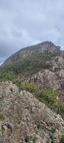
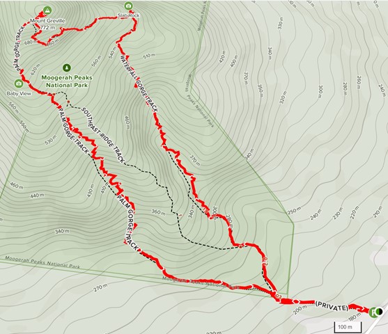
Mt Greville
Moogerah Peaks National Park
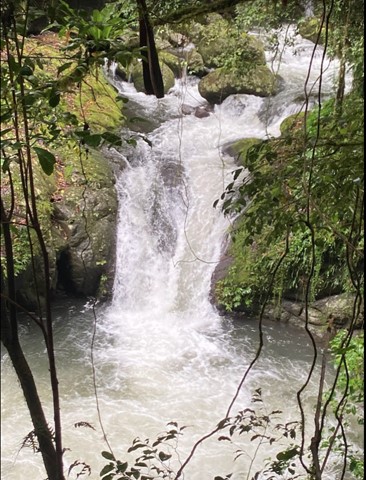
A walk up to the top of Mt Greville circa 770m. Up the waterfall gorge, then visit viewing platform rock slab near top of waterfall gorge. Alternatively, ascend via SE Ridge. Continue to summit then return via Palm Gorge.
 8
km
2
hrs
8
km
2
hrs
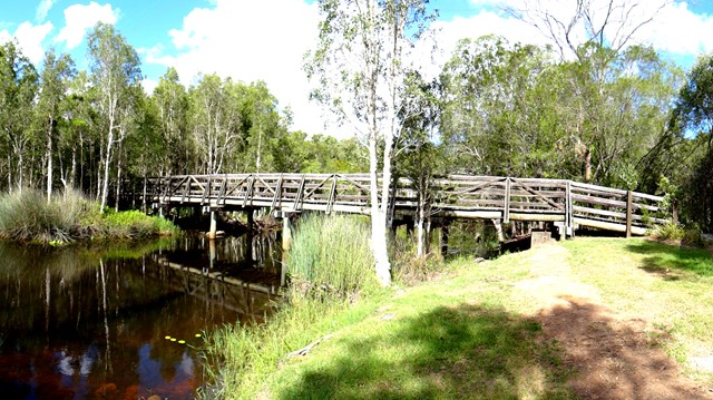
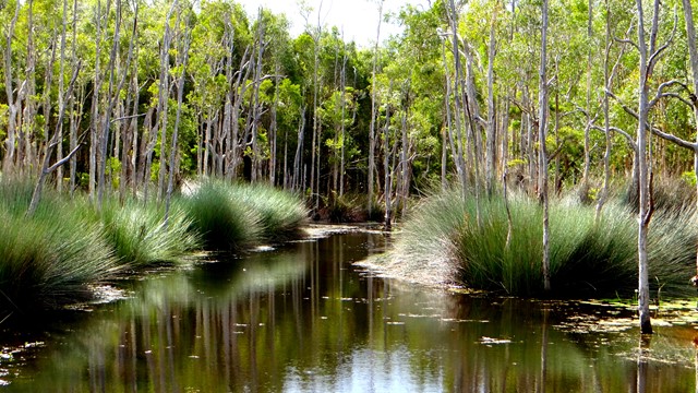
The Rocks Circuit (from Illaweena Street)
Karawatha Forest
Starting from Stretton Reserve on Illaweena St, head to the far end of the picnic area and across the bridge over the lagoon. Start following the power lines and head slightly up hill. About 700 metres in, follow the sign to the right Dianella Trail. There's an interesting and rather random car wreck in here. Keep following it at any sign posts by heading to the Wallaby track.
When you reach the Wallaby track, head right for 170 metres then left for 120 metres onto the Rocks circuit. Head right (ignore the path in front of you) and keep following it around. Stick to the Rocks Circuit. You'll eventually come to an unsigned junction. Don't go uphill to the left (that will take you back to the Wallaby track) but head right down the gully and then up some stairs. This will eventually take you to an excellent little picnic area at the highest point in the park, with a nice view of the local area.
From the picnic area, head west on the Entolasia track towards the reservoirs and mobile phone towers. After the mobile tower (but before the huge/second water reservoir) head left where the sign says Wallaby track, but don't head onto the Wallaby track. There'll be a green arrow painted on a tree. Follow that arrow and head down the Casuarina track. If you ever wander off track, just follow the main track under the power lines until you get back to the bridge and lagoon.
 4
km
1
hr
4
km
1
hr
Poets Rock
Karawatha Forest
From Stretton Reserve, cross the bridge and head up Casuarina Track. Take the right onto Macaluta track. About a kilometre or so in, right before you hit the join with Hakea track, you'll see a steep track heading to the left. Scramble up there and you've reached the peak of Poets Rock. A good place to think and write poetry.
 10.6
km
4
hrs
10.6
km
4
hrs
Box Forest
Lamington National Park
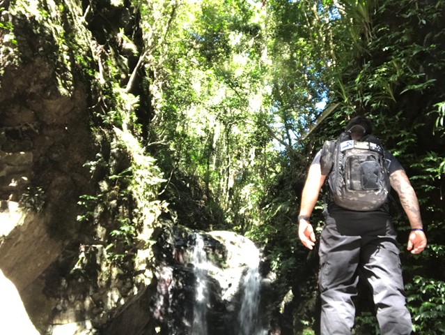
The Box Forest Track leaves the Picnic Rock track 2.7 km from the entrance and is a most rewarding circuit walk. The track winds down through stands of Brush Box and Piccabeen Palms, to the lush sub-tropical rainforest along Canungra Creek. Pepper Vines cling to tall trees that often support spectacular tree gardens.
Turn right at the next track junction. During wet times, you will have to wade through the water when crossing above Wajinya Falls. The track continues near the top of the falls on the other side. Darragumai Falls and Picnic Rock are considered good lunch spots. Don't miss Box Log and Elabana Falls on the way home.
 2
km
40
mins
2
km
40
mins
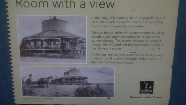
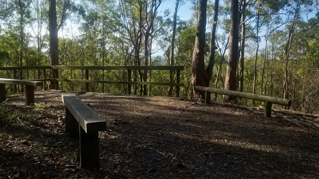
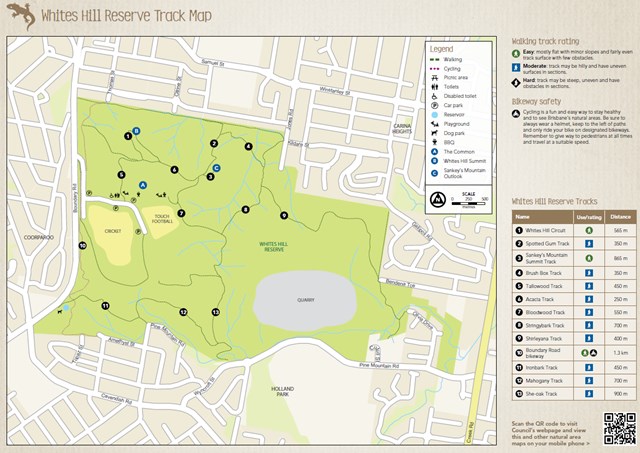
Whites Hill Circuit
Brisbane City Council Local Walks
A nice urban bushland walk to a peak and lookout to Brisbane's CBD. A few tracks that can be combined to a loop.
 15.5
km
2
days
15.5
km
2
days
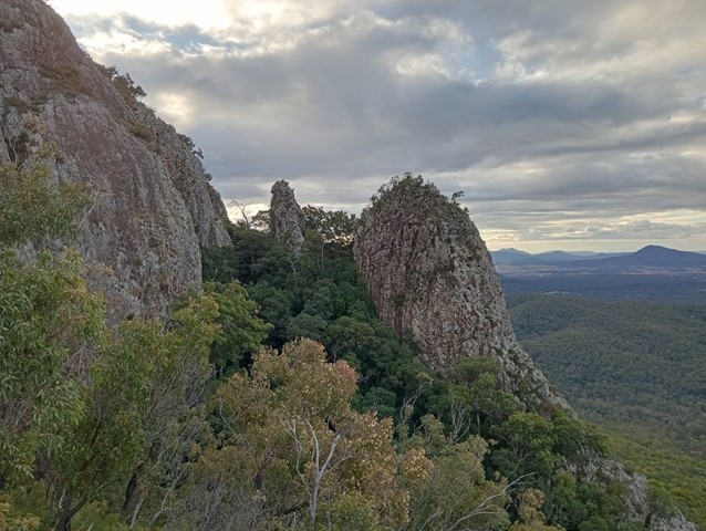
Mt Gar - Briggs Bluff
Grampians National Park
A classic overnight traverse of one of the most rugged landscapes in Victoria, this walk takes in an ascent of Mount Gar (Mount Difficult), panoramic views from Briggs Bluff and a lot of great walking through the wild sandstone country of Grampians-Gariwerd.