
Menu
Suggested searches
Your search found 2398 results...

 4.4
km
return
4.4
km
return
 2
hrs
2
hrs
Bushland Corridors (Rouse Hill)
The Hills Shire
An early farm house, original land grants, a mysterious grave, remnant bushland including Forest Red Gum woodland and heathland, waterways and water birds. The Rouse Hill area was settled early in Sydney’s history. The first land grant in this area was to Governor William Bligh in 1806. Richard Rouse was the next landowner in 1813.
 3.3
km
return
2
hrs
3.3
km
return
2
hrs
Stevensons Creek (Excelsior Reserve/Baulkham Hills)
The Hills Shire
Beautiful creek valleys, sandstone shelters and some sandstone heath land. This walk is one of the more challenging walks in the Hills Shire.
 3.4
km
return
90
mins
3.4
km
return
90
mins
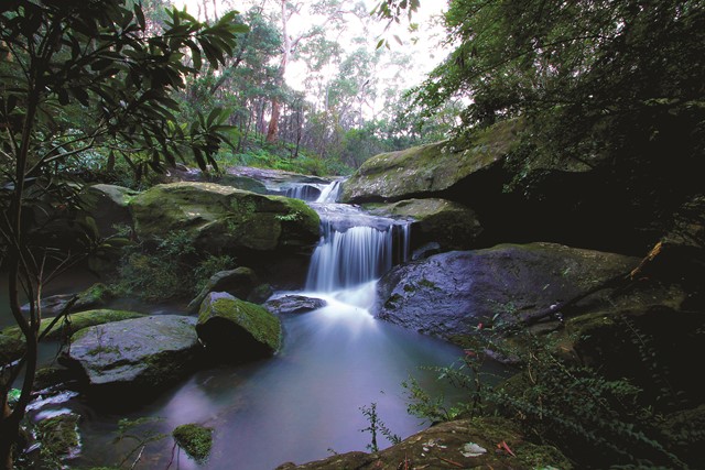
Waterfall Walk (West Pennant Hills/Richard Webb Reserve)
The Hills Shire
Tall Blue Gums, sandstone gullies, a waterfall and wildflowers. This walk follows Darling Mills Creek to the only waterfall in the Hills through some of the prettiest scenery in the Hills.
 7
km
return
4
hrs
7
km
return
4
hrs
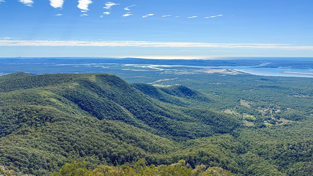
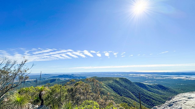
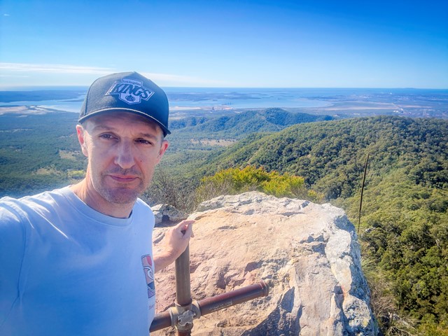
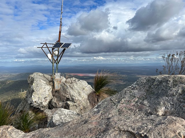
Mount Larcom Walk
Central Queensland
A steep climb up to the Mount Larcom TV relay station. Follow the blue dots and yellow markers and you can't go wrong. The beginning of the track is approximately 2kms and winds towards the base of the climb, lots of loose dirt and grass surrounding the trail. Cross the wooden bridge and the trail is straight up from there. Most of the trail is covered in very loose rock and dirt, lots of tree roots sticking up out of the ground - they make excellent footholds but watch your footing as it can be slippery on the way down. The last section involves some rock scrambling and whilst it is almost vertical towards the peak, three points of contact at all times is easily achieved. Bring plenty of water, at least 2ltrs per person, even in the Winter as this is a fairly strenuous hike. Beware if you have knee issues and the decent is punishing. Your quads will burn with that awesome workout feeling. Anyone can do this climb however some just need to take the full 4hrs turnaround.
 2.5
km
return
2
hrs
2.5
km
return
2
hrs
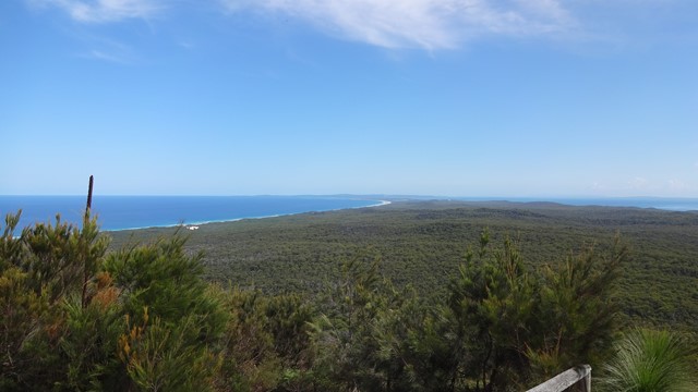
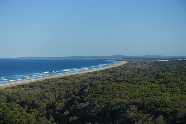
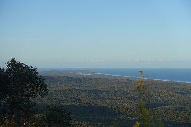
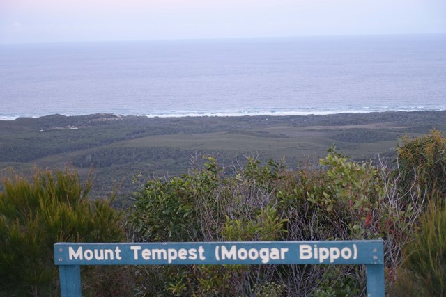
Mount Tempest
Moreton Island National Park
At 285 metres high, Mount Tempest is the highest stabilised sand dune in the world. The walk to the top of Mount Tempest is a memorable one, with sweeping views of Moreton Bay and the island’s length a spectacular experience. The wildflowers are nice in spring and humpback whales can be spotted migrating in late winter and spring.
 23
km
one-way
6
hrs
23
km
one-way
6
hrs
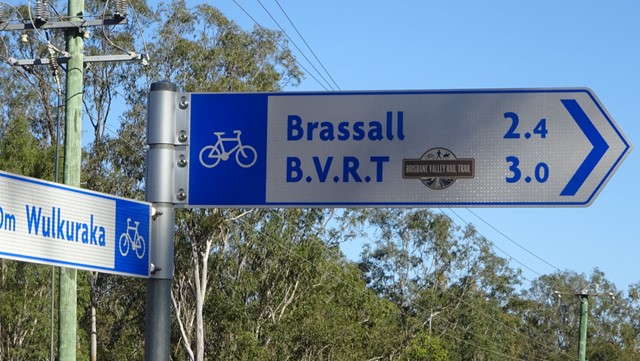
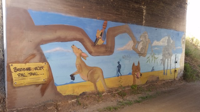
Wulkaraka to Fernvale - Part of BVRT
Brisbane Valley Rail Trail
I rode this but you are certainly allowed to walk it. A fun and enjoyable ride from Wulkaraka station to Fernvale. Look forward to a delicious thick shake and a pie at the renowned Fernvale bakery! The track is mostly flat and easy to follow. A couple of road crossings.
 2
km
return
40
mins
2
km
return
40
mins
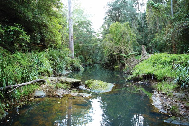
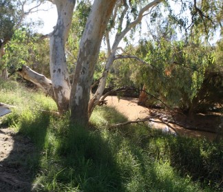
Bulloo River Quilpie
Darling Downs South West
Easy stroll along the Bulloo river just before entering Quilpie.Great for birdwatchers and even fishing ( when river flowing).
 14.3
km
return
6.5
hrs
14.3
km
return
6.5
hrs
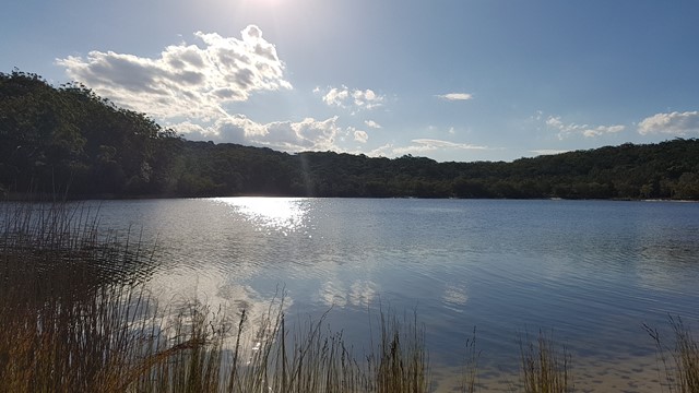
Lake Judd Track
Southwest National Park
This walk starts at the car park off Scots Peak Dam Road. It is a reasonably flat walk through a forest and then across a lot of button grass swamps, which is hard going, but the views across the swamps to Mount Anne make it enjoyable. The track itself is reasonably well marked with a few sections that require a bit of navigational skills. The final section is uphill to get to Judd Lake, but not too difficult. At the lake there is a fairly large flat area for camping next to the lake.
4.2
km
return
90
mins
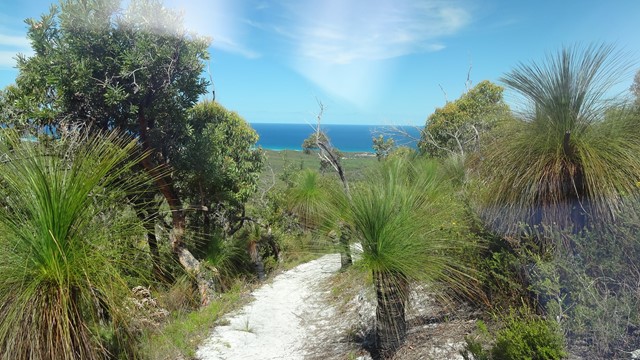
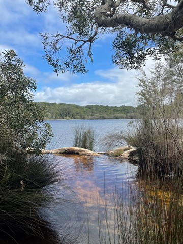
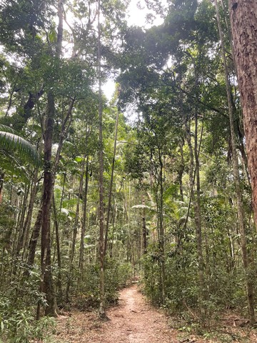
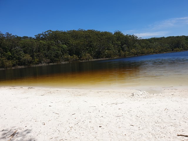
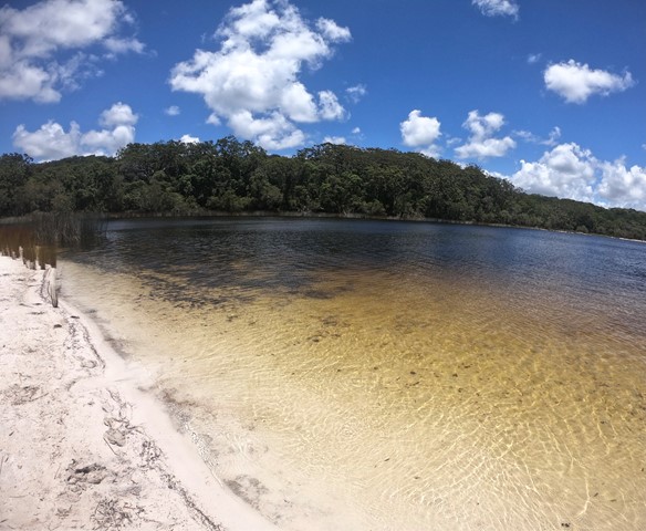
Poona Lake walk
Great Sandy National Park
Easy walk through tall forest with kauri and hoop pines, piccabeen palms and strangler figs
 4.3
km
return
1
hr
4.3
km
return
1
hr
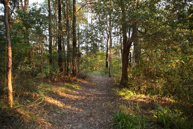
Mookin-bah Reserve
Brisbane City Council Local Walks
There are a number of trails in the Mookin-bah Reserve. All relatively short but can be combined to walk a little over 5km. This walk started at the Greencamp Road entrance and took the Lorikeets then h9neyeater tracks before merging onto the Fairy wren track and walking to Chelsea Road.
The track is signposted and straightforward with the only tricky part at the start of the walk. The walk starts in just a mown grassy track which quickly reaches an a junction that has no signs. Go left and you will quickly be on the bitumen path.
The return journey is approximately 4.3 km