
Menu
Popular Walks
-
South Cape Bay Track
(13 ticks) -
South Coast Track
(8 ticks) -
Western Arthur Ranges
(7 ticks) -
Lake Judd Track
(2 ticks) -
Federation Peak
(2 ticks)
Parent Regions
Popular Walks
-
South Cape Bay Track
(13 ticks) -
South Coast Track
(8 ticks) -
Western Arthur Ranges
(7 ticks) -
Lake Judd Track
(2 ticks) -
Federation Peak
(2 ticks)
Parent Regions
Walks in Southwest National Park

 300
m
return
300
m
return
 15
mins
15
mins
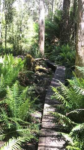
Creepy Crawly Nature Trail
A graded boardwalk trail intentionally designed to make people apreciate some of the difficulties of moving through untracked bush eg. some trees you need to move around.
 52
km
return
3
days
52
km
return
3
days
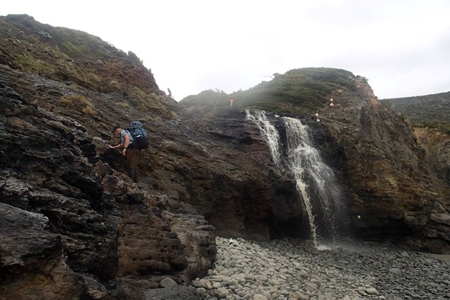
Federation Peak
Picton Road is 16km unsealed (I got a flat tyre in a Toyota Corolla doing 30km/hr) . You park just before the landslide then its around a 3km walk to Farmhouse Creek.
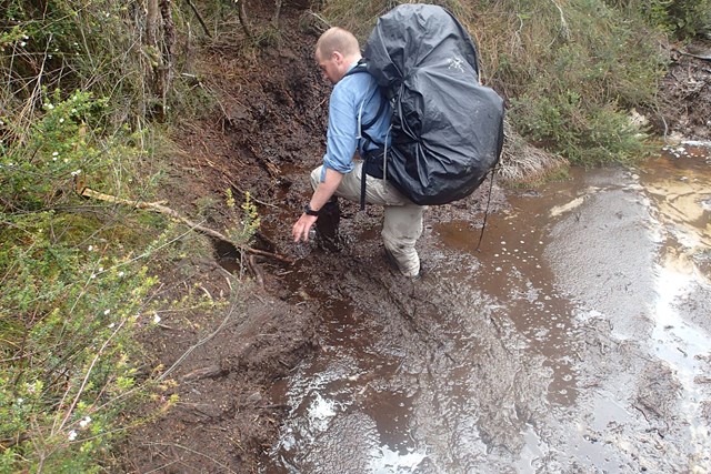
From where you park the car to Cutting Camp is approximately 21km/8-10hrs with around 600m elevation gain. Plenty of mud and root climbing. you will climb under and over fallen trees.
I set up camp at Cutting Camp for 2 nights. There is plenty of water from Cherry Creek alongside the camp but you must treat it as there have been giardia cases.
Day two: climb 600m and about 3-4km 3-4hrs up to Bechervaise Plateau then another approximately 3hrs return to the summit.
If the weather is bad you will not be able to summit. You will need to be comfortable on things similar to Tibrogargan Caves Route.
After the relatively easy famous traverse above Lake Geeves there is a difficult bit to climb where getting up is much easier then getting down and there is zero margin for mistakes.
(Note this information is a guide and you will need to source addition information elsewhere)
(I will refine and add to this later)
 5
km
return
2
hrs
5
km
return
2
hrs
Fishers Point Trail
Walk out to a point along the beaches with some historic ruins at the end.
14.3
km
return
6.5
hrs
Lake Judd Track
This walk starts at the car park off Scots Peak Dam Road. It is a reasonably flat walk through a forest and then across a lot of button grass swamps, which is hard going, but the views across the swamps to Mount Anne make it enjoyable. The track itself is reasonably well marked with a few sections that require a bit of navigational skills. The final section is uphill to get to Judd Lake, but not too difficult. At the lake there is a fairly large flat area for camping next to the lake.
 6.1
km
return
4
hrs
6.1
km
return
4
hrs
Mount Sprent
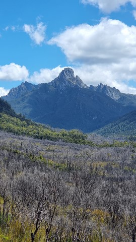
Starting on the dam wall above the Serpentine River you very steeply climb up towards the summit of Mount Sprent with amazing views.
16
km
return
5
hrs
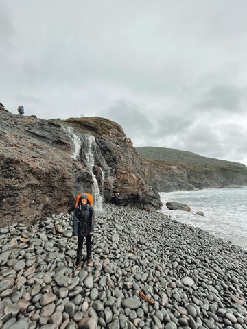
South Cape Bay Track
This is a 16km return walk from Cockle Creek to South Cape Bay. This walk is the most southerly day walk you can do in Australia! When you arrive at the rocky headland, you are looking south to Antarctica but it is still many kilometres south. About 4,000 kms in fact.
 85
km
one-way
7
days
85
km
one-way
7
days
South Coast Track
The 85km South Coast Track runs between Melaleuca and Cockle Creek. There are no roads to Melaleuca, so walkers must either fly, sail or walk in and out.
Most people take about 6 to 8 days to complete the South Coast Track, depending upon time spent enjoying the beaches. Walkers should note that the track surface may be rough and muddy over extended sections.
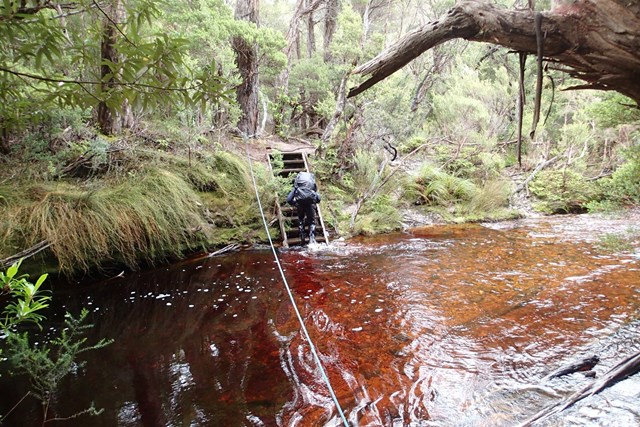
Boat Crossings
There is a water crossing that requires walkers to use small boats at New River Lagoon. Extreme caution is needed when making crossings, particularly in windy weather. You should carry a couple of days extra food to allow for delays.
Track conditions
When crossing the Ironbound Range, note in one day the track goes from sea level to 1000 m above sea level, and back down again. It’s a very full day. Start from the campsite right at the base of the Ironbounds. The South Cape Range is half as high as the Ironbound Range, but equally difficult. It's a rough and muddy track. Start from the nearest campsite and expect a full day. Note that there's no creeks for most of the Ironbound Range and the South Cape Range.
There is no reliable fresh water at the campsite at New River Lagoon crossing. Most other creeks marked on the map are big enough to be flowing even in the driest time of summer.
If you want to visit Osmiridium Beach, be aware that the turnoff is not obvious and many people walk past it. Look for a little path meeting the track.
At South Cape Bay, there’s no track down to South East Cape (the southernmost point of the continent.) There’s no point leaving the South Coast Track to reach it as it’s an impassable coastline. When walking along narrow or rocky beaches at high tide, beware of large wave swells.
 2.4
km
return
2
hrs
2.4
km
return
2
hrs
The Needles Track
A nice short but steep walk to an interesting summit with good views.