


 85
85 7
7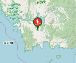
Aussie Bushwalking can keep track of your bushwalks.
Login/signup to tick this walk off.South Coast Track
Southwest National Park
Menu
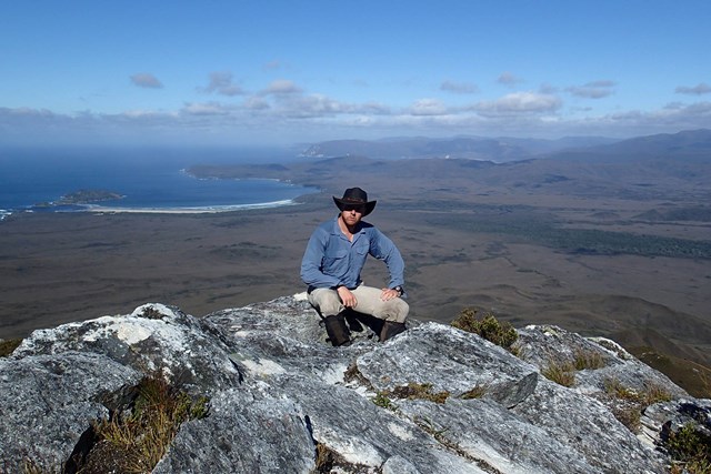
The 85km South Coast Track runs between Melaleuca and Cockle Creek. There are no roads to Melaleuca, so walkers must either fly, sail or walk in and out.
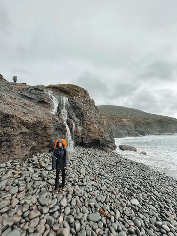
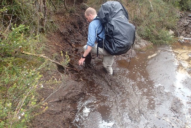
Most people take about 6 to 8 days to complete the South Coast Track, depending upon time spent enjoying the beaches. Walkers should note that the track surface may be rough and muddy over extended sections.
Boat Crossings
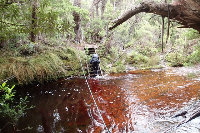
There is a water crossing that requires walkers to use small boats at New River Lagoon. Extreme caution is needed when making crossings, particularly in windy weather. You should carry a couple of days extra food to allow for delays.
Track conditions
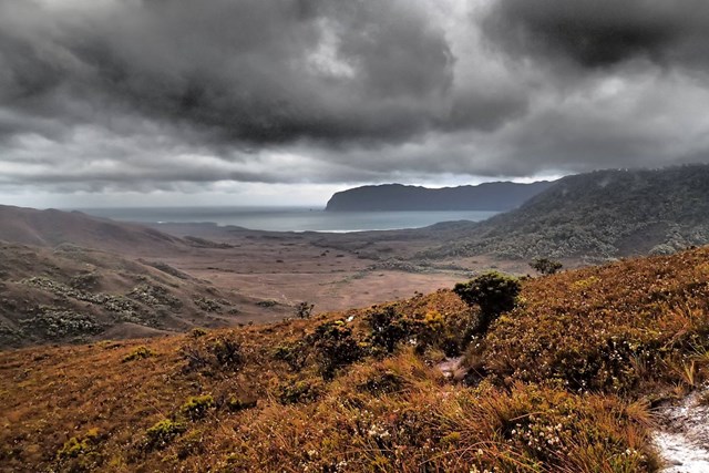
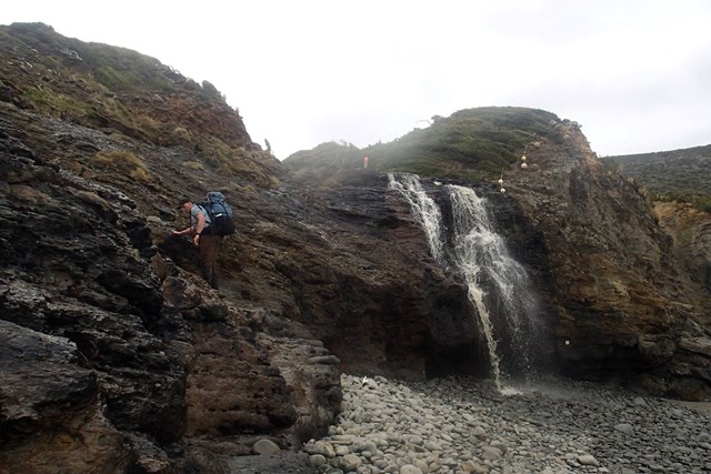
When crossing the Ironbound Range, note in one day the track goes from sea level to 1000 m above sea level, and back down again. It’s a very full day. Start from the campsite right at the base of the Ironbounds. The South Cape Range is half as high as the Ironbound Range, but equally difficult. It's a rough and muddy track. Start from the nearest campsite and expect a full day. Note that there's no creeks for most of the Ironbound Range and the South Cape Range.
There is no reliable fresh water at the campsite at New River Lagoon crossing. Most other creeks marked on the map are big enough to be flowing even in the driest time of summer.
If you want to visit Osmiridium Beach, be aware that the turnoff is not obvious and many people walk past it. Look for a little path meeting the track.
At South Cape Bay, there’s no track down to South East Cape (the southernmost point of the continent.) There’s no point leaving the South Coast Track to reach it as it’s an impassable coastline. When walking along narrow or rocky beaches at high tide, beware of large wave swells.
Scrambling or Climbing
Navigation Required
Coastal
Swamp or Wetland
Getting there
Access to the start of the track
Because plane flights are weather dependent, most people walk west to east (Melaleuca to Cockle Creek). Plane companies operate flights to Melaleuca by light plane, to/from Cambridge Airport near Hobart Airport:
- Par Avion, www.paravion.com.au, ph (03) 6248 5390
Private vehicles may be left at Scotts Peak or at Cockle Creek. Walkers are warned, however, that some vehicles parked in remote locations have been robbed or vandalised.
From Hobart, buses occassionally travel to and from Cockle Creek. Visitors wishing to use public transport or tours to access the walking track should visit our web page on Access to Tasmania's National Parks, Reserves and Walking Tracks.
Maps
The double-sided 1:100,000 scale map called 'South Coast Walks' is the best for the South Coast Track. It shows all tracks, huts, landing strips, plus text on walking notes, heritage and safety information.
Other References
http://www.parks.tas.gov.au/?base=2265
GPS Tracks
- No GPS available for this walk yet.
Comments