
Menu
Suggested searches
Your search found 2398 results...

 4
km
return
4
km
return
 1
hr
1
hr
Hydro Walk
Darling Downs South West
The Hydro walk begins in town, before veering off to the left where it proceeds to follow a route parallel to the road leading out of town; past the new Town Bore, crossing the road leading into the Aerodrome and finishing at the Hydro Power Plant Display. This is rather an interesting place to view.
Many trees, shrubs and plants along the walk have identification plaques.
 2
km
return
45
mins
2
km
return
45
mins
The Gully Walk
Darling Downs South West
This is a stroll along the Moonie River right opposite the Nindigully Pub. It features a nice path with plenty signs in relation to local history and wildlife.
 2
km
return
45
mins
2
km
return
45
mins
Springsure Lookout
Minerva Hills National Park
Fairly easy hike to the lookout when leaving the car at the scenic drive and walk further up. Has some nice views of the town of Springsure
 1.6
km
return
45
mins
1.6
km
return
45
mins
Skyline Lookout
Minerva Hills National Park
From the car park a fairly level track leads to two viewing platforms that look south to Virgin Rock on Mount Zamia and the Springsure township, and north to the rich farming country beyond Eclipse Gap.
 8
km
return
2
hrs
8
km
return
2
hrs
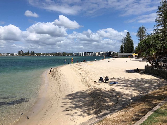
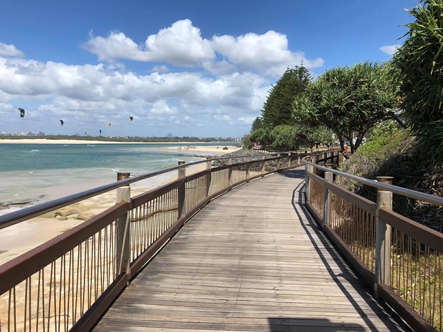
Bulcock Beach to Moffat Beach (SCCP 3)
Sunshine Coast
Enjoy a challenging part of the Sunshine Coast Coastal Pathway, as it winds above cliffs and round Caloundra Head, with fantastic views of the Glass House Mountains, Bribie and Moreton Islands to the south and to the north the beach all the way to Point Cartwright, with Mount Coolum in the distance.
 8.2
km
return
2
hrs
8.2
km
return
2
hrs
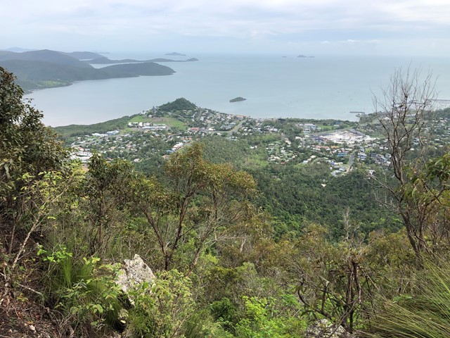
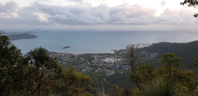
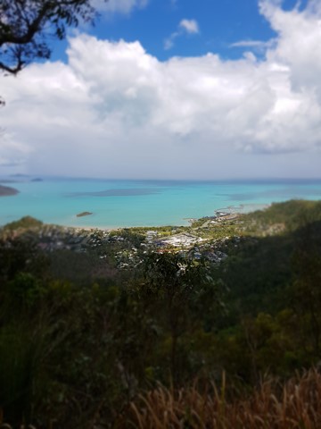
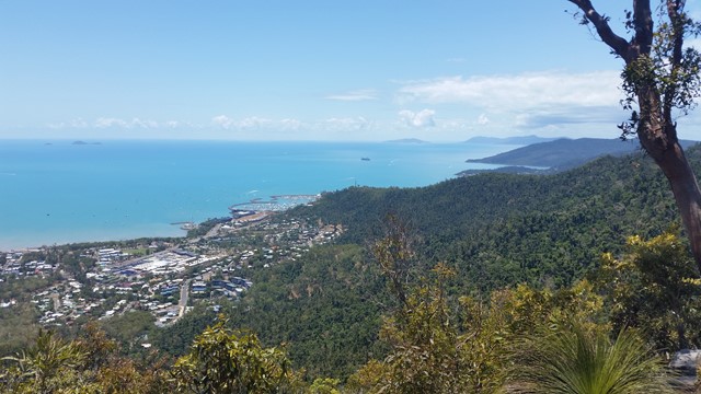
Honeyeater Lookout
Mackay, Isaac and Whitsunday
A walk to a lookout overlooking the Whitsundays and Airlie Beach
 7.4
km
return
5
hrs
7.4
km
return
5
hrs
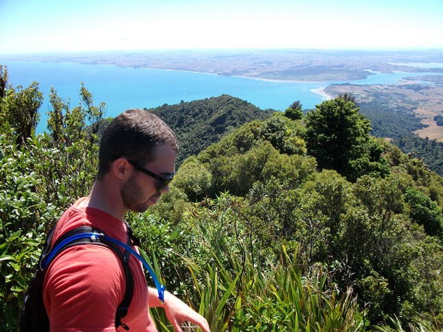
Mt Karioi
North Island NZ
About an hour west of Hamilton lies the extinct Volcano known as Mt Karioi. The track starts off fairly steep through grassland and then thick forest on a very well marked track. Upon reaching the ridgeline you are greeted with excellent views that only get better the higher you go. After the initial climb the walk is fairly undulating until you reach the summit. There are a few ladders/stairs/near vertical ascents where you have the aid of a series of chains but nothing too challenging. The track, though well marked, gets very muddy, so if you decide to attempt this after wet weather be prepared to wreck the clothes you're wearing because you almost certainly will slip at some point. There is a helipad at the very top with 320 degree views out to the Raglan Harbour and beyond.
 12.6
km
return
8
hrs
12.6
km
return
8
hrs
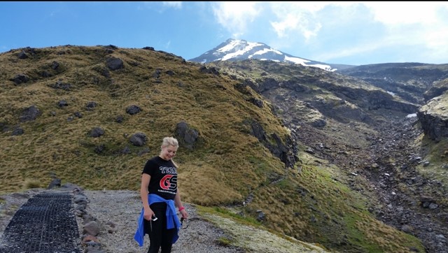
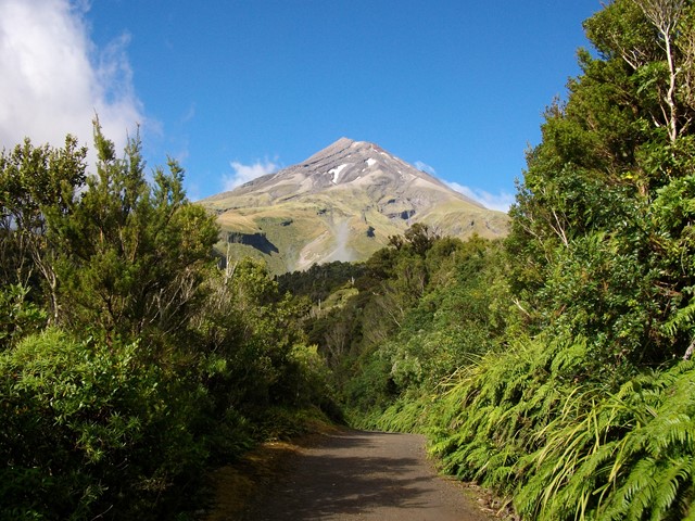
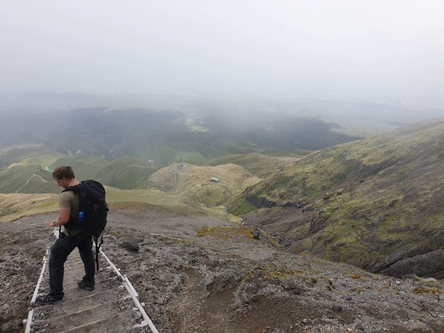
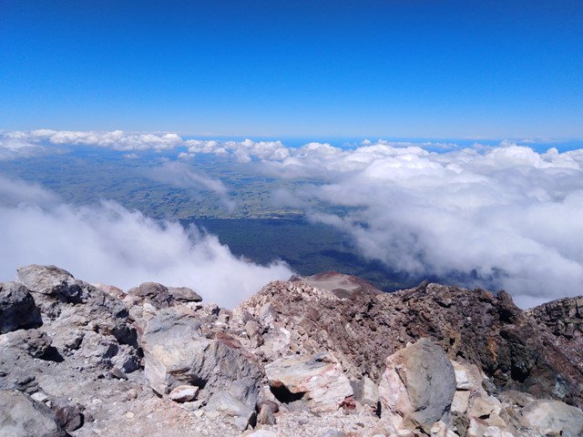
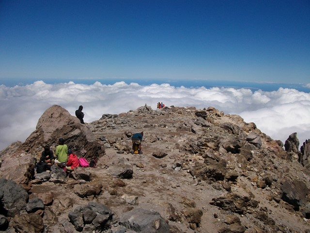
Mt Taranaki
North Island NZ
Active Stratovolcano located just east of New Plymouth on the North Island of New Zealand. 2nd highest mountain on the north island and was used as the backdrop in the film 'The Last Samurai' due to its similarity to Mt Fuji. You can see it all the way from the Tongariro Alpine Crossing on a clear day! It should only be climbed in summer unless you have proper mountaineering experience, even then expect it to be snow/ice capped. An excellent and challenging walk to the summit with a bit of everything - scree/hiking/scrambling/crossing ice plains.
 200
m
return
5
mins
200
m
return
5
mins
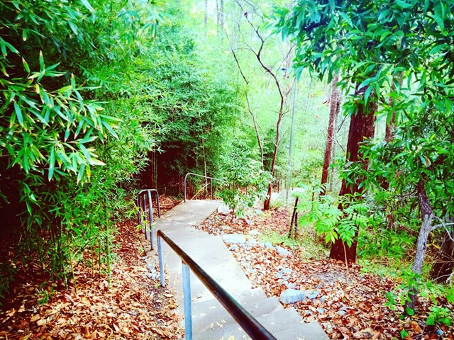
Lara Steps
Sunshine Coast
148 concrete steps on part of Mount Buderim, with trees surrounding. It is short with no particular features and used mainly by people of all ages keeping fit.
 300
m
return
30
mins
300
m
return
30
mins
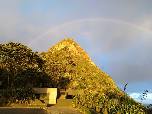
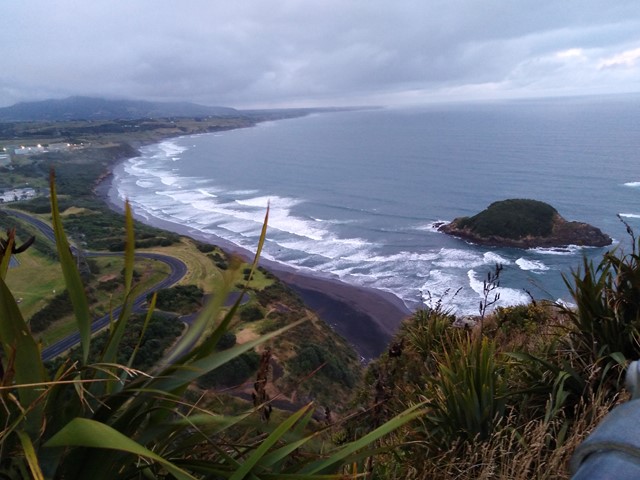
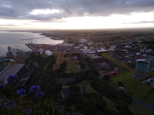
Paritutu Rock Summit
North Island NZ
A short walk/scramble to the top of Paritutu Rock rewards you with premium coastal views perfect for watching the sunset. Located minutes from downtown New Plymouth.