
Menu
Popular Walks
-
Twin Falls Circuit
(635 ticks) -
Purling Brook Falls Circuit
(610 ticks) -
Warrie Circuit
(471 ticks) -
Natural Bridge
(448 ticks) -
Best Of All Lookout
(279 ticks)
Parent Regions
Summary
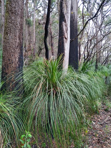
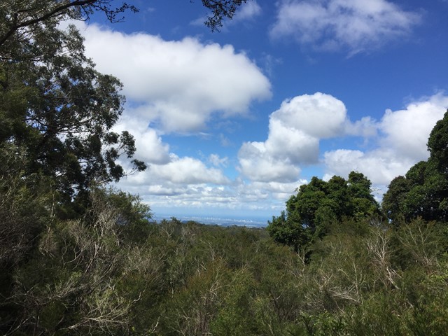
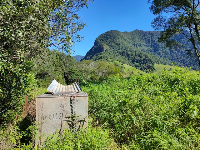
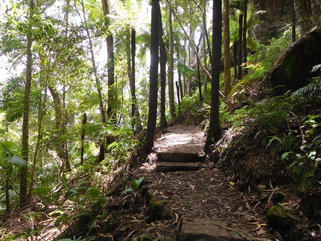
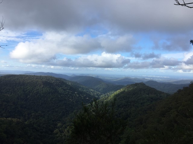
Springbrook is a 29.2 square kilometre National Park in the Gold Coast Hinterland. Only 90 minutes from Brisbane, Springbrook comprises a range of beautiful sub-tropical rainforest, spectacular lookouts and breathtaking waterfalls.
The park is part of the World Heritage Listed Gondwana Rainforests and consists of three sections: Springbrook Plateau, Natural Bridge and Mount Cougal (The Cougals).
Popular Walks
-
Twin Falls Circuit
(635 ticks) -
Purling Brook Falls Circuit
(610 ticks) -
Warrie Circuit
(471 ticks) -
Natural Bridge
(448 ticks) -
Best Of All Lookout
(279 ticks)
Parent Regions
History
Timber getters arrived in the late 1800's they cut down red cedars and beech. In approx 1905 farmers came to the plateau and cleared for settlement and dairy farming.
Features
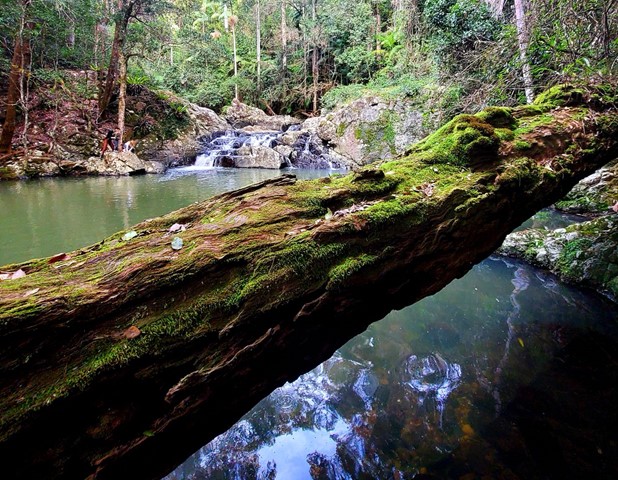
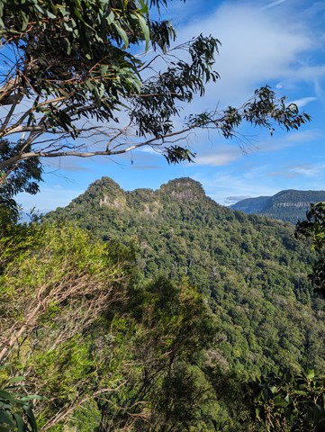
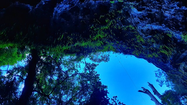
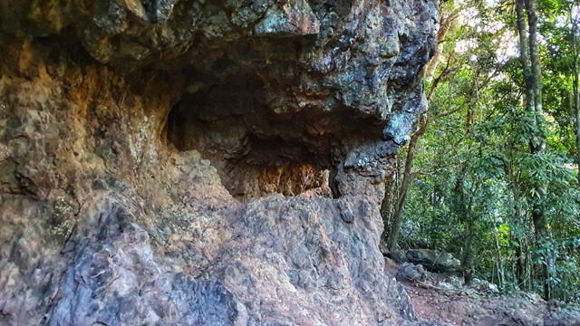
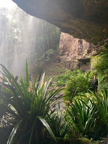
Waterfalls are the most common feature for the plateau. Natural Bridge, which consists of a waterfall plunging into a cave, is very popular and only a short walk. Possibilities for off-track walks are also available.
Access
Springbrook Plateau Section
Take the Mudgeeraba exit from the Pacific Highway (exit 79 from the north, exit 80 from the south) and follow Gold Coast-Springbrook Rd or take exit 69 (Nerang) and follow Nerang-Murwillimbah Rd for 42km till the Springbrook turnoff at Pine Creek Rd
Natural Bridge Section
Take the Nerang Exit from the Pacific Highway (exit 69) and follow Nerang-Murwillimbah Rd for 30km to the park entrance (on the left).
Mt Cougal Section
Take the Currumbin Exit from the Pacific Highway (exit 93) and keep following Currumbin Valley Rd to the end.
Maps
Sunmap Springbrook shows most of the park at 1:25000. The Currumbin and Beechmont maps are useful for the adjoining sections of the border route.
Accommodation
Camping
The Settlement Campground on the plateau. Bookings are made through the National Park office.
A number of private campgrounds are available in the area.
Other
A range of other accommodation is available in the immediate area and of course the Gold Coast is in short driving distance.
Contact details
National Park Website - https://parks.des.qld.gov.au/parks/springbrook/about.html
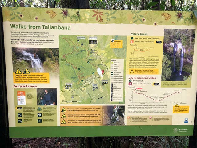
Walks in Springbrook National Park

 2.9
km
return
2.9
km
return
 1
hr
1
hr
Apple Tree Park North and South Trails
A short walk in the forest from Apple Tree Park with views through the trees to Numinbah Valley.
 6
km
return
3
hrs
6
km
return
3
hrs
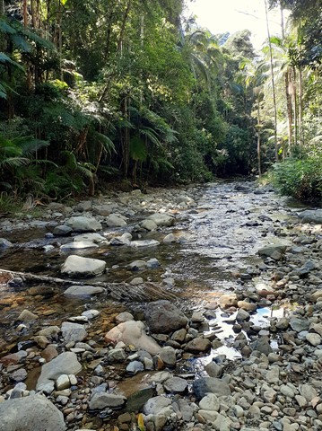
Apple Tree Park to Little Nerang Creek Falls
Start from the car park at Apple Tree Park. Cross the road and decend down the fire trail until you find the NP TRAIL entrance on your left. Decend down to Creek crossing, waterfall and swimming holes. Climb back up the way you came, climbing the equivalent of a 61 story building.
This walk eventually links to the Warringa Pool Track which leads onto the Purling Brook Falls Circuit and is the route taken by the Gold Coast Hinterland Great Walk.
 700
m
return
30
mins
700
m
return
30
mins
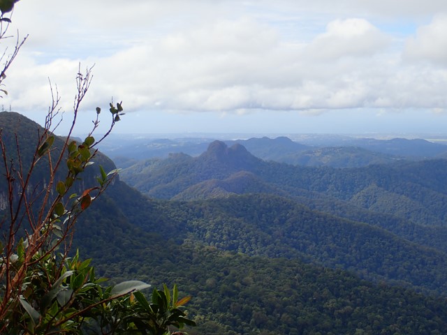
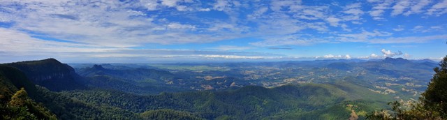
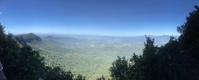
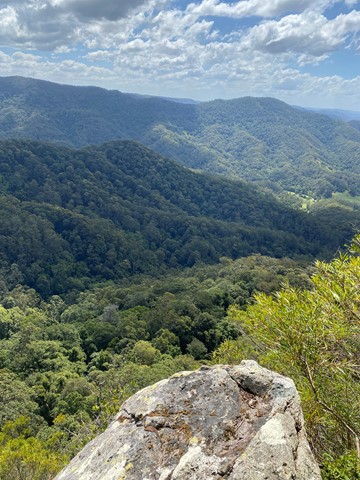
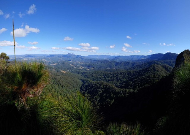
Best Of All Lookout
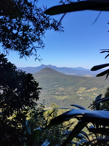
It makes lofty claims... and meets them! This short walk is well worth the effort with excellent views of the Tweed Valley including Mt Warning, Byron Bay and The Cougals. Plus, it includes one of the most accessible stands of Antarctic Beech Forest (Nothofagus Moorei) in Queensland. If you haven't been there, make sure to stop off next time you're on the plateau.
 6
km
return
3.5
hrs
6
km
return
3.5
hrs
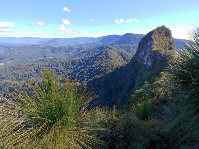
Boyds Butte - from Cougal Cascade
A relatively short walk, but challenging, rainforest walk, with great views as a reward. You'll need a GPS app, or good off-track navigational skills in places.
 100
m
return
5
mins
100
m
return
5
mins
Buliya-Buliya Jagun Boardwalk
Visit Gauriemabah - place of stories, at the old schoolhouse, and discover the many tales of Springbrook. Take a short walk along Buliya-Buliya Jagun Boardwalk look and listen for the many little birds along your way to the lookout.
 4.2
km
return
2
hrs
4.2
km
return
2
hrs
Bushrangers Cave
An off-track walk from the border gate to Bushrangers Caves, which used to be an aboriginal camp. The adventurous can head on up Mt Wagawn to join up with the main Lamington track system.
 1.6
km
return
1
hr
1.6
km
return
1
hr
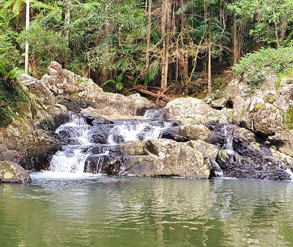
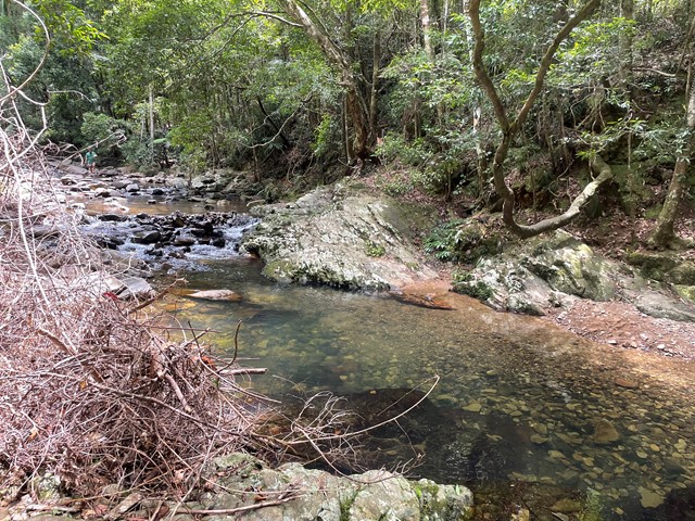
Cougal Cascades
A short walk next to Currumbin Creek. Great for a short walk not too far from the Gold Coast or for cooling off on a hot day (without the sand and salt of the sea).
There are plenty of fantastic swimming holes further up the cascades if you don't mind a 20min walk upstream .
 14.5
km
return
6
hrs
14.5
km
return
6
hrs
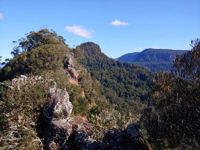
Cougal Cascades to Boyd’s Butte and Mt Cougal East Peak
A circuit walk from Cougal Cascades to Boyd's Butte and Mt Cougal. Includes views from both peaks.
 4.4
km
return
90
mins
4.4
km
return
90
mins
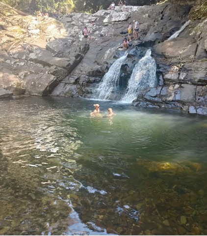
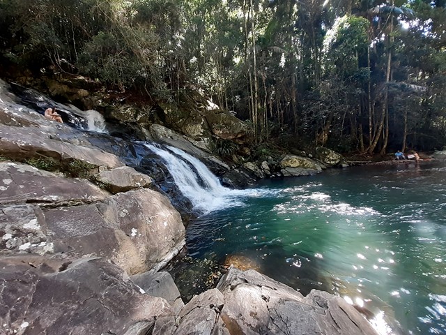
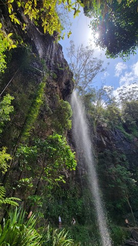
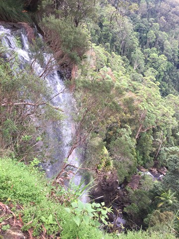
Goomoolahra Falls and Rainbow Falls
No need to complete the full 14 kilometre Warrie circuit, but instead walk 3 kilometres (of the 17 km track) and see at least 3 waterfalls. You are walking along the side of the cliff with sheer drops below and rock faces above.
Very picturesque and one of the nicest walks in Springbrook National Park. Not to be confused with the view of the Goomoolahra Falls from above.
 600
m
return
10
mins
600
m
return
10
mins
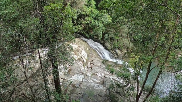
Goomoolahra Falls Lookout Track
Picnic area with a view. Wheelchair friendly track to a stunning view of the top of Goomoolahra Falls with the warrie circuit track below and views of the Springbrook Pinnacle and out to the coast and the general hinterland.