
Menu
Popular Walks
-
Twin Falls Circuit
(636 ticks) -
Purling Brook Falls Circuit
(611 ticks) -
Warrie Circuit
(471 ticks) -
Natural Bridge
(449 ticks) -
Best Of All Lookout
(280 ticks)
Parent Regions
Summary
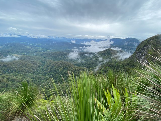
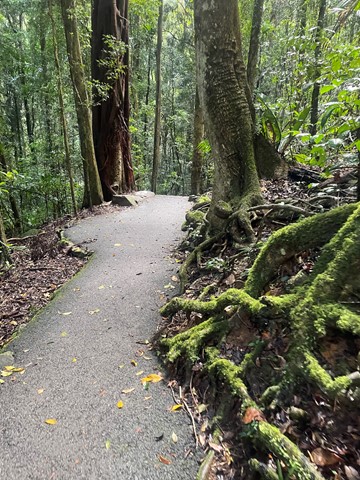
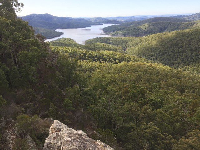
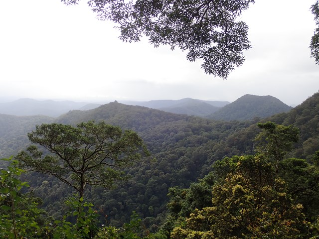
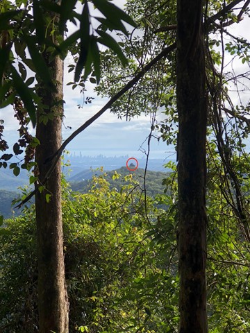
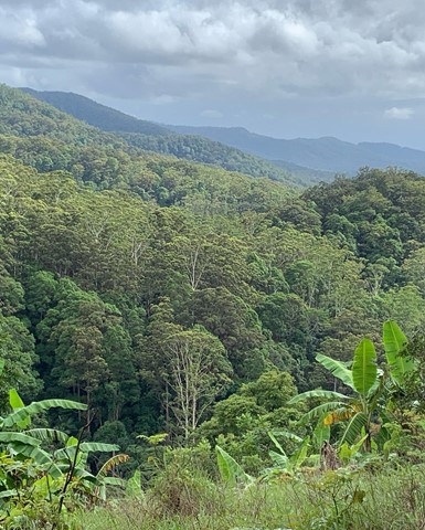
Springbrook is a 29.2 square kilometre National Park in the Gold Coast Hinterland. Only 90 minutes from Brisbane, Springbrook comprises a range of beautiful sub-tropical rainforest, spectacular lookouts and breathtaking waterfalls.
The park is part of the World Heritage Listed Gondwana Rainforests and consists of three sections: Springbrook Plateau, Natural Bridge and Mount Cougal (The Cougals).
Popular Walks
-
Twin Falls Circuit
(636 ticks) -
Purling Brook Falls Circuit
(611 ticks) -
Warrie Circuit
(471 ticks) -
Natural Bridge
(449 ticks) -
Best Of All Lookout
(280 ticks)
Parent Regions
History
Timber getters arrived in the late 1800's they cut down red cedars and beech. In approx 1905 farmers came to the plateau and cleared for settlement and dairy farming.
Features
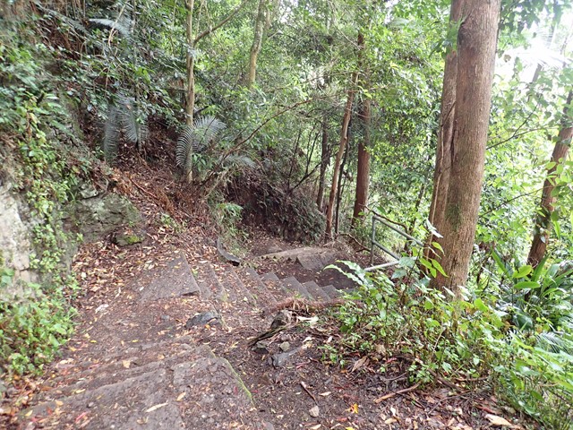
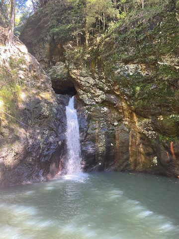
Waterfalls are the most common feature for the plateau. Natural Bridge, which consists of a waterfall plunging into a cave, is very popular and only a short walk. Possibilities for off-track walks are also available.
Access
Springbrook Plateau Section
Take the Mudgeeraba exit from the Pacific Highway (exit 79 from the north, exit 80 from the south) and follow Gold Coast-Springbrook Rd or take exit 69 (Nerang) and follow Nerang-Murwillimbah Rd for 42km till the Springbrook turnoff at Pine Creek Rd
Natural Bridge Section
Take the Nerang Exit from the Pacific Highway (exit 69) and follow Nerang-Murwillimbah Rd for 30km to the park entrance (on the left).
Mt Cougal Section
Take the Currumbin Exit from the Pacific Highway (exit 93) and keep following Currumbin Valley Rd to the end.
Maps
Sunmap Springbrook shows most of the park at 1:25000. The Currumbin and Beechmont maps are useful for the adjoining sections of the border route.
Accommodation
Camping
The Settlement Campground on the plateau. Bookings are made through the National Park office.
A number of private campgrounds are available in the area.
Other
A range of other accommodation is available in the immediate area and of course the Gold Coast is in short driving distance.
Contact details
National Park Website - https://parks.des.qld.gov.au/parks/springbrook/about.html
Walks in Springbrook National Park

 4
km
return
4
km
return
 2
hrs
2
hrs
Gorge Falls
Gorge Falls is a 5.6km return walk along the Cream Track, beginning at the end of Tallebudgera Creek Road.
When you reach the cream track signpost that takes you up some man made steps bear left and follow the path to the left to get to the falls. The track seems to disappear a few times but just continue along the edge of the creek and you keep finding it.
 10.5
km
return
4
hrs
10.5
km
return
4
hrs
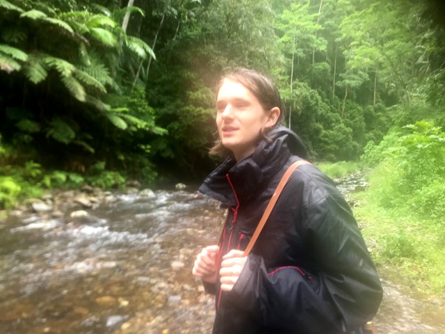
Little Nerang Creek, Purlingbrook Falls, Road return
This walk incorporates parts of the Gold Coast Hinterland Great Walk and the Purlingbrook Falls circuit to see spectacular waterfalls and beautiful rainforest, and it has some great waterholes if it's a hot day!
 2
km
return
1
hr
2
km
return
1
hr
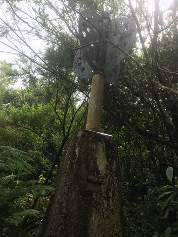
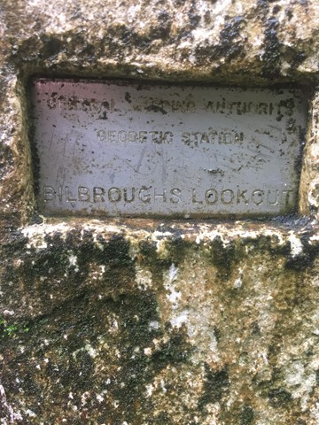
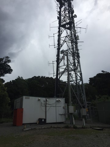
Mount Thillinmam (Bilbroughs Lookout)
A 4wd track through rainforest to Mount Thillinmam (958m). Mount Thillinmam has multiple repeater towers and limited views.
 10
km
5
hrs
10
km
5
hrs
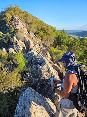
Mt Cougal
A walk along the border fence line to the twin summits of Mt Cougal. There are excellent views from the top!
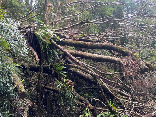
It is hard for beginners. Make sure you check weather. Finding location is a little hard. When arrive see steel gate that states ‘please keep gate clear ta’ On side of gate you can enter, when pass the gate look to your left and see sign with with instructions. Don’t be discouraged when you start, it is a little scary, but it gets easier, but still lots of hill. Follow the barbed wired fence on your left the whole way. The track will go from very narrow to comfortable in some places. Once you reach the last 700 metres or so... it becomes much harder. You will see a thin rope to guide you - do not use this to pull you up as it will break!! You will come to a spot where the track will seem to end. Look for a tree that has arrows etched into it to guide you where to go. There’s also a small pink ribbon tied to a tree branch Up further. You have to go up! It’s hard but worth it.
 1
km
return
30
mins
1
km
return
30
mins
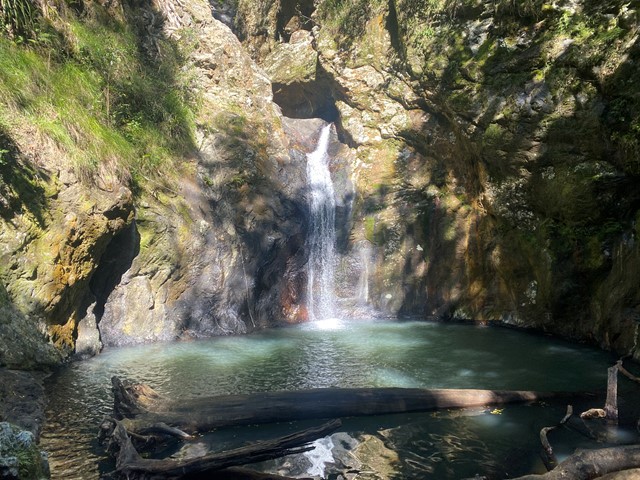
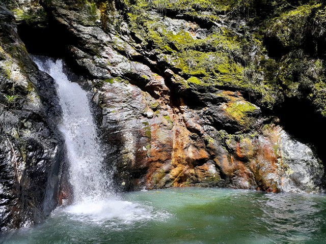
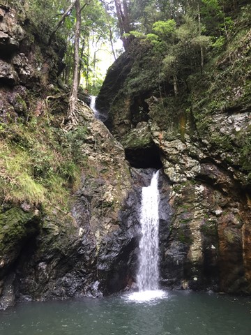
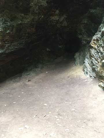
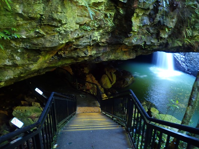
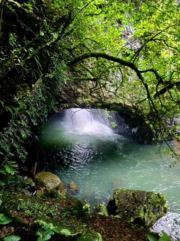
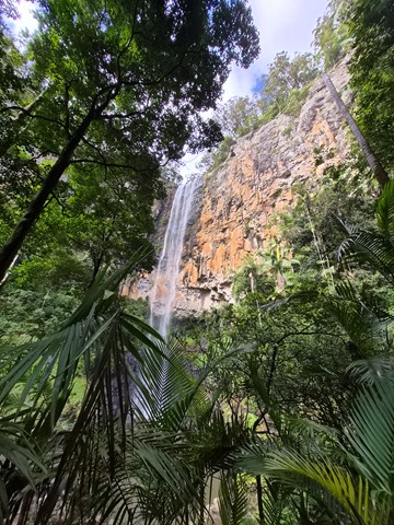
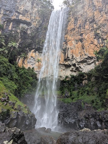
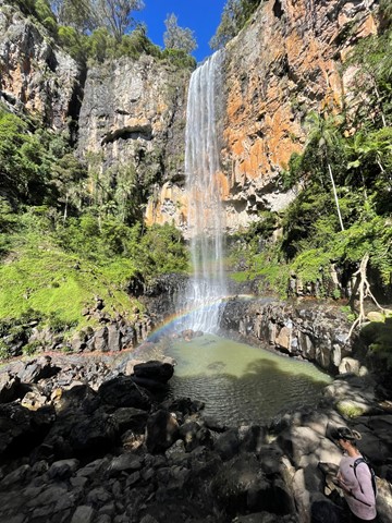
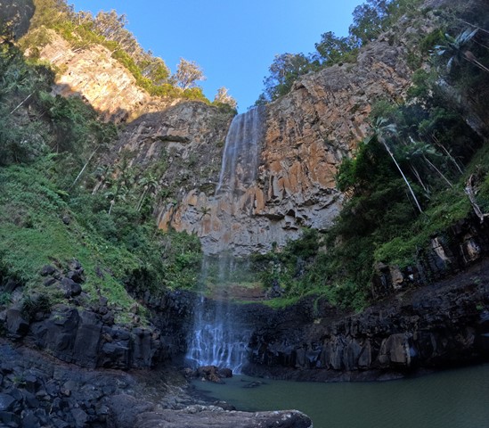
Natural Bridge
A sealed circuit track takes you through the forest, across Cave Creek, and into the arched cave to witness the waterfall plunging from above. At night the cave is illuminated by thousands of glow-worms' tiny green lights. While glow-worms are visible year-round, their display is significantly reduced during the winter months. Interpretive signs along with the circuit highlight the park's special features. The hoop pines Araucaria cunninghamii that emerge through the thick greenery of the surrounding rainforest are living relics of the Jurassic Age—the age of the conifers—about 180 million years ago. These pines are 'living dinosaurs'—they are among the most primitive of conifers.
 8.7
km
return
4
hrs
8.7
km
return
4
hrs
Pages Pinnacle Eastern Approach via Neranwood Break
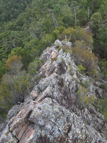
A steep ascent of 368 meters over the first two kilometers up Neranwood Break before following Pinnacle Break to the Pages Pinnacle footpad on the right where The Razorback Ridge is then traversed to the summit.
 4
km
return
2
hrs
4
km
return
2
hrs
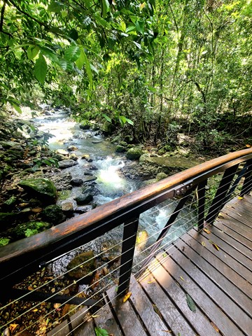
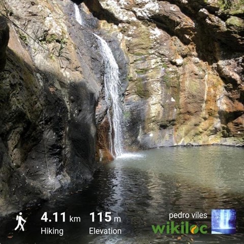
Purling Brook Falls Circuit
Together with Twin Falls Circuit, one of the must do's in this Park. Viewpoints, waterfalls, swimming holes, wildlife, name it, it is there! Optionally add an extra 2km to reach the lower Warringa pool. Follow path clockwise to avoid walking up 450 steps!
 20
km
return
7
hrs
20
km
return
7
hrs
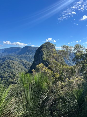
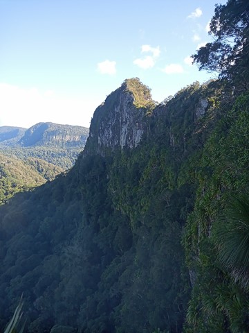
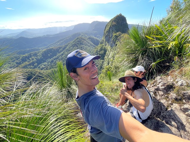
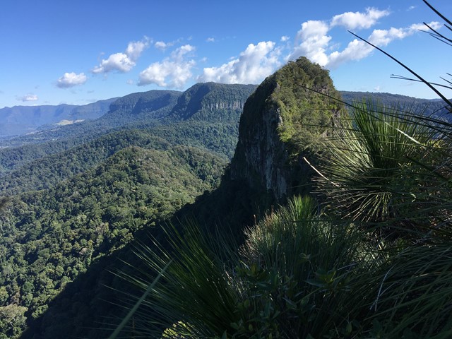
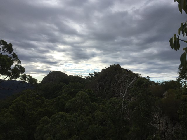
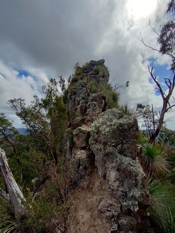
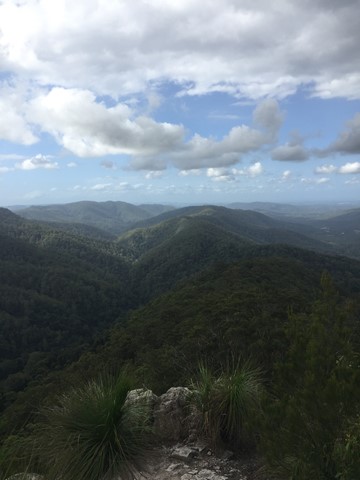
Springbrook Pinnacle
This walk takes you to the Springbrook Pinnacle via the Warrie Circuit. The Pinnacle requires scrambling but offers 360 panoramic views. The Warrie Circuit goes through rainforest with many waterfalls to see and go under.
 11.5
km
return
4.5
hrs
11.5
km
return
4.5
hrs
The Cream Track
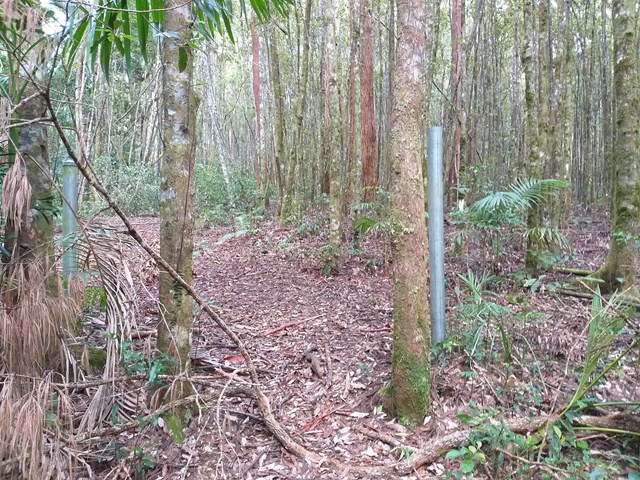
The Cream Track is the name given to a track from the Tallebudgera Valley, up to the Springbrook Plateau, following a route that early dairy farmers used to get their product down to the coast. It is a challenging track, because of its gradient, and especially challenging after rain.
 6
km
return
2.5
hrs
6
km
return
2.5
hrs
The Pinnacle and Fairview Mountain via Valley Break
From the end of Austinville rd follow the 4wd track of Valley Break to Fairview Mountain and then turn left onto a at times overgrown single track till The Pinnacle (Springbrook Pinnacle) which is contoured around to the right where the route up becomes apparent (on the opposite side of the pinnacle as of that you approached (Southern side)). A scramble to the summit which offers 360 views.