
Queen Mary Falls Lookout
Main Range National Park


Menu
GPS Tracks
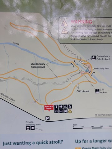
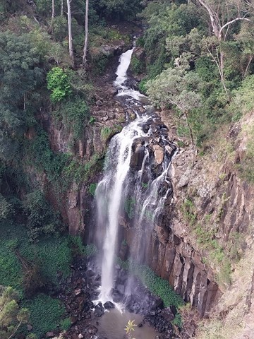
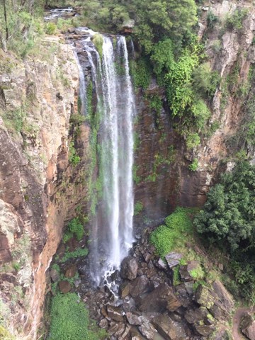
This walk takes you to the top of Queen Mary Falls, which is part of the headwaters of one of Australia's longest river systems, the Murray–Darling. Great care should be taken when viewing the gorge below and carefully supervise children.

Getting there:
From Boonah (64km) take the Boonah/Rathdowney Road south before turning right into Carneys Creek Road and right again into The Head Road, which becomes Spring Creek Road.
From Killarney (11km) take Acacia Street onto Border Road and then turn left into Spring Creek Road.
The approach from Boonah is steep and should be travelled with care. It is unsuitable for caravans.
Maps:
Route/Trail notes:
From the picnic area follow the pathway to the right that takes you to the lookout.
Return the same way but take the right fork after the bridge that passes the Cliff Lookout.
Permits/Costs:
None.
Other References/Comments:
None provided.
 464 Queen Mary Falls Lookout (GPX)
 900
900 30
30
Comments