
Menu
Popular Walks
-
The Pyramid
(308 ticks) -
Castle Rock
(183 ticks) -
Granite Arch
(176 ticks) -
The Sphinx and Turtle Rock
(126 ticks) -
The Junction
(100 ticks)
Parent Regions
Summary
Girraween is a national park which sits on the Queensland-New South Wales border near Stanthorpe. The park lies in the Granite Belt and is very popular for its granite landscape and wildflowers
Popular Walks
-
The Pyramid
(308 ticks) -
Castle Rock
(183 ticks) -
Granite Arch
(176 ticks) -
The Sphinx and Turtle Rock
(126 ticks) -
The Junction
(100 ticks)
Parent Regions
History
Dr Spencer Roberts, a doctor from Stanthorpe, is largely responsible for the creation of Girraween and it's NSW neighbour Bald Rock National Park. The park started as Bald Rock Creek National Park, created in 1930 and Castle Rock National Park, created in 1932. When Napier Gunn offered his property to the government in 1966 the two parks were merged and became Girraween National Park
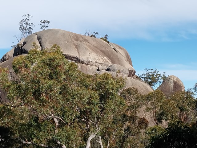
Features
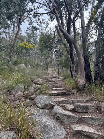
Wildflowers and granite scenery! That nearly sums up the main reasons people walk in Girraween. The park includes a well maintained collection of walking tracks visiting the main features.
Visit in Spring to witness spectacular wildflower displays.
The park also receives snow occasionally during Winter.
Access
The primary access point to the park is from the New England Highway just South of Ballandean. Just follow the signposts onto Pyramids Rd, approximately 7km South of Ballandean or 11km North of Wallangarra. Pyramids Rd gives access to both Bald Rock Creek and Castle Rock camping grounds and the majority of the park's bushwalking trails.
Maps
A free national park map can be downloaded from http://www.derm.qld.gov.au/media/parks_and_forests/parks/girraween_national_park.pdf
Hema maps publish a great map which covers Girraween, Bald Rock and Boonoo Boonoo National Parks.
Accommodation
Camping
One National Park camping ground is available - Castle Rock.
Other
Numerous other accommodation options are available in the surrounding area. Just search for accommodation in the Stanthorpe area.
More Info
Official website - https://parks.des.qld.gov.au/parks/girraween
Vanessa and Chris Ryan have a great website on Girraween with comprehensive info - http://www.rymich.com/girraween/
Walks in Girraween National Park

 8
km
one-way
8
km
one-way
 2
hrs
2
hrs
South Bald Rock RBC via the Stone Cottage
Approximately 8km walk from the stone gate, and then via the old stone cottage to South Bald Rock remote bush camp (yes, there's a "camp"). This walk takes you East along some lovely grassy flat land and around a few rocky outcrops before travelling clockwise around the Northern edge of West Bald Rock, then South, counter-clockwise around Middle Bald Rock, before finally descending into a semi-swampy valley on the Western edge of South Bald Rock. Around the rocky areas there's some ups and downs but easily achievable for someone of moderate fitness and ability. There's a lone "no fires" sign installed indicating the general camp area. Pick your camp site well, as with just a reasonable shower of rain the water only goes downhill. Wouldn't recommend this location during heavy storms or heavy rains, as rising creeks could be hard to predict for beginners.
 5.6
km
return
90
mins
5.6
km
return
90
mins
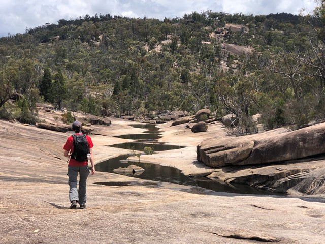
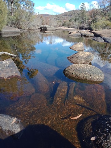
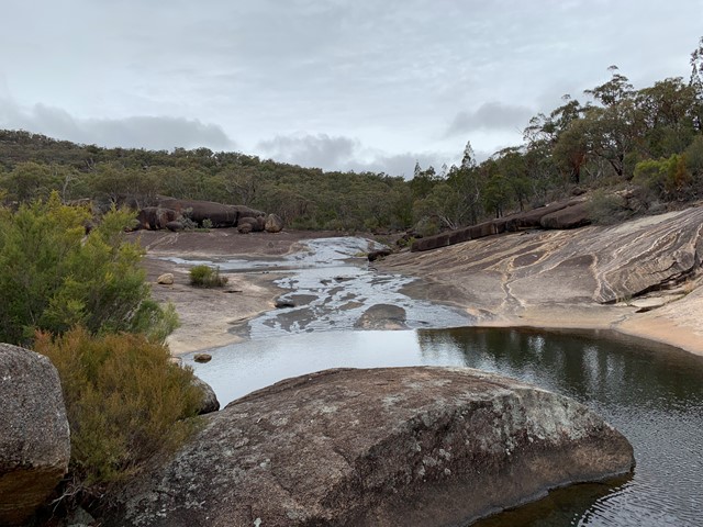
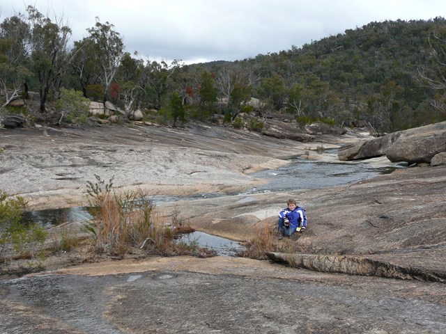
The Junction
Enjoy an easy walk along the northern bank of Bald Rock Creek downstream to its junction with Ramsay Creek. In dry seasons, these creeks may not run.
A must for wildflower lovers, this track is scattered in spring with superb wildflower displays. Flowering shrubs fringing the creek provide nectar for honeyeaters and parrots. Superb fairy-wrens, red-browed firetails and thornbills move through creek bank thickets seeking insects.
 3.8
km
return
2
hrs
3.8
km
return
2
hrs
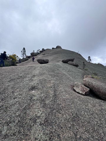
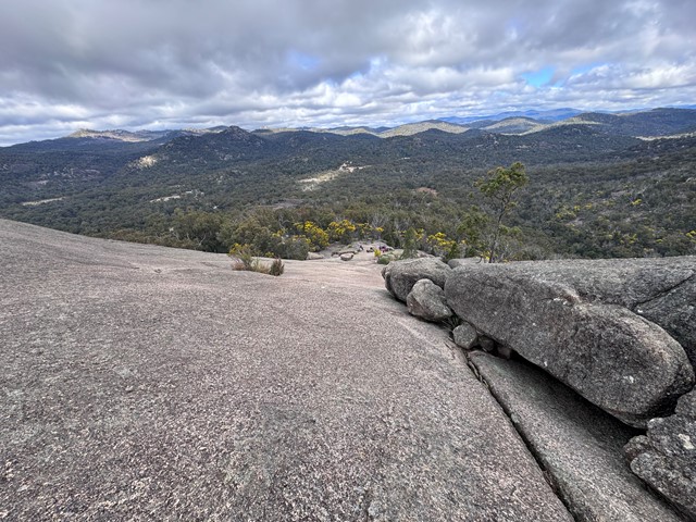
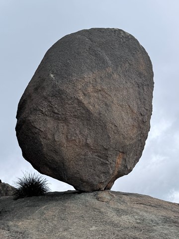
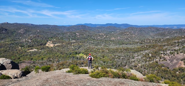
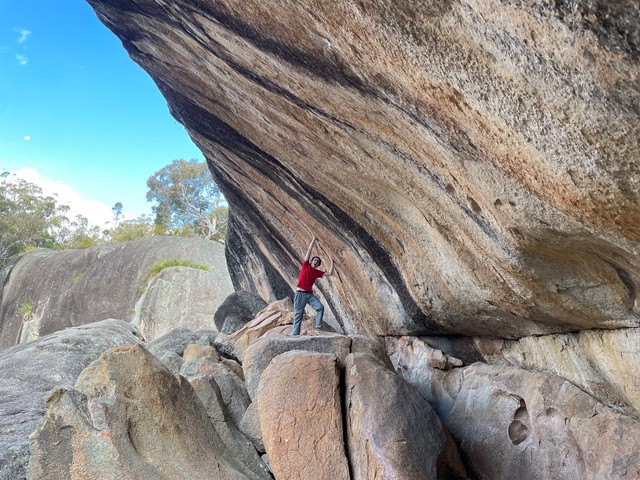
The Pyramid
Grab some magnificent views from the first of Girraween's dominating Pyramids. If the climb doesn't take your breath away, the views of Balancing Rock, Second Pyramid and over Girraween National Park will.
 7
km
return
2.5
hrs
7
km
return
2.5
hrs
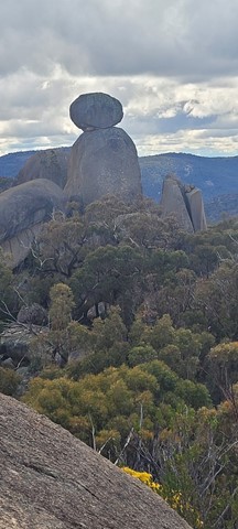
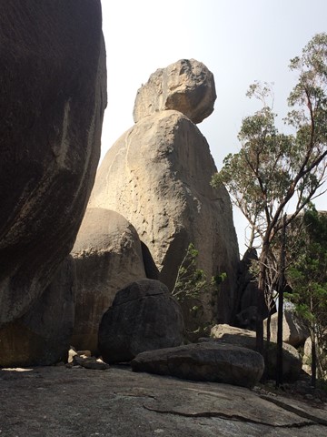
The Sphinx and Turtle Rock
The Sphinx is a granite pinnacle bearing a large balancing tor, while Turtle Rock is a large granite monolith resembling a turtle's back.
 3.8
km
return
105
mins
3.8
km
return
105
mins
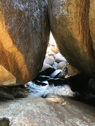
Underground Creek
This walk include spectacular wildflowers, varied birdlife and a creek that disappears beneath boulders that have fallen from the cliffs above creating a wave rock. Climb to above the lava flow for views out to the Aztec Temple and Mt Norman and see the rock pools and the creek gurgling down the crevasses.
 300
m
one-way
15
mins
300
m
one-way
15
mins
Wyberba Walk
A short accessible walk giving everyone a taste of what Girraween National Park has to offer.