
Menu
Popular Walks
-
Hooker Valley Track
(20 ticks) -
Tongariro Alpine Crossing
(17 ticks) -
Milford Track
(14 ticks) -
Everest Base Camp
(14 ticks) -
Kepler Track
(13 ticks)
Sub-Regions
- Albania
- Antarctica
- Argentina
- Canada
- China
- Cook Islands
- Croatia
- Czech Republic
- Egypt
- Fiji
- France
- Germany
- Greece
- Guatemala
- Hawaii
- Ireland
- Italy
- Japan
- Jordan
- Malaysia
- Nepal
- New Zealand
- Norfolk Island
- Papua New Guinea
- Peru
- Poland
- Seychelles
- Singapore
- South Africa
- South Georgia Island
- South Korea
- Spain
- Spitsbergen (Svalbard)
- Taiwan
- Tonga
- Turkey
- United Kingdom
- United States of America
- Vietnam
Summary
We all know Australia is the place for bushwalking... New Zealand has some good tracks too... but surprisingly the rest of the world has some places worth visiting too! (imaging that!)
This is the place to share walks from outside of Australia/New Zealand.
Popular Walks
-
Hooker Valley Track
(20 ticks) -
Tongariro Alpine Crossing
(17 ticks) -
Milford Track
(14 ticks) -
Everest Base Camp
(14 ticks) -
Kepler Track
(13 ticks)
Sub-Regions
- Albania
- Antarctica
- Argentina
- Canada
- China
- Cook Islands
- Croatia
- Czech Republic
- Egypt
- Fiji
- France
- Germany
- Greece
- Guatemala
- Hawaii
- Ireland
- Italy
- Japan
- Jordan
- Malaysia
- Nepal
- New Zealand
- Norfolk Island
- Papua New Guinea
- Peru
- Poland
- Seychelles
- Singapore
- South Africa
- South Georgia Island
- South Korea
- Spain
- Spitsbergen (Svalbard)
- Taiwan
- Tonga
- Turkey
- United Kingdom
- United States of America
- Vietnam
Walks in North Island NZ
(New Zealand)
 7.3
km
return
7.3
km
return
 3
hrs
3
hrs
The Beehive to Cable Car via Te Ahumairangi Hill & Botanic Gardens
From The Beehive & Parliament House make your way to Te Ahumairangi Hill and through the Botanic Gardens to the cable car.
 19.4
km
one-way
7
hrs
19.4
km
one-way
7
hrs
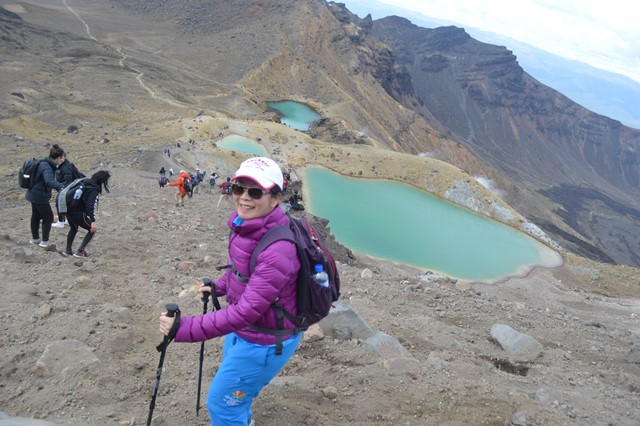
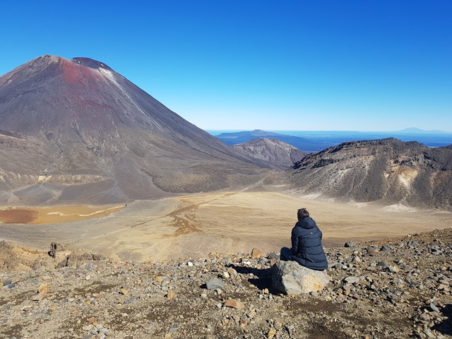
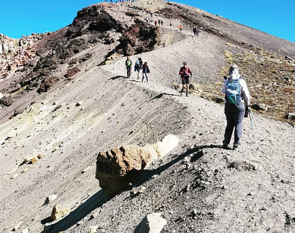
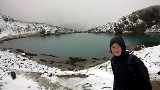
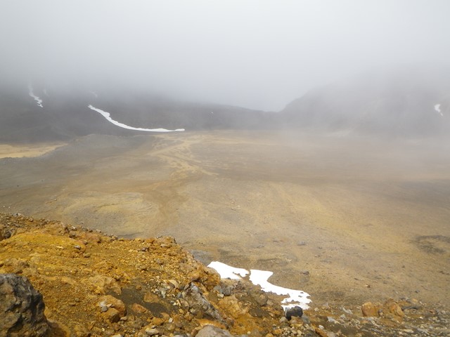
Tongariro Alpine Crossing
This is a wonderfully atmospheric walk through an active volcanic area. It is considered as being one of the best day walks in the world. Highlights include, soda springs which is a waterfall, views of Mt. Ngauruhoe which was used in the lord of the rings films as Mount Doom, south crater, red crater (1868) which is the highest point on the Tongariro Alpine Crossing if done with no diversions, emerald lakes, blue lake and Mt. Tongariro.
 3.2
km
return
90
mins
3.2
km
return
90
mins
Upper Silica Rapids Track
Experience a range of vegetation types as well as the creamy-white Silica Rapid terraces.
The boardwalks makes walking over swampy ground more comfortable and reduces the impact of foot traffic on delicate vegetation. This is a great place to enjoy mountain views particularly Mt. Ruapehu.
10
km
return
3
hrs
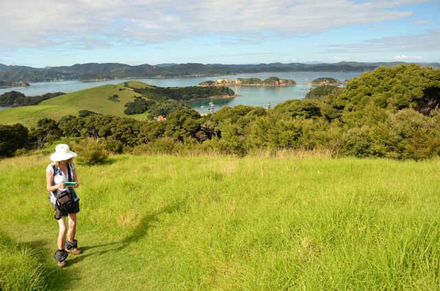
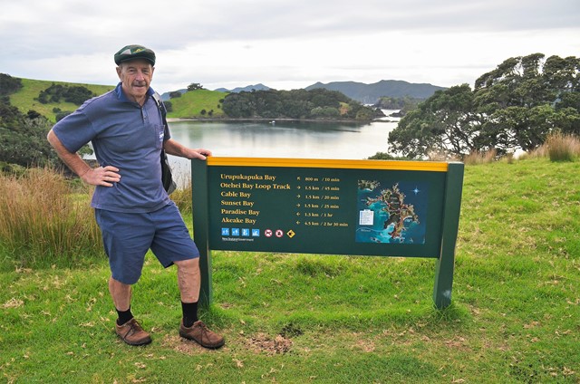
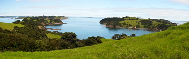
Urupukapuka
Urupukapuka is an island criss-crossed with walks. The article covers the main ones.
 3.8
km
one-way
90
mins
3.8
km
one-way
90
mins
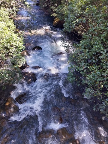
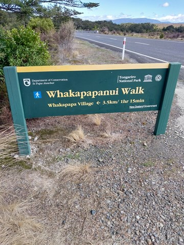
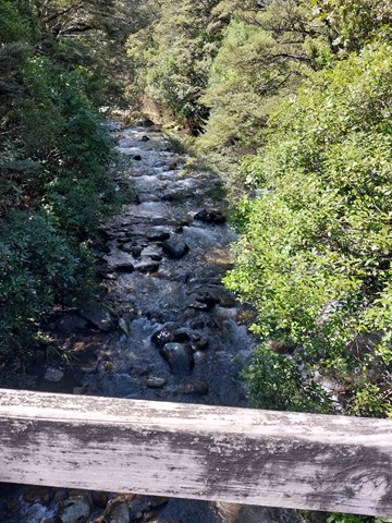
Whakapapanui Track
Follow Whakapapanui Stream and enjoy the shelter of the forest.
Water-logged clearings are passed as the track follows Whakapapanui Stream. Here, storm damaged beech forest is slowly regenerating. Keep a look out along the river for the endangered whio/blue duck. They are the same colour as the rocks so can be very difficult to spot, but you may hear the male’s whistling call.
Walks in South Island NZ
(New Zealand)
60
km
one-way
4
days
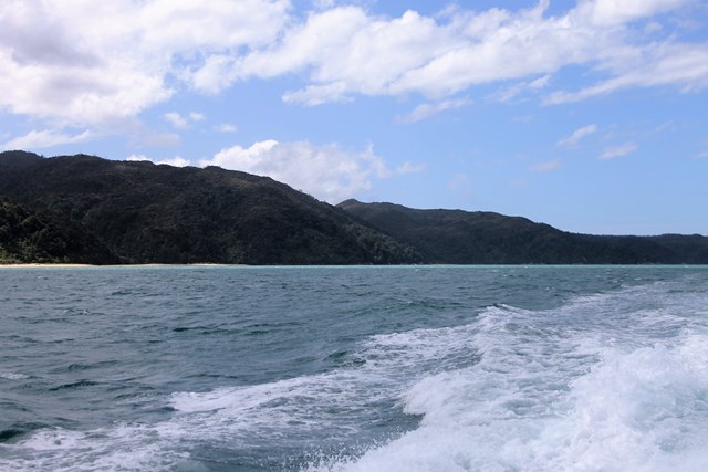
Abel Tasman Coastal Track
Discover Cleopatra's Pool – natural rock pool with a moss-lined waterslide.
Admire the beautiful inlet to Falls River as you walk across a 47 m suspension bridge.
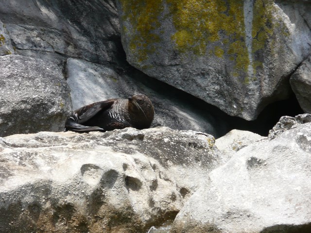
Keep an eye out for fur seals/kekeno.
Crystal-clear waters of Tonga Island Marine Reserve.
The track is well marked and signposted, but some sections may be steep and rough and the track could be muddy.
There is one compulsory tidal crossing – check the tide tables for when it's safe to cross.
Part of the Abel Tasman NP. Easy but challenging walk on well maintained coastal track. Day walks are possible as drop off and pick up by water taxi is available. Combining with sea kayaking amongst the seal colony is a special experience. Many coves, beaches, even a few crossings on hanging bridges. Stunning scenery and lots of birds and wildlife.
 1.4
km
return
30
mins
1.4
km
return
30
mins
Ayrburn Waterfall Walk
A short walk from the Ayrburn entertainment & eatery complex to a waterfall.
13.4
km
return
8
hrs
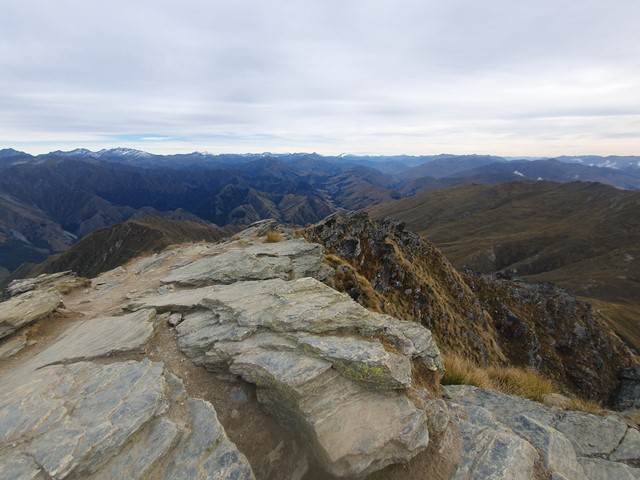
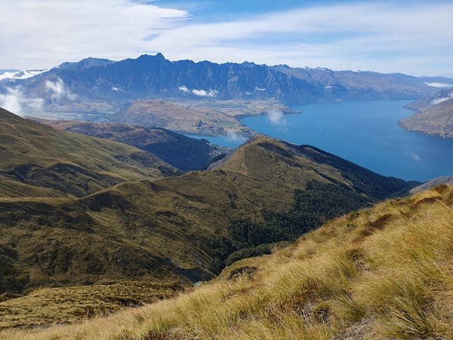
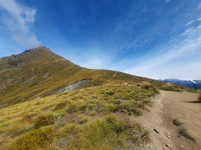
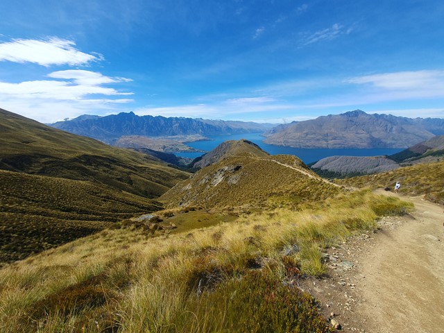
Ben Lomond
A physically challenging ascent to the summit of the most iconic mountain in the Queenstown area.
 5
km
return
2
hrs
5
km
return
2
hrs
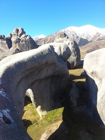
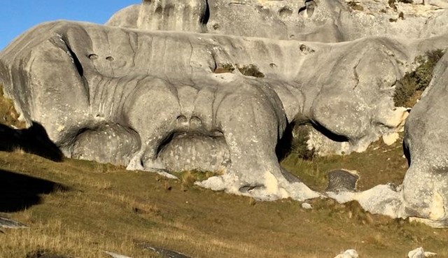
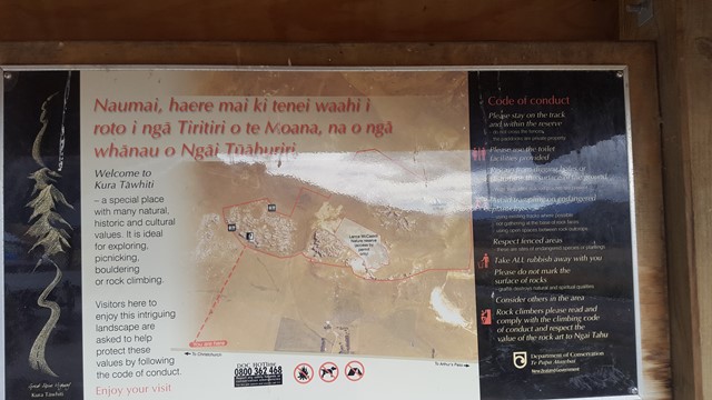
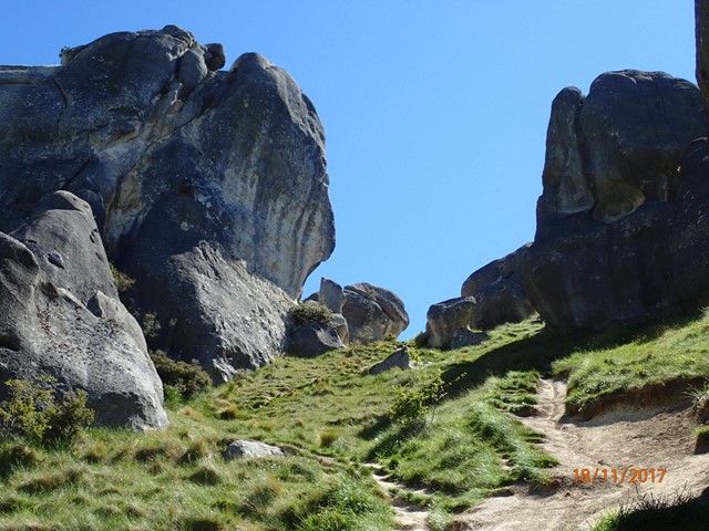
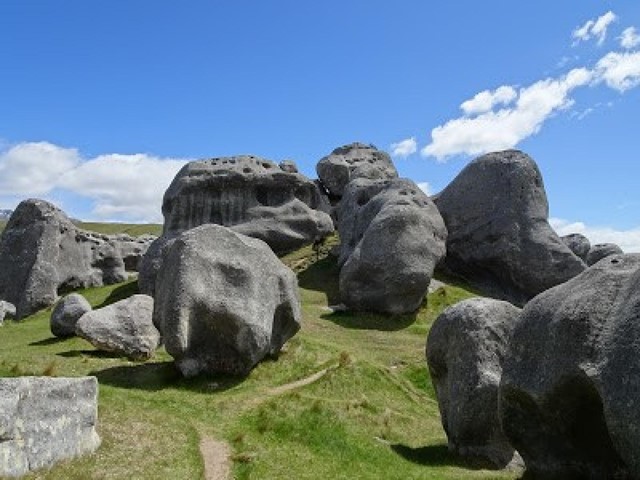
Castle Hill
Castle Hill Basin lies between the Torlesse and Craigieburn mountain ranges and is characterised by its distinctive limestone rock formations. These limestone rock formations are the water eroded remnants of limestone formed during the Oligocene age 30-40 million years ago when much of present day New Zealand was covered by the sea.
The area is of special cultural, spiritual and historical significance to Ngai Tahu who named it Kura Tawhiti (treasure from afar). Hidden amongst the limestone outcrops of Castle Hill are traces of 500-year old charcoal drawings traditionally said to have been left by the Waitaha, the first people to travel through this area.